

Lurg Mhor
Good walks are even better shared.
NH0640 : Purple Mountain Saxifrage
Richard Law Photo source
Overview
Lurg Mhor: A Hiker's Delight
Lurg Mhor, standing proudly at an elevation of 859 meters, is a true gem in the Scottish Highlands. With its rugged terrain and rich geological history, it attracts hikers seeking both challenge and beauty.
Geology
Composed primarily of ancient volcanic rocks, Lurg Mhor showcases the fascinating geology of the Highlands. Its diverse rock formations date back to the volcanic activity during the early Tertiary period. It's not just a pretty face; this mountain tells a story of fire and earth.
Route Overview
The most popular route begins in Glen Carron. Covering a distance of approximately 15 km, the hike can be tackled in about 5 hours, making it a moderate trek suitable for most outdoor enthusiasts. Ascend the northern slopes after following the river, and be prepared for some rocky scrambles!
Summit Features
As you reach the summit, make sure to take a moment to appreciate the prominent cairn. It’s the perfect backdrop for that all-important summit selfie. Just remember, no one likes a cairn hog; share the space with your fellow hikers!
Terrain and Views
The terrain is varied, featuring rocky paths mixed with lush grassy slopes, giving way to some steep sections near the summit. On a clear day, bask in the glorious views of Beinn Eighe, Liathach, and the vast landscape of Torridon and Loch Carron. Remember, the views are best late spring through autumn, so plan your adventure accordingly!
Hazards
While Lurg Mhor is a stunning hill to climb, watch out for loose rocks and be wary of the infamous Highland weather—one minute it’s sunny, and the next, you might think you’re in a rain shower sponsored by the local meteorological society.
Nearby Summits
If you’re feeling adventurous, nearby summits like Beinn Eighe (1010m) and Liathach (1055m) offer great extension routes for those who want to keep their legs working.
Access and Facilities
Access to Lurg Mhor is straightforward. There's a small parking area in Glen Carron, and if you're relying on public transport, local buses connect to Achnasheen, which is a short trek from the start of your adventure. While the trailhead lacks formal facilities, the nearby village of Achnasheen has a hotel and shop where you can stock up on supplies.
History
The name 'Lurg' comes from the Gaelic word 'Lurgan', meaning 'the ridge'. This mountain has long served as a significant landmark for local communities, rich in folklore and history. It's not just a mountain; it’s a piece of Scottish heritage.
So what are you waiting for? Grab your boots, pack your snacks (and maybe a raincoat), and head out to Lurg Mhor for an unforgettable outing in the heart of the Highlands. Happy hiking!
Explore routes near Lurg Mhor
Walks starting near this hill. Open a route to check its map, distance and full itinerary.
Beinn Eighe Lancaster Wreckage at Coire Mhic Fhearchair
View route
Glen Affric: Coire Loch Woodland Trail
View route
Fairy Lochs Liberator Wreckage Circuit
View route
Fort Augustus to Kytra Lock: Caledonian Canal Towpath
View route
Route planning notes
These notes describe possible approaches. Check a route's map and access information when planning your walk.
Lurg Mhor from Glen Carron
A popular route starting from Glen Carron, following the river before ascending the northern slopes of Lurg Mhor.
Make a day of it, together
Find someone to share the walk with, or organise a day out along a route you like.
Photo Gallery
View all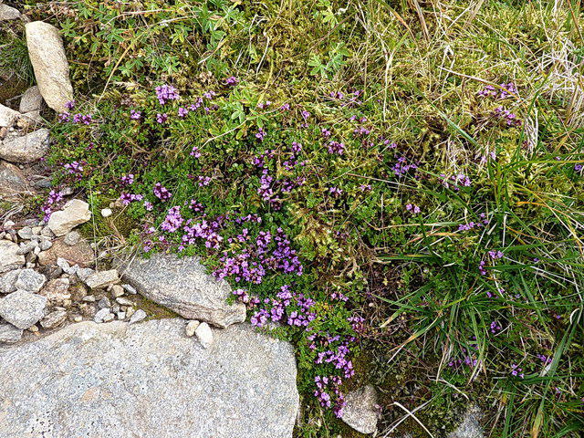 Photo could not load
NH0640 : Purple Mountain Saxifrage
Richard Law
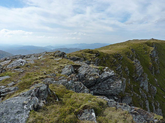 Photo could not load
NH0640 : East ridge of Lurg Mhòr
Richard Law
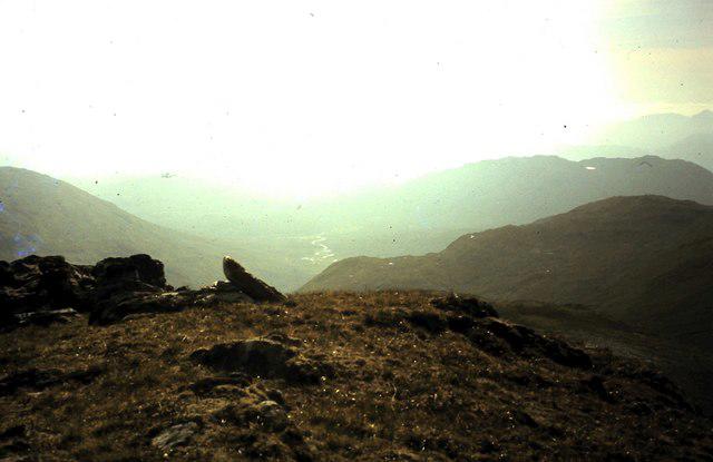 Photo could not load
NH0640 : Summit Lurg Mhor
ronnie leask
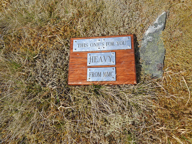 Photo could not load
NH0640 : Heavy Whalley Tribute Lurg Mhòr
Adam Ward
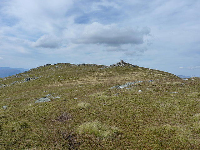 Photo could not load
NH0640 : Summit area from the east
Richard Law
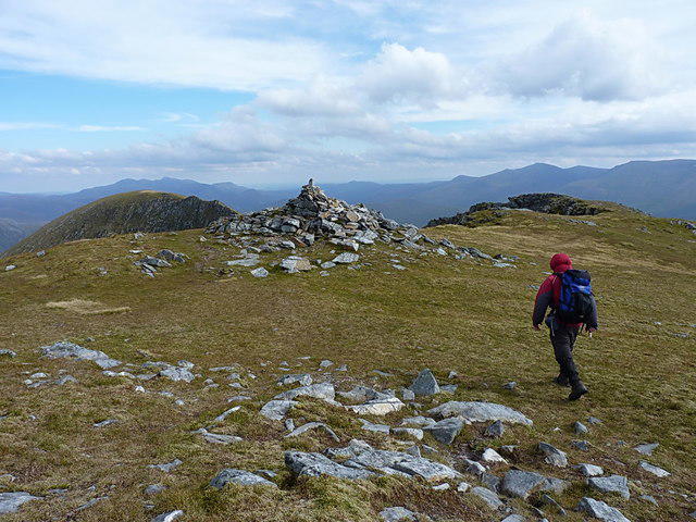 Photo could not load
NH0640 : Last few steps to Lurg Mhòr
Richard Law
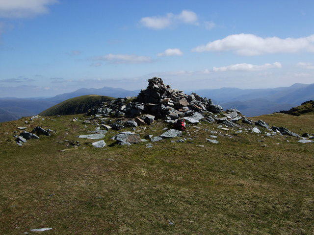 Photo could not load
NH0640 : Summit of Lurg Mhor
Tim Denvir
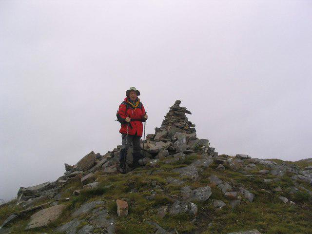 Photo could not load
NH0640 : Lurg Mhòr summit cairn
Russel Wills
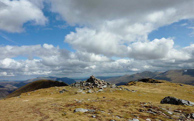 Photo could not load
NH0640 : Lurg Mhor summit
Ian Stewart
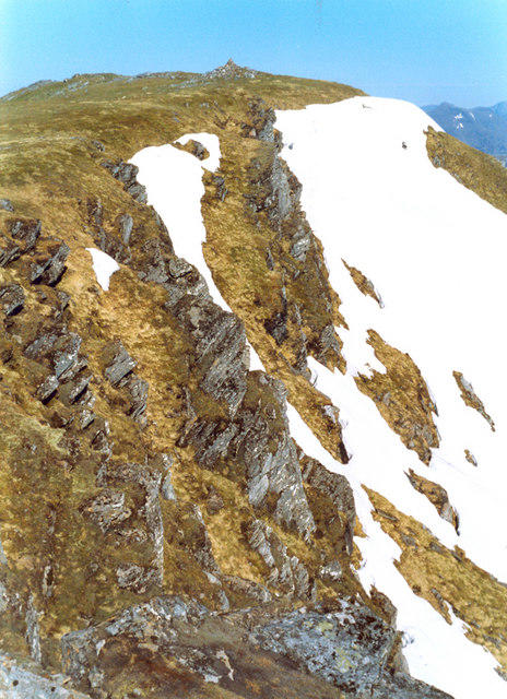
NH0640 : Lurg Mhòr - summit cairn from east ridge
Phil Johnstone
Hill facts and local notes
Classifications
Elevation
987m
3,238 ft
Prominence
442m
Coordinates
57.4131, -5.2237
NH064404
OS Map
25
Explorer: 429
At the Summit
The summit of Lurg Mhor features a prominent cairn, offering a perfect spot for a photo op (just don't confuse it with your lunch!).
Terrain & Geology
Lurg Mhor is primarily composed of volcanic rocks, specifically notable for its diverse geology including basalt and andesite outcrops. The formation of this mountain dates back to the volcanic activity of the early Tertiary period, giving it a rugged appearance.
Views & Scenery
Incredible views of the surrounding peaks including Beinn Eighe and Liathach, along with views across Torridon and Loch Carron.
History & Heritage
Name Origin
The name 'Lurg' is derived from the Gaelic 'Lurgan', meaning 'the ridge', reflecting its prominent position in the landscape.
Historical Significance
Historically, the mountain has been a notable landmark for local communities and is often featured in local folklore.
Getting There & Facilities
Parking
There is a small parking area at the start of the trail in Glen Carron, with room for several vehicles.
Public Transport
Buses operate from towns such as Inverness to Achnasheen, which is approximately 10 km from the trailhead.
Nearby Facilities
There are no formal facilities directly at the trailhead, but Achnasheen has a hotel and a small shop for supplies.
Safety Information
Known Hazards
- Watch out for loose rocks and changing weather conditions; the Scottish Highlands can be temperamental, so be prepared!
General Safety Tips
- Check weather conditions before setting out
- Carry appropriate clothing and equipment
- Let someone know your planned route
- Take a map, compass, and GPS device
- Carry emergency supplies: food, water, first aid kit, torch
Hills
Some common questions about the hills answered
Are there group walks up Lurg Mhor?
Many walkers use Walkmates to join or organise walks with others. You can check for group walks around Lurg Mhor through the maps
Are there other walkers around Lurg Mhor?
Activity varies by location and time, but Walkmates lets you see whether others have shared walks or shown interest in this area. Find other people through the walking friends search walking friends for Lurg Mhor search or of course create your own walk for Lurg Mhor
Can I organise a walk to Lurg Mhor?
Yes. If there aren’t any walks listed already, you can create a walk and make it available for others to join.
If you're signed up to Walkmates, you can create a walk to Lurg Mhor.
How do I find a walk up this hill?
There are often multiple ways to walk this hill, depending on experience and route preference. Walkmates helps you explore walks and routes that others have shared.
Can I suggest a new route up Lurg Mhor?
Yes. You can suggest or create routes to share with others. Walkmates focuses on the social side of walking, so routes are used to help people organise walks and explore areas together, rather than as detailed navigation tools or route libraries.
Other uses really appreciate knowledgeable walkers sharing their routes. Share your favourite route to Lurg Mhor here
The is an error or something incorrect about this hill. How do I let you know?
We always strive to keep the information on Walkmates as accurate as possible. If you find an error, please let us know through the contact form and we'll aim to correct it as quickly as possible
Community Discussion
Comments
Location
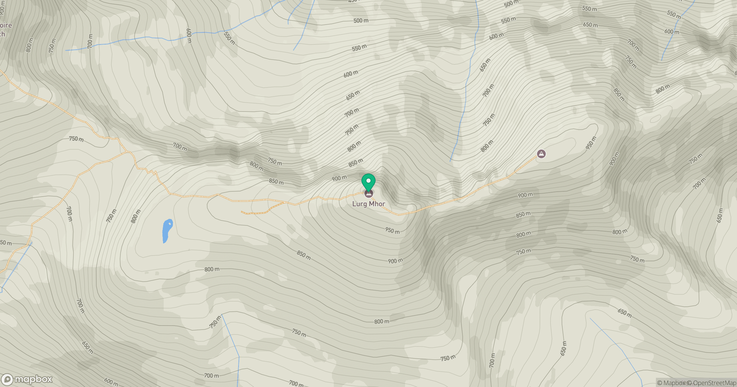
Grid reference: NH064404
View on OpenStreetMapOpens a map in a new tab, centred on the hill.
No comments yet. Be the first.