

Beinn Eighe - Ruadh-stac Mor
Good walks are even better shared.
NG9561 : Summit area of Ruadh-stac Mor
Steven Brown Photo source
Overview
Ruadh-stac Mor (1010 m) is the highest summit of Beinn Eighe in Torridon, on a northern spur above Coire Mhic Fhearchair. The mountain’s other Munro is Spidean Coire nan Clach (993 m). Summit routes are strenuous mountain walks with steep scree, rough ridges and some scrambling.
Beinn Eighe – Ruadh-stac Mor
Ruadh-stac Mor is Beinn Eighe’s highest summit, at 1010 m. It lies on a northern spur above Coire Mhic Fhearchair. Spidean Coire nan Clach, 993 m, is the mountain’s other Munro. The cairn at Ruadh-stac Mor is recorded at NG951611 in DoBIH.
Choosing a walk
- Clockwise western-Munros circuit: The Great Outdoors gives 19.6 km and 7–9 hours for its Glen Torridon itinerary, visiting Ruadh-stac Mor before Spidean Coire nan Clach.
- Anti-clockwise western-Munros circuit: Walkhighlands gives 18 km and 7–9 hours for its itinerary, visiting the same Munros in reverse order. These are each publisher’s estimates for its mapped route, not interchangeable measured totals.
- Ruadh-stac Mor alone can be approached through Coire Mhic Fhearchair and retraced. This combines the ascent described by UKHillwalking with the reverse descent described by Walkhighlands. It uses the steep gully twice and still demands mountain experience.
- Coire Mhic Fhearchair only: 14 km, 3½–5 hours, returning from the lochan. It reaches neither Munro.
- NNR Mountain Trail: 6.5 km, 3–4 hours from the A832 beside Loch Maree. This separate, steep and rocky waymarked circuit also reaches neither Munro.
Mountain safety
The western circuit includes loose scree, steep corrie slopes, rough ridges and short scrambling. Published guides differ on circuit direction; neither direction removes the difficult ground. Wet rock, wind and poor visibility can make progress much harder. The trig pillar west of Spidean Coire nan Clach is below that Munro’s true summit. Careful navigation matters, particularly on the descent into Coire an Laoigh. Use a detailed route description and an appropriate map on the hill.
UKHillwalking highlights winter cornices and possible avalanche problems in both corries. Snow and ice call for winter mountaineering skills and appropriate equipment. Check mountain weather and any current SAIS Torridon report; a report from a previous season does not describe today’s conditions. Mountaineering Scotland explains the preparation required.
Access, landscape and names
The western-Munros walks use the A896 Coire Dubh car park in Glen Torridon. The reserve visitor centre and A832 trails are separate destinations. NatureScot lists visitor facilities and local travel information; check opening times and onward transport before travel.
Beinn Eighe’s landscape combines sandstone, quartzite, glacial corries and ancient pinewoods. Its national nature reserve was established in 1951. See the NatureScot reserve leaflet. Beinn Eighe means “file mountain”, according to LearnGaelic.
Editorial sources checked 16 October 2026, 08:13:49–08:17:26 UTC. DoBIH’s 28 October 2001 record revision is retained separately; it is not the date of this review or a claimed new summit survey.
Explore routes near Beinn Eighe - Ruadh-stac Mor
Walks starting near this hill. Open a route to check its map, distance and full itinerary.
Beinn Eighe Lancaster Wreckage at Coire Mhic Fhearchair
View route
Fairy Lochs Liberator Wreckage Circuit
View route
Loch Affric full circuit from River Affric
View route
Glen Affric: Coire Loch Woodland Trail
View route
Route planning notes
These notes describe possible approaches. Check a route's map and access information when planning your walk.
Western Munros clockwise via Coire Mhic Fhearchair
From the A896 Coire Dubh car park, follow Coire Dubh Mor and contour around Sail Mhor to the lochan. Climb the steep scree gully, visit Ruadh-stac Mor, then return to the saddle and cross the ridge to Spidean Coire nan Clach. Return to the trig pillar, descend Coire an Laoigh and turn west along the road to the start. The Great Outdoors gives 19.6 km and 7–9 hours for this circuit.
Western Munros anti-clockwise via Coire an Laoigh
From Coire Dubh car park, walk east along the A896 to the Coire an Laoigh path. Climb to Spidean Coire nan Clach, return past the trig point and traverse west towards Coinneach Mhor, then north to Ruadh-stac Mor. Return to the saddle and descend the very steep Coire Mhic Fhearchair scree gully; follow the lochan and stalkers path back to the start. Walkhighlands gives 18 km and 7–9 hours.
Ruadh-stac Mor via Coire Mhic Fhearchair, out and back
Use the Coire Dubh approach to Coire Mhic Fhearchair, pass along the lochan’s east side and climb the scree gully to the saddle. Follow the northern spur to Ruadh-stac Mor, then retrace the same way. This return variant uses the steep, loose gully in both directions and omits Spidean Coire nan Clach; it is still a serious mountain walk.
Coire Mhic Fhearchair lochan, no Munro summit
Walk from the A896 Coire Dubh car park through Coire Dubh Mor and around Sail Mhor to the lochan below the Triple Buttress. Return by the same path, without climbing the scree gully. Walkhighlands gives 14 km and 3½–5 hours. The rocky path enters wild, exposed terrain, so this is a substantial hillwalk despite omitting both Munros.
Beinn Eighe NNR Mountain Trail, no Munro summit
A separate waymarked circuit from Coille na Glas Leitir car park on the A832 beside Loch Maree (NH002650). It climbs through pinewoods to the Conservation Cairn and returns through rocky upland terrain. NatureScot and Walkhighlands give 6.5 km and 3–4 hours. It reaches neither Ruadh-stac Mor nor Spidean Coire nan Clach, and includes steep, rocky sections exposed to the weather.
Make a day of it, together
Find someone to share the walk with, or organise a day out along a route you like.
Photo Gallery
View all Photo could not load
NG9561 : Summit area of Ruadh-stac Mor
Steven Brown
 Photo could not load
NG9561 : Stony slope south-east of summit of Ruadh-stac Mòr
Trevor Littlewood
 Photo could not load
NG9561 : View south from Ruadh-stac Mor
Nigel Brown
 Photo could not load
NG9561 : Beinn Eighe
Dave Marley
 Photo could not load
NG9561 : Hard geographing
Roger McLachlan
 Photo could not load
NG9561 : Summit cairn, Ruadh-stac Mòr, Beinn Eighe
John Allan
 Photo could not load
NG9561 : Approaching the summit cone of Ruadh-stac Mòr
John Allan
Hill facts and local notes
Classifications
Elevation
1,010m
3,314 ft
Prominence
632m
Coordinates
57.5937, -5.4295
NG951611
OS Map
19
Explorer: 433
At the Summit
A cairn marks Ruadh-stac Mor. The trig pillar on the main ridge is associated with the approach to Spidean Coire nan Clach, and is below that separate Munro’s true summit.
Terrain & Geology
Beinn Eighe combines Torridonian sandstone with younger quartzite. The pale quartzite is conspicuous on the ridges and scree; the Triple Buttress shows sandstone below quartzite. Glaciers shaped the corries, while thrusting has locally placed older sandstone above younger rock.
Views & Scenery
Ruadh-stac Mor looks back over Coire Mhic Fhearchair and the main Beinn Eighe ridge. The western traverse also gives views towards Liathach and the wild country north of Torridon, when visibility allows.
History & Heritage
Name Origin
Beinn Eighe means “file mountain”, referring to the tool. NatureScot renders Ruadh-stac Mor as “the Greater Steep Red Hill”.
Historical Significance
Beinn Eighe National Nature Reserve was established in 1951 as Britain’s first national nature reserve, protecting habitats that include ancient Scots pinewoods and mountain ground.
Getting There & Facilities
Parking
Coire Dubh car park on the A896 in Glen Torridon, just west of the bridge over Allt a’ Choire Dhuibh Mhòir (Walkhighlands start grid NG958569). This is the western-Munros and Coire Mhic Fhearchair start. The NNR Mountain Trail uses a separate A832 car park.
Public Transport
Walkhighlands lists no public transport to the A896 western-Munros start. NatureScot lists a limited Inverness bus to Kinlochewe and rail to Achnasheen for the reserve area. These do not provide a direct summit-route connection; check current timetables and arrange onward and return travel.
Nearby Facilities
Kinlochewe has a shop, café and accommodation. NatureScot lists toilets at its Beinn Eighe visitor centre on the A832, open 10am–5pm; check current opening arrangements. The visitor centre is separate from the A896 western-Munros start.
Safety Information
Known Hazards
- The Coire Mhic Fhearchair gully is very steep, eroded and loose; it requires care in either direction.
- Rocky ridges and short scrambling become more serious in wet or windy conditions. Poor visibility makes route-finding harder.
- The lochan outflow may be difficult in spate. The steep Coire an Laoigh descent needs careful navigation.
Seasonal Hazards
Snow and ice make this winter mountaineering terrain. Cornices and avalanche-prone snow can affect the ridges, the Coire Mhic Fhearchair gully and Coire an Laoigh. Short daylight, navigation, winter skills and trained use of an ice axe and crampons must be considered. Check mountain weather and available seasonal SAIS reports.
General Safety Tips
- Check weather conditions before setting out
- Carry appropriate clothing and equipment
- Let someone know your planned route
- Take a map, compass, and GPS device
- Carry emergency supplies: food, water, first aid kit, torch
Hills
Some common questions about the hills answered
Are there group walks up Beinn Eighe - Ruadh-stac Mor?
Many walkers use Walkmates to join or organise walks with others. You can check for group walks around Beinn Eighe - Ruadh-stac Mor through the maps
Are there other walkers around Beinn Eighe - Ruadh-stac Mor?
Activity varies by location and time, but Walkmates lets you see whether others have shared walks or shown interest in this area. Find other people through the walking friends search walking friends for Beinn Eighe - Ruadh-stac Mor search or of course create your own walk for Beinn Eighe - Ruadh-stac Mor
Can I organise a walk to Beinn Eighe - Ruadh-stac Mor?
Yes. If there aren’t any walks listed already, you can create a walk and make it available for others to join.
If you're signed up to Walkmates, you can create a walk to Beinn Eighe - Ruadh-stac Mor.
How do I find a walk up this hill?
There are often multiple ways to walk this hill, depending on experience and route preference. Walkmates helps you explore walks and routes that others have shared.
Can I suggest a new route up Beinn Eighe - Ruadh-stac Mor?
Yes. You can suggest or create routes to share with others. Walkmates focuses on the social side of walking, so routes are used to help people organise walks and explore areas together, rather than as detailed navigation tools or route libraries.
Other uses really appreciate knowledgeable walkers sharing their routes. Share your favourite route to Beinn Eighe - Ruadh-stac Mor here
The is an error or something incorrect about this hill. How do I let you know?
We always strive to keep the information on Walkmates as accurate as possible. If you find an error, please let us know through the contact form and we'll aim to correct it as quickly as possible
Community Discussion
Comments
Location
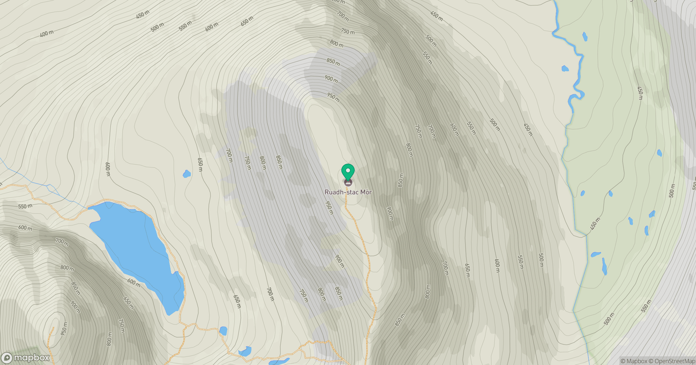
Grid reference: NG951611
View on OpenStreetMapOpens a map in a new tab, centred on the hill.
No comments yet. Be the first.