

Liathach - Mullach an Rathain
Good walks are even better shared.
NG9157 : The Northern Corrie of Mullach an Rathain, Liathach
Michael Earnshaw Photo source
Overview
Liathach - Mullach an Rathain
Liathach is not just another Munro; it’s a royal gem in the crown of the Scottish Highlands. Towering majestically at 1024 meters (3360 feet), this impressive mountain is well known among experienced hikers and climbers, particularly for its craggy ridges and stunning views.
Geology
As you wander through its rugged landscape, take a moment to admire the gneiss that forms the backbone of Liathach. This metamorphic rock, shaped by tectonic forces and sculpted by glacial action, provides a dramatic theatrical backdrop. You may even spot some fascinating rock formations that have stood the test of time…and weather!
Routes
Liathach boasts a variety of routes, each offering unique perspectives:
- North Ridge Route: A challenging trek that takes about 6 hours to complete, it stretches approximately 10 km. This route reveals some of the best vistas, but be prepared for scrambles that might get your heart racing.
- South Ridge Route: Slightly less arduous but equally rewarding, this 9.5 km trail takes around 5.5 hours, inviting you to tread more gently while still soaking in breathtaking views.
Summit Features
At the pinnacle, you'll find a sturdy cairn standing vigil over the breathtaking expanses stretching below. Don't miss your chance for a summit selfie; after all, who wouldn't want to brag about basking in the glory of such heights?
Terrain Type
Expect rocky and rugged terrain punctuated by steep inclines. Be on the lookout for the occasional boggy patch that might surprise you and give your boots a good washing!
Views
Highlights
From the summit, you are rewarded with sweeping views of the Torridon Mountains and the serene Loch Torridon. Clear days can yield a glimpse of the Isle of Skye, serving up a scenic platter that you won't soon forget.
Best Seasons
Late spring and early autumn are your best bets for favourable conditions. Try to avoid the Scottish winter unless you fancy an ice-skating adventure in the mountains!
Hazards
As a wise hiker once said, “The higher you climb, the harder you fall.” So keep an eye on those steep drops and watch your footing; loose rocks have a habit of tumbling all too eagerly!
Access
Reaching Liathach involves a journey to the charming village of Torridon. The small parking area at the end of the road fills up fast, particularly on the weekends, so arrive early to grab a spot. Public transport is a rare commodity in these parts, so travelling by car is advisable.
Facilities
Once you’ve heaved your pack off at the base, reward yourself at the local café which serves hearty meals and a well-deserved cuppa! Toilets are usually available there.
History
Name Meaning
The mountain’s name translates to 'the grey one', reflecting its drab yet majestic facade that demands respect.
Significance
Liathach has carved its place in the hearts of climbers, recognised for both its challenging climbs and awe-inspiring scenery. It stands proud and has seen countless adventures unfold on its slopes.
In conclusion, Liathach – Mullach an Rathain is more than just a physical challenge; it’s an experience woven into the breathtaking tapestry of the Scottish Highlands. Take your time, respect the elements, and the mountain might just reward you with memories worth a lifetime.
Explore routes near Liathach - Mullach an Rathain
Walks starting near this hill. Open a route to check its map, distance and full itinerary.
Beinn Eighe Lancaster Wreckage at Coire Mhic Fhearchair
View route
Fairy Lochs Liberator Wreckage Circuit
View route
Glen Affric: Coire Loch Woodland Trail
View route
Fort Augustus to Kytra Lock: Caledonian Canal Towpath
View route
Route planning notes
These notes describe possible approaches. Check a route's map and access information when planning your walk.
Classic Traverse of Liathach
This is the iconic route traversing the full ridge of Liathach, starting from the car park at Torridon (NG929568). The route ascends steeply to the ridge via a well-trodden path, reaching the first Munro, Spidean a’ Choire Lèith. It then continues along the pinnacled ridge, including the famous Am Fasarinen pinnacles, before summiting Mullach an Rathain. The descent is via a steep, eroded path back to the road at NG9118657691.
Mullach an Rathain Direct Ascent
This route focuses on Mullach an Rathain alone, starting from the car park at NG9118657691. The ascent follows a steep and direct path through Coire Dubh Mor, climbing steadily to the summit. The route offers exceptional views over Glen Torridon and Loch Torridon. Descent is via the same path.
Coire na Caime Circuit
A less technical route that explores the northern flanks of Liathach. Starting from the car park at NG9118657691, the route follows the path into Coire na Caime, offering stunning views of the corrie and its lochans. The route ascends to the ridge west of Mullach an Rathain and then summits Mullach an Rathain itself. Descent is via the same steep path used in the Classic Traverse.
Lower Coire Dubh Exploration
A shorter, less committing walk for those who want to experience Liathach without tackling the full ridge. This route starts from the car park at NG9118657691 and ascends into Coire Dubh Mor to explore the dramatic scenery of the corrie. It does not reach the summit but offers an excellent taste of Liathach’s grandeur.
Western Approach to Mullach an Rathain
This alternative route starts west of the main car park at NG866576 and ascends via a less-travelled path through Coire Liath Mhor, approaching Mullach an Rathain from the west. The path is steep and less defined in places but rewards with a quieter approach and stunning views. Descent is typically made via the standard Mullach an Rathain route to NG9118657691.
Make a day of it, together
Find someone to share the walk with, or organise a day out along a route you like.
Photo Gallery
View all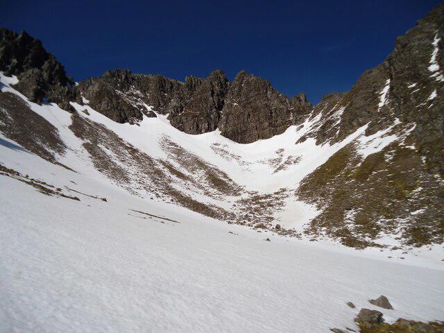 Photo could not load
NG9157 : The Northern Corrie of Mullach an Rathain, Liathach
Michael Earnshaw
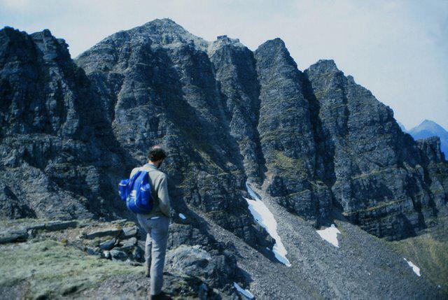 Photo could not load
NG9157 : The Row of Pinnacles below Mullach an Rathain
K A
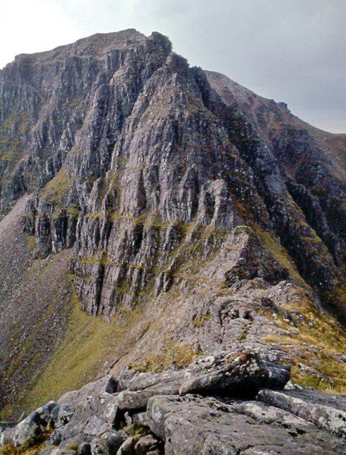 Photo could not load
NG9157 : Mullach an Rathain from the Northern Pinnacles
Alan Reid
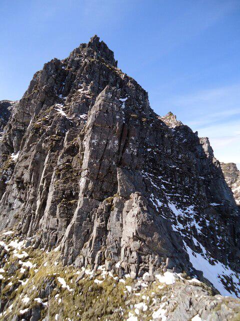 Photo could not load
NG9157 : The Northern Pinnacles of Mullach an Rathain
Michael Earnshaw
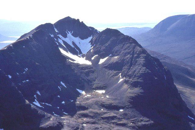 Photo could not load
NG9157 : Mullach an Rathain
Jim Barton
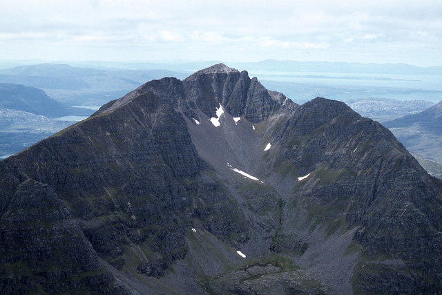 Photo could not load
NG9157 : Mullach an Rathain from Spidean a' Choire Leith
Colin Park
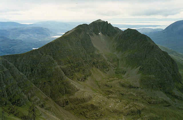 Photo could not load
NG9157 : Mullach an Rathain from the east
Nigel Brown
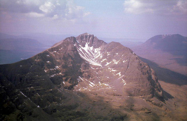 Photo could not load
NG9157 : Mullach an Rathain
Russel Wills
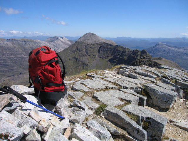 Photo could not load
NG9157 : Liathach - Mullach an Rathain
Rude Health
Hill facts and local notes
Classifications
Elevation
1,024m
3,359 ft
Prominence
152m
Coordinates
57.5609, -5.4925
NG911576
OS Map
25
Explorer: 433
At the Summit
The summit features a prominent cairn, perfect for those all-important summit selfies, and a stunning panorama that will make you forget any leg aches you might have.
Terrain & Geology
Liathach is composed primarily of gneiss, which is a metamorphic rock formed under high pressure and temperature. The dramatic cliffs and ridges are a result of glacial erosion, making it a canvas of jagged features and stunning rock formations.
Views & Scenery
From the summit, you can see the stunning Torridon Mountains and the vast Loch Torridon, as well as glimpses of the Isle of Skye on a clear day.
History & Heritage
Name Origin
The name 'Liathach' translates to 'the grey one' in Gaelic, which is indicative of the mountain's rugged, slate-grey appearance.
Historical Significance
Liathach has long been regarded as one of Scotland's classic climbs, attracting climbers and hikers alike for its stunning beauty and challenging terrain.
Getting There & Facilities
Parking
There's a small parking area located at the end of the road near the village of Torridon, ample enough for several vehicles but can fill quickly on weekends.
Public Transport
Public transport options are limited; it’s best to arrive by car. However, you can reach Torridon by bus from larger towns like Strathcarron.
Nearby Facilities
There is a café in Torridon providing hot meals and drinks, along with a small shop for basics. Toilets are typically available at the café.
Safety Information
Known Hazards
- Steep drops along the ridges, potential for loose rocks, rapidly changing weather conditions.
General Safety Tips
- Check weather conditions before setting out
- Carry appropriate clothing and equipment
- Let someone know your planned route
- Take a map, compass, and GPS device
- Carry emergency supplies: food, water, first aid kit, torch
Hills
Some common questions about the hills answered
Are there group walks up Liathach - Mullach an Rathain?
Many walkers use Walkmates to join or organise walks with others. You can check for group walks around Liathach - Mullach an Rathain through the maps
Are there other walkers around Liathach - Mullach an Rathain?
Activity varies by location and time, but Walkmates lets you see whether others have shared walks or shown interest in this area. Find other people through the walking friends search walking friends for Liathach - Mullach an Rathain search or of course create your own walk for Liathach - Mullach an Rathain
Can I organise a walk to Liathach - Mullach an Rathain?
Yes. If there aren’t any walks listed already, you can create a walk and make it available for others to join.
If you're signed up to Walkmates, you can create a walk to Liathach - Mullach an Rathain.
How do I find a walk up this hill?
There are often multiple ways to walk this hill, depending on experience and route preference. Walkmates helps you explore walks and routes that others have shared.
Can I suggest a new route up Liathach - Mullach an Rathain?
Yes. You can suggest or create routes to share with others. Walkmates focuses on the social side of walking, so routes are used to help people organise walks and explore areas together, rather than as detailed navigation tools or route libraries.
Other uses really appreciate knowledgeable walkers sharing their routes. Share your favourite route to Liathach - Mullach an Rathain here
The is an error or something incorrect about this hill. How do I let you know?
We always strive to keep the information on Walkmates as accurate as possible. If you find an error, please let us know through the contact form and we'll aim to correct it as quickly as possible
Community Discussion
Comments
Location
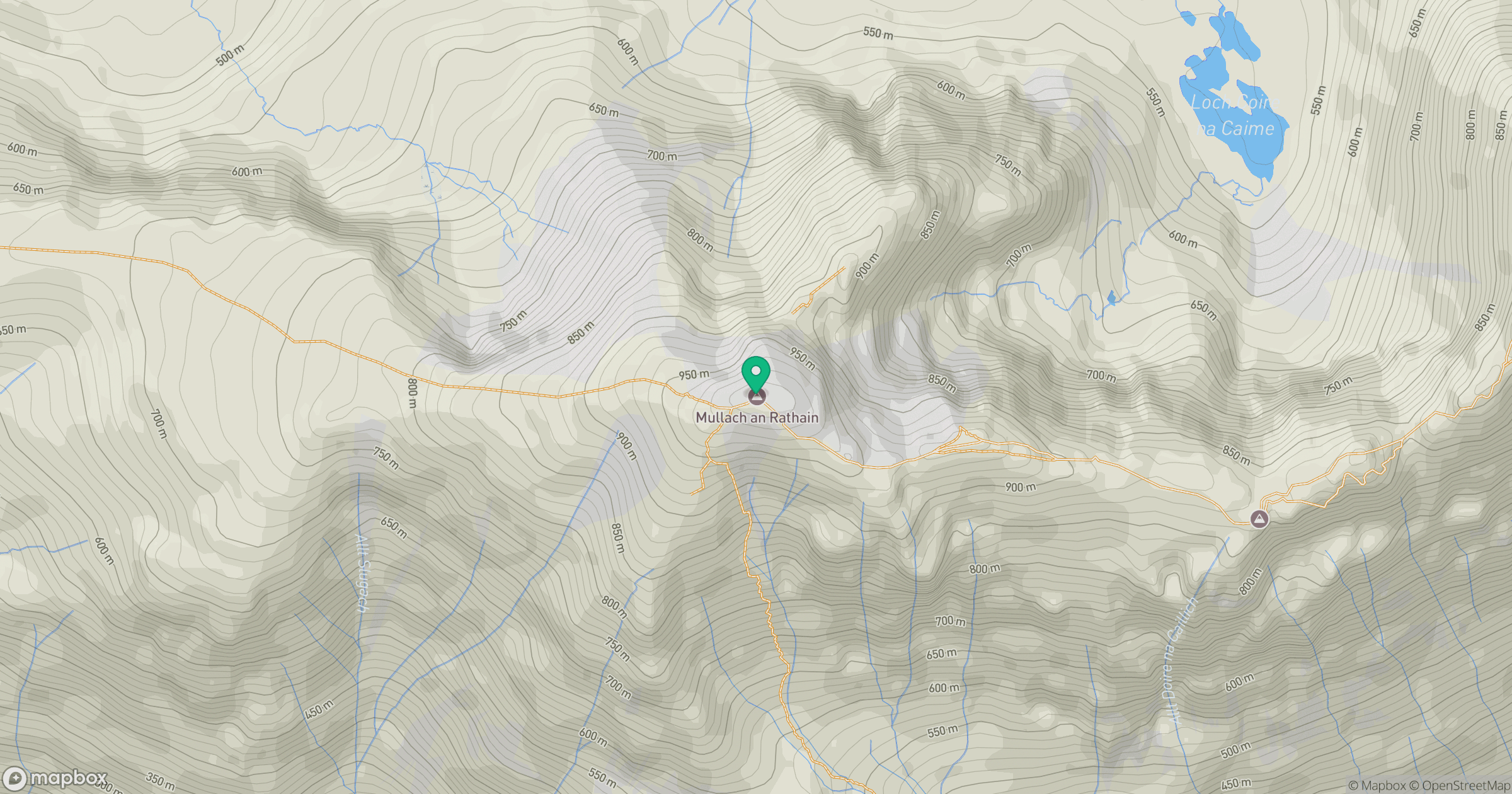
Grid reference: NG911576
View on OpenStreetMapOpens a map in a new tab, centred on the hill.
No comments yet. Be the first.