

Carn Eighe
Good walks are even better shared.
NH1226 : View southeast from Carn Eige
Nigel Brown Photo source
Overview
Carn Eighe: The Majestic Highland Munro
Overview
Nestled in the Scottish Highlands, Carn Eighe stands proud as one of the noteworthy Munros, boasting an elevation of 1183 meters. Its rugged granite and schist formations, carved by ancient glaciers, make it a favourite among hikers.
Geology
Carn Eighe's impressive geology showcases the ancient processes that shaped the Highlands. The granite outcrops provide not only stunning scenery but also a reminder of Scotland's dynamic natural history.
Routes
The most popular route starts in Glen Affric, leading through verdant woods and past sparkling lochs. Allow around six hours to complete the 16 km trek, and keep your camera ready; this path is as much about the journey as the destination!
Summit Features
The summit is easily identifiable by its large cairn, which is a traditional sight for many Munro peaks. It offers a well-deserved resting spot with sweeping views that can leave you breathless.
Terrain
Expect a classic Highland mix: rocky paths, grassy patches, and the occasional bog just to remind you that you're in the wilderness. Good footwear is essential – don’t let your soggy socks be the highlight of your day!
Views
On a clear day, the vistas from Carn Eighe are nothing short of spectacular. You’ll be treated to sights of Loch Mullardoch and the sprawling hills of Glen Affric. Late spring and early autumn provide the best visibility, so plan your hike accordingly.
Hazards
As with all Highland hikes, be prepared for unpredictable weather. Sudden storms can throw a spanner in the works, so check forecasts before heading out. Loose rocks can also pose risks, so tread carefully – tripping on your own feet is one thing, but tumbling down a mountain is wholly another!
Nearby Summits
Don't miss the chance to bag nearby peaks like Carn Ghluasaid and An Socach, both offering their own adventures and stunning views.
Access
While there is parking available at the Glen Affric car park, it does fill up quickly in good weather. Public transport links are sparse, so a car is the way to go. The friendly village of Cannich is the closest for supplies and support.
Facilities
Facilities in Glen Affric are minimal, so bring your own provisions. Cannich offers some cafes and shops, where you can refuel after your quest.
History
The name Carn Eighe, meaning 'the cairn of the eagle', speaks to the rich wildlife of the area. This mountain holds significant cultural and historical value, treasured by the hiking community and nature lovers alike.
In conclusion, whether you’re a seasoned Munro bagger or a first-time hiker, Carn Eighe offers an unforgettable adventure in the heart of the Scottish Highlands. Lace up those boots and happy hiking!
Explore routes near Carn Eighe
Walks starting near this hill. Open a route to check its map, distance and full itinerary.
Loch Affric full circuit from River Affric
View route
Glen Affric: Coire Loch Woodland Trail
View route
Fort Augustus to Kytra Lock: Caledonian Canal Towpath
View route
Great Glen Way low route: Fort Augustus to Invermoriston Old Bridge
View route
Route planning notes
These notes describe possible approaches. Check a route's map and access information when planning your walk.
Classic Carn Eighe Circuit via Glen Affric
This popular route begins at the car park near the end of Glen Affric Road. From here, follow the path alongside the River Affric before ascending the ridge via Bealach Coire Ghaidheil. Carn Eighe is tackled first, followed by its neighbouring Munro, Mam Sodhail, before descending back to the glen.
Carn Eighe via Beinn Fhionnlaidh Link-Up
Starting at the same Glen Affric car park, this route heads to Carn Eighe via the Munro Beinn Fhionnlaidh. A steep ascent up Beinn Fhionnlaidh provides stunning views over Loch Mullardoch, followed by a ridge walk to Carn Eighe. Descend via the Bealach Coire Ghaidheil path.
Carn Eighe from Mullardoch Dam
This lesser-trodden route starts at the Mullardoch dam. Follow the northern shore of Loch Mullardoch before ascending Carn Eighe via its northern ridge. This is a remote and demanding approach but offers a quieter alternative to Glen Affric.
Carn Eighe and Mam Sodhail from Alltbeithe Youth Hostel
This route begins at the Alltbeithe Youth Hostel in Glen Affric. Ascend steeply to Bealach Coire Ghaidheil, then bag Mam Sodhail before continuing along the ridge to Carn Eighe. Return via the same path to the hostel.
Loch Affric Circular Including Carn Eighe
For a longer adventure, start at the Glen Affric car park and circumnavigate Loch Affric as part of the route to Carn Eighe. This involves a mix of walking along lochside paths and tackling the steep ascent to the summit.
Make a day of it, together
Find someone to share the walk with, or organise a day out along a route you like.
Photo Gallery
View all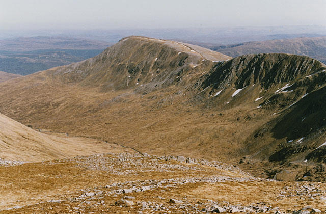 Photo could not load
NH1226 : View southeast from Carn Eige
Nigel Brown
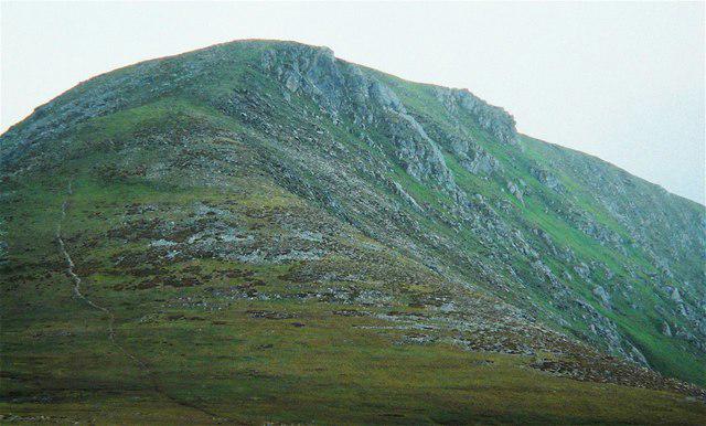 Photo could not load
NH1226 : Carn Eige from the east
AlastairG
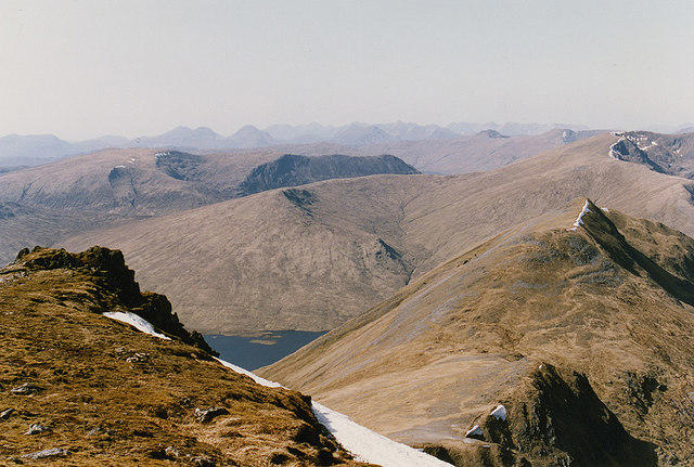 Photo could not load
NH1226 : The ridge out to Beinn Fhionnlaidh
Nigel Brown
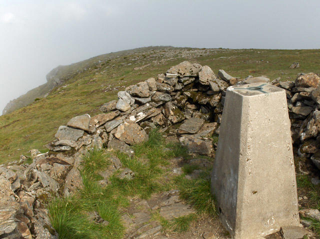 Photo could not load
NH1226 : Carn Eige
Andrew Smith
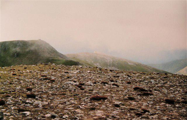 Photo could not load
NH1226 : Màm Sodhail from Carn Eige
AlastairG
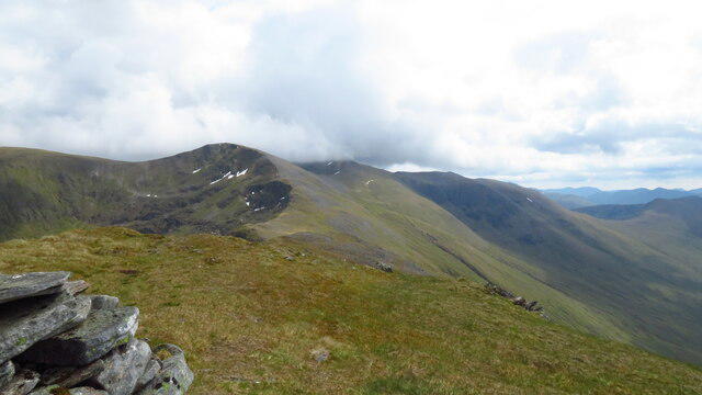 Photo could not load
NH1226 : On Beinn Fhionnlaidh - view to Carn Eighe
Colin Park
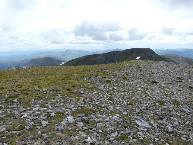 Photo could not load
NH1226 : Mam Sodhail from Carn Eige
Adam Ward
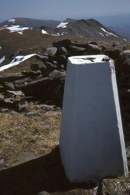 Photo could not load
NH1226 : Summit trig point, Carn Eighe
Jim Barton
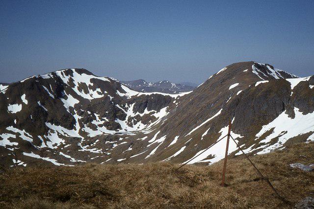 Photo could not load
NH1226 : Carn Eige and Mam Sodhail
Jim Barton
Hill facts and local notes
Classifications
Elevation
1,183m
3,881 ft
Prominence
1,147m
Coordinates
57.2877, -5.1152
NH123261
OS Map
25
Explorer: 414N
At the Summit
The summit of Carn Eighe is marked by a prominent cairn, offering a perfect spot for a photo op and a well-earned snack break. The panoramic views from the top are absolutely breathtaking.
Terrain & Geology
The geology of Carn Eighe primarily consists of granite and schist, typical of the rugged Highland landscape. The mountain's formations were shaped by glacial activity, creating dramatic cliffs and smooth ridges that add to its visual appeal.
Views & Scenery
From the summit, expect to see the stunning Loch Mullardoch and the distant peaks of the Glen Affric hills. On a clear day, the view stretches far and wide, giving hikers a chance to appreciate the grandeur of the Highlands.
History & Heritage
Name Origin
The name 'Carn Eighe' translates to 'the cairn of the eagle', reflecting the wildlife that frequents these heights.
Historical Significance
Carn Eighe has long been a revered peak among Munro baggers. Its rugged beauty and challenging terrain offer a true Highland adventure, attracting outdoor enthusiasts from far and wide.
Getting There & Facilities
Parking
There is parking available at the end of the road leading into Glen Affric, approximately 8 km from the start of the hiking trail. The car park is spacious but can fill up quickly during peak season.
Public Transport
The nearest public transport option is from Cannich, where you can catch a bus to Drumnadrochit; however, a car is recommended for easier access to Glen Affric.
Nearby Facilities
There are limited facilities in Glen Affric, so it's advisable to bring your own snacks and drinks. Facilities in Cannich include cafes and small shops, but be sure to check opening times.
Safety Information
Known Hazards
- Beware of sudden weather changes, which are common in the Highlands. Strong winds and rain can make conditions challenging. Also, be wary of loose rocks on the ascent.
General Safety Tips
- Check weather conditions before setting out
- Carry appropriate clothing and equipment
- Let someone know your planned route
- Take a map, compass, and GPS device
- Carry emergency supplies: food, water, first aid kit, torch
Hills
Some common questions about the hills answered
Are there group walks up Carn Eighe?
Many walkers use Walkmates to join or organise walks with others. You can check for group walks around Carn Eighe through the maps
Are there other walkers around Carn Eighe?
Activity varies by location and time, but Walkmates lets you see whether others have shared walks or shown interest in this area. Find other people through the walking friends search walking friends for Carn Eighe search or of course create your own walk for Carn Eighe
Can I organise a walk to Carn Eighe?
Yes. If there aren’t any walks listed already, you can create a walk and make it available for others to join.
If you're signed up to Walkmates, you can create a walk to Carn Eighe.
How do I find a walk up this hill?
There are often multiple ways to walk this hill, depending on experience and route preference. Walkmates helps you explore walks and routes that others have shared.
Can I suggest a new route up Carn Eighe?
Yes. You can suggest or create routes to share with others. Walkmates focuses on the social side of walking, so routes are used to help people organise walks and explore areas together, rather than as detailed navigation tools or route libraries.
Other uses really appreciate knowledgeable walkers sharing their routes. Share your favourite route to Carn Eighe here
The is an error or something incorrect about this hill. How do I let you know?
We always strive to keep the information on Walkmates as accurate as possible. If you find an error, please let us know through the contact form and we'll aim to correct it as quickly as possible
Community Discussion
Comments
Location
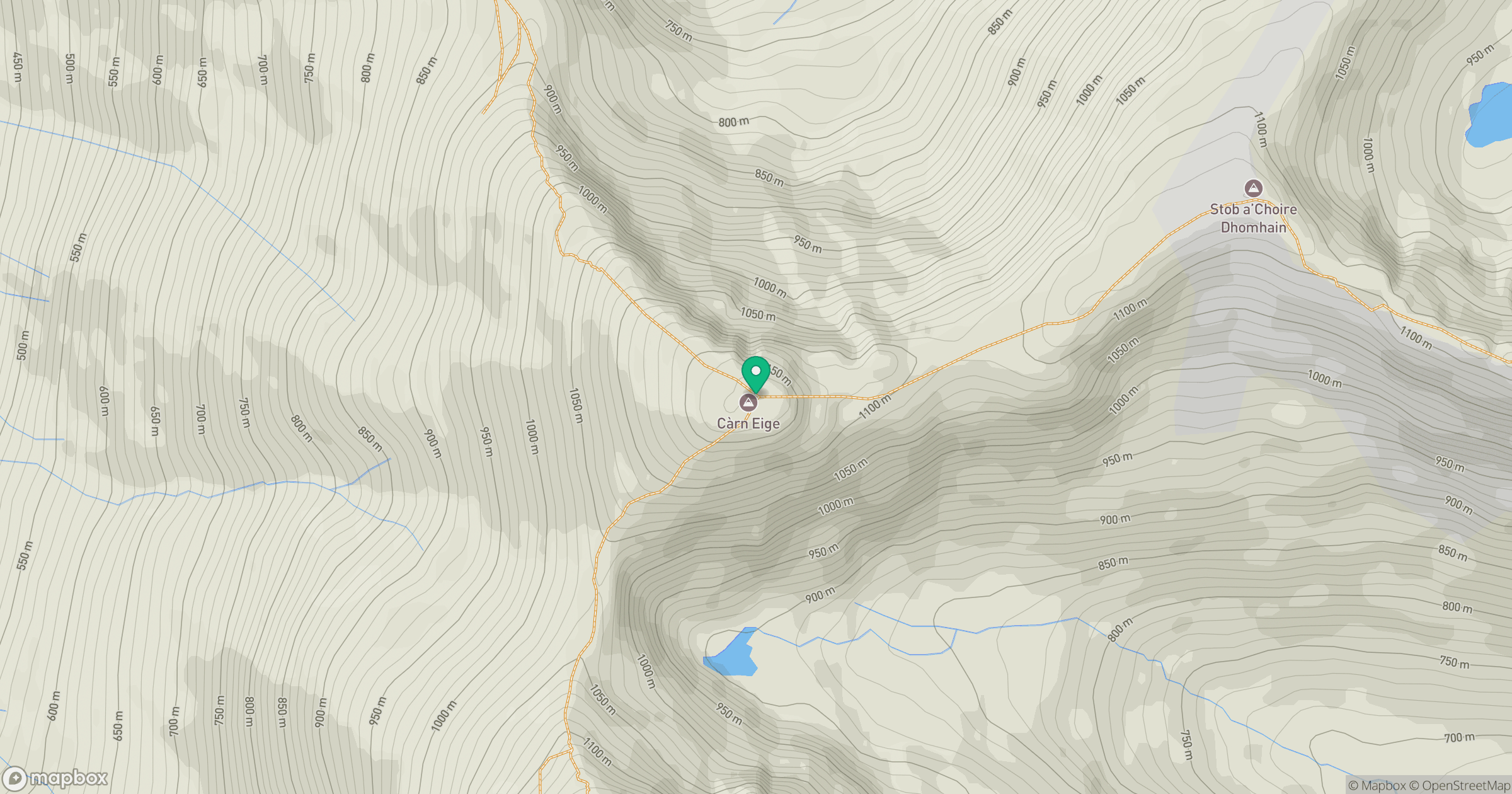
Grid reference: NH123261
View on OpenStreetMapOpens a map in a new tab, centred on the hill.
No comments yet. Be the first.