
UK nation
Walking in Wales
Three national parks, the mountains of Eryri and a path around the entire coast.
Dated walks
Upcoming walks in Wales
12 dates coming up. Check each listing for the meeting point and how to join.
Walk any day
Walking routes in Wales
A few of the 35 routes shared in Wales, each with a map, distance and time estimate.

Photo unavailable
Swansea Marina to Mumbles Pier approach

Photo unavailable
Hafren Forest: full Source of the Severn Trail

Photo unavailable
Ystwyth Trail: Black Covert to Llanilar and back
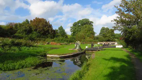
Photo unavailable
Welshpool to Sweeps Bridge: Montgomery Canal and Belan Locks
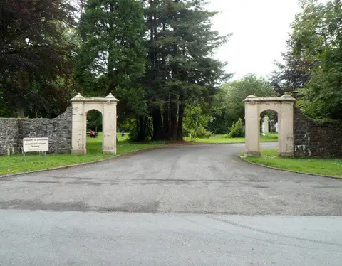
Photo unavailable
Abergwili to Nantgaredig: Tywi Valley Path out and back
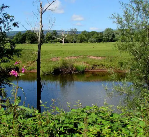
Photo unavailable
Clytha Estate: River Usk, Chapel Ruins and Castle Woods
More routes by area: Clwyd Dyfed Gwent Gwynedd Mid Glamorgan Powys South Glamorgan West Glamorgan
Community
Walkers in Wales
24 walkers based in Wales have public profiles. Say hello, or find someone to walk with.
 Mandy
@MandyLou
Cwmbrân
Morag
@MoragH
Bridgend
 Clare
@Clarelysian
Cross Hands
David
@david1654
Rhondda
 Jim
@Jim
Connah's Quay / Cei Connah
 Michael
@Barker
Welshpool / Y Trallwng
Ian
@Shrimper21
Wrexham / Wrecsam
Region guide
About walking in Wales
Wales is a small country with a lot of walking. Eryri (Snowdonia) has Yr Wyddfa (Snowdon), the highest mountain in Wales, and rugged ranges such as the Glyderau and the Carneddau. Bannau Brycheiniog (the Brecon Beacons) has broad grassy ridges and waterfalls, and the Pembrokeshire Coast is a national park designated mainly for its coastline.
In 2012 the Wales Coast Path made Wales the first country with a continuous path along its whole coastline, around 870 miles. Offa's Dyke Path follows the border with England, and Gower, Llŷn, Anglesey and the Clwydian Range offer gentler days with sea or valley views.
Hill and upland guides: Snowdonia Brecon Beacons Gower Peninsula
Landscapes and trails in Wales
Eryri (Snowdonia)
Yr Wyddfa, the Glyderau and the Carneddau, plus lakes, forests and the rough Rhinogydd.
Explore Eryri (Snowdonia)Bannau Brycheiniog (Brecon Beacons)
Grassy ridges up to Pen y Fan, and the waterfalls of the Waterfall Country.
Explore Bannau Brycheiniog (Brecon Beacons)Pembrokeshire Coast
Cliffs, coves, islands and seabirds along the Pembrokeshire Coast Path.
Wales Coast Path
Around 870 miles following the entire coast of Wales.
Offa's Dyke Path
177 miles from Chepstow to Prestatyn, never far from the border with England.
Gower
The UK's first Area of Outstanding Natural Beauty, with Rhossili Bay and Worm's Head.
Explore GowerGo local
Areas of Wales
Each page has its own routes, dated walks, towns and local walkers.
Good to know
Questions about walking in Wales
Are there group walks in Wales?
Yes. Walkmates currently lists 12 upcoming dated walks in Wales. Each listing shows where to meet and how to join, and you can browse them without an account.
Which is the easiest path up Yr Wyddfa (Snowdon)?
The Llanberis Path is the longest but most gradual route, and it runs alongside the mountain railway. It is still a full mountain day: summit weather can be severe even in summer, so check the mountain forecast and turn back if conditions change.
How long is the Wales Coast Path?
Around 870 miles (1,400 km). Together with Offa's Dyke Path, it lets you walk almost all the way around Wales.
Conditions, access and opening arrangements change. Check the route, the forecast and any organiser's instructions before you set off, and see our walking safety guide.
Find someone to walk with in Wales
Join Walkmates free to save routes, join dated walks and meet walkers near you.
Join Walkmates