

Slioch
Good walks are even better shared.
NH0068 : Winter view of Sgurr an Tuill Bhàin from Slioch
Doug Lee Photo source
Overview
Slioch is a 981.2 m Munro above Loch Maree in Wester Ross. The northern summit is higher than the separate trig-point top. The usual walking approach starts at Incheril near Kinlochewe.
Slioch
Slioch rises above Loch Maree in Wester Ross. DoBIH records the Munro at 981.2 m, NH004690. Its northern summit is higher than the separate 980 m trig-point top to the south.
Summit and geology
The high point is an outcrop 3 m south of the northern cairn; the DoBIH observation notes that rocks to the north may be as high. Do not stop at the lower trig point and assume the summit has been reached.
Torridonian sandstone forms the mountain massif above older Lewisian basement. The boundary preserves an ancient landscape buried by river deposits roughly a billion years ago. Gaelic An Sleaghach is translated as “the spear one”; a link to the pointed buttresses is a suggested interpretation.
Incheril horseshoe
Complete circuit from Incheril car park (NH038624), returning to the same car park. Follow the river and Loch Maree approach, cross the Abhainn an Fhasaigh footbridge, then ascend via the Meall Each–Sgùrr Dubh col and Coire na Sleaghaich to the twin lochans. Continue over the lower trig-point top to Slioch’s true northern summit. Follow the east ridge to Sgùrr an Tuill Bhain, descend its southeast ridge, then turn south and southwest over rough, pathless ground into the corrie and rejoin the outward route for Incheril. Walkhighlands gives 19 km, 8–9 hours and 1144 m ascent for this full horseshoe. The east ridge has brief exposure and the corrie descent needs careful navigation.
Terrain and hazards
Eroded upper paths, boggy corrie ground and a rough, partly pathless descent make this a strenuous day. The northern summit stands above cliffs; the east ridge briefly narrows with exposure. Poor visibility makes identifying the correct descent important. Snow and ice alter the upper slopes and ridge; the quoted time is not a winter estimate.
Access and facilities
Parking is at Incheril car park, NH038624. Westerbus lists services at Incheril Road End on the main road, with a further walk along the minor road to the car park. Plan the service day and return connection around the full mountain day. Kinlochewe has community toilets and refreshments.
The published Letterewe stalking guidance identifies the normal route from Kinlochewe as compatible with estate stalking. The table is dated October 2020; consult the estate about current stalking activity when planning.
Views and neighbouring hills
The outlook includes Loch Maree, Torridon and Fisherfield, with the Western Isles in clear conditions. Sgùrr an Tuill Bhain (934.5 m) belongs to this horseshoe. Beinn a’ Mhuinidh (689.9 m) is a separate nearby hill, not an extra summit on the described route.
Sources
- Walkhighlands: Slioch, near Kinlochewe
- UKHillwalking: The Mighty Slioch
- Get Lost Mountaineering: Slioch from Kinlochewe
- Scottish Geology Trust: Beinn Eighe and Loch Maree
- Gaelic in the landscape
- Scottish Outdoor Access Code: Northern Highlands guidance
- Kinlochewe bus services
- Database of British and Irish Hills, Slioch record 1010.
Explore routes near Slioch
Walks starting near this hill. Open a route to check its map, distance and full itinerary.
Beinn Eighe Lancaster Wreckage at Coire Mhic Fhearchair
View route
Fairy Lochs Liberator Wreckage Circuit
View route
Glen Affric: Coire Loch Woodland Trail
View route
Loch Migdale from Torroy: Spinningdale pinewood and loch shore walk
View route
Route planning notes
These notes describe possible approaches. Check a route's map and access information when planning your walk.
Slioch and Sgùrr an Tuill Bhain from Incheril
Complete circuit from Incheril car park (NH038624), returning to the same car park. Follow the river and Loch Maree approach, cross the Abhainn an Fhasaigh footbridge, then ascend via the Meall Each–Sgùrr Dubh col and Coire na Sleaghaich to the twin lochans. Continue over the lower trig-point top to Slioch’s true northern summit. Follow the east ridge to Sgùrr an Tuill Bhain, descend its southeast ridge, then turn south and southwest over rough, pathless ground into the corrie and rejoin the outward route for Incheril. Walkhighlands gives 19 km, 8–9 hours and 1144 m ascent for this full horseshoe. The east ridge has brief exposure and the corrie descent needs careful navigation.
Make a day of it, together
Find someone to share the walk with, or organise a day out along a route you like.
Photo Gallery
View all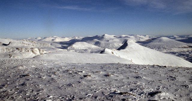 Photo could not load
NH0068 : Winter view of Sgurr an Tuill Bhàin from Slioch
Doug Lee
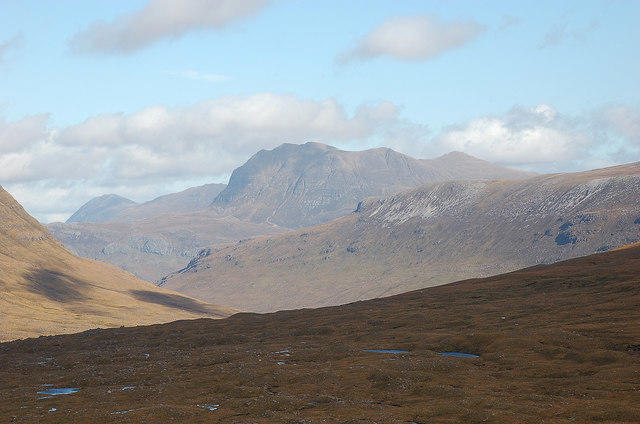 Photo could not load
NH0068 : Slioch from the Torridon hills
Jim Barton
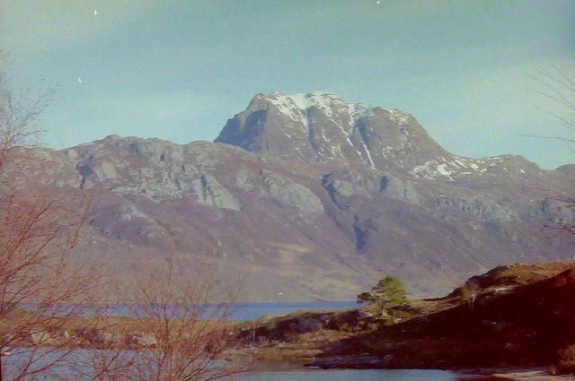 Photo could not load
NH0069 : Slioch
Douglas Nelson
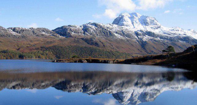 Photo could not load
NH0068 : Siloch reflected in Loch Marie
Robert W Watt
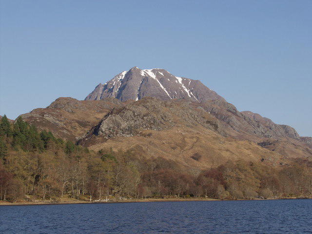 Photo could not load
NH0068 : Slioch from the Letterewe crossing on Loch Maree
Mick Crawley
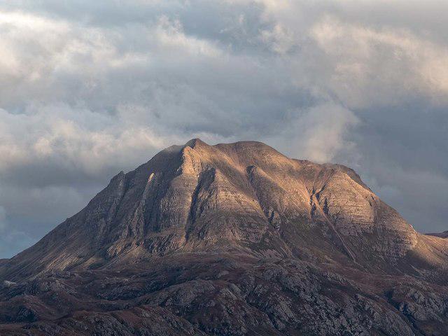 Photo could not load
NH0069 : Slioch
valenta
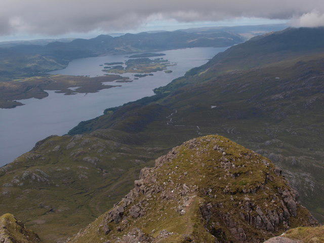 Photo could not load
NH0069 : Top of Slioch's NW spur
Alec MacKinnon
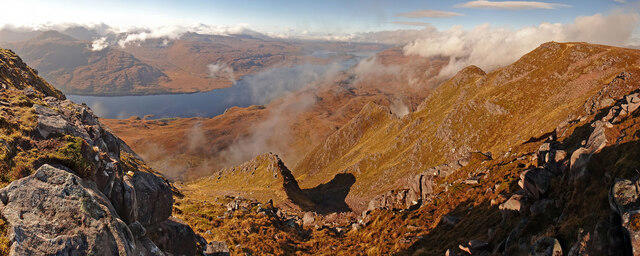 Photo could not load
NH0068 : Slioch Summit Panorama
Adam Ward
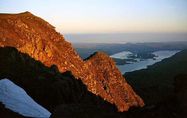 Photo could not load
NH0069 : Early morning light on Slioch
Walter Baxter
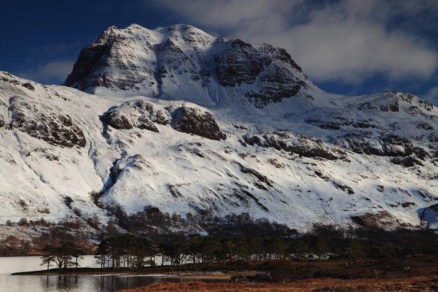
NH0069 : Slioch, Loch Maree.
djmacpherson
Hill facts and local notes
Classifications
Elevation
981m
3,219 ft
Prominence
626m
Coordinates
57.6671, -5.3471
NH004690
OS Map
19
Explorer: 433 435S
At the Summit
The true northern summit is an outcrop 3 m south of the cairn; DoBIH notes that rocks to the north may be as high. The trig point is on a separate, lower 980 m top to the south (DoBIH 1012), not the Munro summit.
Terrain & Geology
Slioch’s mountain massif is formed from Torridonian sandstone, deposited roughly a billion years ago, over older Lewisian basement rocks. Their boundary preserves an ancient erosion surface. The Lewisian rocks are the foundation, rather than the principal rock of the summit massif.
Views & Scenery
Loch Maree and its islands dominate the outlook, with the Torridon mountains to the south and the Fisherfield hills to the north. The Western Isles may be visible in clear conditions.
History & Heritage
Name Origin
Gaelic An Sleaghach, “the spear one”, as given in Scottish Natural Heritage’s Gaelic in the landscape. Its pointed buttresses are suggested as a possible explanation.
Historical Significance
The Gaelic place-name An Sleaghach is recorded in Scottish Natural Heritage’s landscape-name guide; its suggested association with pointed buttresses is an interpretation rather than a documented historical event.
Getting There & Facilities
Parking
Incheril car park near Kinlochewe, signed near the end of the minor road: NH038624.
Public Transport
Westerbus services 700A and 711 are listed at Incheril Road End, on the main road. The walking start is farther along the minor road at Incheril car park; there is no bus stop at the car park in the route guide. Check the service day and return journey against an 8–9-hour mountain circuit.
Nearby Facilities
Kinlochewe has community toilets and refreshments, identified in Country Walking’s route information. Arrange supplies in the village before heading to Incheril.
Safety Information
Known Hazards
- Steep, eroded ground above the twin lochans; loose footing on the descent.
- Cliff edges around the northern summit and brief exposure on the east ridge.
- Pathless descent from Sgùrr an Tuill Bhain into Coire na Sleaghaich requires careful route-finding.
- Boggy corrie ground and a long return to Incheril.
Seasonal Hazards
Snow or ice changes the character of the steep upper slopes and narrowing east ridge; the published 8–9-hour guide time is not a winter timing. For Letterewe stalking information, consult the Scottish Outdoor Access Code guidance and Letterewe Estate; historic seasonal dates are not a live closure notice.
General Safety Tips
- Check weather conditions before setting out
- Carry appropriate clothing and equipment
- Let someone know your planned route
- Take a map, compass, and GPS device
- Carry emergency supplies: food, water, first aid kit, torch
Hills
Some common questions about the hills answered
Are there group walks up Slioch?
Many walkers use Walkmates to join or organise walks with others. You can check for group walks around Slioch through the maps
Are there other walkers around Slioch?
Activity varies by location and time, but Walkmates lets you see whether others have shared walks or shown interest in this area. Find other people through the walking friends search walking friends for Slioch search or of course create your own walk for Slioch
Can I organise a walk to Slioch?
Yes. If there aren’t any walks listed already, you can create a walk and make it available for others to join.
If you're signed up to Walkmates, you can create a walk to Slioch.
How do I find a walk up this hill?
There are often multiple ways to walk this hill, depending on experience and route preference. Walkmates helps you explore walks and routes that others have shared.
Can I suggest a new route up Slioch?
Yes. You can suggest or create routes to share with others. Walkmates focuses on the social side of walking, so routes are used to help people organise walks and explore areas together, rather than as detailed navigation tools or route libraries.
Other uses really appreciate knowledgeable walkers sharing their routes. Share your favourite route to Slioch here
The is an error or something incorrect about this hill. How do I let you know?
We always strive to keep the information on Walkmates as accurate as possible. If you find an error, please let us know through the contact form and we'll aim to correct it as quickly as possible
Community Discussion
Comments
Location
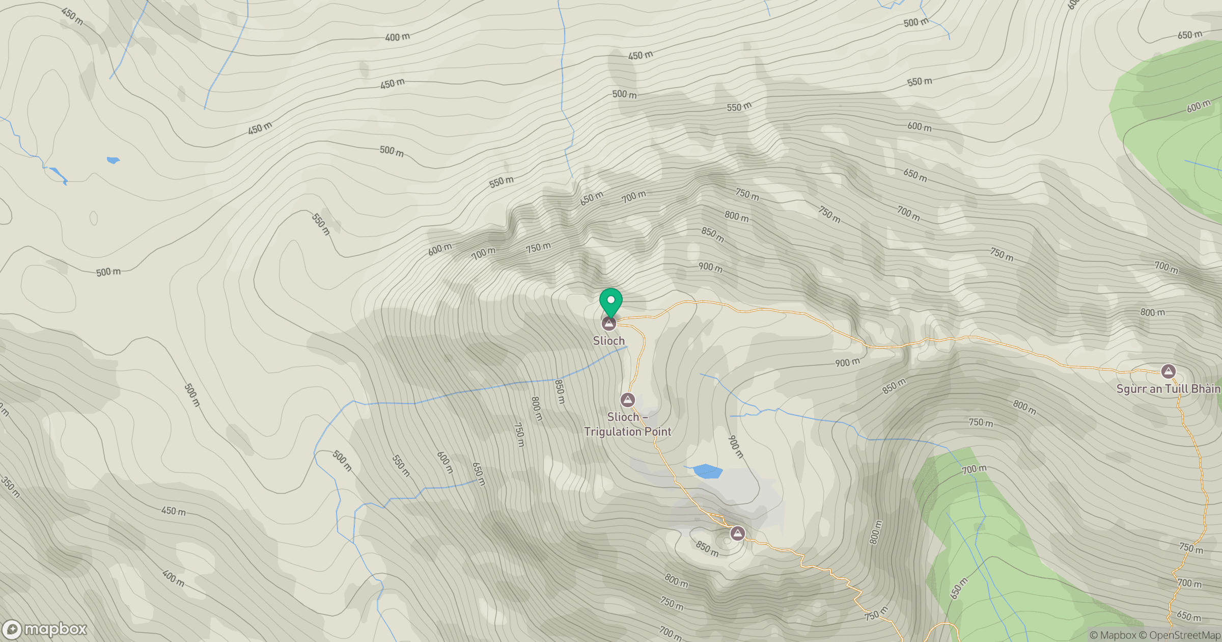
Grid reference: NH004690
View on OpenStreetMapOpens a map in a new tab, centred on the hill.
No comments yet. Be the first.