
English region
Walking in South West England
England's longest National Trail, two wild moors and the cliffs of the Jurassic Coast.
Dated walks
Upcoming walks in South West England
15 dates coming up. Check each listing for the meeting point and how to join.
Walk any day
Walking routes in South West England
A few of the 62 routes shared in South West England, each with a map, distance and time estimate.

Photo unavailable
Lansallos and Polperro coast-and-lanes circuit

Photo unavailable
Camel Trail: Bodmin Scarletts Well to Wenfordbridge

Photo unavailable
Camel Trail: Padstow to Wadebridge and back

Photo unavailable
Granite Way: Lydford village to Okehampton Station

Photo unavailable
Bristol Floating Harbour: SS Great Britain and maritime heritage circuit
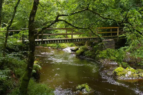
Photo unavailable
Lynmouth, Watersmeet and Ash Bridge woodland circuit
More routes by county: Bristol Cornwall Devon Dorset Gloucestershire Somerset Wiltshire
Community
Walkers in South West England
62 walkers based in South West England have public profiles. Say hello, or find someone to walk with.


Region guide
About walking in South West England
The South West Coast Path runs about 630 miles around the peninsula from Minehead to Poole Harbour. It is England's longest National Trail, taking in the Cornish cliffs, the coves of Devon and the Jurassic Coast, a World Heritage Site in Dorset and East Devon.
Inland, Dartmoor and Exmoor national parks offer open moorland, granite tors and deep wooded valleys, while the Cotswolds, the Mendips, the Quantocks and the Wiltshire downs, home to Avebury and Stonehenge, are gentler. Bath and Bristol add easy riverside and canal walking.
Hill and upland guides: Dartmoor Exmoor Cotswolds Mendip Hills
Landscapes and trails in South West England
South West Coast Path
About 630 miles from Minehead to Poole Harbour, with a lot of up and down along the way.
Dartmoor National Park
Granite tors, open moorland and river valleys. Check the military firing times before heading onto the north moor.
Explore Dartmoor National ParkExmoor National Park
Heather moorland, deep combes and the highest sea cliffs in England.
Explore Exmoor National ParkJurassic Coast
95 miles of cliffs from Exmouth to Studland, including Durdle Door and Lulworth Cove.
Cotswolds
Honey-stone villages and limestone hills. The Cotswold Way runs 102 miles from Chipping Campden to Bath.
Explore CotswoldsMendip Hills
Limestone uplands with Cheddar Gorge and wide views over the Somerset Levels.
Explore Mendip HillsGo local
Counties in South West England
Each page has its own routes, dated walks, towns and local walkers.
Good to know
Questions about walking in South West England
Are there group walks in South West England?
Yes. Walkmates currently lists 15 upcoming dated walks in South West England. Each listing shows where to meet and how to join, and you can browse them without an account.
How long is the South West Coast Path?
About 630 miles (around 1,014 km) from Minehead in Somerset to Poole Harbour in Dorset. Most people walk it in sections, and the total climbing is often compared to going up Everest several times over.
Do I need to check anything before walking on Dartmoor?
Yes. Parts of the north moor are used for military training, so check the published firing times before you go. The weather changes quickly and the open moor can be featureless in mist, so carry a map and compass.
Conditions, access and opening arrangements change. Check the route, the forecast and any organiser's instructions before you set off, and see our walking safety guide.
Find someone to walk with in South West England
Join Walkmates free to save routes, join dated walks and meet walkers near you.
Join Walkmates