

Mam Sodhail
Good walks are even better shared.
NH1225 : Heading Home for Hogmanay
Adam Ward Photo source
Overview
Detailed Write-Up on Mam Sodhail
Overview
Mam Sodhail, towering at 1,176 meters, is a celebrated Munro nestled in the heart of the Scottish Highlands. Renowned for its awe-inspiring views and rugged charm, it is a favourite for hikers looking to challenge themselves while soaking in nature's beauty.
Geology
This magnificent mountain is primarily composed of granite and gneiss, remnants of ancient geological processes. Its stark cliffs and rocky summits pose both challenges and rewards for those adventurous enough to tackle its heights. Make sure to pack a camera—you won't want to miss the views once you're up there!
Routes
North Face Route
The North Face Route offers a thrilling approach to Mam Sodhail, with its rocky outcrops and steep gradients. It takes about 5.5 hours to complete this 11.5 km hike. Bring your best hiking boots—this route lives up to the 'challenging' label!
South East Ridge Route
For those seeking a more moderate trek, the South East Ridge Route is a splendid choice. Covering 10 km, you can expect to reach the summit in about 4 hours, enjoying a cornucopia of scenic views along the way.
Summit Features
At the summit, you'll be greeted by an impressive stone cairn. It's the perfect Instagram spot—just resist the urge to try and build one taller!
Terrain Type
Expect a diverse terrain made up of rocky outcrops, grassy slopes, and a few boggy patches that will keep your gait interesting!
Views
When you reach the top of Mam Sodhail, stunning views await. You can see the iconic Ben Nevis looming in the distance and the shimmering waters of Loch Ness. Early risers might just catch a magical sunrise that makes it all worthwhile!
In terms of best seasons, spring and early summer are ideal for witnessing the splendor of blooming flora, while autumn graces the landscape with brilliant foliage.
Hazards
Hiking Mam Sodhail comes with its fair share of excitement, but potential hazards do exist. Watch out for weather changes; they can be as unpredictable as a cat on a hot tin roof. Treacherous footing on rocky terrain demands vigilance.
Nearby Summits
If you’re feeling adventurous, consider a visit to Carn Eige (1,183 meters) or An Socach (931 meters), both of which add some extra adventure to your hiking itinerary!
Access
The nearest parking area is found near Dundreggan, accommodating several vehicles. It's quite popular, so don’t miss out by arriving too late!
If you're using public transport, local bus services from Inverness can get you close by, but do verify the schedules.
The quaint village of Invermoriston is the nearest town and provides basic amenities, though options are sparse on the mountain itself, so ensure you're well-equipped before setting off!
Facilities
While on your adventure, remember to keep an eye out for cafes and shops in Invermoriston. They can be lifesavers for a hot drink after a long hike!
History
The name Mam Sodhail derives from Gaelic, meaning 'The Hill of the Sodhail', underscoring the region's rich linguistic history. Its cultural significance is notable, as it stands as a crucial landmark for Munro-baggers looking to complete their lists.
Conclusion
In conclusion, Mam Sodhail is a gem in the Scottish Highlands that beckons both seasoned hikers and newcomers alike. Ensure to pack your snacks, lace up your boots, and embark on an unforgettable journey!
Happy hiking!
Explore routes near Mam Sodhail
Walks starting near this hill. Open a route to check its map, distance and full itinerary.
Glen Affric: Coire Loch Woodland Trail
View route
Fort Augustus to Kytra Lock: Caledonian Canal Towpath
View route
Beinn Eighe Lancaster Wreckage at Coire Mhic Fhearchair
View route
Banavie to Glen Loy Aqueduct: Neptune’s Staircase Canal Towpath
View route
Route planning notes
These notes describe possible approaches. Check a route's map and access information when planning your walk.
Mam Sodhail and Carn Eige Circular via Glen Affric
A classic and popular circular route starting from the Glen Affric car park, this route ascends Mam Sodhail via Coire Leachavie before continuing to Carn Eige, the neighbouring Munro. The descent is made along the ridge back towards Glen Affric, offering stunning views of Loch Affric and the surrounding peaks. This is a challenging but rewarding hike, often considered one of the finest in Scotland.
Mam Sodhail and Beinn Fhionnlaidh Traverse
This route takes in Mam Sodhail in combination with Beinn Fhionnlaidh, another Munro in the area. Starting from Affric Lodge, the path climbs steadily through Gleann nam Fiadh, reaching Mam Sodhail first. From there, the route traverses to Beinn Fhionnlaidh, offering expansive views of the wilderness of Glen Affric. Descent is made via the same glen, providing a full day of mountain adventure.
Direct Ascent of Mam Sodhail via Coire Leachavie
This shorter route focuses solely on Mam Sodhail, making it ideal for those wishing to target a single Munro. Starting at the Glen Affric car park, the trail follows a well-defined path through the impressive Coire Leachavie. The terrain becomes steeper closer to the summit, but the views of Glen Affric and beyond make the effort worthwhile. The return is via the same path.
Mam Sodhail and Tom a' Choinich Ridge Walk
This route combines Mam Sodhail with Tom a' Choinich, a neighbouring Munro known for its dramatic ridge. Starting from the Glen Affric car park, the route ascends Tom a' Choinich first before continuing across the ridge to Mam Sodhail. The descent follows a path down Coire Leachavie, completing a memorable circuit of two impressive peaks.
Glen Affric to Mam Sodhail Linear Route
This linear route begins at the Glen Affric Youth Hostel, offering a more remote and tranquil approach to Mam Sodhail. The trail follows the upper reaches of Glen Affric before ascending the mountain from the southwest. This approach provides a unique perspective on Mam Sodhail and its surrounding landscape. The return is by the same route.
Make a day of it, together
Find someone to share the walk with, or organise a day out along a route you like.
Photo Gallery
View all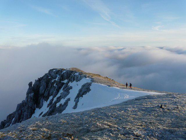 Photo could not load
NH1225 : Heading Home for Hogmanay
Adam Ward
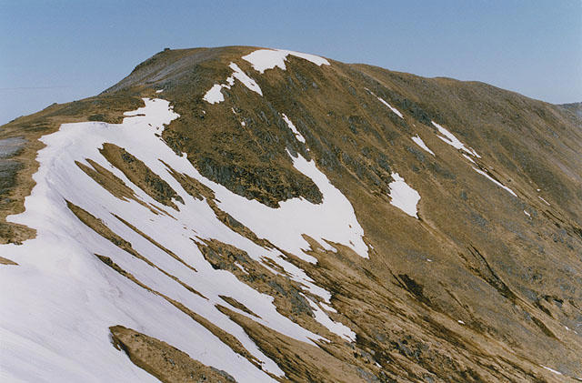 Photo could not load
NH1125 : The southwest ridge of Màm Sodhail
Nigel Brown
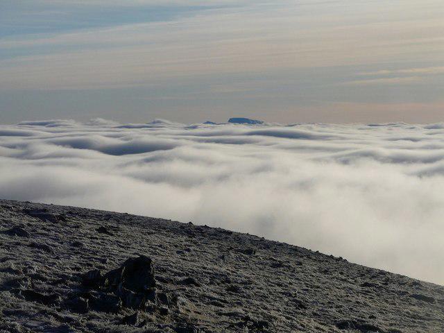 Photo could not load
NH1125 : Only Giants Make It
Adam Ward
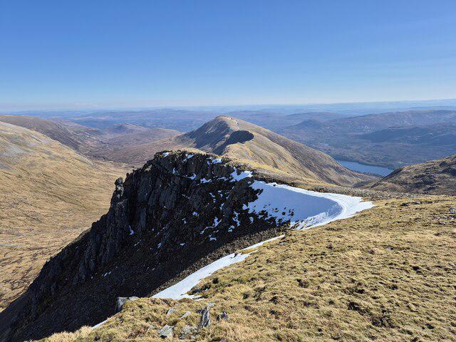 Photo could not load
NH1225 : Eastern ridge of Mam Sodhail
Steven Brown
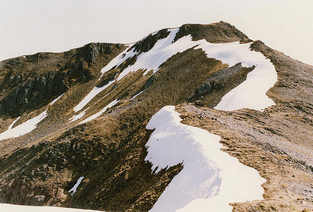 Photo could not load
NH1225 : Màm Sodhail from the north
Nigel Brown
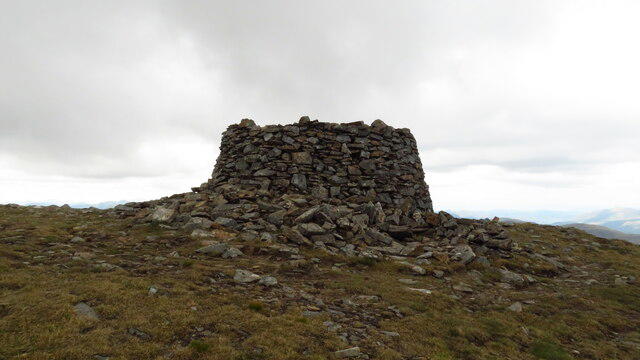 Photo could not load
NH1125 : Summit cairn on Mam Sodhail
Colin Park
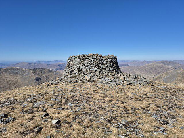 Photo could not load
NH1125 : Large cairn on Mam Sodhail
Steven Brown
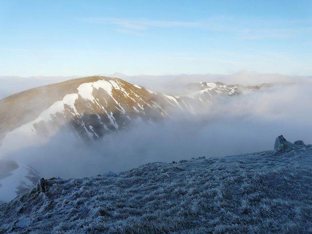 Photo could not load
NH1125 : Carn Eige from Mam Sodhail
Adam Ward
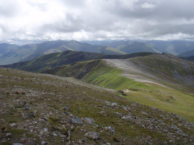 Photo could not load
NH1125 : View down the ridge toward Sgurr na Lapaich
Roger McLachlan
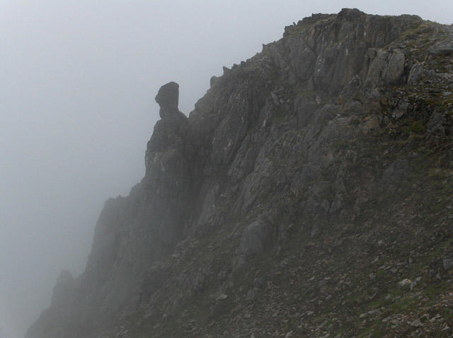
NH1225 : Rocks, Mam Sodhail
Andrew Smith
Hill facts and local notes
Classifications
Elevation
1,179m
3,869 ft
Prominence
132m
Coordinates
57.2798, -5.1203
NH120253
OS Map
25
Explorer: 414N
At the Summit
The summit is marked by a substantial stone cairn, offering a perfect spot for a picture postcard view. Up here, you might even feel like king or queen of the hill.
Terrain & Geology
Mam Sodhail is primarily composed of granite and gneiss, typical of the rugged Scottish Highlands. The mountain's elevation and geological history contribute to its stark, awe-inspiring landscapes.
Views & Scenery
From the summit, you can enjoy views of the surrounding peaks, including the majestic Ben Nevis to the south-west and Loch Ness to the east.
History & Heritage
Name Origin
Mam Sodhail translates to 'The Hill of the Sodhail', with roots in the Gaelic language, reflecting the rich cultural heritage of the region.
Historical Significance
Mam Sodhail is not just a mountain, it's a Munro! Hikers often seek to conquer all 282 Munros, and Mam Sodhail is a beloved stop on that journey.
Getting There & Facilities
Parking
Parking is available at the roadside near the small community of Dundreggan, with space for several vehicles. Get there early, as spots fill up fast!
Public Transport
Buses run from nearby Inverness, though it’s advisable to check local schedules as they can vary.
Nearby Facilities
There are a few cafes and shops in Invermoriston, but facilities are limited on the mountain itself, so come prepared!
Safety Information
Known Hazards
- Be wary of changing weather conditions which can shift in a heartbeat. Loose rocks can make for tricky footing, so watch your step!
General Safety Tips
- Check weather conditions before setting out
- Carry appropriate clothing and equipment
- Let someone know your planned route
- Take a map, compass, and GPS device
- Carry emergency supplies: food, water, first aid kit, torch
Hills
Some common questions about the hills answered
Are there group walks up Mam Sodhail?
Many walkers use Walkmates to join or organise walks with others. You can check for group walks around Mam Sodhail through the maps
Are there other walkers around Mam Sodhail?
Activity varies by location and time, but Walkmates lets you see whether others have shared walks or shown interest in this area. Find other people through the walking friends search walking friends for Mam Sodhail search or of course create your own walk for Mam Sodhail
Can I organise a walk to Mam Sodhail?
Yes. If there aren’t any walks listed already, you can create a walk and make it available for others to join.
If you're signed up to Walkmates, you can create a walk to Mam Sodhail.
How do I find a walk up this hill?
There are often multiple ways to walk this hill, depending on experience and route preference. Walkmates helps you explore walks and routes that others have shared.
Can I suggest a new route up Mam Sodhail?
Yes. You can suggest or create routes to share with others. Walkmates focuses on the social side of walking, so routes are used to help people organise walks and explore areas together, rather than as detailed navigation tools or route libraries.
Other uses really appreciate knowledgeable walkers sharing their routes. Share your favourite route to Mam Sodhail here
The is an error or something incorrect about this hill. How do I let you know?
We always strive to keep the information on Walkmates as accurate as possible. If you find an error, please let us know through the contact form and we'll aim to correct it as quickly as possible
Community Discussion
Comments
Location
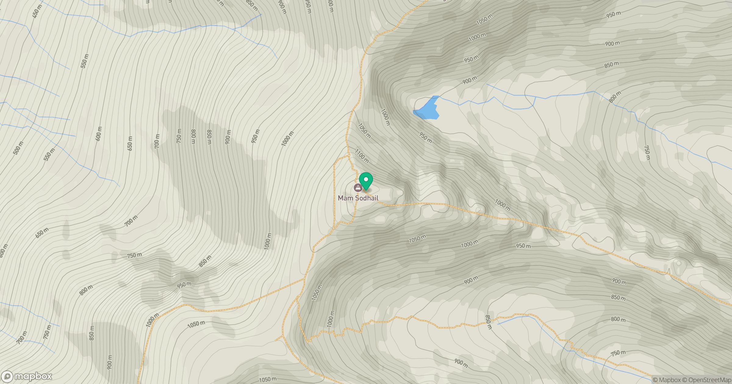
Grid reference: NH120253
View on OpenStreetMapOpens a map in a new tab, centred on the hill.
No comments yet. Be the first.