
Creag Dhubh Mhor
Good walks are even better shared.
Overview
Creag Dhubh Mhor
Creag Dhubh Mhor is a towering Munro located in the stunning Scottish Highlands, reaching a height of 927 meters. The mountain is well-loved by hikers for its rugged terrain and remarkable vistas.
Geology
The geology of Creag Dhubh Mhor is primarily granite, featuring striking cliffs and fascinating glacial erosion marks. The rocky outcrops provide a dramatic backdrop for adventurers and photographers alike.
Routes
There are a couple of popular routes leading up Creag Dhubh Mhor:
- West Approach from A832: This moderate route spans approximately 11.5 km with a beautiful ascent. It is perfect for those looking for a more leisurely climb with spectacular views.
- East Ridge: If you’re feeling adventurous, opt for the East Ridge route. At around 9 km, it's challenging and offers scrambles that will get your adrenaline pumping.
Summit Features
Reaching the summit rewards hikers with a trig point standing proudly against the elements. Expect breathtaking panoramic views which would make any postcard jealous. The hard-shelled trig point also makes a great spot for a selfie!
Views
From the summit, revel in the sight of fellow peaks such as Sgurr Mhor and Beinn Alligin. The views over the Isle of Skye on clear days are nothing short of spectacular. The best time for stunning visual experiences tends to be late spring or early autumn when the weather is typically friendly!
Hazards
As with any mountain, safety first! Be prepared for rapidly changing weather conditions. The summit can be windy, and some trails may be slippery after rain—so choose your footwear wisely!
Nearby Summits
If you’re keen to get more stamps in your hiking passport, nearby summits include:
- Sgurr Mhor (964 m)
- Beinn Alligin (986 m)
Access
- Nearest Parking: A small parking area located off the A832 will be your launch point. Please park thoughtfully to not obstruct any access.
- Public Transport: Buses from Inverness to Achnasheen can bring you reasonably close to the trailhead.
- Nearest Town: The quaint town of Garve is the closest, just a short drive away and offers some amenities.
Facilities
There are no facilities on the mountain itself, but Garve has a little café and shop to stock up on snacks and drinks before your hike. No one likes hiking on an empty stomach!
History
Creag Dhubh Mhor translates to 'Big Black Rock', likely a nod to the mountain's imposing presence. Its rugged beauty has made it a favourite among locals and visitors looking for a good hike.
So, lace up those boots and prepare for an adventure on Creag Dhubh Mhor—just remember, the mountain doesn’t walk itself! Enjoy and stay safe.
Explore routes near Creag Dhubh Mhor
Walks starting near this hill. Open a route to check its map, distance and full itinerary.
Beinn Eighe Lancaster Wreckage at Coire Mhic Fhearchair
View route
Glen Affric: Coire Loch Woodland Trail
View route
Fairy Lochs Liberator Wreckage Circuit
View route
Fort Augustus to Kytra Lock: Caledonian Canal Towpath
View route
Route planning notes
These notes describe possible approaches. Check a route's map and access information when planning your walk.
West Approach from A832
A straightforward ascent via the west, starting from the A832 road, this route offers a gentle gradient and stunning scenery as you near the summit.
East Ridge
A more challenging route that follows the east ridge, offering spectacular views and a few scrambly bits to keep the excitement alive.
Make a day of it, together
Find someone to share the walk with, or organise a day out along a route you like.
Hill facts and local notes
Classifications
Elevation
611m
2,005 ft
Prominence
168m
Coordinates
57.4098, -5.3599
NG982404
OS Map
25
Explorer: 429
At the Summit
At the summit, you'll find a prominent trig point surrounded by a wind-swept plateau, and if you’re lucky, you might spot a witty sheep or two.
Terrain & Geology
Composed primarily of granite, Creag Dhubh Mhor showcases glacial erosion features typical of the Scottish Highlands, with rugged cliffs and striking rock formations that add to its charm.
Views & Scenery
From the summit, you can see the stunning peaks of the Torridon range, the distant Isle of Skye, and the serene lochs that dot the landscape.
History & Heritage
Name Origin
Creag Dhubh Mhor translates to 'Big Black Rock', possibly due to its dark granite appearance and imposing stature.
Historical Significance
This mountain has been a favourite among local climbers and hikers for years, celebrated not only for its natural beauty but also for its challenging ascents.
Getting There & Facilities
Parking
There is a small parking area off the A832 about 3 km before the ascent begins. Be sure to park considerately.
Public Transport
The nearest public transport is the bus service that stops at Achnasheen, from where you can walk to the starting point.
Nearby Facilities
While there are no facilities directly on the mountain, Garve has a café and a shop for supplies before heading out.
Safety Information
Known Hazards
- Changing weather conditions can pose risks; the wind can be fierce at the summit, and certain sections may be slippery when wet.
General Safety Tips
- Check weather conditions before setting out
- Carry appropriate clothing and equipment
- Let someone know your planned route
- Take a map, compass, and GPS device
- Carry emergency supplies: food, water, first aid kit, torch
Hills
Some common questions about the hills answered
Are there group walks up Creag Dhubh Mhor?
Many walkers use Walkmates to join or organise walks with others. You can check for group walks around Creag Dhubh Mhor through the maps
Are there other walkers around Creag Dhubh Mhor?
Activity varies by location and time, but Walkmates lets you see whether others have shared walks or shown interest in this area. Find other people through the walking friends search walking friends for Creag Dhubh Mhor search or of course create your own walk for Creag Dhubh Mhor
Can I organise a walk to Creag Dhubh Mhor?
Yes. If there aren’t any walks listed already, you can create a walk and make it available for others to join.
If you're signed up to Walkmates, you can create a walk to Creag Dhubh Mhor.
How do I find a walk up this hill?
There are often multiple ways to walk this hill, depending on experience and route preference. Walkmates helps you explore walks and routes that others have shared.
Can I suggest a new route up Creag Dhubh Mhor?
Yes. You can suggest or create routes to share with others. Walkmates focuses on the social side of walking, so routes are used to help people organise walks and explore areas together, rather than as detailed navigation tools or route libraries.
Other uses really appreciate knowledgeable walkers sharing their routes. Share your favourite route to Creag Dhubh Mhor here
The is an error or something incorrect about this hill. How do I let you know?
We always strive to keep the information on Walkmates as accurate as possible. If you find an error, please let us know through the contact form and we'll aim to correct it as quickly as possible
Community Discussion
Comments
Location
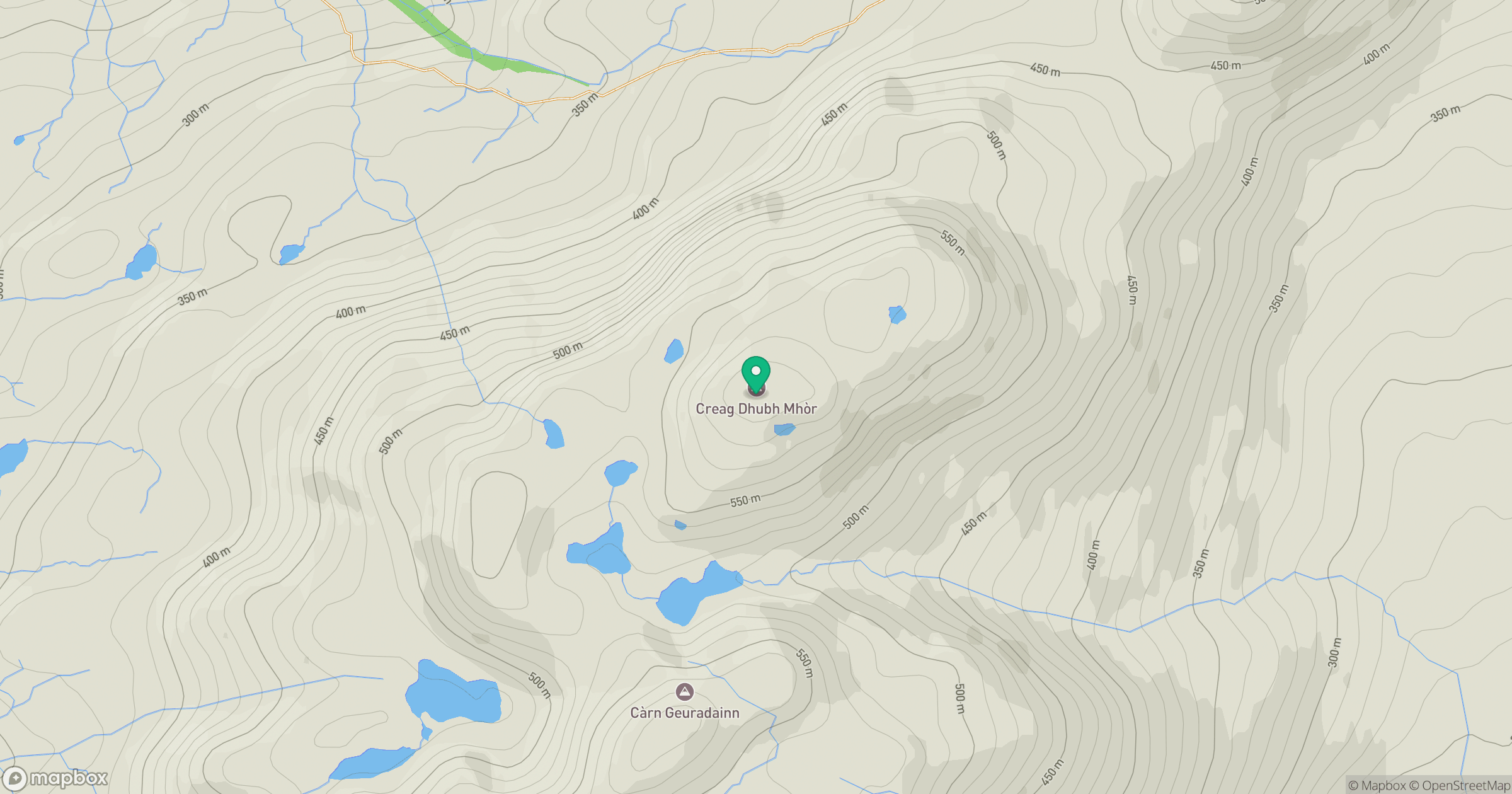
Grid reference: NG982404
View on OpenStreetMapOpens a map in a new tab, centred on the hill.
No comments yet. Be the first.