

Beinn Alligin - Tom na Gruagaich
Good walks are even better shared.
NG8560 : Tom na Gruagaich
Alistair Oram Photo source
Overview
Beinn Alligin - Tom na Gruagaich
Beinn Alligin, particularly its peak Tom na Gruagaich, is a prominent Munro nestled in the majestic Scottish Highlands. Towering at 986 meters, it showcases not only natural beauty but also a rich tapestry of geological history.
Geology
The mountain is primarily formed of striking Torridonian sandstone, giving it a rugged yet picturesque appearance. This rock was formed over a billion years ago and encapsulates layers that speak of ancient rivers and deltas. Notably, the evidence of glaciation adds to the mountain's charm, making it a fantastic spot for geology aficionados!
Routes
Two prominent routes serve as gateways to this enchanting peak:
- Coire nan Laogh Route - This route is a gem, taking you through lush valleys and providing impressive views. At around 8 km, it’s perfect for those seeking a moderate challenge.
- Circular Route via the Horns of Alligin - An exhilarating option for the brave-hearted, this trek challenges you to scale the famous Horns, offering stunning vistas of the Torridonian landscape along the way.
Summit Features
Reaching the summit rewards hikers with a modest rocky outcrop and a quaint cairn – a perfect spot for a break while soaking in the panoramic views.
Terrain
Expect a blend of rocky paths and grassy slopes. The rugged terrain adds a delightful twist to your hiking experience, but do pay attention to your footing!
Views
From the top, you’ll be treated to a spectacular panorama, with awe-inspiring views of Liathach and Beinn Eighe beckoning in the distance. Late spring to early autumn is the prime time for this adventure, though autumn’s colours are hard to beat.
Hazards
While it’s a stunning hike, don’t underestimate the unpredictability of mountain weather and tricky footing in certain areas. Always don good footwear and be prepared for a quick weather change!
Nearby Summits
For those wanting to tackle more peaks, the nearby Liathach and Beinn Eighe offer great challenges as well!
Access
The nearest parking area is conveniently located near Torridon village, but do be sure to arrive early to secure your spot. Public transport does exist from Inverness, but is infrequent, so planning ahead is key.
Facilities
Facilities are limited in Torridon, with a small shop and cafe providing just enough for your hiking essentials. Perfect for a quick refuel!
History
Beinn Alligin, or Tom na Gruagaich, roughly translates to ‘Hill of the Maiden’, steeped in local folklore and history. To locals, this peak is not just a mountain but a significant cultural symbol.
So, lace up those boots and prepare for a day of adventure - Beinn Alligin awaits with open arms (and a few rocks to trip over)!
Explore routes near Beinn Alligin - Tom na Gruagaich
Walks starting near this hill. Open a route to check its map, distance and full itinerary.
Beinn Eighe Lancaster Wreckage at Coire Mhic Fhearchair
View route
Fairy Lochs Liberator Wreckage Circuit
View route
Glen Affric: Coire Loch Woodland Trail
View route
Fort Augustus to Kytra Lock: Caledonian Canal Towpath
View route
Route planning notes
These notes describe possible approaches. Check a route's map and access information when planning your walk.
Beinn Alligin Circuit via Tom na Gruagaich
The classic Beinn Alligin circuit is one of Scotland's most iconic mountain walks. Starting from the car park at NG869576, follow the well-maintained path along the Abhainn Coire Mhic Nobuil before ascending steeply to Tom na Gruagaich. From here, continue along the ridge to Sgùrr Mhòr, tackling the famed Horns of Alligin before descending back to the glen.
Tom na Gruagaich Direct Ascent
This route focuses solely on summiting Tom na Gruagaich. Begin at the car park at NG869576 and follow the path along the glen before branching off to ascend directly to the summit. This is a shorter, more straightforward route, ideal for those wanting to experience a Munro summit without tackling the full ridge.
Beinn Alligin East Approach
Approaching Beinn Alligin from the east, this route offers a quieter alternative. Starting from the same car park, follow the trail into Coire nan Laogh, ascending gradually to Tom na Gruagaich. This approach provides a less steep ascent, suitable for those looking for a more gradual climb.
Winter Traverse of Beinn Alligin
For experienced mountaineers, a winter traverse of Beinn Alligin offers a thrilling challenge. Starting again from NG869576, the route follows the standard circuit but requires ice axes, crampons, and winter navigation skills. The snow-covered Horns of Alligin add an extra layer of difficulty and beauty.
Family-Friendly Glen Walk with Summit View
This route doesn’t summit Tom na Gruagaich but instead takes a leisurely walk along the lower slopes of Beinn Alligin, offering stunning views of the summit and surrounding landscape. Ideal for families or those seeking a less strenuous outing. Start from NG869576 and follow the well-marked glen paths.
Make a day of it, together
Find someone to share the walk with, or organise a day out along a route you like.
Photo Gallery
View all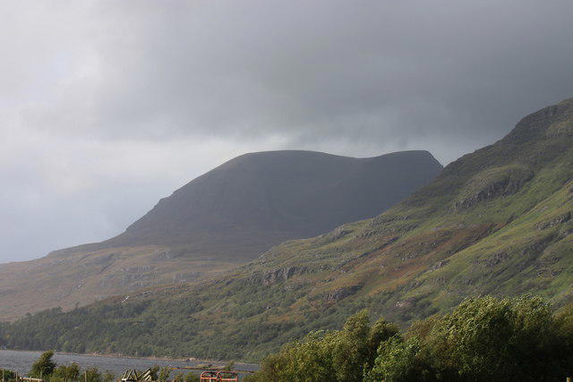 Photo could not load
NG8560 : Tom na Gruagaich
Alistair Oram
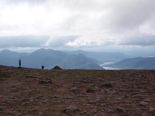 Photo could not load
NG8560 : Cairn at the head of Coire nan Laogh
Alec MacKinnon
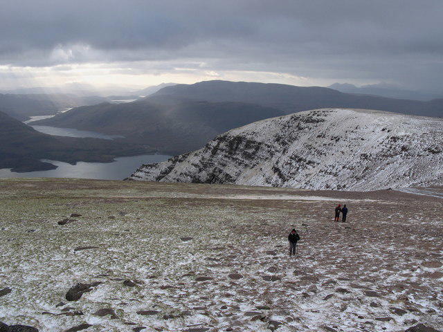 Photo could not load
NG8560 : Tom na Gruagaich, Ben Alligin
Lisa Jarvis
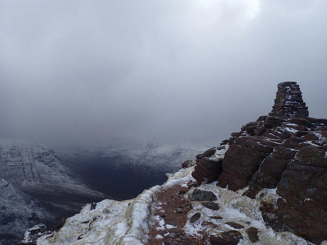 Photo could not load
NG8560 : Trig pillar Tom na Gruagaich
Didier Silberstein
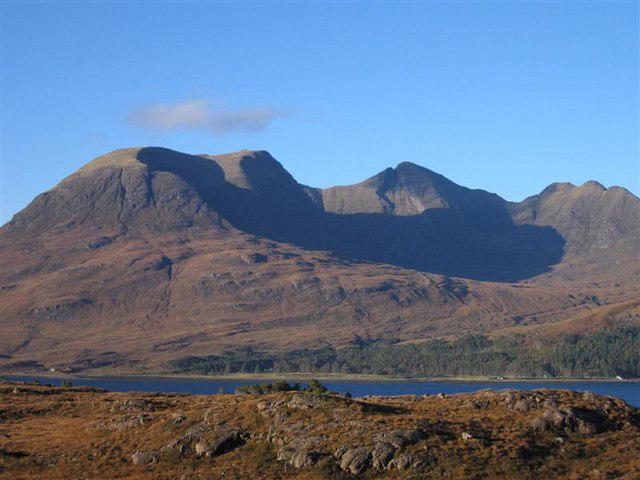 Photo could not load
NG8560 : Beinn Alligin in Autumn Sunshine
David Crocker
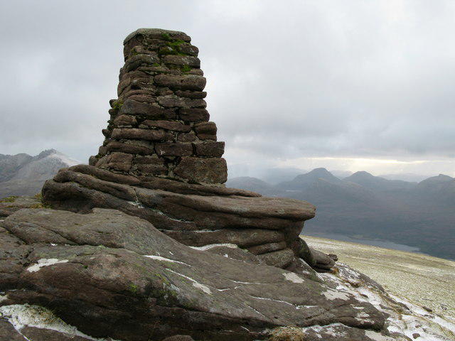 Photo could not load
NG8560 : Summit cairn, Tom na Gruagaich
Lisa Jarvis
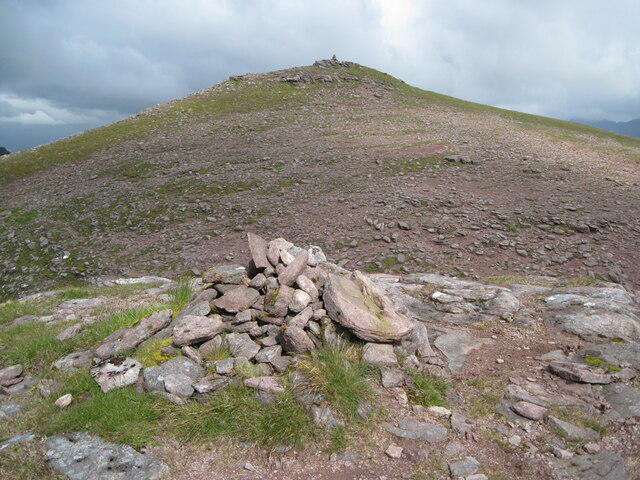 Photo could not load
NG8560 : Summit of Tom na Gruagaich from cairn above Coire nan Laogh
Chris Wimbush
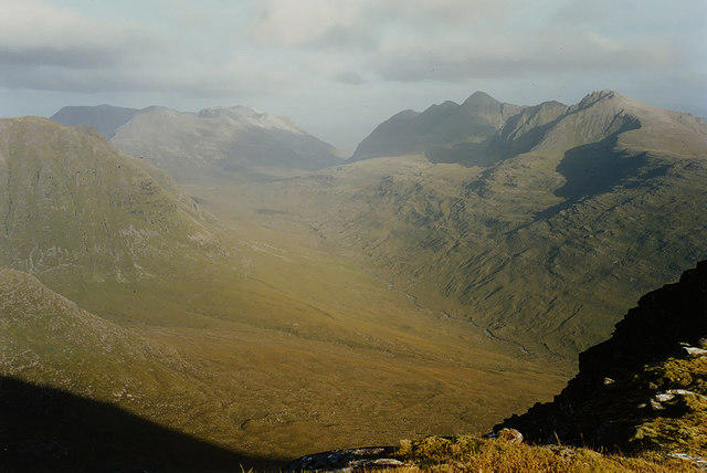 Photo could not load
NG8560 : View east from Tom na Gruagaich
Nigel Brown
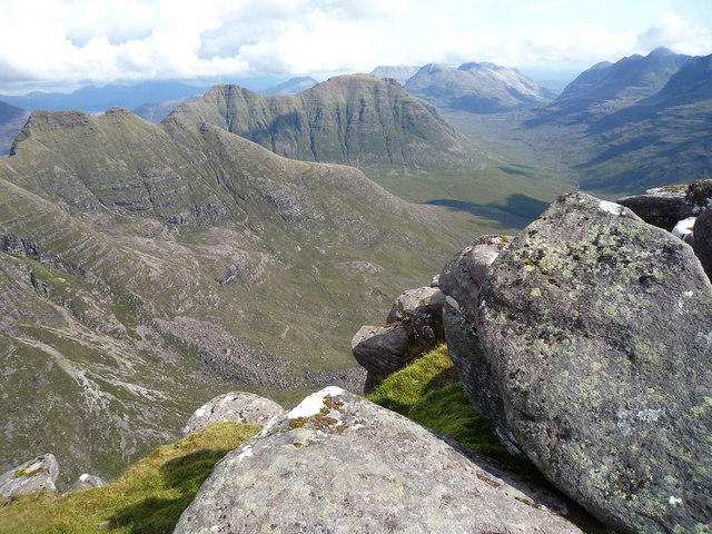 Photo could not load
NG8560 : Summit boulders of Tom na Gruagaich
Julian Paren
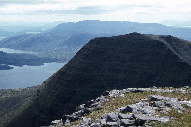
NG8560 : Tom na Gruagaich from Sgurr Mor
Colin Park
Hill facts and local notes
Classifications
Elevation
922m
3,025 ft
Prominence
155m
Coordinates
57.5805, -5.5819
NG859601
OS Map
19 24
Explorer: 433
At the Summit
The summit of Tom na Gruagaich features a small rocky outcrop and a cairn, where you can rest your weary legs and take in the panoramic views of the surrounding peaks.
Terrain & Geology
Beinn Alligin is primarily composed of Torridonian sandstone, which dates back over 1 billion years, showcasing layers formed from ancient riverbeds and deltas. Its geology tells a tale of immense geological processes, including faulting and glaciation, making it a prime spot for geology enthusiasts.
Views & Scenery
From the summit, enjoy breathtaking views of Liathach, Beinn Eighe, and the majestic coastline of Torridon in the far distance.
History & Heritage
Name Origin
Tom na Gruagaich translates to ‘Hill of the Maiden,’ thought to be derived from local folklore.
Historical Significance
Beinn Alligin has been a significant landmark for centuries and holds cultural importance in local Gaelic traditions.
Getting There & Facilities
Parking
Parking is available at the start of the Alligin path, near the village of Torridon. Make sure to arrive early during peak season as spaces can fill up quickly.
Public Transport
The nearest bus service is from Inverness to Torridon, though it runs infrequently. It's advisable to check schedules in advance.
Nearby Facilities
There are limited facilities in Torridon, including a small shop and a café, perfect for grabbing a hot drink or snack for your adventure.
Safety Information
Known Hazards
- Watch out for sudden weather changes and steep drops near the summit. Also, slippery rocky sections can make for tricky footing, so good footwear is essential.
General Safety Tips
- Check weather conditions before setting out
- Carry appropriate clothing and equipment
- Let someone know your planned route
- Take a map, compass, and GPS device
- Carry emergency supplies: food, water, first aid kit, torch
Hills
Some common questions about the hills answered
Are there group walks up Beinn Alligin - Tom na Gruagaich?
Many walkers use Walkmates to join or organise walks with others. You can check for group walks around Beinn Alligin - Tom na Gruagaich through the maps
Are there other walkers around Beinn Alligin - Tom na Gruagaich?
Activity varies by location and time, but Walkmates lets you see whether others have shared walks or shown interest in this area. Find other people through the walking friends search walking friends for Beinn Alligin - Tom na Gruagaich search or of course create your own walk for Beinn Alligin - Tom na Gruagaich
Can I organise a walk to Beinn Alligin - Tom na Gruagaich?
Yes. If there aren’t any walks listed already, you can create a walk and make it available for others to join.
If you're signed up to Walkmates, you can create a walk to Beinn Alligin - Tom na Gruagaich.
How do I find a walk up this hill?
There are often multiple ways to walk this hill, depending on experience and route preference. Walkmates helps you explore walks and routes that others have shared.
Can I suggest a new route up Beinn Alligin - Tom na Gruagaich?
Yes. You can suggest or create routes to share with others. Walkmates focuses on the social side of walking, so routes are used to help people organise walks and explore areas together, rather than as detailed navigation tools or route libraries.
Other uses really appreciate knowledgeable walkers sharing their routes. Share your favourite route to Beinn Alligin - Tom na Gruagaich here
The is an error or something incorrect about this hill. How do I let you know?
We always strive to keep the information on Walkmates as accurate as possible. If you find an error, please let us know through the contact form and we'll aim to correct it as quickly as possible
Community Discussion
Comments
Location
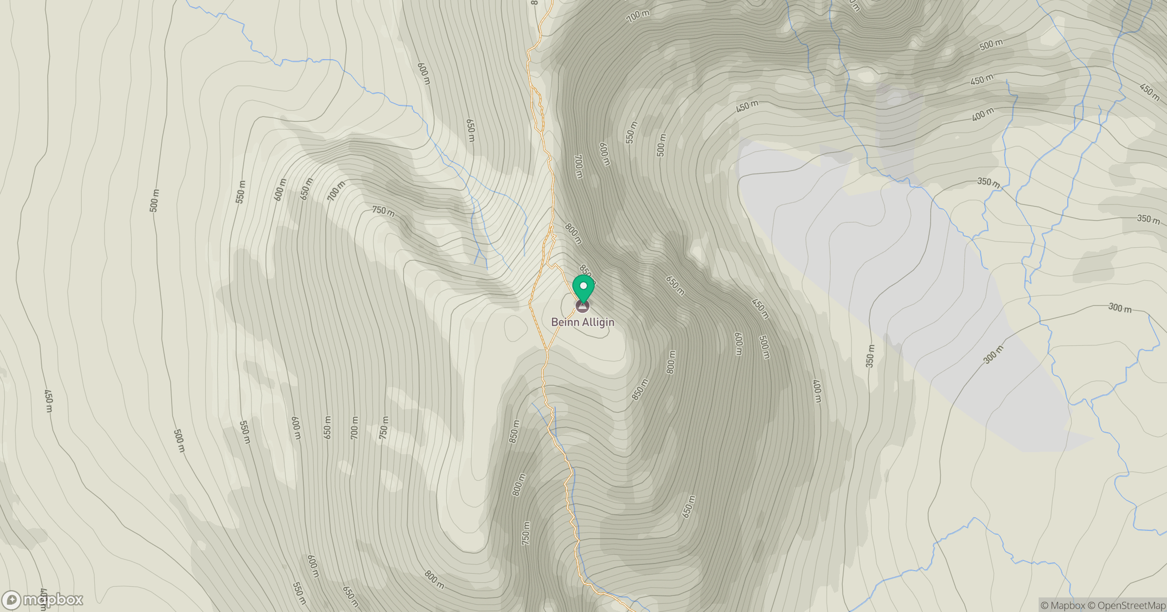
Grid reference: NG859601
View on OpenStreetMapOpens a map in a new tab, centred on the hill.
No comments yet. Be the first.