
Beinn Raimh
Good walks are even better shared.
Overview
Beinn Raimh: A Highland Jewel
Overview
Beinn Raimh stands tall in the Scottish Highlands, a striking Munro that attracts hikers looking for both adventure and spectacular scenery. With an elevation of 850 meters, it offers a challenge that's not too daunting for those relatively new to hillwalking.
Geology
The striking features of Beinn Raimh come from its Schist foundations, sculpted by the relentless forces of nature. The rugged cliffs juxtaposed with smoother glens tell the story of glacial movements that have shaped this stunning landscape over millennia.
Routes
The Beinn Raimh Circuit is the most popular choice for those seeking to summit this proud peak. This moderate 12 km circuit takes approximately 4.5 hours and rewards you at every turn with views that are nothing short of spectacular. Don't forget your camera!
Summit Features
Upon reaching the summit, hikers are greeted by a well-built cairn, a perfect spot to rest and bask in your accomplishments. The panoramic views are unparalleled, making the ascent well worth the effort.
Terrain Type
Prepare for a mix of rocky patches and grassy slopes, with some boggy areas to keep the experience interesting. Good footwear is essential here unless you enjoy a bit of splashtastic fun!
Views
From the peak, your gaze will be drawn to An Teallach’s dramatic profiles and the shimmering waters of Loch Broom. Best visited in spring or autumn, you can expect crystal-clear skies and less chance of getting soaked.
Hazards
Always be prepared for sudden weather changes in the Highlands. The wind can pick up inexplicably, and those loose rocks are not as friendly as they look, so tread carefully.
Nearby Summits
Don’t rush off once you've conquered Beinn Raimh. Nearby peaks like Beinn a' Chlaidheimh and An Teallach are also worthy of exploration and offer additional trails.
Access
Getting to Beinn Raimh is straightforward. The nearest parking resides near Dundonnell, just a short drive south from Ullapool. If you're relying on public transport, do check the bus timetables to avoid long waits.
Facilities
Before and after your hike, Ullapool offers various facilities, including cafés to fuel your journey and shops to fill your pack with snacks.
History
The name 'Beinn Raimh' may not roll off the tongue easily, but it captures the essence of Scottish Highlands wildlife. With deep historical roots, this mountain has been a silent observer of local clans and their stories, making it a culturally significant site.
In conclusion, Beinn Raimh is a must-visit for hikers who crave adventure without the excessive difficulty. Don’t just take our word for it—get out there, feet on the ground and fresh air in your lungs! Happy hiking!
Explore routes near Beinn Raimh
Public walks starting within 80 km of this hill. Nearby does not mean a route reaches the summit; check its map and access before setting out.
Beinn Eighe Lancaster Wreckage at Coire Mhic Fhearchair
View route
Loch Affric full circuit from River Affric
View route
Fairy Lochs Liberator Wreckage Circuit
View route
Glen Affric: Coire Loch Woodland Trail
View route
Route planning notes
These notes describe possible approaches, not verified navigable routes or permission to cross land. Check current paths, local access rules and conditions before setting out.
Beinn Raimh Circuit
A popular circular route that combines stunning views and a moderate challenge.
Make a day of it, together
Find someone to share the walk with, or organise a day out along a route you like.
Hill facts and local notes
Classifications
Elevation
448m
1,469 ft
Prominence
147m
Coordinates
57.3204, -5.5762
NG847311
OS Map
24
Explorer: 428S
At the Summit
The summit features a prominent cairn with panoramic views, perfect for that triumphant photo op.
Terrain & Geology
Beinn Raimh is primarily composed of Schist, which was formed during the Caledonian Orogeny. The craggy peaks and smooth glens offer a perfect example of glacial erosion, accentuating the mountain's rugged beauty.
Views & Scenery
From the summit, expect breathtaking views of the surrounding peaks including An Teallach and the fertile valleys below. Loch Broom glitters in the distance, making it a sight not to be missed.
History & Heritage
Name Origin
The name 'Beinn Raimh' is derived from Gaelic, roughly translating to 'Hill of the Rhea', referring to the local wildlife.
Historical Significance
The mountain has been a focal point for local folklore and has ties to historical clans of the Scottish Highlands.
Getting There & Facilities
Check current local access restrictions, parking rules and transport timetables before travelling. These notes do not confirm public access to the summit.
Parking
There is a small car park near the village of Dundonnell, approximately 3 km from the trailhead.
Public Transport
Stagecoach bus services connect Inverness to Dundonnell, but check the schedule as they can be infrequent.
Nearby Facilities
Ullapool has a range of facilities including cafés, shops, and public toilets, ensuring you’re well-prepared for your adventure.
Safety Information
Known Hazards
- Beware of sudden weather changes; conditions can shift faster than you can say 'where's my jacket?' Be cautious of loose rocks, particularly on the ascent.
General Safety Tips
- Check weather conditions before setting out
- Carry appropriate clothing and equipment
- Let someone know your planned route
- Take a map, compass, and GPS device
- Carry emergency supplies: food, water, first aid kit, torch
Hills
Some common questions about the hills answered
Are there group walks up Beinn Raimh?
Many walkers use Walkmates to join or organise walks with others. You can check for group walks around Beinn Raimh through the maps
Are there other walkers around Beinn Raimh?
Activity varies by location and time, but Walkmates lets you see whether others have shared walks or shown interest in this area. Find other people through the walking friends search walking friends for Beinn Raimh search or of course create your own walk for Beinn Raimh
Can I organise a walk to Beinn Raimh?
Yes. If there aren’t any walks listed already, you can create a walk and make it available for others to join.
If you're signed up to Walkmates, you can create a walk to Beinn Raimh.
How do I find a walk up this hill?
There are often multiple ways to walk this hill, depending on experience and route preference. Walkmates helps you explore walks and routes that others have shared.
Can I suggest a new route up Beinn Raimh?
Yes. You can suggest or create routes to share with others. Walkmates focuses on the social side of walking, so routes are used to help people organise walks and explore areas together, rather than as detailed navigation tools or route libraries.
Other uses really appreciate knowledgeable walkers sharing their routes. Share your favourite route to Beinn Raimh here
The is an error or something incorrect about this hill. How do I let you know?
We always strive to keep the information on Walkmates as accurate as possible. If you find an error, please let us know through the contact form and we'll aim to correct it as quickly as possible
Community Discussion
Comments
Location
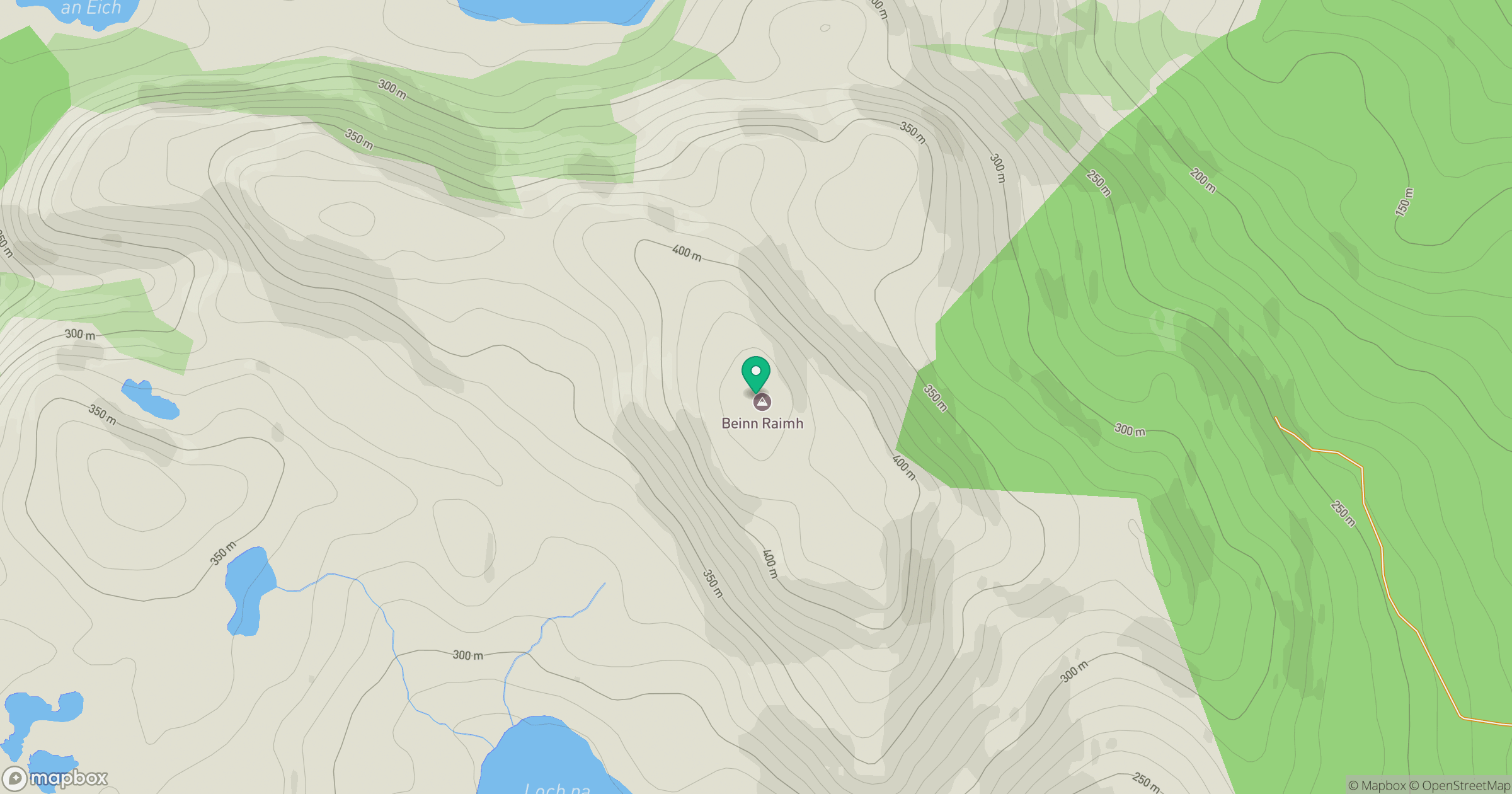
Grid reference: NG847311
View on OpenStreetMapOpens a map in a new tab, centred on the hill.
Hills within 30 km
Straight-line distance, not a walking route or confirmation of access.
Beinn Sgritheall
974m
Ladhar Bheinn
1,020m
Liathach - Mullach an Rathain
1,024m
An Caisteal
622m
Sgurr Fhuaran
1,069m
No comments yet. Be the first.