

Ladhar Bheinn
Good walks are even better shared.
NG8204 : The summit ridge of Ladhar Bheinn
Alan Reid Photo source
Overview
Ladhar Bheinn
Ladhar Bheinn stands proudly as one of the shining jewels in the Scottish Highlands. With an elevation of 1020 meters (3346 feet), it is a Munro that beckons adventurers from all corners of the globe.
Geology
The mountain is primarily composed of gneiss—a rock that dates back to the Precambrian era. If you look closely, the patterns in the rocks tell of the earth's tumultuous past, where massive geological forces sculpted the rugged landscape we see today.
Routes
There are two prominent routes to tackle this magnificent peak:
- Inverie to Ladhar Bheinn: This route provides an adventurous hike with plenty of elevation gain. You'll trek through diverse terrain and be rewarded with spectacular views along the way.
- Barrisdale Bay Approach: A quieter, less-travelled route that leads you through stunning coastal scenery before ascending Ladhar Bheinn.
Whatever path you choose, be prepared for a good workout!
Summit Features
Upon reaching the summit, climbers are greeted by a large stone cairn, which makes for a great photo opportunity. Take a moment to enjoy the vastness of the Highlands and, if you're feeling particularly lucky, keep an eye out for a local caprine—the goats that often share the summit with eager hikers.
Terrain
Expect rocky and rugged terrain throughout the hike. Parts may become quite boggy, especially after a wet spell, so sturdy boots are highly recommended.
Views
The summit views are nothing short of spectacular. On clear days, you can see the majestic Isle of Skye and the sprawling landscapes of Knoydart. Spring and autumn are particularly rewarding times for a visit when nature paints the scenery with vibrant hues.
Access
Getting to Ladhar Bheinn isn't too much of a hassle. The nearest parking is found in Inverie, so try to snag a spot early, especially during peak seasons. For those relying on public transport, the ferry from Mallaig is your best bet—perfect for those who enjoy a bit of sea breeze before taking to the slopes.
Facilities
Inverie has a small shop and a lovely café where you can refuel after your hike. The Old Forge pub is a must-visit; after all, what better way to celebrate a successful ascent than with a pint in the remotest pub in mainland Britain?
History
The name Ladhar Bheinn means 'the hill of the fork', which is an apt description of its geographical features. It holds a spot in local folklore, adding cultural richness to your hiking experience.
Tread carefully, enjoy the wilderness, and remember: the journey is just as important as the destination! Whether you're there for the views, the challenge, or the company of fellow hikers, Ladhar Bheinn will undoubtedly leave you with lasting memories.
Happy hiking!
Explore routes near Ladhar Bheinn
Walks starting near this hill. Open a route to check its map, distance and full itinerary.
Banavie to Glen Loy Aqueduct: Neptune’s Staircase Canal Towpath
View route
Loch Affric full circuit from River Affric
View route
Ben Nevis via Mountain Path
View route
Glen Affric: Coire Loch Woodland Trail
View route
Route planning notes
These notes describe possible approaches. Check a route's map and access information when planning your walk.
Inverie Circular via Gleann an Dubh-Lochain
Starting from Inverie, this is one of the most popular routes to Ladhar Bheinn. The trail follows Gleann an Dubh-Lochain, passing scenic lochs and rugged terrain. After reaching Mam Suidheig, the climb intensifies with a steep ascent to the summit ridge. The return route follows the same path back to Inverie.
Barrisdale Bay Approach
This route begins at Barrisdale Bay, accessible via Loch Hourn. The ascent follows the stalkers' path through Coire Dhorrcail, offering breathtaking coastal views. The climb becomes steep near the summit ridge, but the effort is rewarded with panoramic views from Ladhar Bheinn's summit. The descent retraces the same path to Barrisdale.
Knoydart Traverse via Aonach Sgoilte
This adventurous route begins in Inverie and traverses Aonach Sgoilte before ascending Ladhar Bheinn. The route is demanding, with some scrambling required on the ridge. It offers a magnificent exploration of Knoydart's rugged landscapes. Return via the Gleann an Dubh-Lochain route or descend directly into Coire Dhorrcail.
Coire Dhorrcail Direct Ascent
A shorter but steeper route, this ascent starts from Barrisdale Bay and heads directly into Coire Dhorrcail. The climb is strenuous and requires good navigation skills, but it provides a more direct path to Ladhar Bheinn's summit. The descent follows the same route back to Barrisdale.
Mam Barrisdale Ridge Route
Starting from Barrisdale, this route ascends via Mam Barrisdale, offering a gradual climb before tackling the steeper sections near the summit. The ridge walk to Ladhar Bheinn is a highlight, providing spectacular views of Knoydart and beyond. Return by retracing your steps to Mam Barrisdale.
Make a day of it, together
Find someone to share the walk with, or organise a day out along a route you like.
Photo Gallery
View all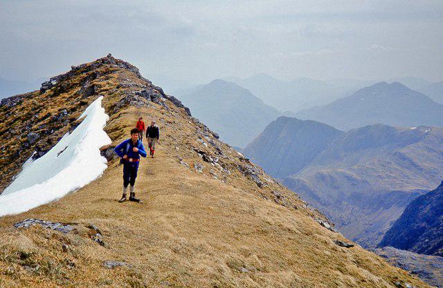 Photo could not load
NG8204 : The summit ridge of Ladhar Bheinn
Alan Reid
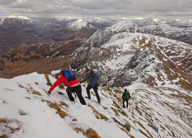 Photo could not load
NG8203 : Ladhair Bheinn - South East Ridge
Adam Ward
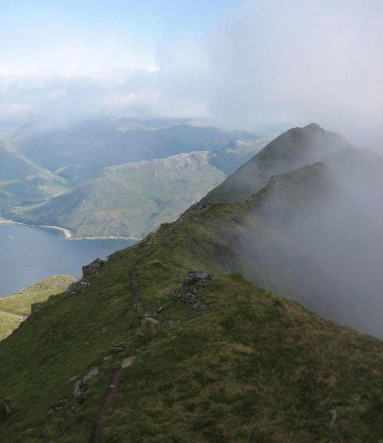 Photo could not load
NG8204 : The Ridge to Stob a'Choire Odhair
John Graham
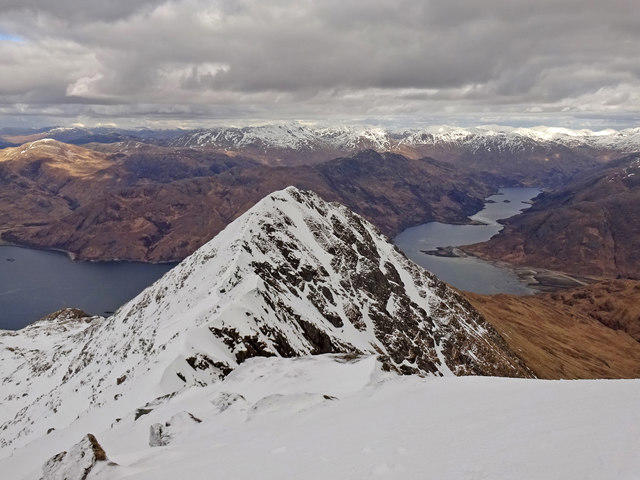 Photo could not load
NG8203 : Ladhair Bheinn - View North East
Adam Ward
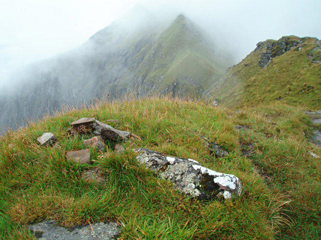 Photo could not load
NG8203 : Start of NE ridge of Ladhar Bheinn
Chris Eilbeck
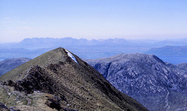 Photo could not load
NG8203 : Ridge continuing westwards from summit of Ladhar Bheinn
Trevor Littlewood
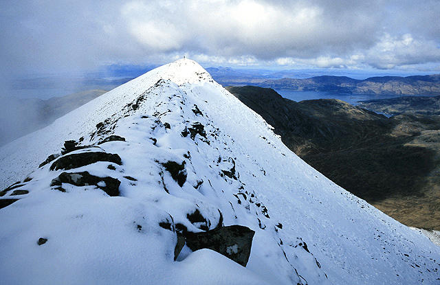 Photo could not load
NG8204 : On the summit ridge of Ladhar Bheinn
Walter Baxter
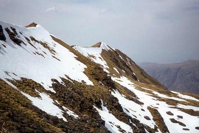 Photo could not load
NG8204 : Coire Gorm on the north face of Ladhar Bheinn
Alan Reid
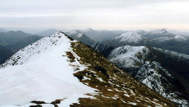 Photo could not load
NG8203 : Ladhar Bheinn
Dumgoyach
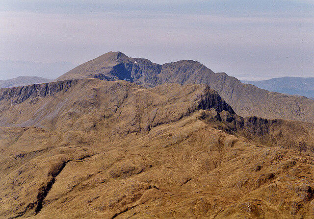
NG8203 : Ladhar Bheinn from the south east
Nigel Brown
Hill facts and local notes
Classifications
Elevation
1,020m
3,346 ft
Prominence
795m
Coordinates
57.0753, -5.5918
NG824039
OS Map
33
Explorer: 413S
At the Summit
The summit is marked by a substantial cairn, providing a perfect spot for summiteers to take in the panoramic views whilst catching their breath, and if they’re lucky, a feral goat or two.
Terrain & Geology
Primarily composed of gneiss, Ladhar Bheinn showcases classic Highland geology with rocky outcrops and ancient formations that tell the story of geological upheaval over millions of years.
Views & Scenery
From the summit, enjoy sweeping views of Knoydart, the Isle of Skye, and the expansive surrounding landscapes. On a clear day, the panorama is simply jaw-dropping.
History & Heritage
Name Origin
The name 'Ladhar Bheinn' translates to 'the hill of the fork', possibly referring to the geographical features surrounding it.
Historical Significance
Ladhar Bheinn is not only a Munro but also holds cultural significance in local folklore and is admired by climbers and hikers alike for its dramatic scenery.
Getting There & Facilities
Parking
Parking is available at Inverie, but spaces are limited and it's advisable to arrive early. Be prepared for a short walk to the trailhead.
Public Transport
The nearest public transport is via ferry from Mallaig to Inverie, which operates regularly in the summer months.
Nearby Facilities
Inverie offers a small shop and a café, as well as the famous Old Forge pub, which claims to be the remotest pub in mainland Britain, ideal for a post-hike pint.
Safety Information
Known Hazards
- Rocky terrain can be challenging, particularly in wet weather. Be wary of loose stones and sudden weather changes typical of the Highlands.
General Safety Tips
- Check weather conditions before setting out
- Carry appropriate clothing and equipment
- Let someone know your planned route
- Take a map, compass, and GPS device
- Carry emergency supplies: food, water, first aid kit, torch
Hills
Some common questions about the hills answered
Are there group walks up Ladhar Bheinn?
Many walkers use Walkmates to join or organise walks with others. You can check for group walks around Ladhar Bheinn through the maps
Are there other walkers around Ladhar Bheinn?
Activity varies by location and time, but Walkmates lets you see whether others have shared walks or shown interest in this area. Find other people through the walking friends search walking friends for Ladhar Bheinn search or of course create your own walk for Ladhar Bheinn
Can I organise a walk to Ladhar Bheinn?
Yes. If there aren’t any walks listed already, you can create a walk and make it available for others to join.
If you're signed up to Walkmates, you can create a walk to Ladhar Bheinn.
How do I find a walk up this hill?
There are often multiple ways to walk this hill, depending on experience and route preference. Walkmates helps you explore walks and routes that others have shared.
Can I suggest a new route up Ladhar Bheinn?
Yes. You can suggest or create routes to share with others. Walkmates focuses on the social side of walking, so routes are used to help people organise walks and explore areas together, rather than as detailed navigation tools or route libraries.
Other uses really appreciate knowledgeable walkers sharing their routes. Share your favourite route to Ladhar Bheinn here
The is an error or something incorrect about this hill. How do I let you know?
We always strive to keep the information on Walkmates as accurate as possible. If you find an error, please let us know through the contact form and we'll aim to correct it as quickly as possible
Community Discussion
Comments
Location
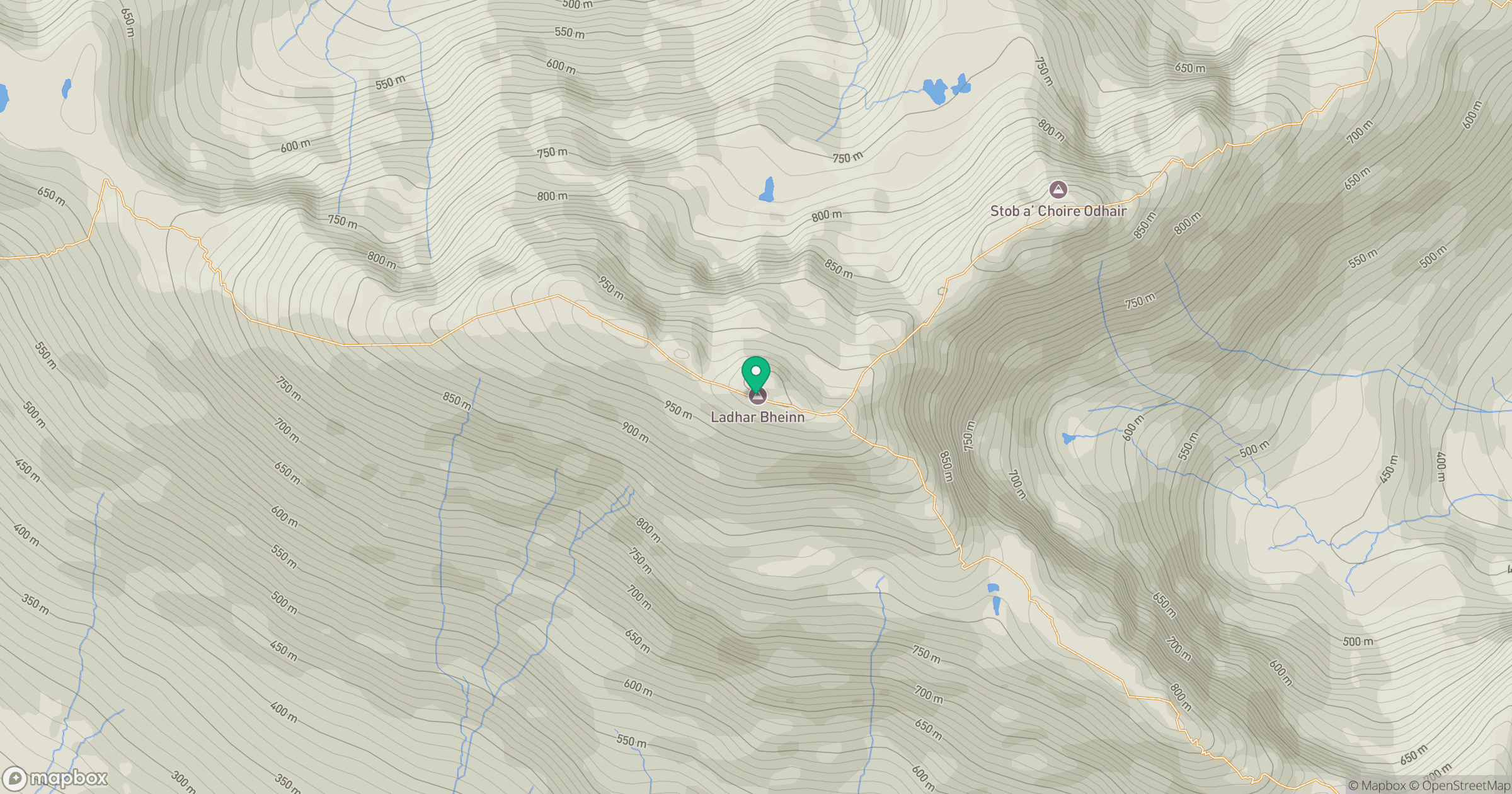
Grid reference: NG824039
View on OpenStreetMapOpens a map in a new tab, centred on the hill.
No comments yet. Be the first.