

Beinn Sgritheall
Good walks are even better shared.
NG8312 : South eastern ridge of Beinn Sgritheall
Chris Wimbush Photo source
Overview
Beinn Sgritheall
Beinn Sgritheall is a 974 m Munro above Arnisdale and Loch Hourn. Its main summit is the cairn beside a stone shelter at NG8359112671. DoBIH records the trig point 5 m south as destroyed.
Arnisdale circuit
Use the provided car park, NG843105, and the signed hill path from the village’s western end. Climb through Bealach Arnasdail and over the east top to the main summit. The return follows the rocky west ridge to the lochan near NG816126, turns left down the steep woodland path through Coille Mhialairigh, then turns left along the coast road for about 3 km back to the same car park. Walkhighlands gives 10 km, 1095 m ascent and 4–6 hours, including that road section.
Expect very steep grass and scree, an airy upper ridge and a narrow, eroded descent. The west-ridge turn requires deliberate navigation, especially in mist. This is a strenuous mountain circuit; the road return does not make the descent easy. In clear weather the outlook takes in Loch Hourn, Knoydart and Skye.
Landscape and access
Regional geological research describes folded Morar Group metasediments and Glenelg gneisses around Arnisdale, including the major Beinn Sgritheall Synform. Rock types vary across this complex setting.
Do not park on village verges. Follow the Scottish Outdoor Access Code and current advice about land management or stalking. No site-specific closure was established in the sources checked on 18 October 2026; this is not an assurance that access is unrestricted on your walking day. Check local signs. Current trailhead bus services and facility openings were not verified, so arrange transport and supplies in advance.
Sources checked: 18 October 2026.
Explore routes near Beinn Sgritheall
Walks starting near this hill. Open a route to check its map, distance and full itinerary.
Banavie to Glen Loy Aqueduct: Neptune’s Staircase Canal Towpath
View route
Beinn Eighe Lancaster Wreckage at Coire Mhic Fhearchair
View route
Glen Affric: Coire Loch Woodland Trail
View route
Ben Nevis via Mountain Path
View route
Route planning notes
These notes describe possible approaches. Check a route's map and access information when planning your walk.
Beinn Sgritheall from Arnisdale, west-ridge circuit
Start and finish at the provided Arnisdale car park (NG843105). Take the signed hill path from the western part of the village, climbing via Bealach Arnasdail and the east top to the main summit. Descend the rocky west ridge to the lochan near NG816126, then turn left down the steep, narrow path through Coille Mhialairigh to the coast road. Turn left and follow the road for about 3 km back to Arnisdale and the car park. Walkhighlands gives 10 km, 1095 m ascent and 4–6 hours for this whole circuit, including the road return.
Make a day of it, together
Find someone to share the walk with, or organise a day out along a route you like.
Photo Gallery
View all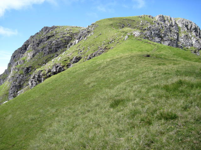 Photo could not load
NG8312 : South eastern ridge of Beinn Sgritheall
Chris Wimbush
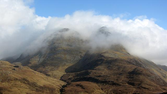 Photo could not load
NG8312 : Beinn Sgritheall
Richard Webb
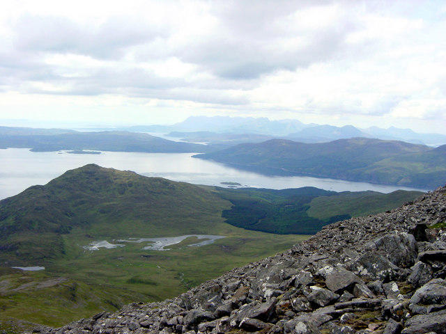 Photo could not load
NG8312 : Looking West From Beinn Sgritheall June 2003
Barry Dale
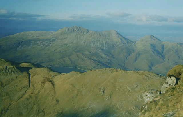 Photo could not load
NG8312 : Beinn Sgritheall from Ladhar Bheinn
AlastairG
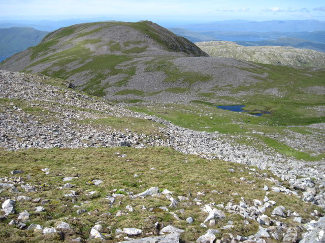 Photo could not load
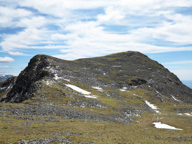
NG8312 : Towards the northern top of Beinn Sgritheall
Chris Wimbush
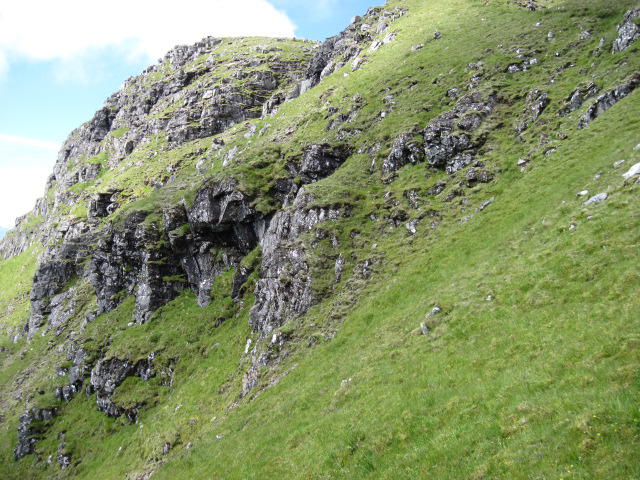 Photo could not load
NG8312 : Crags on south face of Beinn Sgritheall
Chris Wimbush
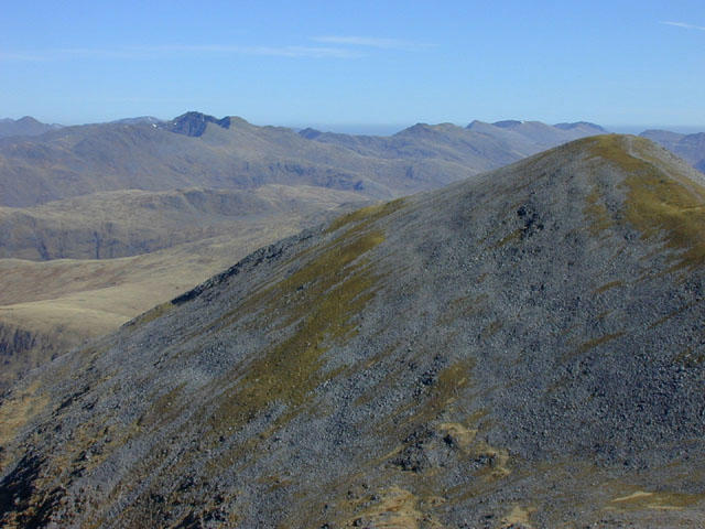 Photo could not load
NG8312 : View east from Beinn Sgritheall
Nigel Brown
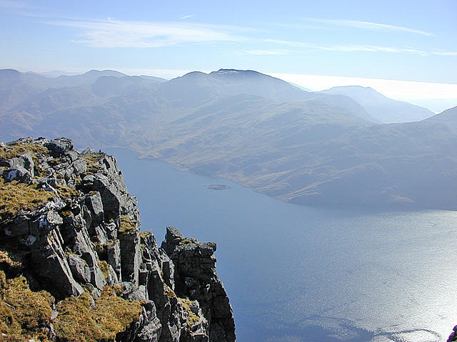 Photo could not load
NG8312 : View south from Beinn Sgritheall
Nigel Brown
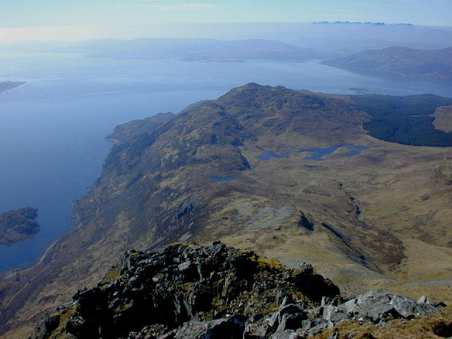 Photo could not load
NG8312 : View west from Beinn Sgritheall
Nigel Brown
NG8312 : Beinn Sgritheall
Trevor Littlewood
Hill facts and local notes
Classifications
Elevation
974m
3,196 ft
Prominence
500m
Coordinates
57.1538, -5.5797
NG835126
OS Map
33
Explorer: 413S
At the Summit
Cairn by a stone shelter at NG8359112671. The primary record says the trig point 5 m south is destroyed.
Terrain & Geology
The Arnisdale–Glenelg area contains strongly folded Morar Group metasedimentary rocks and older Glenelg gneisses. The Beinn Sgritheall Synform is a major structure described by BGS researchers; a blanket description of the mountain as granite is inappropriate. Individual outcrops vary.
Views & Scenery
Loch Hourn immediately below, Knoydart and the mountains of Skye in clear conditions.
Getting There & Facilities
Parking
Use the provided Arnisdale car park at NG843105 for the circuit. Walkhighlands specifically asks walkers not to park on the verges.
Public Transport
No current scheduled service to the Arnisdale trailhead was verified for this audit. Confirm transport and a return arrangement before setting out.
Nearby Facilities
Prepare supplies before arriving. Undiscovered Scotland describes a heritage centre and public toilets at nearby Corran, but current opening and availability were not verified.
Safety Information
Known Hazards
- Very steep grass and scree can be slippery or loose; the upper ridge has exposed sections.
- The west-ridge descent needs careful navigation to the turn near the lochan; the steep woodland path is narrow and eroded.
- Mist can obscure ridge junctions and the descent; this is not a waymarked low-level walk.
- The circuit includes about 3 km of road walking back to Arnisdale.
General Safety Tips
- Check weather conditions before setting out
- Carry appropriate clothing and equipment
- Let someone know your planned route
- Take a map, compass, and GPS device
- Carry emergency supplies: food, water, first aid kit, torch
Hills
Some common questions about the hills answered
Are there group walks up Beinn Sgritheall?
Many walkers use Walkmates to join or organise walks with others. You can check for group walks around Beinn Sgritheall through the maps
Are there other walkers around Beinn Sgritheall?
Activity varies by location and time, but Walkmates lets you see whether others have shared walks or shown interest in this area. Find other people through the walking friends search walking friends for Beinn Sgritheall search or of course create your own walk for Beinn Sgritheall
Can I organise a walk to Beinn Sgritheall?
Yes. If there aren’t any walks listed already, you can create a walk and make it available for others to join.
If you're signed up to Walkmates, you can create a walk to Beinn Sgritheall.
How do I find a walk up this hill?
There are often multiple ways to walk this hill, depending on experience and route preference. Walkmates helps you explore walks and routes that others have shared.
Can I suggest a new route up Beinn Sgritheall?
Yes. You can suggest or create routes to share with others. Walkmates focuses on the social side of walking, so routes are used to help people organise walks and explore areas together, rather than as detailed navigation tools or route libraries.
Other uses really appreciate knowledgeable walkers sharing their routes. Share your favourite route to Beinn Sgritheall here
The is an error or something incorrect about this hill. How do I let you know?
We always strive to keep the information on Walkmates as accurate as possible. If you find an error, please let us know through the contact form and we'll aim to correct it as quickly as possible
Community Discussion
Comments
Location
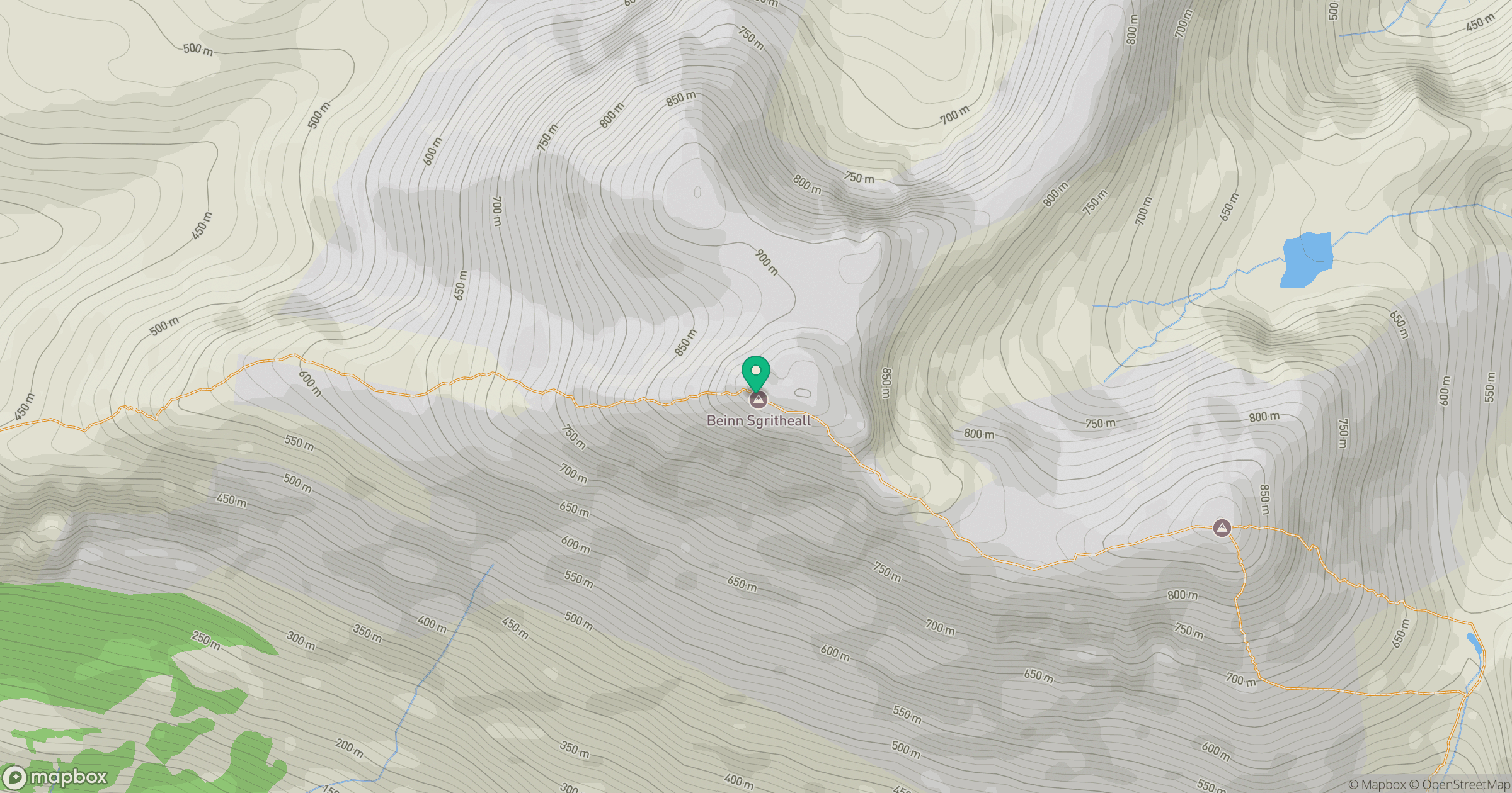
Grid reference: NG835126
View on OpenStreetMapOpens a map in a new tab, centred on the hill.
No comments yet. Be the first.