

Aonach Buidhe
Good walks are even better shared.
NH0532 : Aonach Buidhe
wrobison Photo source
Overview
Aonach Buidhe
Introduction
Aonach Buidhe, at 944 meters, is a splendid Munro that beckons hikers with its captivating views and delightful challenges. Nestled in the heart of the Scottish Highlands, it stands proudly, embodying the rugged beauty of the region.
Geology
The mountain predominantly consists of Old Red Sandstone, with formations that depict the long and complex geological history of Scotland. The ever-changing climate has accentuated the features of stone, creating crags and scree slopes that add charm and challenge to your hike.
Hiking Routes
The Allt na Lairige Route is the most popular way to ascend Aonach Buidhe. At 9.5 km in length, this moderate hike offers spectacular scenery along its well-defined paths. You'll start alongside the flowing Allt na Lairige river, a true delight to the ear, before climbing higher amongst breathtaking backdrops.
Summit Features
Upon reaching the summit, you'll be greeted by a small yet proudly erected cairn. It seems to hold the weight of many adventures, with hikers gathering to capture the moment in front of awe-inspiring landscapes. Keep your camera at the ready!
Terrain
The terrain here is a mix of rocky outcrops and grassy stretches, with the occasional bog to keep you on your toes. Suitable footwear is essential on this journey—leave the flip-flops at home!
Views
Once at the top, feast your eyes upon the remarkable Ben More and the glistening Loch Awe. The view stretches out across a land of rolling hills and delightful valleys, offering a picture-perfect feast for nature lovers.
Hazards
Keep an eye out for loose rocks that might ever so kindly greet you while trekking. Weather changes can be quite dramatic in the Highlands, so pack accordingly to avoid resembling a drowned rat!
Nearby Summits
If you find yourself enchanted by the hills, consider next tackling Ben More, an imposing neighbor with elevation over 1174 meters.
Access
The nearest parking lies at the end of a public road by the Allt na Lairige, where you can park your steed comfortably. While public transport is somewhat scarce, Crianlarich is accessible by train or bus. A local taxi can whisk you away from there.
Facilities
Before or after your trek, Crianlarich has cafes ready to refuel you with some hearty meals and hot drinks. Just what you need after tackling Aonach Buidhe!
History
The name Aonach Buidhe translates to 'Yellow Ridge', a fitting name grounded in the honeyed hues of flora that grace the mountainside. This area boasts a cultural richness that speaks to significant historical events in Scottish history.
Conclusion
Whether you're an experienced mountaineer or a weekend walker, Aonach Buidhe offers a slice of Highland heaven. Prepare well, tread safely, and soak in the wonders of this majestic landscape.
Remember, hiking is less about conquering mountains and more about embracing nature’s finest invitations!
Explore routes near Aonach Buidhe
Walks starting near this hill. Open a route to check its map, distance and full itinerary.
Glen Affric: Coire Loch Woodland Trail
View route
Beinn Eighe Lancaster Wreckage at Coire Mhic Fhearchair
View route
Fort Augustus to Kytra Lock: Caledonian Canal Towpath
View route
Fairy Lochs Liberator Wreckage Circuit
View route
Route planning notes
These notes describe possible approaches. Check a route's map and access information when planning your walk.
Allt na Lairige Route
This popular route follows the Allt na Lairige river, meandering through enchanting glens and providing stunning views as you ascend. The path is well-defined, making it easier to navigate.
Make a day of it, together
Find someone to share the walk with, or organise a day out along a route you like.
Photo Gallery
View all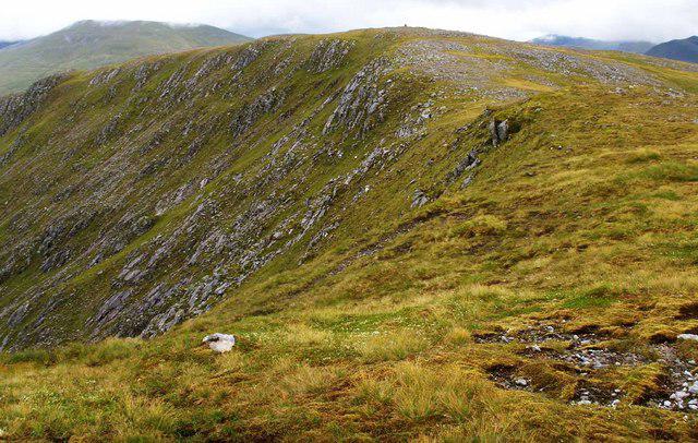 Photo could not load
NH0532 : Aonach Buidhe
wrobison
Hill facts and local notes
Classifications
Elevation
899m
2,949 ft
Prominence
474m
Coordinates
57.3412, -5.2293
NH057324
OS Map
25
Explorer: 414N 429
At the Summit
The summit boasts a small cairn, which has likely seen more selfies than hikers. Expect panoramic views over the surrounding hills, lakes, and maybe even spot a deer or two if you’re lucky.
Terrain & Geology
Aonach Buidhe is primarily composed of Old Red Sandstone, featuring extensive scree slopes and rocky outcrops. The unique geological formations reflect the tumultuous processes that shaped the Scottish Highlands.
Views & Scenery
Notable sightings include Ben More, the stunning Loch Awe, and the sprawling expanses of the surrounding Munros, which stand like mighty guardians of the landscape.
History & Heritage
Name Origin
Aonach Buidhe translates from Gaelic to 'Yellow Ridge', possibly referring to the colours of the heather that blooms in abundance here.
Historical Significance
The area has been pivotal in various historical events, making it a rich tapestry of cultural stories waiting to be uncovered.
Getting There & Facilities
Parking
Parking is available at the end of the public road near the Allt na Lairige, providing ample space for vehicles.
Public Transport
Public transport options are limited, but you can reach the nearby town of Crianlarich by train or bus, from where local taxis can be hired.
Nearby Facilities
Cafes and toilets can be found in Crianlarich, offering a good spot to refuel before or after your hike.
Safety Information
Known Hazards
- Be wary of loose rocks, especially on the ascent and descent. Sudden weather changes can also occur, so always be prepared.
General Safety Tips
- Check weather conditions before setting out
- Carry appropriate clothing and equipment
- Let someone know your planned route
- Take a map, compass, and GPS device
- Carry emergency supplies: food, water, first aid kit, torch
Hills
Some common questions about the hills answered
Are there group walks up Aonach Buidhe?
Many walkers use Walkmates to join or organise walks with others. You can check for group walks around Aonach Buidhe through the maps
Are there other walkers around Aonach Buidhe?
Activity varies by location and time, but Walkmates lets you see whether others have shared walks or shown interest in this area. Find other people through the walking friends search walking friends for Aonach Buidhe search or of course create your own walk for Aonach Buidhe
Can I organise a walk to Aonach Buidhe?
Yes. If there aren’t any walks listed already, you can create a walk and make it available for others to join.
If you're signed up to Walkmates, you can create a walk to Aonach Buidhe.
How do I find a walk up this hill?
There are often multiple ways to walk this hill, depending on experience and route preference. Walkmates helps you explore walks and routes that others have shared.
Can I suggest a new route up Aonach Buidhe?
Yes. You can suggest or create routes to share with others. Walkmates focuses on the social side of walking, so routes are used to help people organise walks and explore areas together, rather than as detailed navigation tools or route libraries.
Other uses really appreciate knowledgeable walkers sharing their routes. Share your favourite route to Aonach Buidhe here
The is an error or something incorrect about this hill. How do I let you know?
We always strive to keep the information on Walkmates as accurate as possible. If you find an error, please let us know through the contact form and we'll aim to correct it as quickly as possible
Community Discussion
Comments
Location
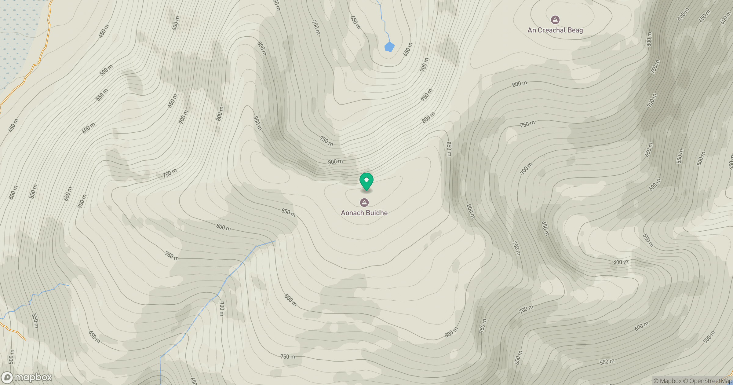
Grid reference: NH057324
View on OpenStreetMapOpens a map in a new tab, centred on the hill.
No comments yet. Be the first.