

Wild Boar Fell East Top
Good walks are even better shared.
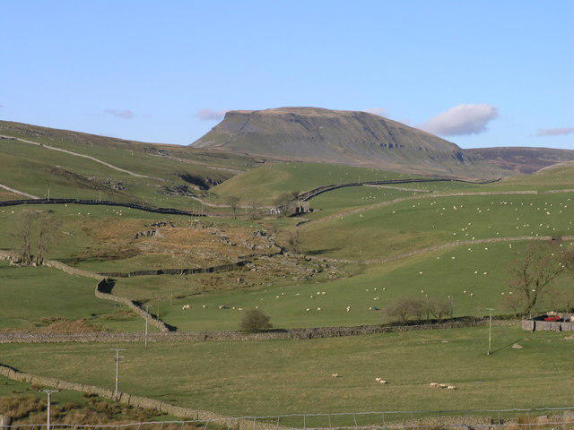
SD7698 : High White Scar
Bill Boaden Photo source
Overview
Wild Boar Fell East Top
Nestled in the stunning Yorkshire Dales, Wild Boar Fell East Top stands at an impressive elevation of 703 meters. This Marilyn offers not just a test of your hiking skills but a chance to soak in some of the most breathtaking views England has to offer.
Geology
The geology of Wild Boar Fell is primarily limestone with patches of sandstone, which create a dramatic landscape filled with ridges and dips. This unique combination contributes to the rich biodiversity of the region, making it a favourite amongst geologists and avid naturalists alike.
Routes
One of the most popular routes to reach the summit is the Wild Boar Fell Circular. This trek spans approximately 8.5 km and typically takes around 3.5 hours to complete. It's classified as moderate, making it accessible for most hikers.
Summit Features
Upon reaching the summit, you'll find a sturdy stone cairn and a trig point, which makes for an excellent photo op and a boast-worthy bragging right!
Terrain Type
Expect a mixed bag of terrain, comprising rocky paths, grassy slopes, and a few boggy areas waiting to catch out the unsuspecting hiker. Good footwear is essential!
Views
The views from the top are nothing short of spectacular. Look out for the Howgill Fells and the northern Pennines—perfect for those who played ‘spot the landmark’. Late spring to early autumn is the best time for optimal visibility, particularly during those magical hours around dawn and dusk.
Hazards
While the hike is rewarding, be aware of sudden weather shifts typical of the Yorkshire Dales. Moreover, be cautious in the boggy sections; they can be more treacherous than they look!
Nearby Summits
Don’t miss the opportunity to explore nearby summits such as Wild Boar Fell and Calder High for an extended adventure in these rolling hills.
Access
The closest parking is available at a small area by the A685 near Nateby. For those relying on public transport, buses from Kirkby Stephen make it easy to reach the starting point. Once you’ve tackled the fell, a stop at one of the delightful cafés in Kirkby Stephen for a cup of tea is highly recommended!
Facilities
You won’t find toilets on the fell itself, but nearby Kirkby Stephen has facilities to cater for weary walkers.
History
The name ‘Wild Boar’ harkens back to the time when wild boars roamed the hills—rest assured, you won’t need to carry a spear!
In summary, Wild Boar Fell East Top is not just a hill to climb but also a beautiful showcase of nature's art, steeped in history and waiting to be explored.
Happy hiking!
Explore routes near Wild Boar Fell East Top
Walks starting near this hill. Open a route to check its map, distance and full itinerary.
Ingleton Waterfalls Walk
View route
Pen-y-ghent from Horton in Ribblesdale
View route
Yorkshire Three Peaks Challenge – Gentle Pace
View route
Yorkshire Three Peaks Challenge – Sub-12 Hour
View route
Route planning notes
These notes describe possible approaches. Check a route's map and access information when planning your walk.
Wild Boar Fell Circular
A scenic circular route that allows for a leisurely ascent, suitable for all skill levels.
Make a day of it, together
Find someone to share the walk with, or organise a day out along a route you like.
Photo Gallery
View all Photo could not load
SD7598 : Small tarn on Wild Boar Fell
Ian Taylor
 Photo could not load
SD7698 : Wild Boar Fell
John Illingworth
 Photo could not load
SD7698 : Blackbed Scar
T Eyre
 Photo could not load
SD7698 : The cairns do look like people from down in the valley
Ian Greig
 Photo could not load
SD7698 : Cairns above Yoadcomb Scar, Wild Boar Fell
Karl and Ali
 Photo could not load
SD7698 : Cairns on High White Scar, Wild Boar Fell
Colin Park
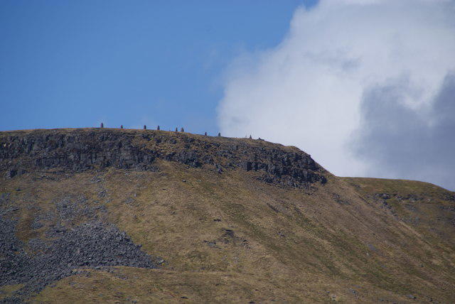 Photo could not load
SD7698 : High White Scar
Bill Boaden
 Photo could not load
SD7698 : Cairns on Wild Boar Fell
David Brown
 Photo could not load
SD7698 : A collusion of cairns
Ian Greig

SD7698 : Everchanging Cairns, Wild Boar Fell
Tom Richardson
Hill facts and local notes
Classifications
Elevation
707m
2,320 ft
Prominence
4m
Coordinates
54.3817, -2.3687
SD761985
OS Map
98
Explorer: OL19S
At the Summit
The summit boasts a notable stone cairn, a trig point, and expansive views that leave one breathless—mostly from the altitude, but also the scenery.
Terrain & Geology
The area is predominantly composed of limestone, with some sandstone features, creating stunning geological formations and unique landscapes.
Views & Scenery
On a clear day, you can see the iconic peaks of the Howgill Fells and the northern Pennines. Spotting a few sheep is almost guaranteed!
History & Heritage
Name Origin
The name 'Wild Boar' is thought to reference the wild boars that roamed the area centuries ago—though you’re unlikely to encounter one during your trek!
Historical Significance
The region is steeped in history and folklore, with connections to ancient trade routes and notable events from centuries past.
Getting There & Facilities
Parking
There is a small parking area at the foot of the fell, accessible via the A685, near the village of Nateby.
Public Transport
Regular bus services run from Kirkby Stephen, connecting to Nateby. Check local timetables for the latest details.
Nearby Facilities
There are no facilities on the fell, but friendly locals in nearby Kirkby Stephen can point you to the nearest café for a post-hike treat, and there are public toilets in the town.
Safety Information
Known Hazards
- Be mindful of sudden weather changes, as the Yorkshire Dales is known for its quick shifts in conditions. Also, the boggy areas can be deceptively tricky!
General Safety Tips
- Check weather conditions before setting out
- Carry appropriate clothing and equipment
- Let someone know your planned route
- Take a map, compass, and GPS device
- Carry emergency supplies: food, water, first aid kit, torch
Hills
Some common questions about the hills answered
Are there group walks up Wild Boar Fell East Top?
Many walkers use Walkmates to join or organise walks with others. You can check for group walks around Wild Boar Fell East Top through the maps
Are there other walkers around Wild Boar Fell East Top?
Activity varies by location and time, but Walkmates lets you see whether others have shared walks or shown interest in this area. Find other people through the walking friends search walking friends for Wild Boar Fell East Top search or of course create your own walk for Wild Boar Fell East Top
Can I organise a walk to Wild Boar Fell East Top?
Yes. If there aren’t any walks listed already, you can create a walk and make it available for others to join.
If you're signed up to Walkmates, you can create a walk to Wild Boar Fell East Top.
How do I find a walk up this hill?
There are often multiple ways to walk this hill, depending on experience and route preference. Walkmates helps you explore walks and routes that others have shared.
Can I suggest a new route up Wild Boar Fell East Top?
Yes. You can suggest or create routes to share with others. Walkmates focuses on the social side of walking, so routes are used to help people organise walks and explore areas together, rather than as detailed navigation tools or route libraries.
Other uses really appreciate knowledgeable walkers sharing their routes. Share your favourite route to Wild Boar Fell East Top here
The is an error or something incorrect about this hill. How do I let you know?
We always strive to keep the information on Walkmates as accurate as possible. If you find an error, please let us know through the contact form and we'll aim to correct it as quickly as possible
Community Discussion
Comments
Location
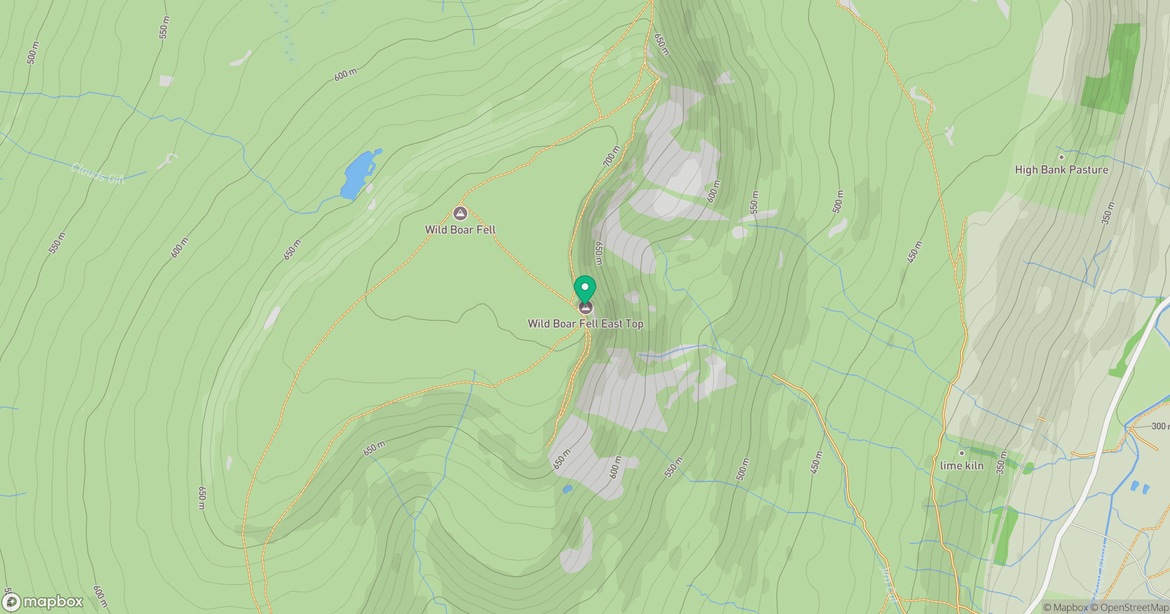
Grid reference: SD761985
View on OpenStreetMapOpens a map in a new tab, centred on the hill.
No comments yet. Be the first.