

Wild Boar Fell
Good walks are even better shared.
SD7598 : Wild Boar Fell
Ian Greig Photo source
Overview
Wild Boar Fell
Wild Boar Fell, standing at 705 meters, is a prominent feature in the Yorkshire Dales, perfect for hikers looking to stretch their legs and soak up some splendid views. The fell can easily be accessed from several routes, and once there, you'll be greeted not only by the summit trig point but also by a friendly cairn that practically begs for a selfie!
Geology
The fell is predominantly composed of limestone and sandstone that dates back to the Carboniferous period. This geological composition not only shapes its rugged charm but also supports unique flora and fauna that thrill nature enthusiasts. Feel free to marvel at the rocks, but no, they won’t marvel back!
Routes
There are a few popular routes to the summit. The most straightforward is from the B6259, offering a moderate trek with steady gains. If you're feeling a tad more adventurous, try the Roman Road Route, which gives you the flavours of history and a bit of a workout!
Summit Features
Once you've completed your ascent, the summit features await you—a large stone cairn and a trig pillar stand proudly against the sky. It's a prime photo opportunity for those wanting to show off on social media, boasting an impressive background.
Terrain
The terrain is predominantly grassy with rocky patches. Be prepared for the odd boggy encounter, especially in wetter months—waterproof boots are your friends here! Let’s face it, nobody wants soggy socks halfway through a hike.
Views
The views from Wild Boar Fell are truly a treat. On a clear day, you can gaze out over the enchanting Yorkshire Dales, spotting the Howgill Fells and the distant Ingleborough. Spring and autumn are excellent seasons for hiking here, showcasing the area’s wildflowers or vibrant foliage, respectively.
Hazards
While the views are stunning, it's important to remain cautious of slippery conditions, especially after rainfall. The weather can change on a dime, so keep an eye out for sudden fog or squalls – it can turn from sunny to soggy faster than you can say ‘breath of fresh air’.
Access
Parking is available at a layby along the B6259, and if public transport is more your style, buses to nearby towns like Hawes or Sedbergh can get you close—you might need to put your walking shoes on for the last leg!
Nearby Summits
If you're feeling ambitious, why not add nearby summits like The Calf or Foul Enter to your itinerary? It’ll make for a truly memorable walking day in these stunning hills.
Conclusion
A hike up Wild Boar Fell is bound to leave you with lasting memories and perhaps a joke or two. As always, embrace the beauty of nature, respect the landscape, and keep your spirits high!
Happy hiking!
Explore routes near Wild Boar Fell
Walks starting near this hill. Open a route to check its map, distance and full itinerary.
Ingleton Waterfalls Walk
View route
Pen-y-ghent from Horton in Ribblesdale
View route
Yorkshire Three Peaks Challenge – Gentle Pace
View route
Yorkshire Three Peaks Challenge – Sub-12 Hour
View route
Route planning notes
These notes describe possible approaches. Check a route's map and access information when planning your walk.
Wild Boar Fell from the B6259
This route takes you up from the road near the village of Keld, making for a straightforward ascent with beautiful views along the way.
The Roman Road Route
Follow this ancient path, and you'll feel like you're walking in the footsteps of history as you approach the summit with great views of the surrounding hills.
Make a day of it, together
Find someone to share the walk with, or organise a day out along a route you like.
Photo Gallery
View all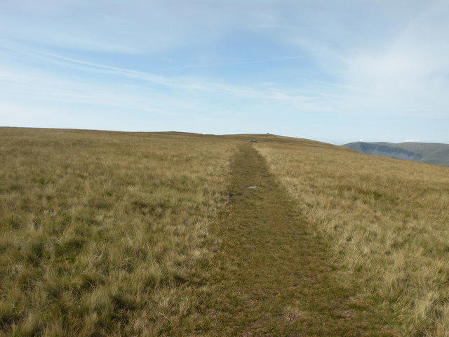 Photo could not load
SD7698 : Path over Wild Boar Fell
malcolm tebbit
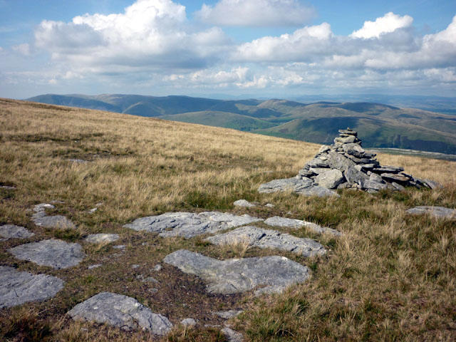 Photo could not load
SD7598 : Cairn, Wild Boar Fell
Karl and Ali
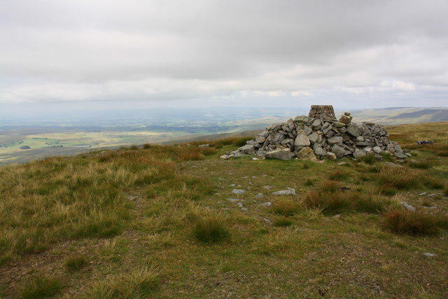 Photo could not load
SD7598 : Trig point in stone shelter on Wild Boar Fell
Roger Templeman
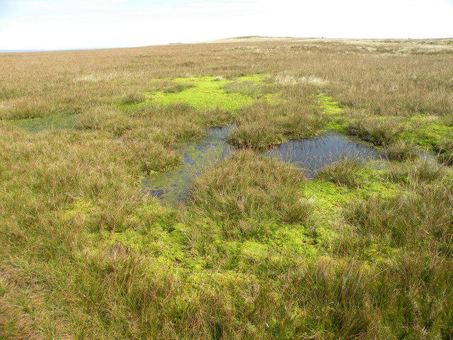 Photo could not load
SD7598 : Pond on Wild Boar Fell
malcolm tebbit
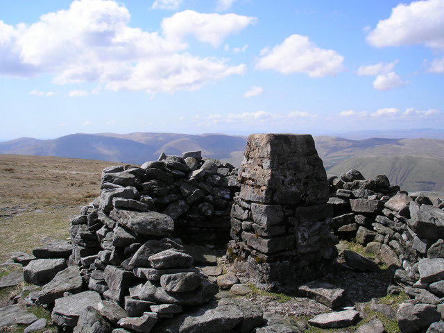 Photo could not load
SD7598 : Wild Boar Fell trig point
John Illingworth
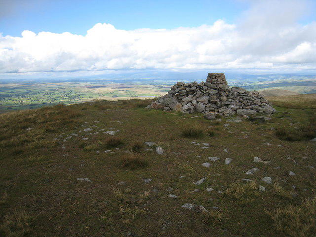 Photo could not load
SD7598 : Shelter and Trig Point on Wild Boar Fell
Philip Barker
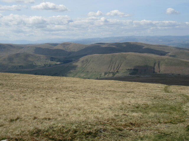 Photo could not load
SD7598 : Wild Boar Fell summit
T Eyre
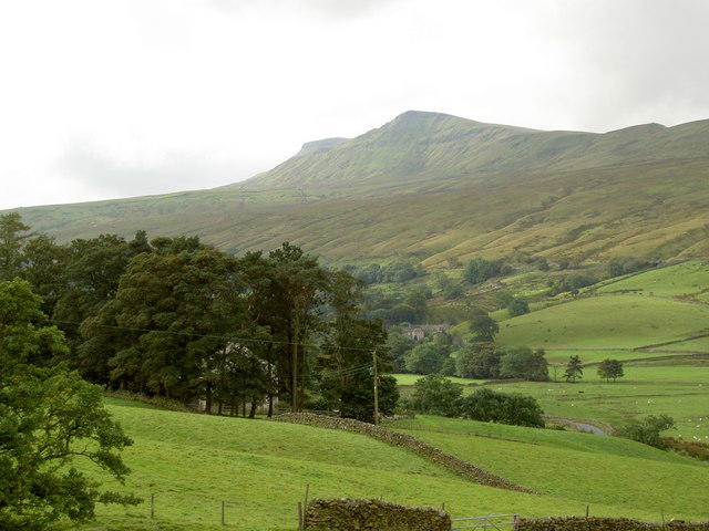 Photo could not load
SD7598 : Wild Boar Fell
Ian Greig
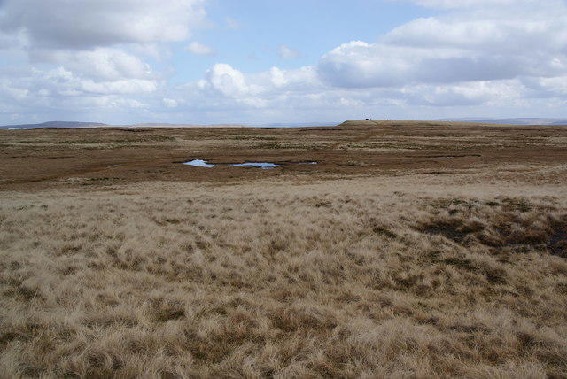 Photo could not load
SD7598 : Wild Boar Fell summit plateau
Bill Boaden
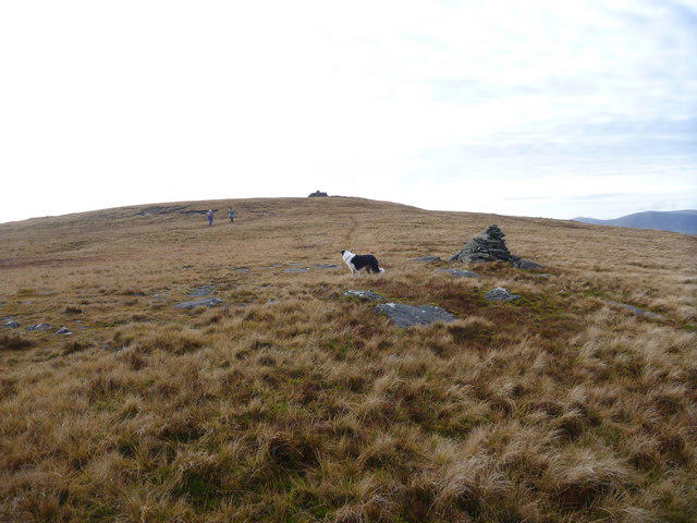
SD7598 : Crossing the Wild Boar Fell plateau
Andy Waddington
Hill facts and local notes
Classifications
Elevation
708m
2,324 ft
Prominence
353m
Coordinates
54.3841, -2.3741
SD758987
OS Map
98
Explorer: OL19S
At the Summit
The summit features a large cairn and a trig point, perfect for bragging rights in your hiking tales. It's also a great spot for a panoramic photo op!
Terrain & Geology
Wild Boar Fell is composed predominantly of limestone and sandstone deposits dating back to the Carboniferous period, providing a rich and varied geology that has shaped the landscape.
Views & Scenery
From the summit, you can see the breadth of the Yorkshire Dales, including the fells of the Howgill Fells to the south and the magnificent Ingleborough in the north.
History & Heritage
Name Origin
The name 'Wild Boar Fell' is believed to derive from the wild boars that roamed the area centuries ago, adding a dash of drama to your hiking tales.
Historical Significance
Historically, the fell has been a landmark for local communities and a part of traditional shepherding routes, ingrained in the local culture.
Getting There & Facilities
Parking
There is a small layby along the B6259 where you can park; ensure you park considerately and leave enough room for other vehicles.
Public Transport
The nearest public transport options involve buses to Hawes or Sedbergh, from where local taxis or a bit of walking can get you to the trailhead.
Nearby Facilities
A few cafes in Kirkby Stephen offer light refreshments, and you can find public toilets there too—perfect for a pre-hike pit stop.
Safety Information
Known Hazards
- Potential for slippery surfaces, especially after rain. Be wary of sudden changes in weather, as visibility can drop quickly.
General Safety Tips
- Check weather conditions before setting out
- Carry appropriate clothing and equipment
- Let someone know your planned route
- Take a map, compass, and GPS device
- Carry emergency supplies: food, water, first aid kit, torch
Hills
Some common questions about the hills answered
Are there group walks up Wild Boar Fell?
Many walkers use Walkmates to join or organise walks with others. You can check for group walks around Wild Boar Fell through the maps
Are there other walkers around Wild Boar Fell?
Activity varies by location and time, but Walkmates lets you see whether others have shared walks or shown interest in this area. Find other people through the walking friends search walking friends for Wild Boar Fell search or of course create your own walk for Wild Boar Fell
Can I organise a walk to Wild Boar Fell?
Yes. If there aren’t any walks listed already, you can create a walk and make it available for others to join.
If you're signed up to Walkmates, you can create a walk to Wild Boar Fell.
How do I find a walk up this hill?
There are often multiple ways to walk this hill, depending on experience and route preference. Walkmates helps you explore walks and routes that others have shared.
Can I suggest a new route up Wild Boar Fell?
Yes. You can suggest or create routes to share with others. Walkmates focuses on the social side of walking, so routes are used to help people organise walks and explore areas together, rather than as detailed navigation tools or route libraries.
Other uses really appreciate knowledgeable walkers sharing their routes. Share your favourite route to Wild Boar Fell here
The is an error or something incorrect about this hill. How do I let you know?
We always strive to keep the information on Walkmates as accurate as possible. If you find an error, please let us know through the contact form and we'll aim to correct it as quickly as possible
Community Discussion
Comments
Location
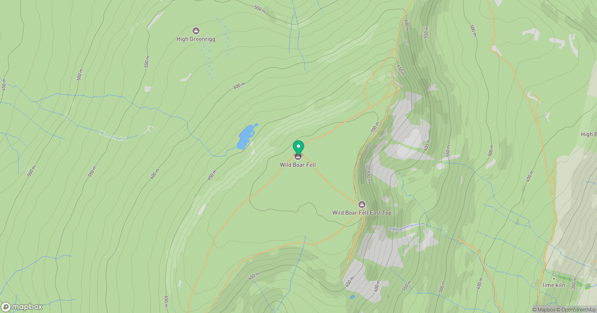
Grid reference: SD758987
View on OpenStreetMapOpens a map in a new tab, centred on the hill.



No comments yet. Be the first.