

Buckden Pike
Good walks are even better shared.
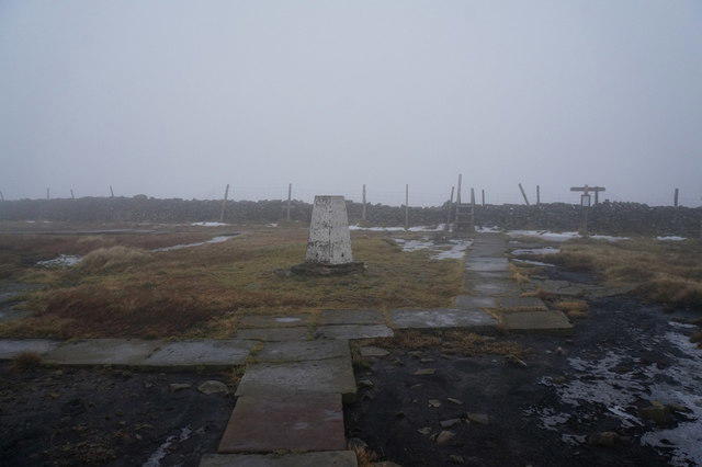
SD9678 : Buckden Pike Trig Point In Mist.
Steve Partridge Photo source
Overview
Buckden Pike
Introduction
Buckden Pike, towering at 702 metres, is the jewel of the Yorkshire Dales, offering eager hikers stunning panoramic views and a taste of the rugged countryside.
Geology
The geology of Buckden Pike tells a tale of ancient seas and shifting tectonic plates. Composed mainly of limestone from the Carboniferous period, this mountain showcases a rich tapestry of geological history, making it a natural laboratory for geology enthusiasts.
Routes
The most frequented route starts from Buckden Village. This moderate circular trail stretches about 9 km and typically takes around 4 hours to complete. Be prepared for a mixture of rocky and grassy terrain, occasionally taking you through areas that can resemble a bog after good rainfall.
Summit Features
At the summit, you'll find a well-preserved trig point, which is a great spot to rest your weary legs and snap a few photos. The surrounding rocky outcrops add to the allure, giving you that authentic 'King of the Hill' feeling.
Views
Once you reach the summit, the views are nothing short of breathtaking. On a clear day, you can see across Wensleydale, spot the distinctive peaks of the Yorkshire Dales, and catch a glimpse of the North Pennines. The best time for those views? Spring and autumn, when the landscape is alive with colour. And early risers might just be rewarded with a stunning sunrise.
Hazards
As with any hiking adventure, be mindful of the elements. The weather can change at the drop of a hat in the Dales, leaving you in unexpected rain or mist. Paths may also be slippery, so sturdy footwear is a must.
Nearby Summits
If you fancy extending your adventure, consider bagging Great Whernside or Cray Village Hill, both nearby peaks that offer further exploration opportunities.
Access
Parking is available in Buckden Village, which comes with a small fee during peak seasons. Public transport options do exist, but do check the local bus schedules to avoid being left high and dry.
Facilities
When the hiking is done, treat yourself to a stop at one of the local cafes or the pub in Buckden for a well-deserved refreshment.
Conclusion
Buckden Pike is more than just a hike; it’s a journey through history, nature, and your own limits. Pack your essentials, head up into the clouds, and remember: the only thing better than a view from the top is a good London Fog latte waiting for you below. Stay safe and enjoy the climb!
Explore routes near Buckden Pike
Walks starting near this hill. Open a route to check its map, distance and full itinerary.
Buckden Pike Wellington Wreckage and Memorial
View route
Pen-y-ghent from Horton in Ribblesdale
View route
Yorkshire Three Peaks Challenge – Gentle Pace
View route
Yorkshire Three Peaks Challenge – Sub-12 Hour
View route
Route planning notes
These notes describe possible approaches. Check a route's map and access information when planning your walk.
Classic Buckden Pike Loop via Buckden Village
This popular route starts in the picturesque village of Buckden and ascends Buckden Pike via a well-trodden path. The route begins by following Buckden Beck upstream, passing waterfalls, and then climbs steeply up the fellside to reach the summit. From the summit cairn, walkers can enjoy stunning views of the surrounding Yorkshire Dales. The route loops back down via the Polish War Memorial and returns to Buckden via a gentle descent along grassy paths.
Buckden Pike and Great Whernside Circuit
This longer and more challenging route links Buckden Pike with its neighbouring peak, Great Whernside. Starting at the grid reference SD9606178786, the walk ascends Buckden Pike via a steep climb and then traverses the ridge with panoramic views. After descending to the valley, the route continues with a second ascent to Great Whernside before looping back to the start. A rewarding day for experienced walkers.
Buckden Pike via Starbotton
This scenic route starts in the charming village of Starbotton and takes a less direct path to Buckden Pike. The ascent follows quiet trails through moorland and past old mine workings, providing a sense of remoteness. Upon reaching the summit, walkers can take in the expansive views before descending along a different route back to Starbotton.
Short Ascent of Buckden Pike from Buckden
This is a shorter, more direct route to the summit of Buckden Pike, ideal for those with limited time. Starting in Buckden, the route heads straight up the fellside, offering a quick but steep ascent. After enjoying the views from the top, walkers can return via the same path or take a slightly different descent through the moorland.
Buckden Pike via Walden Valley
This less-travelled route approaches Buckden Pike from the quieter Walden Valley. Starting near Walden Head, the path ascends gradually through open countryside before steepening as it nears the summit. The return journey follows a different route, offering a chance to explore more of the surrounding landscape.
Make a day of it, together
Find someone to share the walk with, or organise a day out along a route you like.
Photo Gallery
View all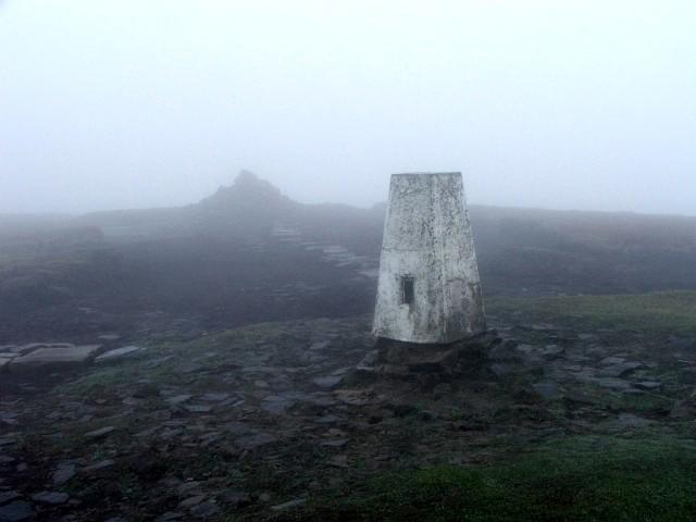 Photo could not load
SD9678 : Buckden Pike Trig Point In Mist.
Steve Partridge
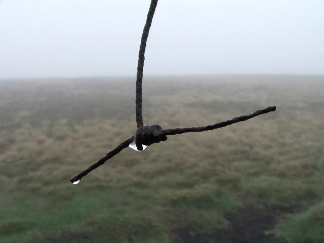 Photo could not load
SD9678 : Droplets On A rusty Wire Fence.
Steve Partridge
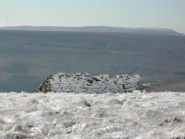 Photo could not load
SD9678 : Buckden Pike in winter
Nigel Auty
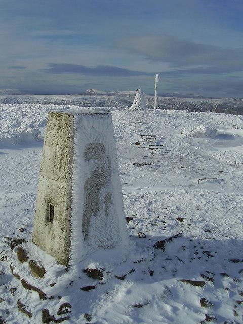 Photo could not load
SD9678 : Trig pillar and cairn on Buckden pike.
steven ruffles
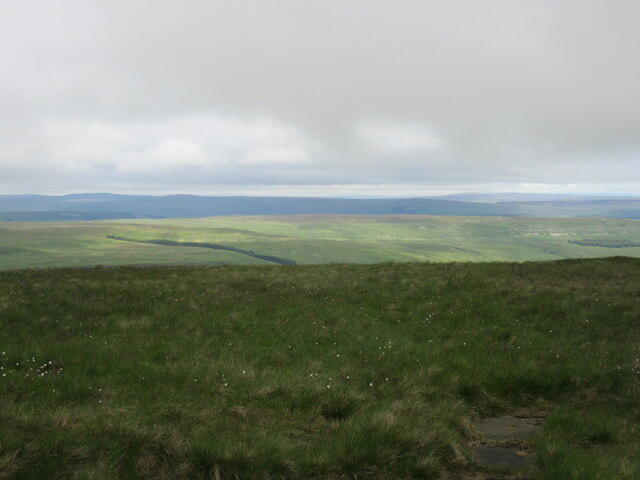 Photo could not load
SD9678 : Buckden Pike summit
T Eyre
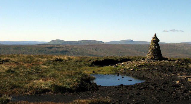 Photo could not load
SD9678 : Summit area of Buckden Pike
Trevor Littlewood
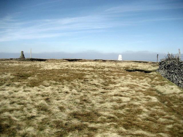 Photo could not load
SD9678 : Summit Furniture on Buckden Pike
Chris Heaton
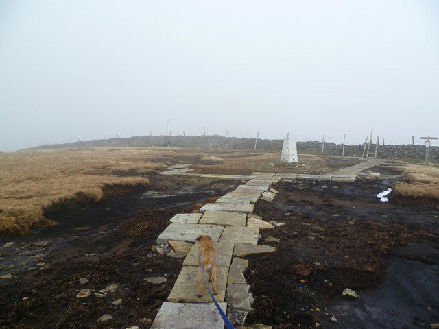 Photo could not load
SD9678 : On Buckden Pike
Michael Graham
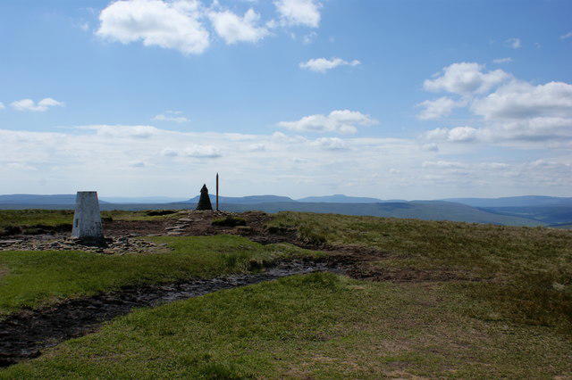 Photo could not load
SD9678 : Buckden Pike trig point & cairn with Pen-y-ghent on the horizon
Ian Greig
SD9678 : The Trig Point on Buckden Pike, Yorkshire
Ian S
Hill facts and local notes
Classifications
Elevation
702m
2,302 ft
Prominence
209m
Coordinates
54.2048, -2.0619
SD960787
OS Map
98
Explorer: OL30S
At the Summit
The summit boasts a prominent trig point, surrounded by rocky outcrops and expansive views of the surrounding valleys.
Terrain & Geology
Buckden Pike is predominantly composed of sedimentary rock, particularly limestone, formed during the Carboniferous period. The unique geological structure contributes to the diverse flora and fauna found in the area.
Views & Scenery
From the summit, enjoy spectacular views of Wensleydale, the Yorkshire Dales, and the North Pennines on a clear day.
History & Heritage
Name Origin
The name 'Buckden' is believed to derive from Old English, meaning 'the hill where the buccas (a type of tree) grow'.
Historical Significance
Buckden Pike has been a significant landmark for centuries, often used by shepherds and hikers for navigation.
Getting There & Facilities
Parking
Parking is available in Buckden Village, around SD 997 787, with a small parking fee applicable during peak months.
Public Transport
Buses run to Buckden from Grassington and Kettlewell, but it’s best to check local timetables ahead.
Nearby Facilities
Cafes and toilets are available in Buckden, along with a pub offering refreshments for weary hikers.
Safety Information
Known Hazards
- Weather can change quickly; prepare for all conditions. Some paths may be slippery when wet, and low visibility can occur in fog.
General Safety Tips
- Check weather conditions before setting out
- Carry appropriate clothing and equipment
- Let someone know your planned route
- Take a map, compass, and GPS device
- Carry emergency supplies: food, water, first aid kit, torch
Hills
Some common questions about the hills answered
Are there group walks up Buckden Pike?
Many walkers use Walkmates to join or organise walks with others. You can check for group walks around Buckden Pike through the maps
Are there other walkers around Buckden Pike?
Activity varies by location and time, but Walkmates lets you see whether others have shared walks or shown interest in this area. Find other people through the walking friends search walking friends for Buckden Pike search or of course create your own walk for Buckden Pike
Can I organise a walk to Buckden Pike?
Yes. If there aren’t any walks listed already, you can create a walk and make it available for others to join.
If you're signed up to Walkmates, you can create a walk to Buckden Pike.
How do I find a walk up this hill?
There are often multiple ways to walk this hill, depending on experience and route preference. Walkmates helps you explore walks and routes that others have shared.
Can I suggest a new route up Buckden Pike?
Yes. You can suggest or create routes to share with others. Walkmates focuses on the social side of walking, so routes are used to help people organise walks and explore areas together, rather than as detailed navigation tools or route libraries.
Other uses really appreciate knowledgeable walkers sharing their routes. Share your favourite route to Buckden Pike here
The is an error or something incorrect about this hill. How do I let you know?
We always strive to keep the information on Walkmates as accurate as possible. If you find an error, please let us know through the contact form and we'll aim to correct it as quickly as possible
Community Discussion
Comments
Location
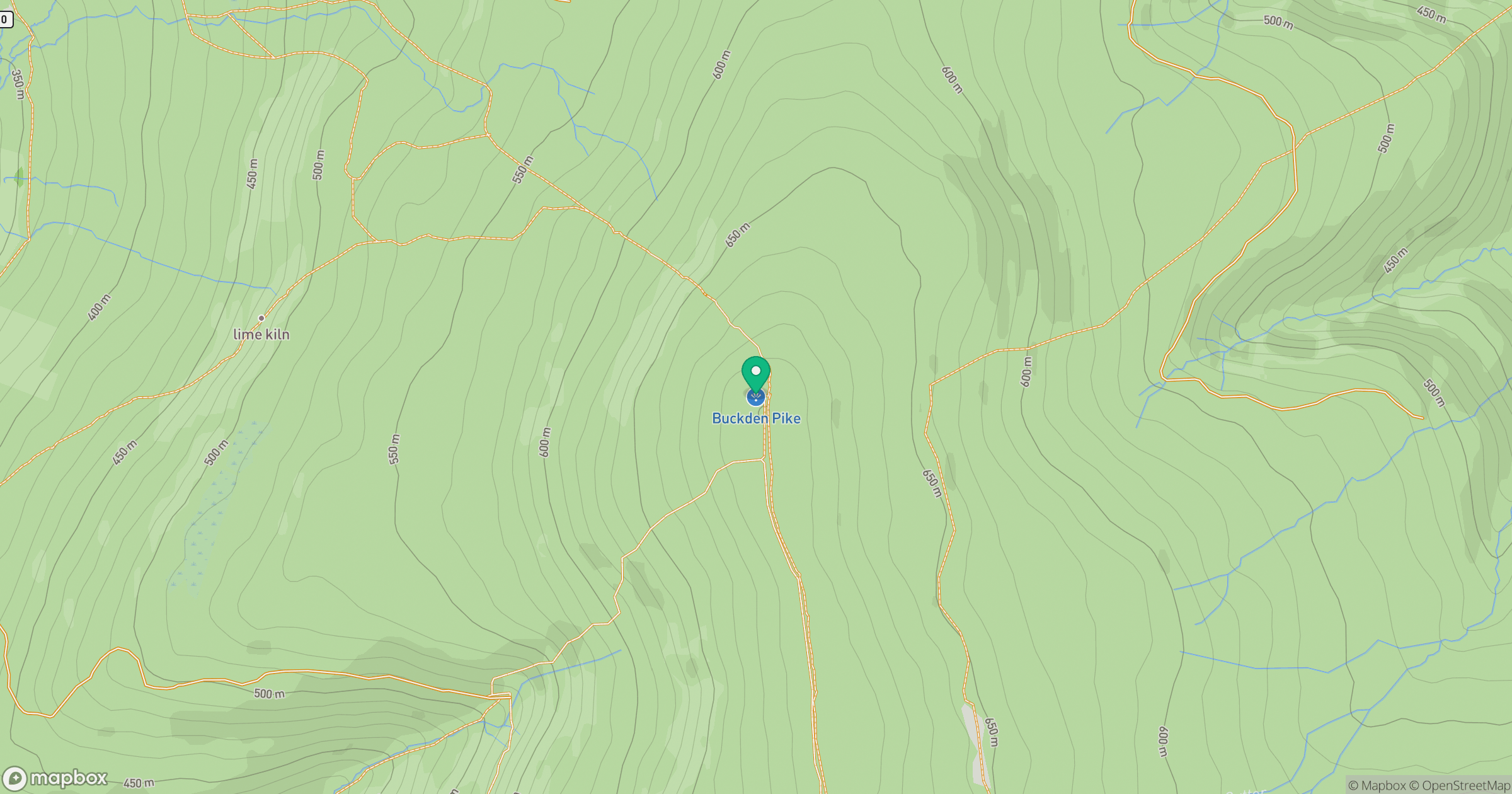
Grid reference: SD960787
View on OpenStreetMapOpens a map in a new tab, centred on the hill.
Nearby Hills

Pen-y-ghent
694m
Nine Standards Rigg
662m

Ingleborough
723m

Whernside
737m
Rombalds Moor [Ilkley Moor]
402m
No comments yet. Be the first.