

Thorpe Cloud
Good walks are even better shared.
SK1551 : Walkers in the Dove Dale
derek dye Photo source
Overview
Thorpe Cloud is a 287 m limestone hill at the southern entrance to Dovedale in Derbyshire, between Thorpe and Ilam. Its rocky summit overlooks the River Dove, Bunster Hill and the surrounding White Peak countryside. The ascent is short but steep, with slippery limestone and drops near the ridge. Follow the signed summit route and check local notices: a walk using Dovedale’s stepping stones depends on river conditions and whether the crossing is open.
Thorpe Cloud
Thorpe Cloud rises to 287 m above the southern entrance to Dovedale in the Peak District. It is an Ethel and a Tump, with 79 m of prominence. The recorded summit is a rock outcrop at the south-eastern end of the ridge, at SK151509. Views take in the River Dove, Bunster Hill and the countryside around Ilam.
Choosing a summit walk
The hill is a short but steep outing. The final ascent and descent cross rough limestone, and the ridge has steep drops. Follow the current signed route, usually marked with blue posts; erosion management can change the permitted line, so worn shortcuts and older map lines should not override signs on the ground.
From Dovedale car park, a summit outing can use the downstream footbridge and the marked approach around the southern side of the hill, returning the same way. This avoids needing to cross the stepping stones. Connecting paths can still be affected by flooding or closures.
Peak District Kids publishes a 2.5 km circuit combining the stepping stones, the summit and the downstream footbridge. Allow roughly 1–2 hours, depending on pace and stops. That circuit is an option only when the stones are open and safe to cross. Never use submerged stones or disregard barriers; choose the bridge-based approach or change plans if conditions are unsuitable.
The National Park’s low-level riverside walk reaches the stepping stones in about 640 m from the car park. Its accessibility rating applies to that approach, not to the rocky summit climb or a crossing of the stones.
Parking, transport and facilities
Use National Trust Dovedale car park, reached from Thorpe Road along a narrow lane. It can fill at busy times. Narlows Lane in Thorpe is a paid alternative with a longer walk-in. Check National Trust visitor information for current parking arrangements and notices, and keep lanes and gateways clear.
Dovedale car park has paid public toilets and seasonal refreshments. Check the National Park’s toilet information for current payment arrangements. Ilam Park offers additional visitor facilities. Bring what you need for the hill itself.
Derbyshire Connect serves Thorpe and Dovedale by advance booking, Monday–Saturday. Arrange both outward and return journeys; this is an on-demand service rather than a fixed-timetable bus.
Conditions and care
Use footwear with good grip: loose or polished limestone can be slippery, particularly after rain. Ice, snow and strong wind make the steep ground more serious. Supervise children near the ridge, keep dogs on leads around livestock and wildlife, and take an offline map because reception in Dovedale is unreliable.
Landscape and history
Thorpe Cloud is a limestone reef knoll, part of the White Peak’s Carboniferous landscape. Natural England explains the resistant, fossil-bearing limestone of these knolls. Leave fossils and loose stones in place.
National Trust heritage records describe Romano-British pottery found on the hill, including second–fourth-century material recovered in 1977 and 1985. The finds support Roman-period activity without establishing a single certain purpose for the hilltop.
Explore routes near Thorpe Cloud
Walks starting near this hill. Open a route to check its map, distance and full itinerary.
Tissington Trail: Ashbourne, Thorpe Station and Tissington return
View route
Carsington Water: full reservoir circuit
View route
Manifold Way: Hulme End to Waterhouses
View route
High Peak Trail: Friden, Newhaven Tunnel and Hurdlow Bridge
View route
Route planning notes
These notes describe possible approaches. Check a route's map and access information when planning your walk.
Thorpe Cloud from Dovedale via the footbridge
From Dovedale car park, cross the downstream footbridge over the River Dove and join the signed Thorpe Cloud route around the southern side of the hill. Follow current waymarkers for the steep rocky ascent and return the same way. This avoids the stepping stones; obey any path closures and do not enter floodwater.
Thorpe Cloud and stepping stones circuit (conditions permitting)
Start at Dovedale car park, follow the riverside path to the stepping stones, then use the signed summit route and return by the downstream footbridge. Only cross the stones when open and safe; use the bridge-based approach if closed, flooded or slippery. Published circuit: about 2.5 km, taking roughly 1–2 hours depending on pace and stops. Follow current waymarkers where erosion diversions alter the path.
Make a day of it, together
Find someone to share the walk with, or organise a day out along a route you like.
Photo Gallery
View all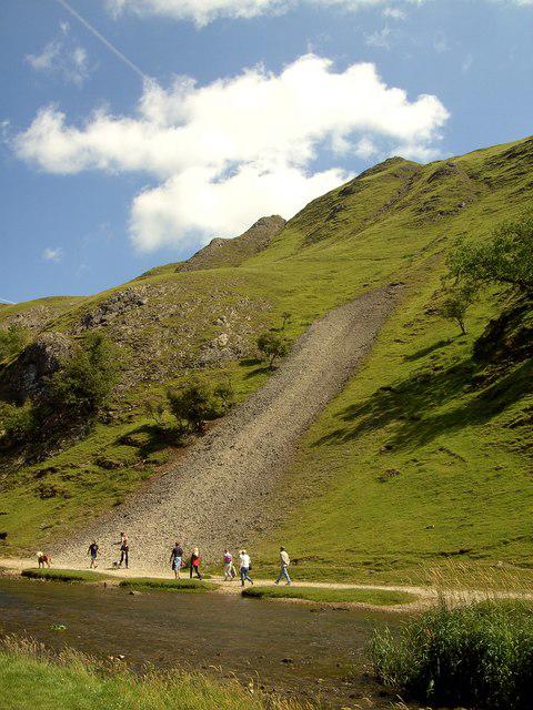 Photo could not load
SK1551 : Walkers in the Dove Dale
derek dye
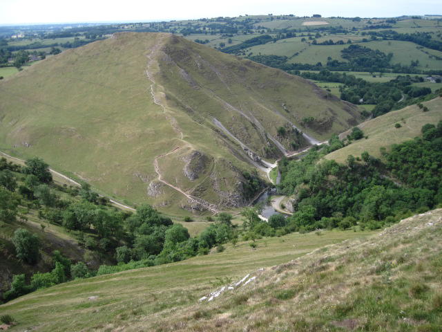 Photo could not load
SK1551 : Thorpe Cloud
Chris Wimbush
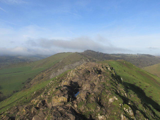 Photo could not load
SK1551 : The rocky summit of Thorpe Cloud
steven ruffles
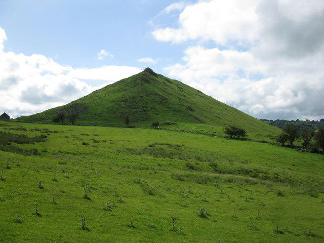 Photo could not load
SK1550 : Thorpe Cloud
don cload
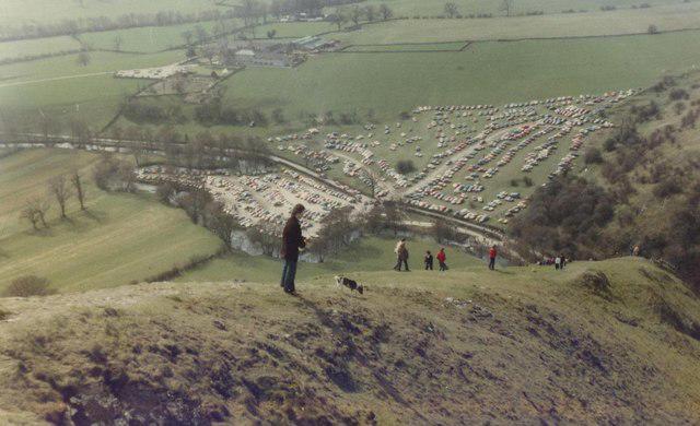 Photo could not load
SK1551 : View from Thorpe Cloud, Dovedale
Michael Westley
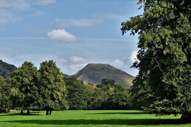 Photo could not load
SK1551 : Ilam Park: Looking towards Thorpe Cloud, the flat-topped hill
Michael Garlick
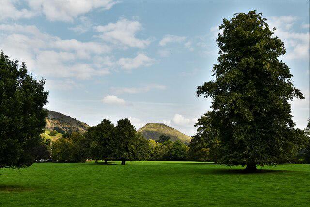 Photo could not load
SK1551 : Ilam Park: Looking towards Thorpe Cloud, the flat-topped hill
Michael Garlick
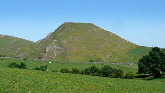 Photo could not load
SK1551 : Thorpe Cloud
Mark Percy
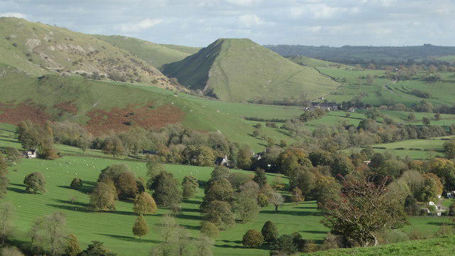 Photo could not load
SK1551 : View towards Thorpe Cloud from below Upper Musden
Colin Park
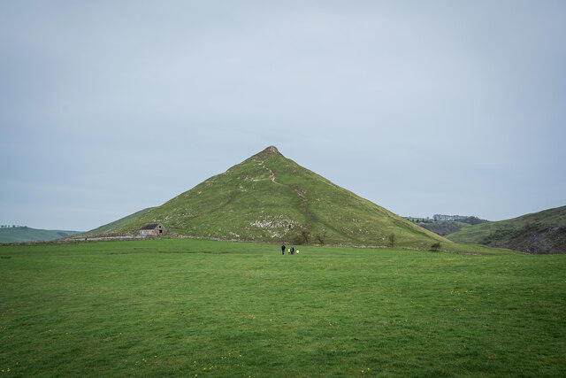
SK1550 : Thorpe Cloud
Brian Deegan
Hill facts and local notes
Classifications
Elevation
287m
942 ft
Prominence
79m
Coordinates
53.0559, -1.7748
SK151509
OS Map
119
Explorer: OL24E
At the Summit
A rocky outcrop at the south-eastern end of the summit ridge is the recorded high point.
Terrain & Geology
Thorpe Cloud is a Carboniferous limestone reef knoll. The Dovedale knolls include carbonate mud-mounds formed in an ancient marine environment; their resistant limestone stands above the surrounding landscape. Fossils occur in the limestone. Leave rocks and fossils in place in this protected landscape.
Views & Scenery
Views along Dovedale and the River Dove, across to Bunster Hill, and towards Ilam Park and the surrounding White Peak countryside.
History & Heritage
Name Origin
Thorpe refers to the neighbouring village. Cloud comes from Old English clūd, used for a rock or rocky hill.
Historical Significance
National Trust archaeological records document Romano-British pottery from Thorpe Cloud, including sherds dated to the second–fourth centuries AD found in 1977 and 1985. These finds provide evidence of Roman-period activity on the hill; the precise use of the summit remains a matter of interpretation.
Getting There & Facilities
Parking
National Trust Dovedale car park, DE6 2AY, is the main nearby starting point (approximately SK 1465 5095). It is reached along a narrow lane with passing places off Thorpe Road. Parking charges apply, with free parking for National Trust members under the current arrangements; check the operator’s latest charges and opening times. It can fill on busy weekends and holidays. Narlows Lane car park in Thorpe (SK 1635 5048) is a paid alternative for a longer approach through Thorpe Pastures and Lin Dale. Keep lanes, verges and gateways clear.
Public Transport
Derbyshire Connect is a pre-booked, demand-responsive service covering Ashbourne, Thorpe and Dovedale, operating Monday–Saturday. Confirm your pick-up, drop-off and return journey with Ashbourne Community Transport before travelling: 01335 342951, https://www.ashbournect.org.uk/derbyshire-connect . It has no fixed route or timetable.
Nearby Facilities
Paid public toilets and refreshment concessions are at Dovedale car park; check current opening times and payment arrangements. Refreshment opening is seasonal. Ilam Park has a tea-room and further visitor facilities. There are no summit facilities. The surfaced riverside approach is a separate low-level walk; the steep, rocky summit route is unsuitable for wheelchairs or pushchairs.
Safety Information
Known Hazards
- The ascent is steep and rocky, with loose or worn limestone that can be slippery even outside wet weather. Wear footwear with good grip and descend carefully.
- The summit ridge has steep drops; supervise children closely and avoid the exposed top in strong winds.
- Dovedale stepping stones can be slippery, damaged or submerged. Obey closure notices and never cross when covered by water. The downstream footbridge provides a crossing alternative, but connecting paths may also flood.
- Mobile reception is poor or absent in Dovedale. Carry an offline map and plan the return route before setting off.
- Livestock graze the area. Keep dogs on leads and leave gates as found.
Seasonal Hazards
Rain makes the limestone and grassy slopes more slippery; ice and snow increase the risk on the steep ascent and descent. High river levels, especially in winter, can flood the stepping stones and riverside paths. Check National Trust notices before travelling and follow signs on site; do not enter floodwater.
General Safety Tips
- Check weather conditions before setting out
- Carry appropriate clothing and equipment
- Let someone know your planned route
- Take a map, compass, and GPS device
- Carry emergency supplies: food, water, first aid kit, torch
Hills
Some common questions about the hills answered
Are there group walks up Thorpe Cloud?
Many walkers use Walkmates to join or organise walks with others. You can check for group walks around Thorpe Cloud through the maps
Are there other walkers around Thorpe Cloud?
Activity varies by location and time, but Walkmates lets you see whether others have shared walks or shown interest in this area. Find other people through the walking friends search walking friends for Thorpe Cloud search or of course create your own walk for Thorpe Cloud
Can I organise a walk to Thorpe Cloud?
Yes. If there aren’t any walks listed already, you can create a walk and make it available for others to join.
If you're signed up to Walkmates, you can create a walk to Thorpe Cloud.
How do I find a walk up this hill?
There are often multiple ways to walk this hill, depending on experience and route preference. Walkmates helps you explore walks and routes that others have shared.
Can I suggest a new route up Thorpe Cloud?
Yes. You can suggest or create routes to share with others. Walkmates focuses on the social side of walking, so routes are used to help people organise walks and explore areas together, rather than as detailed navigation tools or route libraries.
Other uses really appreciate knowledgeable walkers sharing their routes. Share your favourite route to Thorpe Cloud here
The is an error or something incorrect about this hill. How do I let you know?
We always strive to keep the information on Walkmates as accurate as possible. If you find an error, please let us know through the contact form and we'll aim to correct it as quickly as possible
Community Discussion
Comments
Location
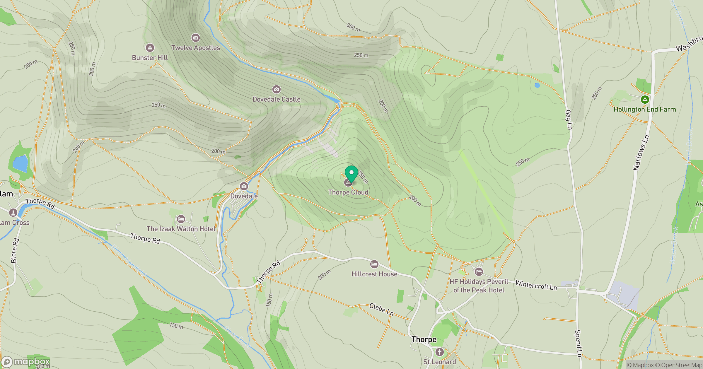
Grid reference: SK151509
View on OpenStreetMapOpens a map in a new tab, centred on the hill.
Nearby Hills
The Roaches
505m

Kinder Scout
636m
Rombalds Moor [Ilkley Moor]
402m

The Wrekin
407m
Winter Hill
456m
No comments yet. Be the first.