

Wetton Hill
Good walks are even better shared.
Overview
Wetton Hill
Overview
Wetton Hill rises gracefully to 388 meters, offering not just a lovely hike but a glimpse into the geological grandeur of the Peak District. It's classified as a Marilyn, which means it has at least 150 meters of prominence—rightly so, given its lovely views!
Geology
Composed predominantly of limestone, the surrounding landscape is a testament to the forces of nature over eons. The region boasts fascinating karst features, including limestone pavements and fascinating cave systems. Don’t be surprised if you encounter ancient fossils along the trails—just remember, they’re for looking, not for taking!
Routes
The main route from Wetton village takes you on a delightful 4.5 km loop to the summit. This moderate trail is well-trodden, making it a favourite among local hikers.
Summit Features
Upon reaching the summit, you’ll be greeted by a proud trig point and a friendly cairn, waiting patiently for hikers to capture their triumph on camera.
Terrain
As you traverse Wetton Hill, expect a mixture of grassy slopes, rocky outcrops, and occasional boggy bits that might surprise you, especially after a good rain. It is an ideal setting for sturdy hiking boots!
Views
From the summit, the vistas are simply marvellous. Expect a panoramic sweep of the surrounding countryside; spring hues and autumnal shades create a picturesque backdrop that is perfect for a photo shoot—a code red for Instagram enthusiasts!
Hazards
Pay attention to your surroundings, especially concerning livestock that shares this fine landscape. Wet trails can also add a level of challenge—sturdy footwear will serve you well and save you from unplanned aquatic experiences!
Nearby Summits
Gooch Hill and Hampson Hill are close companions; they’re worth exploring if you’ve got some extra energy and time.
Access
Limited parking is available in Wetton, providing access to the trails. Public transport is also nearby, with Ashbourne serving as the closest town.
Facilities
After your hike, indulge in some local fare at one of Wetton's village cafes or pubs. They often welcome weary hikers with open arms and warm meals.
History
The name 'Wetton' reflects its geographical past, echoing tales of damp landscapes. Historically, Wetton Hill has served locals for centuries—whether as a lookout point or a social gathering spot, this hill has seen it all.
Whether you're a seasoned rambler or just keen to stretch your legs, Wetton Hill offers a delightful escape into nature.
Conclusion
So strap on those boots and grab a buddy—we’re off to Wetton Hill! Bring your sense of humour along; after all, laughter may just halve the effort!
Explore routes near Wetton Hill
Public walks starting within 80 km of this hill. Nearby does not mean a route reaches the summit; check its map and access before setting out.
Manifold Way: Hulme End to Waterhouses
View route
High Peak Trail: Friden, Newhaven Tunnel and Hurdlow Bridge
View route
Tissington Trail: Parsley Hay, Hartington Station and Heathcote
View route
Tissington Trail: full route from Parsley Hay to Ashbourne
View route
Route planning notes
These notes describe possible approaches, not verified navigable routes or permission to cross land. Check current paths, local access rules and conditions before setting out.
Wetton to Wetton Hill
A popular loop that takes hikers from Wetton village up to the summit of Wetton Hill, providing stunning views and a great opportunity to experience the landscape of the Peak District.
Make a day of it, together
Find someone to share the walk with, or organise a day out along a route you like.
Photo Gallery
View all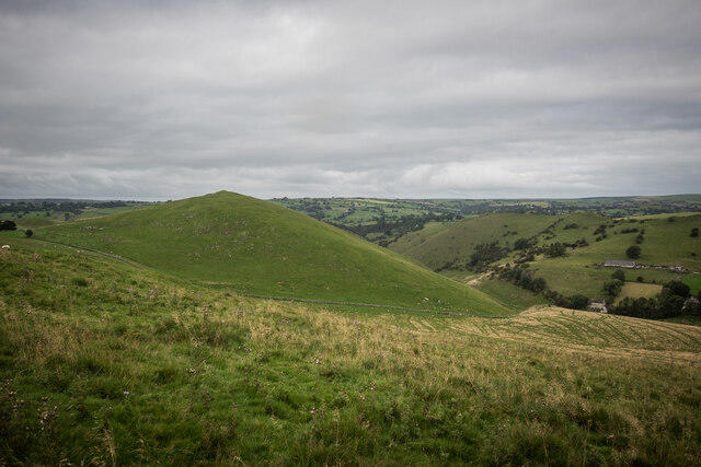 Photo could not load
SK1156 : From Wetton Hill Summit 371m
Brian Deegan
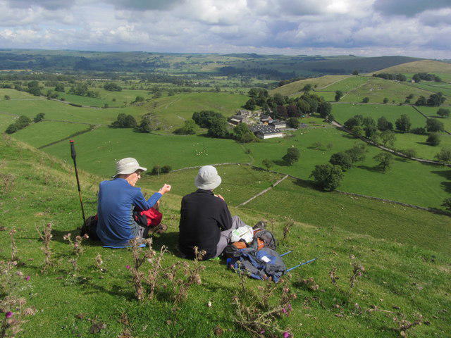 Photo could not load
SK1156 : Walkers take an elevenses break, summit NE of Wetton Hill
Colin Park
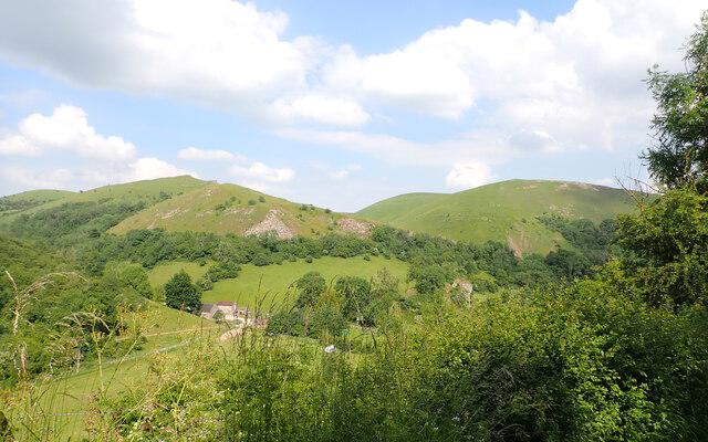 Photo could not load
SK1156 : Wetton Hills, Staffordshire Moorlands
Phil Brandon Hunter
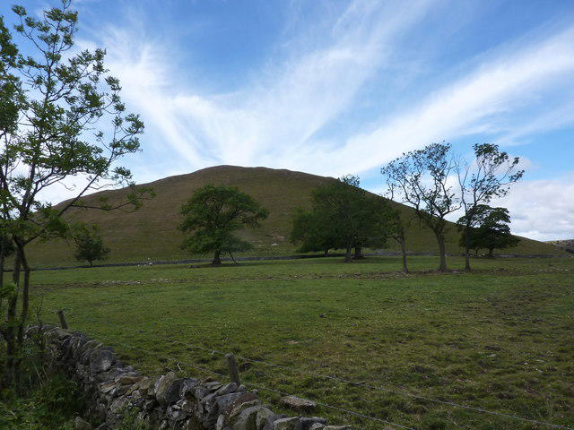 Photo could not load
SK1156 : Wetton Hill
Peter Barr
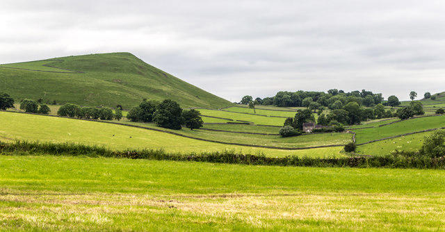 Photo could not load
SK1156 : Wetton Hill
Peter McDermott
Hill facts and local notes
Classifications
Elevation
371m
1,217 ft
Prominence
132m
Coordinates
53.1064, -1.8327
SK112565
OS Map
119
Explorer: OL24W
At the Summit
The summit features a small cairn and a trig point. Both make for excellent photo opportunities, so don’t forget your camera!
Terrain & Geology
Wetton Hill is primarily composed of limestone, which is characteristic of the carboniferous limestone plateau that dominates this part of the Peak District. The area is rich in geological features including karst landscapes, caves, and distinctive outcrops.
Views & Scenery
From the summit, you can take in panoramic views of the surrounding countryside, including the rugged beauty of the Peak District and the villages nestled within the valleys.
History & Heritage
Name Origin
The name 'Wetton' may refer to the Old English 'Wēot', which means ‘wet land’, reflecting the area’s marshy origins.
Historical Significance
Wetton Hill has held significance for local communities for centuries, often being used as a meeting point and lookout due to its elevation.
Getting There & Facilities
Check current local access restrictions, parking rules and transport timetables before travelling. These notes do not confirm public access to the summit.
Parking
There is limited parking available in Wetton village, which is the ideal starting point for your hike. Please park considerately.
Public Transport
The nearest bus service is from Ashbourne. Consult local timetables for details.
Nearby Facilities
There are no on-site facilities on Wetton Hill itself, but Wetton village has a few local cafes and pubs for a hearty post-hike meal. Toilets may be available in local establishments, so be sure to ask!
Safety Information
Known Hazards
- Watch out for livestock, as this area is farmed. Also, be cautious of slippery paths after rain.
General Safety Tips
- Check weather conditions before setting out
- Carry appropriate clothing and equipment
- Let someone know your planned route
- Take a map, compass, and GPS device
- Carry emergency supplies: food, water, first aid kit, torch
Hills
Some common questions about the hills answered
Are there group walks up Wetton Hill?
Many walkers use Walkmates to join or organise walks with others. You can check for group walks around Wetton Hill through the maps
Are there other walkers around Wetton Hill?
Activity varies by location and time, but Walkmates lets you see whether others have shared walks or shown interest in this area. Find other people through the walking friends search walking friends for Wetton Hill search or of course create your own walk for Wetton Hill
Can I organise a walk to Wetton Hill?
Yes. If there aren’t any walks listed already, you can create a walk and make it available for others to join.
If you're signed up to Walkmates, you can create a walk to Wetton Hill.
How do I find a walk up this hill?
There are often multiple ways to walk this hill, depending on experience and route preference. Walkmates helps you explore walks and routes that others have shared.
Can I suggest a new route up Wetton Hill?
Yes. You can suggest or create routes to share with others. Walkmates focuses on the social side of walking, so routes are used to help people organise walks and explore areas together, rather than as detailed navigation tools or route libraries.
Other uses really appreciate knowledgeable walkers sharing their routes. Share your favourite route to Wetton Hill here
The is an error or something incorrect about this hill. How do I let you know?
We always strive to keep the information on Walkmates as accurate as possible. If you find an error, please let us know through the contact form and we'll aim to correct it as quickly as possible
Community Discussion
Comments
Location
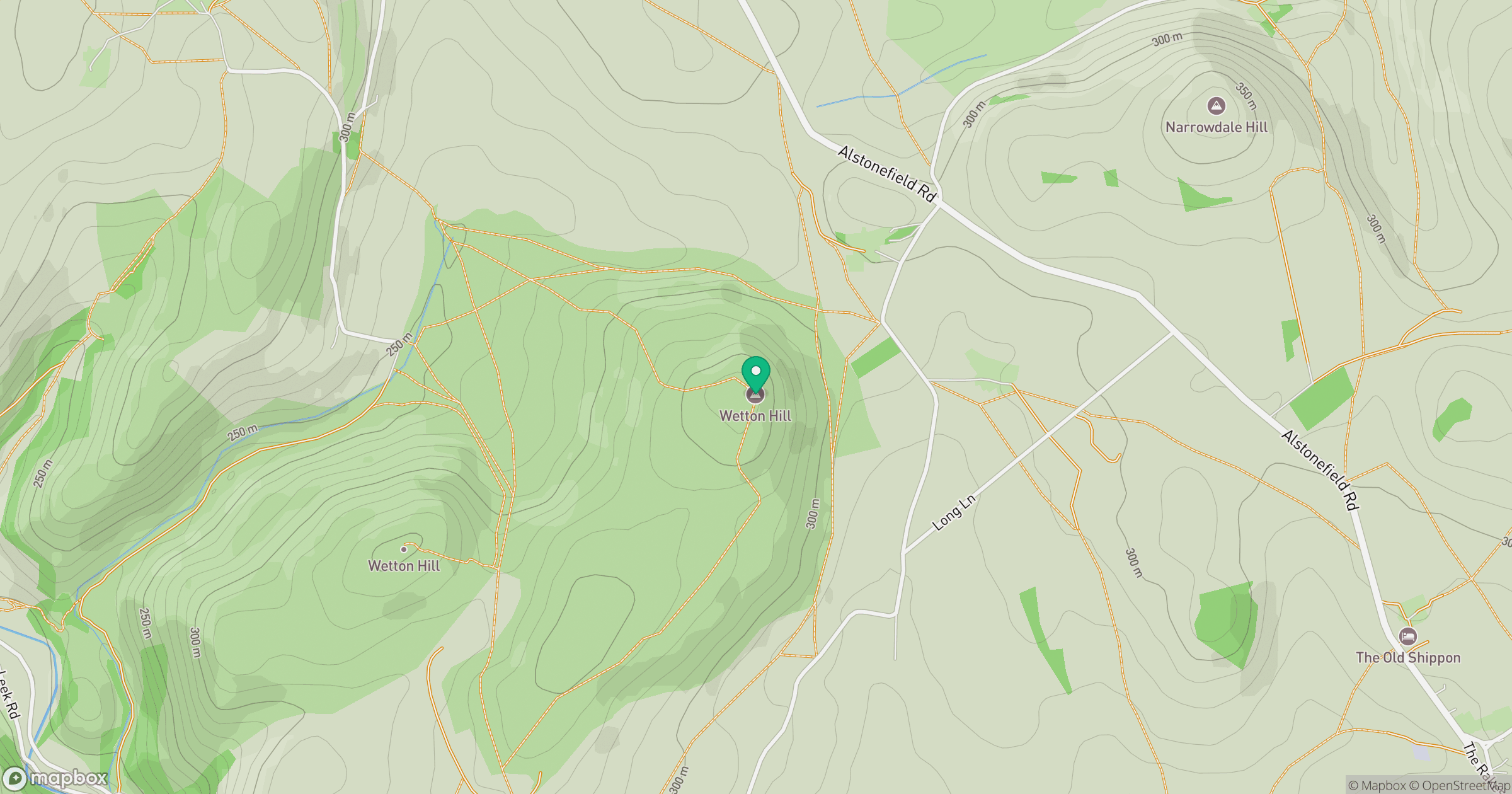
Grid reference: SK112565
View on OpenStreetMapOpens a map in a new tab, centred on the hill.
Hills within 30 km
Straight-line distance, not a walking route or confirmation of access.
No comments yet. Be the first.