
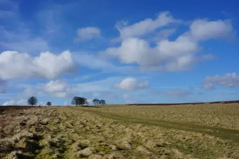
Longstone Moor
Good walks are even better shared.
Overview
Longstone Moor: A Hiker's Paradise
Nestled in the heart of the Peak District National Park, Longstone Moor offers outdoor enthusiasts a delightful mix of adventure and tranquil landscapes. With an elevation of 493 meters, this Marilyn is a treat for both seasoned hikers and those just looking for a pleasant stroll.
Geology
Longstone Moor is a geological wonder, predominantly formed from Carboniferous limestone. You’ll be stepping on ancient rock that tells a story of time long past, with hidden caves waiting for the curious explorer. Before you know it, you’ll feel like an unwitting archaeologist—just with less dirt and more snacks!
Access
Nearest Parking
Access is easy via the car park at Great Longstone (SK 207 724). Just don’t forget to pay for parking—unlike sandwiches, parking fines don’t come with a lovely view!
Public Transport
For those relying on public transport, buses regularly travel between Bakewell and Great Longstone. The nearest train station is located in Bakewell, which is a mere 4 miles away. Grab a bus and leave those car keys behind!
Nearest Town
The quaint town of Bakewell is your closest port of call. Famous for its pudding, it’s worth a stop for a sweet treat after your hike.
Routes
1. Longstone Edge Circular
- Distance: 9.0 km
- Time: 3.5 hours
- Difficulty: Moderate
This lovely circular route starts from Great Longstone and winds through fields and woodland before leading you to some breathtaking views along Longstone Edge. Remember to bring your binoculars; you might spot a few feathered friends!
2. Longstone Moor from Hassop
- Distance: 5.5 km
- Time: 2.0 hours
- Difficulty: Easy
This straightforward route from Hassop offers gentle slopes, making it perfect for families. You can even practice your best slow-motion walk while taking in the scenery.
Summit Features
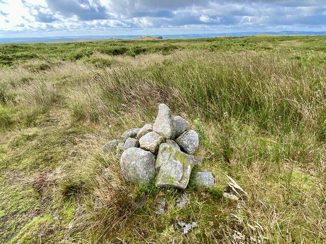
At the summit, you’ll find a noticeable cairn and what’s better than a stunning view indicator? It's like having a personal tour guide without the small talk!
Views
The views from Longstone Moor are nothing short of spectacular. From the top, you can marvel at the surrounding dales, the rugged gritstone edges, and on a particularly clear day, perhaps even the distant peaks of the White Peak. The best times to absorb these views are late spring when the heather bursts into life or in autumn when nature decides to throw a colourful farewell party.
Hazards
Keep your wits about you, as the terrain can be uneven, with sudden drops that might catch the unwary. Watch your step! The boggy patches are grand in their own right, but treachery awaits those who venture too boldly.
Nearby Summits
Don’t miss out on the neighboring heights! Carlswark Rock and Burbage Edge are excellent companions that offer their own unique charms and views. Expand your adventure!
Facilities
After an exhilarating hike, grab a bite at Great Longstone, or enjoy a delightful coffee in Bakewell. Just don’t forget to sample the famous Bakewell pudding!
History
The name Longstone derives from the old English 'long stone', possibly referring to ancient standing stones that still dot the landscape. With its rich heritage and connection to ancient settlements, the moor exudes a certain charm that whispers the tales of yesteryears.
In conclusion, Longstone Moor is a gem for all outdoor enthusiasts. So lace up your boots, pack that lunch, and hit the trails—adventure awaits!
Explore routes near Longstone Moor
Public walks starting within 80 km of this hill. Nearby does not mean a route reaches the summit; check its map and access before setting out.
Miller’s Dale to Bakewell guided walk
View route
Miller’s Dale to Bakewell guided walk
View route
Miller’s Dale to Bakewell guided walk
View route
Miller’s Dale to Bakewell guided walk
View route
Route planning notes
These notes describe possible approaches, not verified navigable routes or permission to cross land. Check current paths, local access rules and conditions before setting out.
Longstone Edge Circular
A popular circular route starting from the village of Great Longstone, passing through scenic fields and offering a brilliant mix of views and wildlife.
Longstone Moor from Hassop
A straightforward ascent from Hassop that offers gentle slopes and lovely views of the surrounding dales.
Make a day of it, together
Find someone to share the walk with, or organise a day out along a route you like.
Photo Gallery
View all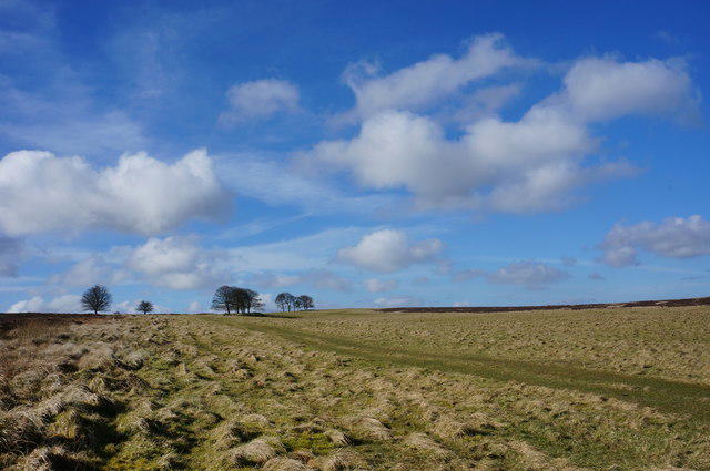 Photo could not load
SK1973 : View fromWatersaw Rake
Peter Barr
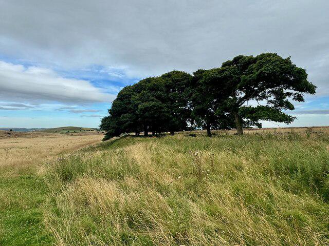 Photo could not load
SK1973 : Scots pines on Longstone Moor
David Lally
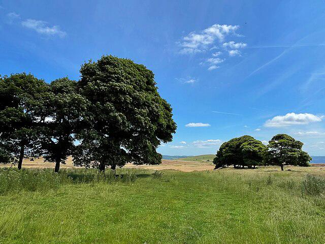 Photo could not load
SK1973 : Isolated trees on Longstone Moor
Graham Hogg
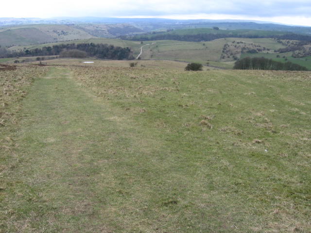 Photo could not load
SK1873 : Footpath from Longstone Moor
Chris Wimbush
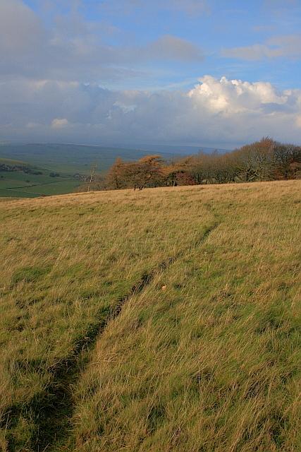 Photo could not load
SK1873 : Rabbit Trod on Longstone Moor
Mick Garratt
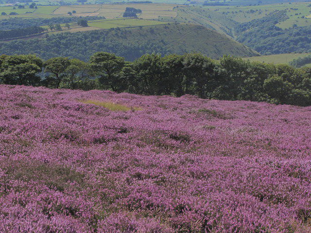 Photo could not load
SK1873 : Heather on Longstone Moor, NW of Great Longstone
Colin Park
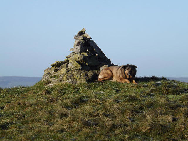 Photo could not load
SK1873 : Oska guards the cairn
IAIN BARKER
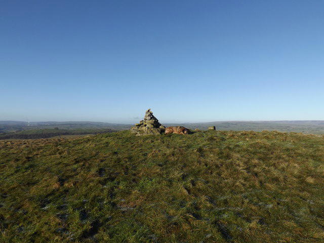 Photo could not load
SK1873 : Burial mound and cairn on Longstone Edge
IAIN BARKER
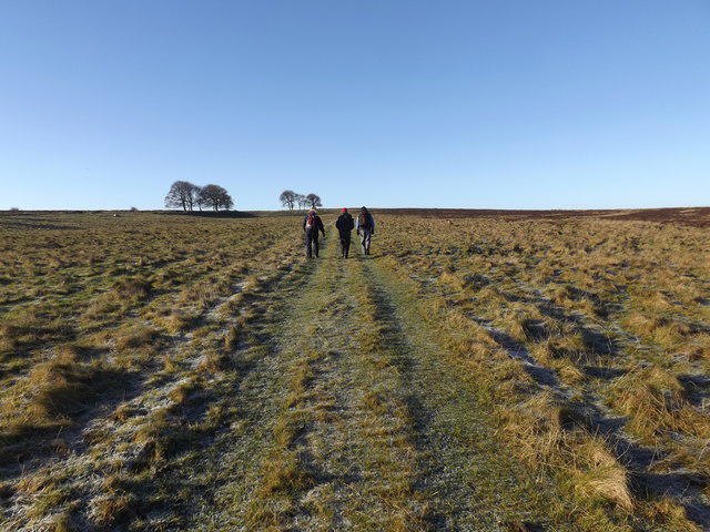 Photo could not load
SK1873 : Space
IAIN BARKER
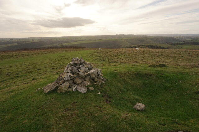
SK1873 : Cairn on Longstone Moor
Bill Boaden
Hill facts and local notes
Classifications
Elevation
395m
1,296 ft
Prominence
108m
Coordinates
53.2563, -1.7184
SK188732
OS Map
119
Explorer: OL24E
At the Summit
The summit of Longstone Moor features a large cairn and a stunning view indicator, making it a perfect spot for an impromptu picnic (with sandwiches, of course).
Terrain & Geology
Longstone Moor is primarily composed of Carboniferous limestone, which is known for its characteristic cliffs and hidden caves. There are also patches of gritstone and mudstone, providing a fascinating geological tapestry.
Views & Scenery
From the summit, hikers can catch glimpses of the surrounding dales, the gritstone edges of the Dark Peak, and on a clear day, perhaps even the far-off hills of the White Peak.
History & Heritage
Name Origin
The name 'Longstone' is derived from the old English for 'long stone', likely referring to the ancient standing stones found in the region.
Historical Significance
Longstone Moor has been a popular walking site for centuries, attracting both hikers and an array of wildlife. It's also known for its historical significance related to the surrounding ancient settlements.
Getting There & Facilities
Check current local access restrictions, parking rules and transport timetables before travelling. These notes do not confirm public access to the summit.
Parking
There is a car park at Great Longstone (SK 207 724) which provides easy access to the start of multiple hiking routes. Parking charges may apply.
Public Transport
Buses operate from Bakewell to Great Longstone regularly. The nearest train station is in Bakewell, about 4 miles away.
Nearby Facilities
Great Longstone has a small shop and a café for refreshments. Public toilets are available in Bakewell.
Safety Information
Known Hazards
- Beware of uneven terrain and sudden drops, especially near crags. Boggy areas can be slippery, so tread carefully!
General Safety Tips
- Check weather conditions before setting out
- Carry appropriate clothing and equipment
- Let someone know your planned route
- Take a map, compass, and GPS device
- Carry emergency supplies: food, water, first aid kit, torch
Hills
Some common questions about the hills answered
Are there group walks up Longstone Moor?
Many walkers use Walkmates to join or organise walks with others. You can check for group walks around Longstone Moor through the maps
Are there other walkers around Longstone Moor?
Activity varies by location and time, but Walkmates lets you see whether others have shared walks or shown interest in this area. Find other people through the walking friends search walking friends for Longstone Moor search or of course create your own walk for Longstone Moor
Can I organise a walk to Longstone Moor?
Yes. If there aren’t any walks listed already, you can create a walk and make it available for others to join.
If you're signed up to Walkmates, you can create a walk to Longstone Moor.
How do I find a walk up this hill?
There are often multiple ways to walk this hill, depending on experience and route preference. Walkmates helps you explore walks and routes that others have shared.
Can I suggest a new route up Longstone Moor?
Yes. You can suggest or create routes to share with others. Walkmates focuses on the social side of walking, so routes are used to help people organise walks and explore areas together, rather than as detailed navigation tools or route libraries.
Other uses really appreciate knowledgeable walkers sharing their routes. Share your favourite route to Longstone Moor here
The is an error or something incorrect about this hill. How do I let you know?
We always strive to keep the information on Walkmates as accurate as possible. If you find an error, please let us know through the contact form and we'll aim to correct it as quickly as possible
Community Discussion
Comments
Location
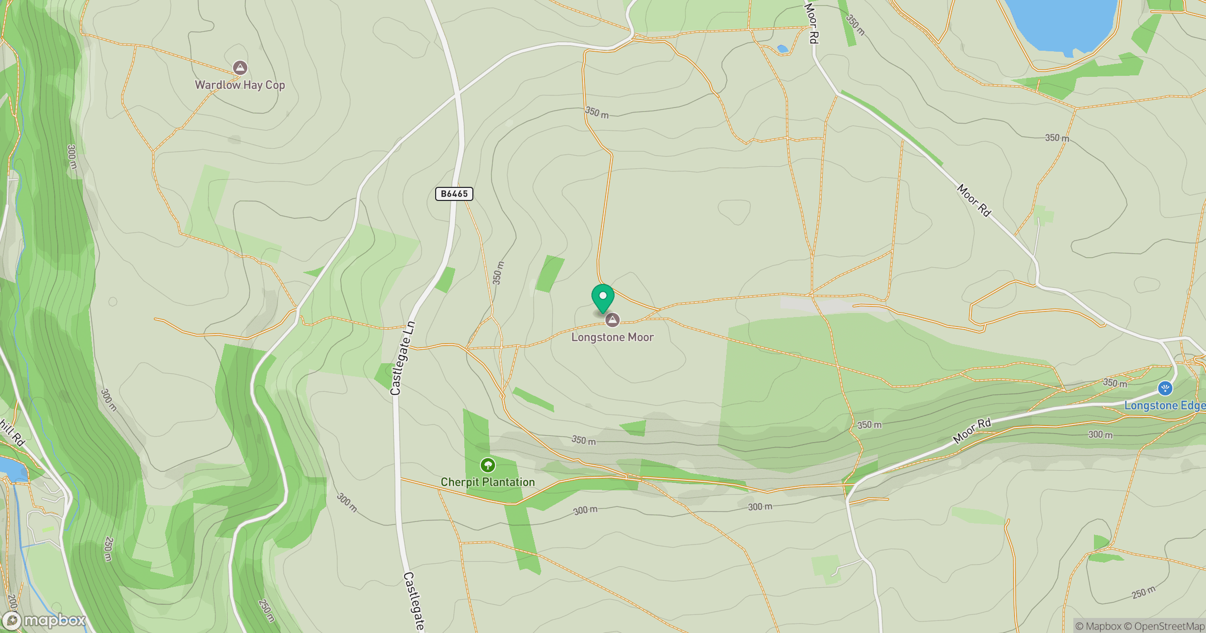
Grid reference: SK188732
View on OpenStreetMapOpens a map in a new tab, centred on the hill.
Hills within 30 km
Straight-line distance, not a walking route or confirmation of access.
No comments yet. Be the first.