

Shutlingsloe
Good walks are even better shared.
SJ9769 : Shutlingsloe & Croker Hill from Whetstone Ridge
Colin Park Photo source
Overview
Shutlingsloe is a 506 m gritstone hill near Wildboarclough and Macclesfield Forest in Cheshire’s Peak District. Its steep-sided profile is known locally as the Matterhorn of Cheshire. Paths lead to a rocky summit with a trig point nearby; the final approaches include steep slopes and stone steps.
Shutlingsloe
Shutlingsloe rises to 506 m beside Wildboarclough and Macclesfield Forest in the Cheshire Peak District. Its distinctive profile has earned it the nickname “Matterhorn of Cheshire”.
Summit and landscape
The highest point is a rock with a plaque, about 10 m north-northeast of the trig point and 20 cm above its base. Chatsworth Grit caps the summit, with Roaches Grit on the lower slopes. The outlook takes in the Cheshire Plain and the Peak District hills.
Walking routes
- Clough House, Wildboarclough: a 4.8 km loop using the signed Langley approach, the summit, the north-side flagged descent and a grassy path back to the outward track. Peak District Walks gives 1–2 hours.
- Trentabank: a 10 km circuit through Macclesfield Forest, over the summit, down to Wildboarclough and onward through Oaken Clough and Hanging Gate before returning to Trentabank. Visit Cheshire grades it Challenging and gives 3–4 hours.
Terrain and access
Expect steep final slopes, substantial stone steps, uneven paths and muddy ground. The summit is open to the weather. Forest works may cause local diversions; follow the signs and avoid closed work areas.
Trentabank has pay-and-display parking, toilets and a picnic area. Clough House is the start for the shorter loop. Buses from Macclesfield serve Langley, requiring an onward walk to the forest.
Name and cultural history
The name is usually interpreted as “Scyttel’s hill”. The hill appears as “Shuttlingslow” in Alan Garner’s The Weirdstone of Brisingamen, first published in 1960.
Explore routes near Shutlingsloe
Walks starting near this hill. Open a route to check its map, distance and full itinerary.
Three Shires guided hike
View route
Tittesworth Reservoir
View route
Rudyard Lake Circuit near Leek
View route
Manifold Way: Hulme End to Waterhouses
View route
Route planning notes
These notes describe possible approaches. Check a route's map and access information when planning your walk.
Shutlingsloe from Clough House, Wildboarclough
From Clough House car park, take the short road section to the signed Langley footpath. Follow the farm track and waymarked uphill path to Shutlingsloe. Descend north on the flagged steps, turn right onto the grassy path around the hill, then rejoin the outward track and return to Clough House. Peak District Walks gives 1–2 hours for this complete loop.
Trentabank, Shutlingsloe and Oaken Clough circular
From Trentabank car park, climb through Macclesfield Forest and follow the paved path to Shutlingsloe. Descend steeply to Wildboarclough, pass the Crag Inn and continue on hillside paths to Oaken Clough. Climb through the clough, descend to the Hanging Gate, then return by lanes and forest paths to Trentabank. Visit Cheshire gives 3–4 hours for the full circuit.
Make a day of it, together
Find someone to share the walk with, or organise a day out along a route you like.
Photo Gallery
View all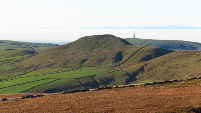 Photo could not load
SJ9769 : Shutlingsloe & Croker Hill from Whetstone Ridge
Colin Park
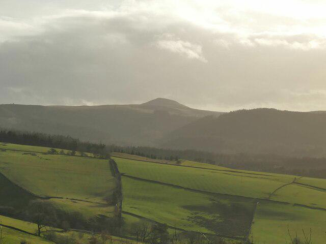 Photo could not load
SJ9769 : View towards Shutlingsloe from Tegg's Nose visitor centre
Stephen Craven
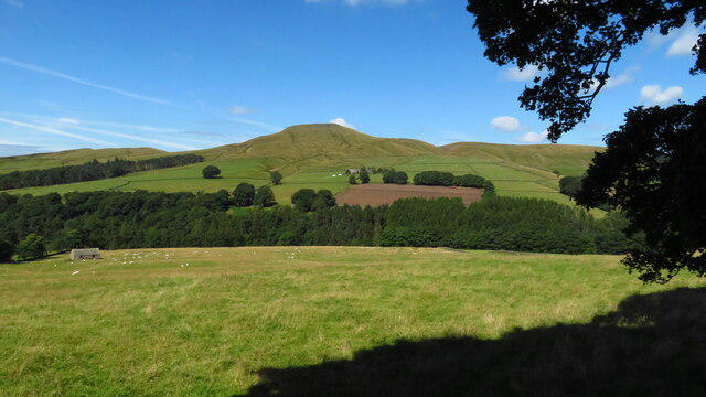 Photo could not load
SJ9769 : Shutlingsloe from near Crag Hall, Wildboarclough
Colin Park
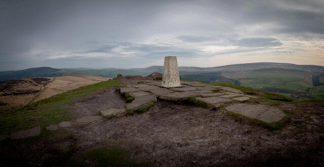 Photo could not load
SJ9769 : Shuttlingsloe Summit Panno
Brian Deegan
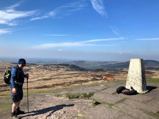 Photo could not load
SJ9769 : Shutlingsloe Summit and Triangulation Pillar
Jonathan Clitheroe
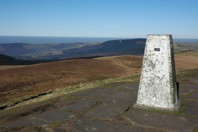 Photo could not load
SJ9769 : Trig point on Shutlingsloe
Philip Halling
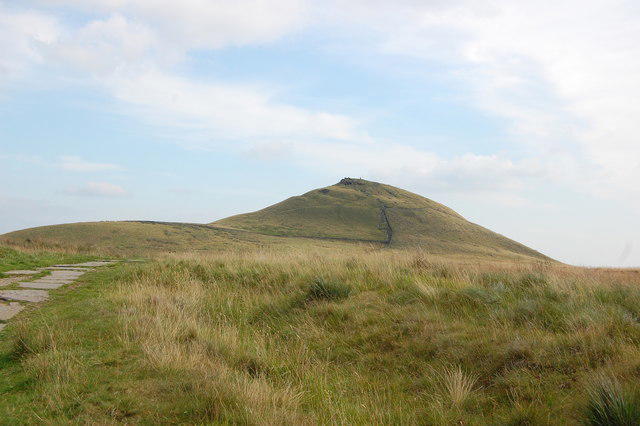 Photo could not load
SJ9769 : Shutlingsloe
Trevor Harris
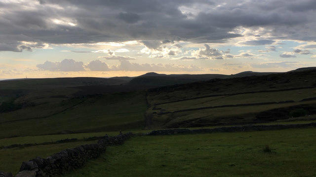 Photo could not load
SJ9769 : Skyline looking WNW from Oliver Hill, Flash
Philip Cornwall
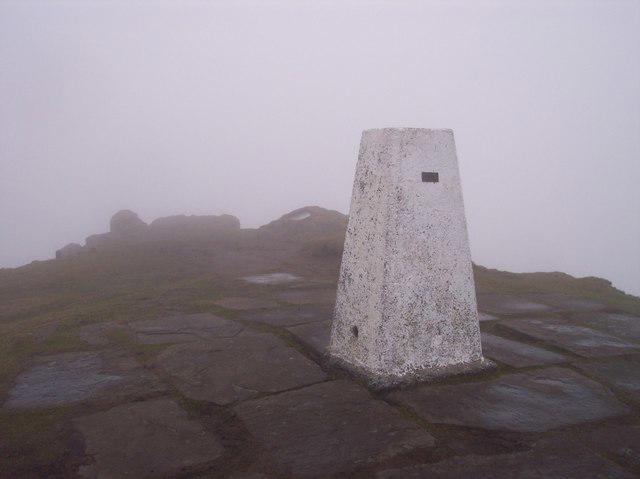 Photo could not load
SJ9769 : Shutlingsloe Trig. Pillar
Raymond Knapman
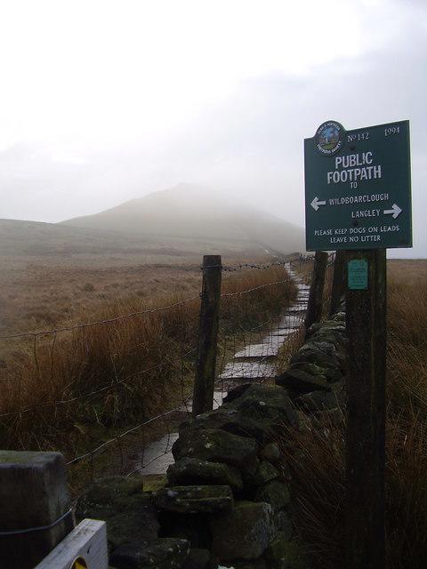
SJ9769 : Looking back to a misty Shutlingsloe.
steven ruffles
Hill facts and local notes
Classifications
Elevation
506m
1,660 ft
Prominence
133m
Coordinates
53.2233, -2.0367
SJ976695
OS Map
118
Explorer: OL24W
At the Summit
A rock with a plaque is the highest point. The Database of British and Irish Hills places it 10 m north-northeast of the trig point and 20 cm above the trig point base.
Terrain & Geology
The summit is capped by Chatsworth Grit, a coarse sandstone in the Carboniferous succession. Roaches Grit forms much of the lower slopes. These resistant sandstone layers give Shutlingsloe its rocky profile.
Views & Scenery
Views across the Cheshire Plain to the west and the Peak District hills to the east.
History & Heritage
Name Origin
Usually interpreted as “Scyttel’s hill”, from an Old English personal name and hlaw, meaning hill.
Historical Significance
Shutlingsloe appears as “Shuttlingslow” in Alan Garner’s The Weirdstone of Brisingamen, first published in 1960.
Getting There & Facilities
Parking
Clough House car park, Wildboarclough (SJ 98722 69877; SK11 0BD), serves the shorter loop; the postcode alone is imprecise. Trentabank car park, Clarke Lane, Macclesfield Forest (SK11 0NS), is pay and display, with United Utilities listing hours of 06:00–00:00. Follow local parking notices and signed forestry diversions.
Public Transport
High Peak services 14/14A link Macclesfield with Langley, Monday to Saturday. An onward walk is needed from Langley to Macclesfield Forest. Check the current timetable and return service before setting out.
Nearby Facilities
Trentabank has public toilets and a picnic area. United Utilities lists toilet opening hours of 07:30–17:00. There are no facilities on the summit.
Safety Information
Known Hazards
- Steep summit slopes and tall stone steps require care, especially on the descent.
- Uneven paths and muddy moorland sections occur on the approaches.
- The open summit is exposed to wind; mobile reception in Macclesfield Forest can be unreliable.
- Forestry work can affect paths and parking. Follow signed diversions and keep out of closed work areas.
- Some routes include country lanes, stiles and gates.
General Safety Tips
- Check weather conditions before setting out
- Carry appropriate clothing and equipment
- Let someone know your planned route
- Take a map, compass, and GPS device
- Carry emergency supplies: food, water, first aid kit, torch
Hills
Some common questions about the hills answered
Are there group walks up Shutlingsloe?
Many walkers use Walkmates to join or organise walks with others. You can check for group walks around Shutlingsloe through the maps
Are there other walkers around Shutlingsloe?
Activity varies by location and time, but Walkmates lets you see whether others have shared walks or shown interest in this area. Find other people through the walking friends search walking friends for Shutlingsloe search or of course create your own walk for Shutlingsloe
Can I organise a walk to Shutlingsloe?
Yes. If there aren’t any walks listed already, you can create a walk and make it available for others to join.
If you're signed up to Walkmates, you can create a walk to Shutlingsloe.
How do I find a walk up this hill?
There are often multiple ways to walk this hill, depending on experience and route preference. Walkmates helps you explore walks and routes that others have shared.
Can I suggest a new route up Shutlingsloe?
Yes. You can suggest or create routes to share with others. Walkmates focuses on the social side of walking, so routes are used to help people organise walks and explore areas together, rather than as detailed navigation tools or route libraries.
Other uses really appreciate knowledgeable walkers sharing their routes. Share your favourite route to Shutlingsloe here
The is an error or something incorrect about this hill. How do I let you know?
We always strive to keep the information on Walkmates as accurate as possible. If you find an error, please let us know through the contact form and we'll aim to correct it as quickly as possible
Community Discussion
Comments
Location
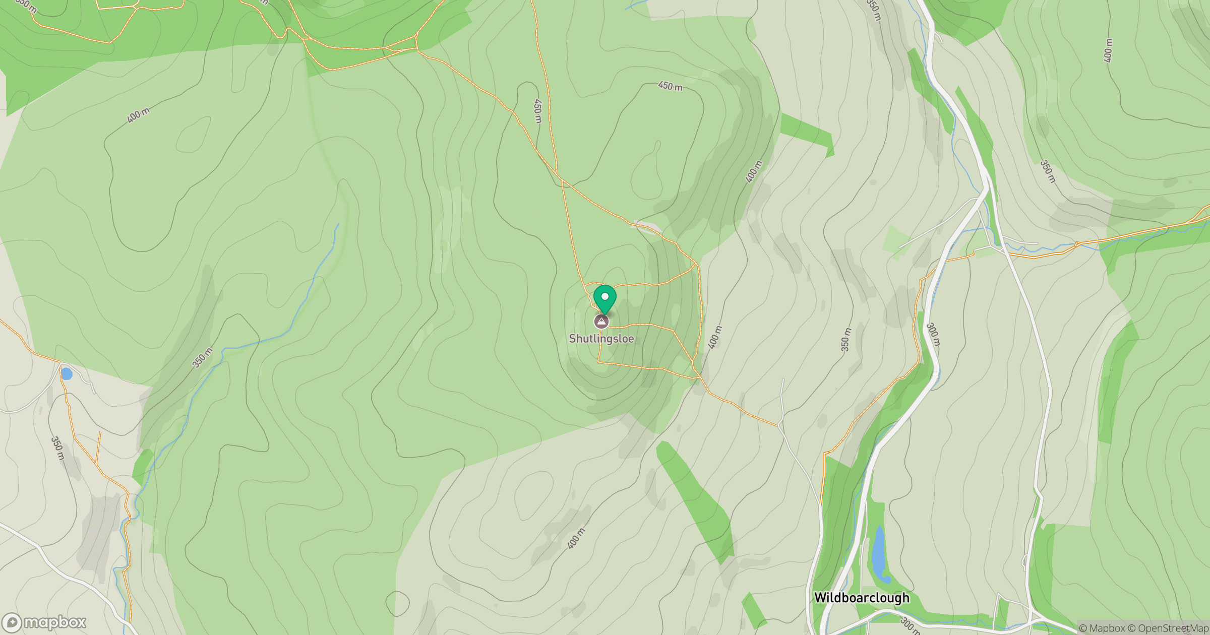
Grid reference: SJ976695
View on OpenStreetMapOpens a map in a new tab, centred on the hill.
Nearby Hills
The Roaches
505m

Kinder Scout
636m
Winter Hill
456m

Pendle Hill
557m
Rombalds Moor [Ilkley Moor]
402m
No comments yet. Be the first.