

Shining Tor
Good walks are even better shared.
Overview
Shining Tor is the 559 m county top of Cheshire, on the Peak District ridge west of the Goyt Valley. A concrete trig pillar stands beside the summit wall, with the highest ground just north-northeast of it. Approaches include the Cat & Fiddle road, the ridge over Cats Tor from Pym Chair, and a longer climb from Errwood Reservoir. These are different routes with different starts and returns. Open moorland makes wind, mist and wet ground important considerations.
Shining Tor
Shining Tor rises to 559 m above the western side of the Goyt Valley in the Peak District. It is Cheshire’s highest point, on the Cheshire East–Derbyshire boundary ridge. Cats Tor is the separate top to the north; Shutlingsloe is the distinctive hill to the southwest. Neither is an alternative name for this summit. [1, 2, 6]
Finding the summit
A white concrete trig pillar stands beside the boundary wall. The Database of British and Irish Hills places the highest ground 7 m north-northeast of the pillar, at SJ 99466 73749, and records a mound east of the wall at SJ 99475 73744 as similar in height. Use the provided crossing rather than climbing the wall. [1, 5]
Choose a route and its return
- Cat & Fiddle road out-and-back: start at the A537 layby near the Stake Farm approach, follow the track north, keep right at the initial fork and continue past the farm. At the upper junction take the path toward Shining Tor, then return to the same layby. The linked guide gives approximately 4 km and 1–1.5 hours. These figures exclude any extra walk from the distillery or another parking place. [8]
- Pym Chair ridge: from Pym Chair car park, join the signed hill path and walk south over Cats Tor, continuing along the flagged ridge to Shining Tor. Retrace the ridge to Pym Chair. The published round trip is about 6.6 km. The high starting point reduces the climb but leaves much of the walk exposed to wind. [3]
- Errwood Hall circuit: a longer climb from the reservoir follows Stake Side to the summit. The linked 6 km circuit returns north along the ridge, turns east before Cats Tor, and descends by forestry tracks and the Errwood Hall area. Its ridge exit is unsigned and easy to miss; use the full route map. This is a different itinerary from the Park Authority’s Rivers, Ruins & Ridges walk, whose summit visit is an additional out-and-back detour. [2, 5]
Terrain and preparation
Expect open moorland, grass and earth paths, rough tracks and stone paving. Wet ground can be boggy, and paved or rocky sections need care in rain or frost. Carry warm and waterproof layers and a map; mist, wind and changing weather matter even on the short approach. On the Park Authority route, an unbridged stream may make turning back sensible after heavy rain. Keep dogs on a lead around livestock and ground-nesting birds, take litter home and avoid fires or barbecues. Follow any signed forestry diversions. [2, 3, 10]
Views and geology
In clear conditions, look across the Cheshire Plain, towards Shutlingsloe and Jodrell Bank; distant Welsh hills may be visible. Visibility is weather-dependent. The local sandstone succession includes Chatsworth Grit, part of the Carboniferous Millstone Grit sequence. [5, 6, 9, 13]
Parking, transport and facilities
Choose parking for your actual route. Forestry England lists Pym Chair, The Street and Errwood Hall car parks. The road south from Errwood towards Derbyshire Bridge is one-way. From 1 May to the end of September, on Sundays and bank holidays, the road from The Street to Derbyshire Bridge closes to visitor motor traffic from 10:30 to 17:30. Check signs and current access information. [7]
The Cat & Fiddle is now Forest Distillery with a bar and shop. Its car park is private and for customers, who must register their vehicle on arrival; ask the operator before leaving a car for a walk. Meals are not served, though snacks are available. Bring food and water, and plan toilet stops before reaching the hill or Goyt Valley car parks. [5, 11, 12]
Transport checked 16 October 2026: High Peak’s service 58 normally links Buxton and Macclesfield via the Cat & Fiddle, but an active diversion means it is not serving that stop through 30 October 2026. Check the operator’s live notice and return journey before travelling; do not assume the normal route has resumed. [4]
Sources
- Database of British and Irish Hills v18.6, rows 2812, 3640 and 3644
- Peak District National Park: Rivers, Ruins & Ridges in the Goyt Valley
- Peak District Kids: Shining Tor from Pym Chair
- High Peak: service 58
- Walk Peak District: Shining Tor summit circuit
- Walking Britain walk 3510: Shining Tor, Cats Tor and Foxlow Edge
- Forestry England: Goyt Valley visitor information
- 10Adventures: Shining Tor via Cat and Fiddle Road
- British Geological Survey: Buxton, Leek and Bakewell memoir
- Forestry England: tree felling at Goyt Valley
- Forest Distillery: bar at the Cat & Fiddle
- Forest Distillery: frequently asked questions
- British Geological Survey: Chapel en le Frith memoir
Explore routes near Shining Tor
Walks starting near this hill. Open a route to check its map, distance and full itinerary.
Three Shires guided hike
View route
Tittesworth Reservoir
View route
Miller’s Dale to Bakewell guided walk
View route
Miller’s Dale to Bakewell guided walk
View route
Route planning notes
These notes describe possible approaches. Check a route's map and access information when planning your walk.
Cat & Fiddle road out-and-back
From the A537 layby near Stake Farm, follow the track north, keep right at the initial fork and continue past the farm. Turn towards Shining Tor at the upper junction, reach the summit beside the wall, then retrace to the same layby. The guide estimates 4 km and 1–1.5 hours; extra walking from other parking is excluded. An exposed moorland walk: check weather, take care on wet ground and verify road access. Distillery customer parking is separate.
Make a day of it, together
Find someone to share the walk with, or organise a day out along a route you like.
Photo Gallery
View all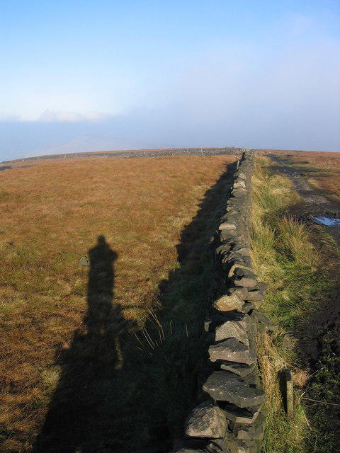 Photo could not load
SJ9973 : North from Shining Tor
Peter Turner
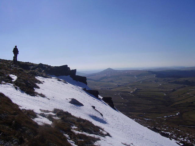 Photo could not load
SJ9973 : Shining Tor
steven ruffles
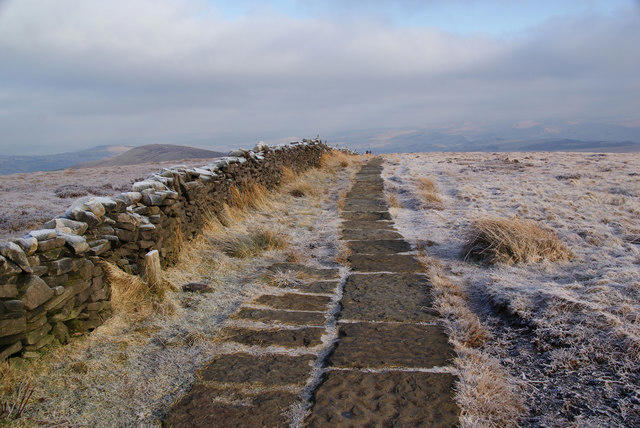 Photo could not load
SJ9973 : Footpath north from Shining Tor
Bill Boaden
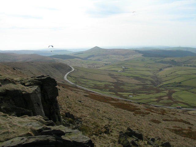 Photo could not load
SJ9973 : View Southwest from Shining Tor
John Topping
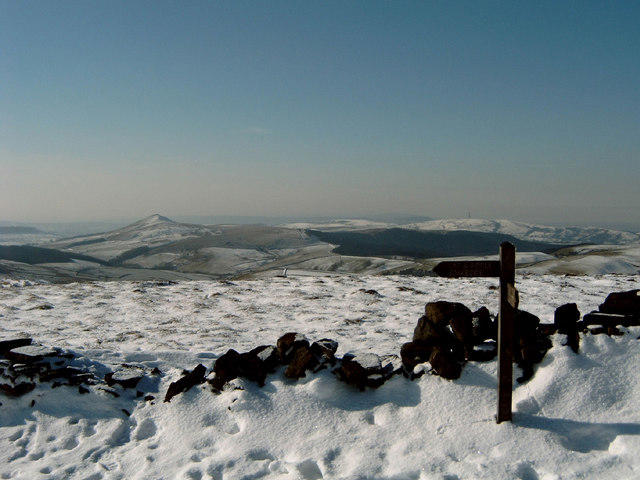 Photo could not load
SJ9973 : Shining Tor
M Pollard
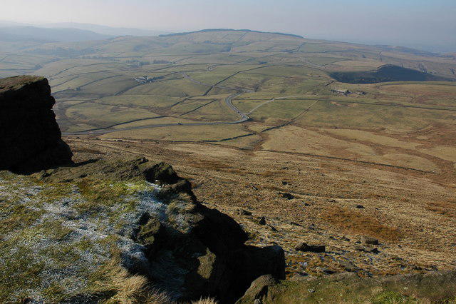 Photo could not load
SJ9973 : Crags on Shining Tor
Philip Halling
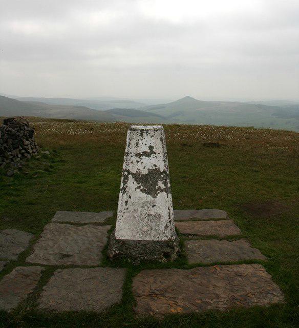 Photo could not load
SJ9973 : Trig point on Shining Tor
Graham Hogg
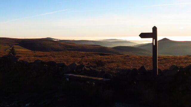 Photo could not load
SJ9973 : Finger post at the summit of Shining Tor
Colin Park
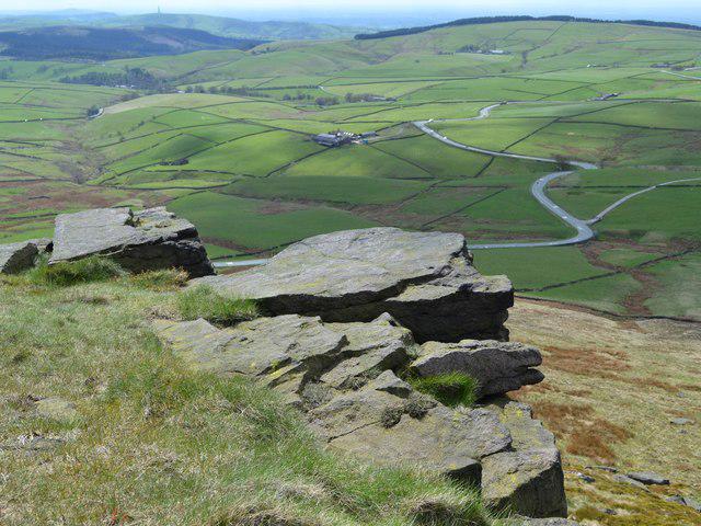 Photo could not load
SJ9973 : Shining Tor rocks and view to Long Clough Valley
Neil Theasby
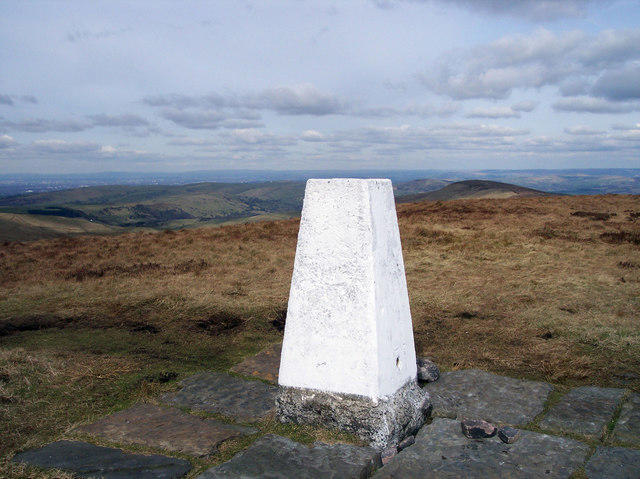
SJ9973 : Shining Tor Trig. Pillar
Raymond Knapman
Hill facts and local notes
Classifications
Elevation
559m
1,834 ft
Prominence
236m
Coordinates
53.2607, -2.0095
SJ994737
OS Map
118
Explorer: OL24W
At the Summit
A white concrete trig pillar stands beside the boundary wall. DoBIH places the highest ground 7 m north-northeast of it at SJ 99466 73749; a mound east of the wall at SJ 99475 73744 is of similar height. Use the provided wall crossing.
Terrain & Geology
The local Carboniferous sandstone succession includes Chatsworth Grit, within the Millstone Grit sequence. British Geological Survey memoirs describe these beds around Shining Tor and exposures south of the summit; Shining Tor Grit is an older local name for Chatsworth Grit.
Views & Scenery
Clear-weather views include the Cheshire Plain, nearby Shutlingsloe and Jodrell Bank, with Welsh hills visible in good conditions. The northern ridge leads towards Cats Tor; views depend on visibility.
History & Heritage
Historical Significance
Errwood Hall’s ruins lie below the hill in the Goyt Valley and can be visited on some approaches. The hall was built in 1840 for the Grimshawe family and demolished in 1934 during the reservoir works.
Getting There & Facilities
Parking
Choose parking for your route: an A537 layby for the short Stake Farm approach; Pym Chair for the ridge; Errwood Hall or The Street for Goyt Valley walks. Follow seasonal road closures and local signs. Cat & Fiddle parking is private/customer-only and requires vehicle registration on arrival; ask before leaving a car there for a walk.
Public Transport
Checked 16 October 2026: High Peak 58 normally links Buxton and Macclesfield via the Cat & Fiddle, but the operator says it is not serving that stop during a diversion through 30 October 2026. Check the current notice and return timetable at https://www.highpeakbuses.com/bus-services/58/ before travelling. Plan onward travel for the Goyt Valley or Pym Chair starts.
Nearby Facilities
The Cat & Fiddle is Forest Distillery, with a bar and shop. It serves drinks and snacks rather than meals; check opening before relying on it. There are no public toilets at Pym Chair or Errwood Hall car parks. Bring food and water and plan toilet stops in advance.
Safety Information
Known Hazards
- Exposed moorland can be windy and misty, with rapid weather changes; carry warm and waterproof layers and navigation equipment.
- Uneven paths, wet stone paving and boggy ground require care. Frost or snow can make the hill and its access roads more difficult.
- The Park Authority route from Errwood includes an unbridged stream; do not cross if water levels make it unsafe.
- Follow signed forestry closures and diversions, and keep clear of working machinery.
- Use designated parking and take care where approaches cross or follow roads. Keep dogs on a lead around livestock and ground-nesting birds.
Seasonal Hazards
Wind, mist and wet ground can affect the open ridge in any season. Frost or snow can make paths slippery and disrupt road access. Seasonal motor-traffic restrictions affect the Goyt Valley; check current signs and notices.
General Safety Tips
- Check weather conditions before setting out
- Carry appropriate clothing and equipment
- Let someone know your planned route
- Take a map, compass, and GPS device
- Carry emergency supplies: food, water, first aid kit, torch
Hills
Some common questions about the hills answered
Are there group walks up Shining Tor?
Many walkers use Walkmates to join or organise walks with others. You can check for group walks around Shining Tor through the maps
Are there other walkers around Shining Tor?
Activity varies by location and time, but Walkmates lets you see whether others have shared walks or shown interest in this area. Find other people through the walking friends search walking friends for Shining Tor search or of course create your own walk for Shining Tor
Can I organise a walk to Shining Tor?
Yes. If there aren’t any walks listed already, you can create a walk and make it available for others to join.
If you're signed up to Walkmates, you can create a walk to Shining Tor.
How do I find a walk up this hill?
There are often multiple ways to walk this hill, depending on experience and route preference. Walkmates helps you explore walks and routes that others have shared.
Can I suggest a new route up Shining Tor?
Yes. You can suggest or create routes to share with others. Walkmates focuses on the social side of walking, so routes are used to help people organise walks and explore areas together, rather than as detailed navigation tools or route libraries.
Other uses really appreciate knowledgeable walkers sharing their routes. Share your favourite route to Shining Tor here
The is an error or something incorrect about this hill. How do I let you know?
We always strive to keep the information on Walkmates as accurate as possible. If you find an error, please let us know through the contact form and we'll aim to correct it as quickly as possible
Community Discussion
Comments
Location
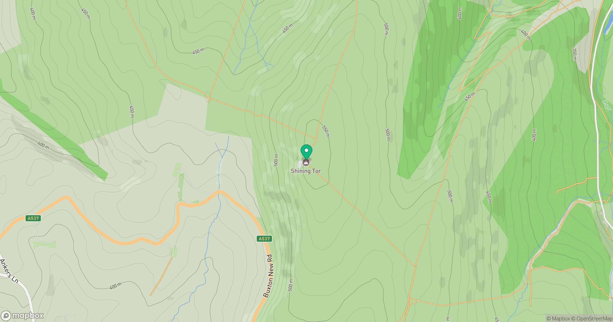
Grid reference: SJ994737
View on OpenStreetMapOpens a map in a new tab, centred on the hill.
Nearby Hills
The Roaches
505m

Kinder Scout
636m
Winter Hill
456m
Rombalds Moor [Ilkley Moor]
402m

Pendle Hill
557m
No comments yet. Be the first.