

Wolfscote Hill
Good walks are even better shared.
SK1358 : Wolfscote Hill
Rude Health Photo source
Overview
Wolfscote Hill: A Hiker's Delight
Wolfscote Hill, standing tall at 454 meters, is a hidden gem in the Peak District that every outdoor enthusiast should love attempting to conquer. Nestled at the coordinates (53.0814, -1.8201), this Marilyn offers both stunning views and an engaging hiking experience.
Geology
The hill is mainly composed of limestone, and one can find a fascinating display of karst features, including limestone pavements. Keep your eyes peeled for unique rock formations and the occasional resident sheep—a truly scenic (and woolly) experience!
Access
Parking is relatively straightforward, with a small car park located near the entrance of Wolfscote Dale. However, if you plan to go on a weekend, be prepared for a bit of competition for a good spot.
If you're relying on public transport, bus services connecting from Buxton to Hartington will get you within a pleasant walk to the trailhead. And while you're in the area, make sure to pay a visit to Hartington, just 3 km away—this charming village features a delightful cafe and plenty of places to sample Derbyshire cheese!
The Route
One of the most beloved routes to the summit is the Wolfscote Dale path, a scenic journey that measures around 6.8 km and takes about 2.5 hours to complete. This moderate trek winds through picturesque valleys and offers a few gentle surprises in terms of elevation, so get ready to work those calves!
Summit Features
Upon reaching the summit, you'll be greeted by a small trig point—the quintessential marker for all hikers. This is the perfect spot to rest, recharge, and take in the remarkably diverse landscapes that the Peak District offers. Don’t forget to snap a photo before the crows come to investigate your snacks!
Views
As for the views, they are simply breathtaking. You'll see the undulating hills stretching out before you, with notable sights including the villages of Biggin-by-Hartington and Hartington, especially striking in spring and autumn when nature really puts on a show.
Hazards
While hiking, it’s good to keep in mind that weather conditions can change with hardly any notice. Always carry a map, and never underestimate the importance of checking the forecast before setting off.
So grab your hiking boots and get ready to explore Wolfscote Hill—there's nothing quite like conquering a Marilyn and soaking in the serene beauty of the Peak District. Safe hiking!
Explore routes near Wolfscote Hill
Walks starting near this hill. Open a route to check its map, distance and full itinerary.
High Peak Trail: Friden, Newhaven Tunnel and Hurdlow Bridge
View route
Tissington Trail: Parsley Hay, Hartington Station and Heathcote
View route
Tissington Trail: Ashbourne, Thorpe Station and Tissington return
View route
Carsington Water: full reservoir circuit
View route
Route planning notes
These notes describe possible approaches. Check a route's map and access information when planning your walk.
Wolfscote Dale via Wolfscote Hill Path
A scenic route through Wolfscote Dale leading up to the summit offering stunning views of the surrounding valleys.
Make a day of it, together
Find someone to share the walk with, or organise a day out along a route you like.
Photo Gallery
View all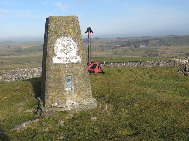 Photo could not load
SK1358 : Wolfscote Hill
Rude Health
Hill facts and local notes
Classifications
Elevation
388m
1,273 ft
Prominence
102m
Coordinates
53.1219, -1.7967
SK137583
OS Map
119
Explorer: OL24W
At the Summit
The summit features a small trig point surrounded by breathtaking views; it's the perfect spot for a picnic—just watch out for those cheeky crows eyeing your sarnies!
Terrain & Geology
Wolfscote Hill is primarily composed of limestone, which gives rise to unique karst topography including limestone pavements and some impressive outcrops. The erosion patterns often reflect the historical sedimentary processes that shaped the area over millions of years.
Views & Scenery
From the summit, you can spot the stunning rolling hills of the Peak District, as well as the picturesque villages of Biggin-by-Hartington and Hartington.
History & Heritage
Name Origin
Wolfscote is derived from Old English elements meaning 'the cottage or dwelling of the wolves', adding an intriguing sense of mystery to your hike.
Historical Significance
The area is rich in quarrying history, and you might spot some old limestone workings as you ascent, which were integral to the local economy.
Getting There & Facilities
Parking
There's a small car park near the entrance of Wolfscote Dale. Please note, it can fill up quickly on weekends.
Public Transport
The nearest bus service runs from Buxton to Hartington, with just a slight stroll to the trailhead.
Nearby Facilities
A cafe is available in Hartington for refreshments, and public toilets are also located there. Be sure to indulge in some Derbyshire cheese!
Safety Information
Known Hazards
- Watch out for sudden weather changes. It can go from sunny to shrouded in mist quicker than you can say 'bring a map!'
General Safety Tips
- Check weather conditions before setting out
- Carry appropriate clothing and equipment
- Let someone know your planned route
- Take a map, compass, and GPS device
- Carry emergency supplies: food, water, first aid kit, torch
Hills
Some common questions about the hills answered
Are there group walks up Wolfscote Hill?
Many walkers use Walkmates to join or organise walks with others. You can check for group walks around Wolfscote Hill through the maps
Are there other walkers around Wolfscote Hill?
Activity varies by location and time, but Walkmates lets you see whether others have shared walks or shown interest in this area. Find other people through the walking friends search walking friends for Wolfscote Hill search or of course create your own walk for Wolfscote Hill
Can I organise a walk to Wolfscote Hill?
Yes. If there aren’t any walks listed already, you can create a walk and make it available for others to join.
If you're signed up to Walkmates, you can create a walk to Wolfscote Hill.
How do I find a walk up this hill?
There are often multiple ways to walk this hill, depending on experience and route preference. Walkmates helps you explore walks and routes that others have shared.
Can I suggest a new route up Wolfscote Hill?
Yes. You can suggest or create routes to share with others. Walkmates focuses on the social side of walking, so routes are used to help people organise walks and explore areas together, rather than as detailed navigation tools or route libraries.
Other uses really appreciate knowledgeable walkers sharing their routes. Share your favourite route to Wolfscote Hill here
The is an error or something incorrect about this hill. How do I let you know?
We always strive to keep the information on Walkmates as accurate as possible. If you find an error, please let us know through the contact form and we'll aim to correct it as quickly as possible
Community Discussion
Comments
Location
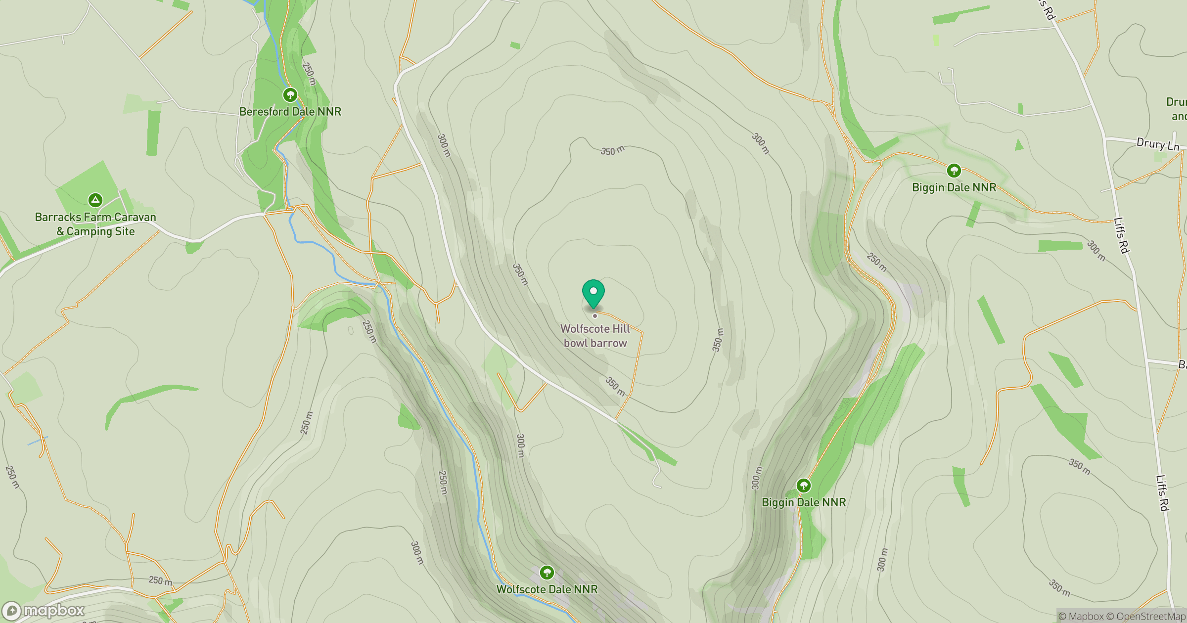
Grid reference: SK137583
View on OpenStreetMapOpens a map in a new tab, centred on the hill.
Nearby Hills
The Roaches
505m

Kinder Scout
636m
Rombalds Moor [Ilkley Moor]
402m

The Wrekin
407m
Winter Hill
456m
No comments yet. Be the first.