
Lees Moor
Good walks are even better shared.
Overview
Lees Moor
Overview
Lees Moor, standing at 395 meters, is a splendid spot nestled within the breathtaking Peak District National Park. Resplendent with wildlife and demanding a hearty hike, it promises both views and a good workout—so don't forget to stretch!
Geology
The geological formation of Lees Moor is dominated by millstone grit, creating a rugged terrain that has shaped the rich ecology of the area. Keep your eyes peeled for various endemic plant species that flourish here.
Routes
There are several routes to tackle Lees Moor, with the Moorland Trail from Crowden being a definite favourite among seasoned walkers. At 7.5 km long, this moderate trail will take you through stunning landscapes that speak volumes of the Peak District's beauty. Alternatively, consider the Oldham Way for those looking for a longer trek (11 km), where you can soak in the exquisite surroundings at your leisure.
Summit Features
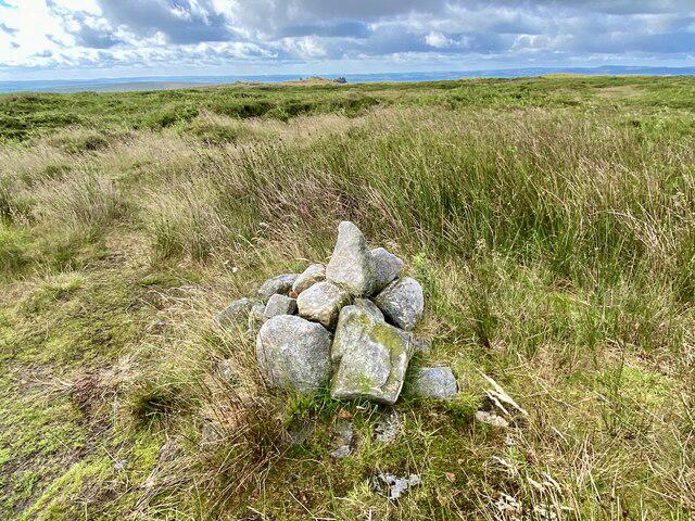
Upon reaching the summit, you'll be welcomed by a delightful stone cairn, making it an ideal backdrop for memorable photographs. And remember, victory is best celebrated with a hearty munch on your favourite snacks!
Terrain
Make sure to wear sturdy shoes as Lees Moor's terrain varies from grassy patches to rocky outcrops, and be cautious of the boggy spots—your shoes will thank you!
Views
Once at the top, be prepared to be jaw-dropped by the sweeping vistas over the Dark Peak. On clear days, landmarks such as Saddleworth Moor and the distant Pennines can be spotted. The best seasons for these breathtaking views are undoubtedly spring and summer; just mind the sunburn!
Hazards
As always, an intrepid hiker should keep an ear out for the weather forecast—moors can be temperamental, changing moods faster than a toddler in a sweet shop. Uneven grounds and boggy bits also pose risks, especially after rain, so tread carefully!
Access
Easily accessible, Lees Moor sits a short commute from the bustling town of Glossop. Near to the Crowden Campsite, parking is quite limited but will suffice for daytrippers. If you're utilising public transport, there are bus services running from both Glossop and Ashton-under-Lyne.
Facilities
After a rewarding wander, why not quell your thirst at one of Glossop's quaint cafes, or take advantage of the public toilets at Crowden before heading off for more adventures?
History
The name 'Lees' relates to a clearing, while 'Moor' reflects the stunning moorland we see today. Historically significant, these lands were crucial for agriculture, particularly sheep grazing, and remain a cherished communal gathering spot!
In conclusion, Lees Moor is more than just a hike; it's an adventure filled with history, breathtaking views, and perhaps, a few muddy shoes. Happy hiking!
Explore routes near Lees Moor
Public walks starting within 80 km of this hill. Nearby does not mean a route reaches the summit; check its map and access before setting out.
Bakewell to Headstone Viaduct: Monsal Trail and Tunnel Walk
View route
Monsal Trail: Bakewell Station to Blackwell Mill
View route
High Peak Trail: Friden, Newhaven Tunnel and Hurdlow Bridge
View route
Tissington Trail: Parsley Hay, Hartington Station and Heathcote
View route
Route planning notes
These notes describe possible approaches, not verified navigable routes or permission to cross land. Check current paths, local access rules and conditions before setting out.
Moorland Trail from Crowden
A scenic walk that takes you through wild moors and offers stunning views of the surrounding landscape.
Oldham Way
A segment of the Oldham Way that loops around the areas close to Lees Moor, suitable for both walking and cycling.
Make a day of it, together
Find someone to share the walk with, or organise a day out along a route you like.
Hill facts and local notes
Classifications
Elevation
304m
997 ft
Prominence
143m
Coordinates
53.2036, -1.6283
SK249674
OS Map
119
Explorer: OL24E
At the Summit
The summit of Lees Moor features a prominent stone cairn, providing a perfect photo op and a chance for hikers to take a breather while enjoying panoramic views.
Terrain & Geology
Lees Moor is primarily composed of millstone grit, a durable sandstone that creates distinctive rugged landscapes characteristic of the Peak District. The geology contributes to the area's rich biodiversity, with various plant species adapted to the unique soil conditions.
Views & Scenery
From the summit, walkers can enjoy sweeping views over the Dark Peak and the surrounding moorlands, often spotting landmarks like Saddleworth Moor and the distant hills of the Pennines.
History & Heritage
Name Origin
The name 'Lees' ties back to Old English, referencing a clearing or meadow, while 'Moor' signifies the moorland landscape typical of the region.
Historical Significance
Historically, the moors have been essential to local agriculture and sheep grazing, and they hold cultural significance as a traditional gathering place for local communities.
Getting There & Facilities
Check current local access restrictions, parking rules and transport timetables before travelling. These notes do not confirm public access to the summit.
Parking
There is a small car park at the Crowden Campsite (postcode S33 8WA) that provides a great starting point for your adventure.
Public Transport
Buses operate from nearby towns such as Glossop and Ashton-under-Lyne, bringing hikers close to the start of their journey.
Nearby Facilities
Nearby facilities include cafes in Glossop for some post-hike refreshments and public toilets available at Crowden.
Safety Information
Known Hazards
- Beware of sudden weather changes; the moors can be unpredictable. Also, keep an eye out for uneven terrain and potential boggy areas, particularly in wet seasons.
General Safety Tips
- Check weather conditions before setting out
- Carry appropriate clothing and equipment
- Let someone know your planned route
- Take a map, compass, and GPS device
- Carry emergency supplies: food, water, first aid kit, torch
Hills
Some common questions about the hills answered
Are there group walks up Lees Moor?
Many walkers use Walkmates to join or organise walks with others. You can check for group walks around Lees Moor through the maps
Are there other walkers around Lees Moor?
Activity varies by location and time, but Walkmates lets you see whether others have shared walks or shown interest in this area. Find other people through the walking friends search walking friends for Lees Moor search or of course create your own walk for Lees Moor
Can I organise a walk to Lees Moor?
Yes. If there aren’t any walks listed already, you can create a walk and make it available for others to join.
If you're signed up to Walkmates, you can create a walk to Lees Moor.
How do I find a walk up this hill?
There are often multiple ways to walk this hill, depending on experience and route preference. Walkmates helps you explore walks and routes that others have shared.
Can I suggest a new route up Lees Moor?
Yes. You can suggest or create routes to share with others. Walkmates focuses on the social side of walking, so routes are used to help people organise walks and explore areas together, rather than as detailed navigation tools or route libraries.
Other uses really appreciate knowledgeable walkers sharing their routes. Share your favourite route to Lees Moor here
The is an error or something incorrect about this hill. How do I let you know?
We always strive to keep the information on Walkmates as accurate as possible. If you find an error, please let us know through the contact form and we'll aim to correct it as quickly as possible
Community Discussion
Comments
Location
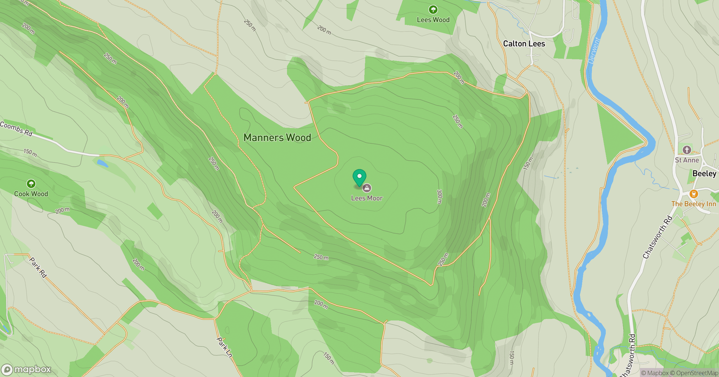
Grid reference: SK249674
View on OpenStreetMapOpens a map in a new tab, centred on the hill.
Hills within 30 km
Straight-line distance, not a walking route or confirmation of access.
No comments yet. Be the first.