

The Roaches
Good walks are even better shared.
SK0063 : Eastern slopes of The Roaches
John Topping Photo source
Overview
The Roaches is a 505 m gritstone ridge near Upper Hulme and Leek, on the south-western edge of the Peak District. Rocky paths lead past Doxey Pool to the summit, with longer walks continuing through Back Forest to Lud’s Church. The escarpment is also an established rock-climbing area.
The Roaches
Overview
The Roaches rises to 505 m near Upper Hulme and Leek on the south-western edge of the Peak District. The summit is a benchmarked rock 3 m southwest of the trig point. The dramatic ridge is an established walking and rock-climbing area, with views over Tittesworth Reservoir and the Staffordshire countryside.
Choosing a walk
The route cards describe distinct circuits with different starts and returns. The short Roach Road circuit reaches the summit and returns on eastern paths without climbing Hen Cloud. The Hen Cloud circuit visits both summits and returns through woodland. Longer options add Lud’s Church, or continue to Ramshaw Rocks. From Gradbach, the summit is an out-and-back addition to a woodland and Back Forest circuit; a walk to Lud’s Church alone does not reach The Roaches summit.
Ground and safety
Expect steep steps, uneven gritstone, moorland and muddy woodland. The cliff edges are unfenced and the ridge is exposed. Wear suitable footwear, carry a map and weather protection, and take particular care with children. Some circuits include permissive paths, farm approaches, lanes and road crossings: follow current signs and use the signed paths around farm buildings.
Access
Southern walks use designated laybys on Roach Road. Gradbach has a separate small car park for the northern approach. Park only where permitted and keep access clear. Upper Hulme has bus links with Leek and Buxton, but allow for the walk from the main-road stops and check your return service. There are no public toilets on the ridge walks.
Keep dogs on leads. Doxey Pool is fenced for habitat recovery; do not enter the enclosure. Barbecues and campfires are prohibited. Follow current conservation and forestry notices.
Rock and heritage
The crags expose Roaches Grit, a Carboniferous sandstone. Rockhall Cottage below the crags became the Don Whillans Memorial Hut, formally opened in 1993. The name Roaches is commonly linked to the French word for rocks. The mermaid story associated with Doxey Pool is folklore.
Explore routes near The Roaches
Walks starting near this hill. Open a route to check its map, distance and full itinerary.
Tittesworth Reservoir
View route
Rudyard Lake Circuit near Leek
View route
Three Shires guided hike
View route
Manifold Way: Hulme End to Waterhouses
View route
Route planning notes
These notes describe possible approaches. Check a route's map and access information when planning your walk.
Roach Road ridge and eastern return
Start and finish at the footpath gate on Roach Road (SK00416211). Climb the stepped paths to the ridge, pass Doxey Pool and reach the summit rock beside the trig point. Retrace the ridge to the eastern descent, then follow the permissive path, lanes and signed farm-bypass footpaths back below Hen Cloud to Roach Road. This 5.5 km circuit does not climb Hen Cloud. The published estimate is 2 hours without children, or 3–4 hours with young children exploring. Follow current access signs on the permissive section.
Lud’s Church and The Roaches via Clough Head
Start and finish near The Roaches Tea Rooms on Roach Road. Follow the lane and paths via Royal Cottage and Clough Head to Lud’s Church, then the woodland path to Roach End. Climb the ridge to the summit, continue past Doxey Pool, and descend by the gully and path below the crags to Rockhall. Return along the lane to the starting layby. Countryfile’s published circuit is 9.3 km, about 4 hours, and includes road walking, exposed ridge paths and muddy woodland. It does not return through Gradbach.
Hen Cloud and The Roaches from Roaches Hall
Begin at the signed Roaches Hall entrance on Roach Road, using the public footpath past the hall to climb Hen Cloud. Descend to the saddle, climb onto The Roaches ridge and continue past Doxey Pool to the summit. Retrace the ridge before descending through the woodland below the crags; return to Roach Road and walk back to your starting point. The published circuit is 6.6 km with an estimated 1.5–2 hours, excluding any extra road approach from your parking space. Steep rocky paths and two separate summits.
Hen Cloud, Roaches, Lud’s Church and Ramshaw Rocks
Start and finish at the Roach Road layby near Upper Hulme (SK0069661258). Climb Hen Cloud and The Roaches, descend to Roach End, visit Lud’s Church and loop west through Back Forest to Roach End. Continue east beside Black Brook to Ramshaw Rocks, then return on paths via Naychurch and Well Farm to Roach Road. Peak District Walks gives 17 km, 761 m ascent and 5–6 hours for this full circuit. It is a longer hill day with several climbs and road crossings.
Gradbach, Lud’s Church and summit detour
Start and finish at Gradbach car park (SJ998662). Follow the lane past Gradbach Mill and cross the footbridge, then climb through woodland to Lud’s Church. Continue west to the Back Forest ridge and follow it east to Roach End. Climb to The Roaches summit and return to Roach End by the same path. Descend through woodland to the original footbridge, then retrace the riverside approach to Gradbach. Walking Britain’s base circuit is 7.3 km; the summit out-and-back adds about 1.6 km (1 mile), making roughly 9 km overall.
Make a day of it, together
Find someone to share the walk with, or organise a day out along a route you like.
Photo Gallery
View all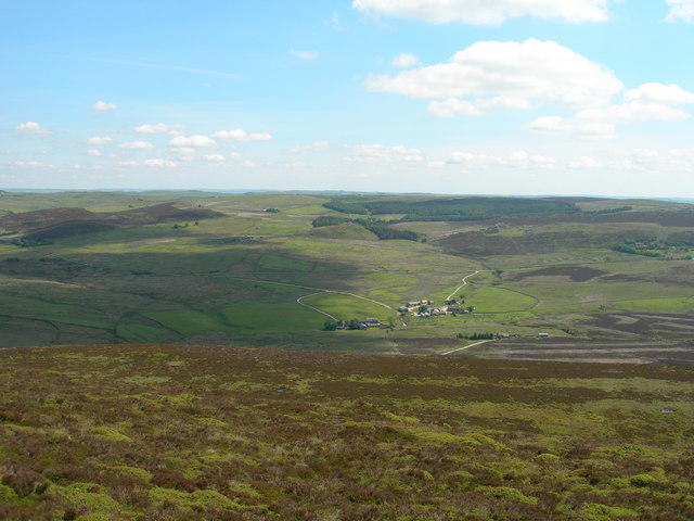 Photo could not load
SK0063 : Eastern slopes of The Roaches
John Topping
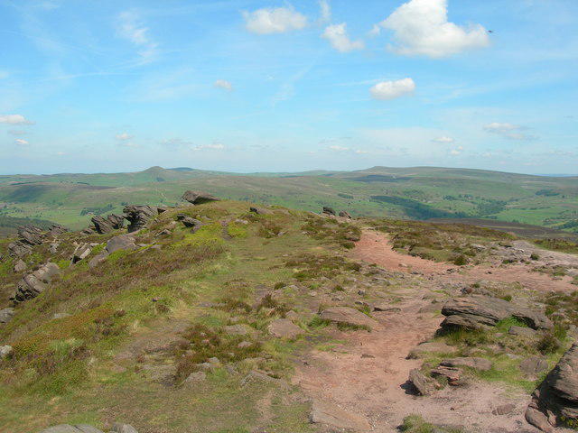 Photo could not load
SK0063 : Shutlingsloe and Shining Tor from the Roaches
John Topping
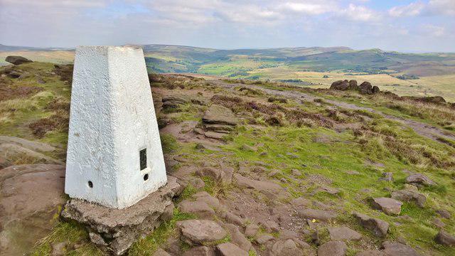 Photo could not load
SK0063 : Trig point above Roach End
Chris Morgan
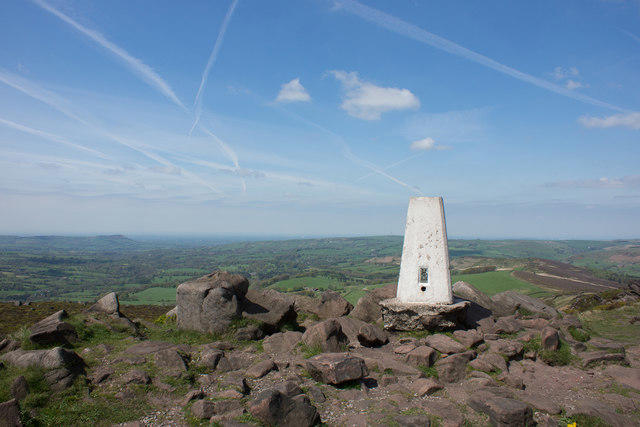 Photo could not load
SK0063 : The Trig Point, The Roaches
Brian Deegan
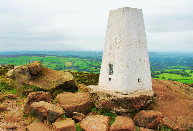 Photo could not load
SK0063 : Triangulation Pillar - The Roaches
Stu JP
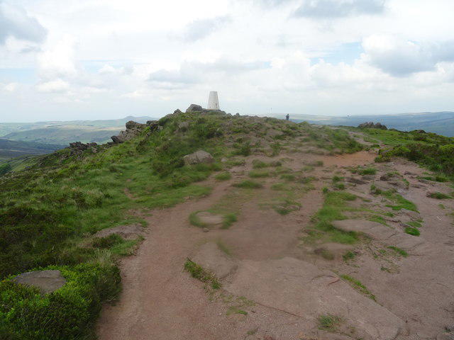 Photo could not load
SK0063 : Making for the trig point on The Roaches
John M
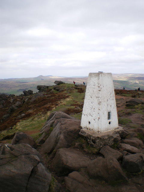 Photo could not load
SK0063 : Roaches trig - looking north
Richard Law
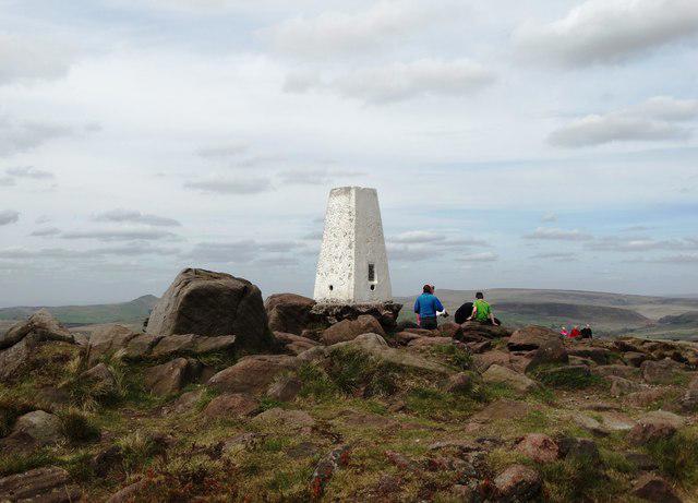 Photo could not load
SK0063 : Triangulation Pillar 505 - The Roaches
Neil Theasby
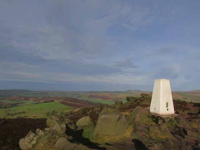 Photo could not load
SK0063 : Roaches summit.
steven ruffles
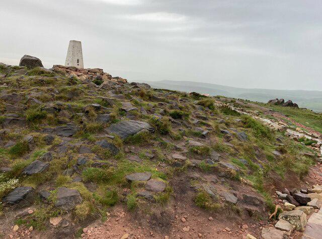
SK0063 : Trig Pillar at the Summit of the Roaches
Jonathan Clitheroe
Hill facts and local notes
Classifications
Elevation
505m
1,657 ft
Prominence
123m
Coordinates
53.1721, -1.9999
SK001638
OS Map
119
Explorer: OL24W
At the Summit
The highest point is a benchmarked rock 3 m southwest of the trig point, at 505 m. The trig is a useful landmark on the open gritstone ridge; take care near the unfenced crags.
Terrain & Geology
The escarpment exposes Roaches Grit, a Carboniferous sandstone unit of Marsdenian age. The British Geological Survey describes feldspar-rich sandstone, ranging from fine to coarse grained, and interprets its deposition in a delta-top setting. Roach End to Hen Cloud is a partial type section of the unit.
Views & Scenery
In clear weather the ridge overlooks Tittesworth Reservoir, the Staffordshire Moorlands and the countryside around Leek. Hen Cloud and Ramshaw Rocks are nearby distinctive outcrops.
Best Seasons
Flowering heather colours the moorland purple in summer.
History & Heritage
Name Origin
The name is generally explained as coming from the French roches, meaning rocks.
Historical Significance
The Roaches has a long climbing history associated with Don Whillans and Joe Brown. Rockhall Cottage was converted into the Don Whillans Memorial Hut and officially opened in January 1993. Staffordshire Wildlife Trust began managing the Roaches estate under a 125-year lease in May 2013. Stories about a mermaid in Doxey Pool belong to local folklore.
Getting There & Facilities
Parking
Use the designated laybys on Roach Road near Upper Hulme and Rockhall for southern ridge walks. A separate small car park at Gradbach, near the former youth hostel/Gradbach Mill, serves the northern woodland approach. Parking can fill quickly; do not park outside marked areas or block access. There is no single car park serving every route.
Public Transport
Upper Hulme is served by the 108 between Leek and Buxton on Mondays–Saturdays and the A53 on Sundays. Check the current operator or county timetable and the last return bus. The stops are on the A53/Old Buxton Road, with an additional walk to the Roach Road trail starts.
Nearby Facilities
There are no public toilets on the ridge walks. Refreshments are available around Upper Hulme and Leek; check opening times before relying on them. The Roaches Tea Rooms is near the southern approach, while Rockhall Cottage is a climbing hut rather than a public visitor centre.
Safety Information
Known Hazards
- The escarpment has unfenced drops. Keep clear of cliff edges and supervise children closely.
- Steep rock steps and uneven paths need care; woodland sections and Lud’s Church can be muddy or boggy.
- The open ridge is exposed to wind and poor visibility. Carry a map and suitable clothing, and choose a route that matches the conditions.
- Several circuits use lanes or cross roads. Follow signed footpaths around farm buildings and respect current diversions.
- Keep dogs on leads. Doxey Pool is fenced to protect its eroded margins; do not enter the enclosure or paddle.
Seasonal Hazards
Wet weather makes the rocky and woodland paths slippery or muddy. Dry moorland is vulnerable to wildfire: barbecues and campfires are prohibited on the nature reserve. Follow on-site forestry and conservation notices.
General Safety Tips
- Check weather conditions before setting out
- Carry appropriate clothing and equipment
- Let someone know your planned route
- Take a map, compass, and GPS device
- Carry emergency supplies: food, water, first aid kit, torch
Hills
Some common questions about the hills answered
Are there group walks up The Roaches?
Many walkers use Walkmates to join or organise walks with others. You can check for group walks around The Roaches through the maps
Are there other walkers around The Roaches?
Activity varies by location and time, but Walkmates lets you see whether others have shared walks or shown interest in this area. Find other people through the walking friends search walking friends for The Roaches search or of course create your own walk for The Roaches
Can I organise a walk to The Roaches?
Yes. If there aren’t any walks listed already, you can create a walk and make it available for others to join.
If you're signed up to Walkmates, you can create a walk to The Roaches.
How do I find a walk up this hill?
There are often multiple ways to walk this hill, depending on experience and route preference. Walkmates helps you explore walks and routes that others have shared.
Can I suggest a new route up The Roaches?
Yes. You can suggest or create routes to share with others. Walkmates focuses on the social side of walking, so routes are used to help people organise walks and explore areas together, rather than as detailed navigation tools or route libraries.
Other uses really appreciate knowledgeable walkers sharing their routes. Share your favourite route to The Roaches here
The is an error or something incorrect about this hill. How do I let you know?
We always strive to keep the information on Walkmates as accurate as possible. If you find an error, please let us know through the contact form and we'll aim to correct it as quickly as possible
Community Discussion
Comments
Location
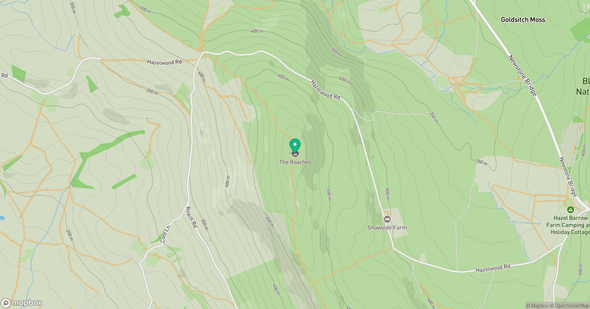
Grid reference: SK001638
View on OpenStreetMapOpens a map in a new tab, centred on the hill.
Nearby Hills

Kinder Scout
636m
Winter Hill
456m

The Wrekin
407m
Rombalds Moor [Ilkley Moor]
402m

Pendle Hill
557m
No comments yet. Be the first.