
Telegraph Hill
Good walks are even better shared.
Overview
Telegraph Hill
Overview
Nestled in the heart of the Shropshire Hills, Telegraph Hill is more than just a name on a map; it’s a delightful escape for hikers and nature enthusiasts alike. Standing tall at 197 meters, it offers a perfect blend of accessible terrain and stunning views.
Geology
Telegraph Hill is predominantly formed from sedimentary rock. The various layers tell a tale of ancient marine environments. If you’re up for a bit of rock gazing, you might even stumble upon some fossilised remnants from eras gone by. Mother Nature surely has a flair for storytelling!
Routes
The Shenstone Trail is a favourite among locals and visitors. Starting in the quaint village of Lydham, it offers a picturesque walk with gentle slopes, making it suitable for all ages.
Route Details
- Description: Scenic route weaving through verdant landscapes.
- Distance: 4.5 km
- Estimated Time: 1.5 hours
- Difficulty Level: Easy
Summit Features
The summit features a prominent trig point that provides the perfect selfie back-drop, so don’t forget your camera. From here, the landscape unfolds in every direction, a patchwork of fields and woodlands.
Terrain
Expect a blend of grassy hills with some rocky outcrops. This provides a soft cushion for your feet while keeping the sights interesting.
Views
Highlights
On a clear day, the views are nothing short of spectacular. To the west, the rugged silhouette of the Welsh mountains tempts adventurous spirits, while the gentle Shropshire hills provide a soothing contrast.
Best Seasons
Spring and autumn showcase the area’s vibrancy, with blooming flowers and autumnal hues painting the landscape.
Hazards
Watch your step; certain paths can be slippery after rain, and while the resident sheep are rather photogenic, they're usually more interested in their next patch of grass.
Nearby Summits
Don’t miss the chance to explore nearby peaks such as Long Mynd and Stiperstones, both offering unique landscapes and challenges for avid hikers.
Access
Parking
There are limited parking facilities in Lydham. Arriving early is advised, as this hidden gem tends to attract fellow nature lovers.
Public Transport
Buses from Bishops Castle serve the area, perfect for those looking to leave the car behind.
Nearest Town
Bishops Castle is the closest town and offers charming spots for refreshments after your hike.
Facilities
After a day on the trail, head to one of the cafes in Bishops Castle. A spot of tea and cake is just what you need!
History
The name 'Telegraph Hill' harks back to its role in communication; it once served as a signaling point for messages. It’s steeped in local history and folklore, making it a point of interest for history buffs as well.
Conclusion
Telegraph Hill is a haven for those looking to enjoy nature without the fuss of an epic climb. Perfect for a leisurely stroll, stunning views, and a slice of cake afterward – what’s not to love?
Explore routes near Telegraph Hill
Public walks starting within 80 km of this hill. Nearby does not mean a route reaches the summit; check its map and access before setting out.
Hardy's Cottage, Stinsford and Dorchester from Thorncombe Wood
View route
Dorchester Walk with Men Walking & Talking
View route
Sturminster Newton, Cutt Mill and Stalbridge Lane
View route
Weymouth to Sandsfoot Gardens: Rodwell Trail and Radipole waterside return
View route
Route planning notes
These notes describe possible approaches, not verified navigable routes or permission to cross land. Check current paths, local access rules and conditions before setting out.
Shenstone Trail
A scenic route starting from the village of Lydham, weaving through lush landscapes and offering a gentle ascent to the summit.
Make a day of it, together
Find someone to share the walk with, or organise a day out along a route you like.
Hill facts and local notes
Classifications
Elevation
267m
876 ft
Prominence
121m
Coordinates
50.8436, -2.5064
ST644050
OS Map
194
Explorer: 117W
At the Summit
At the summit, you'll find a well-marked trig point, like a proud sentinel reigning over the beautiful Shropshire landscape.
Terrain & Geology
Primarily composed of sedimentary rock, the hill's strata tell a story of ancient environments. You might even find bits of coal, reminding you of nature's recycling habits.
Views & Scenery
On a clear day, you can see the Welsh mountains to the west and the rolling hills of the Shropshire countryside spread out beneath you.
History & Heritage
Name Origin
The name 'Telegraph Hill' derives from the early signaling stations that once marked the hill as a communication point.
Historical Significance
The hill has historical importance, particularly during wartime as a lookout point, and features in local folklore.
Getting There & Facilities
Check current local access restrictions, parking rules and transport timetables before travelling. These notes do not confirm public access to the summit.
Parking
Limited parking available at the village of Lydham. Best to arrive early to ensure a spot.
Public Transport
Bus services run from nearby towns such as Bishops Castle; check local schedules for details.
Nearby Facilities
Look out for charming cafes in Bishops Castle, where you can treat yourself to a slice of cake or a hearty meal after your hike.
Safety Information
Known Hazards
- Be aware of the occasional muddy patches, especially after a rain. And while sheep may seem friendly, they're more interested in munching grass than in your company!
General Safety Tips
- Check weather conditions before setting out
- Carry appropriate clothing and equipment
- Let someone know your planned route
- Take a map, compass, and GPS device
- Carry emergency supplies: food, water, first aid kit, torch
Hills
Some common questions about the hills answered
Are there group walks up Telegraph Hill?
Many walkers use Walkmates to join or organise walks with others. You can check for group walks around Telegraph Hill through the maps
Are there other walkers around Telegraph Hill?
Activity varies by location and time, but Walkmates lets you see whether others have shared walks or shown interest in this area. Find other people through the walking friends search walking friends for Telegraph Hill search or of course create your own walk for Telegraph Hill
Can I organise a walk to Telegraph Hill?
Yes. If there aren’t any walks listed already, you can create a walk and make it available for others to join.
If you're signed up to Walkmates, you can create a walk to Telegraph Hill.
How do I find a walk up this hill?
There are often multiple ways to walk this hill, depending on experience and route preference. Walkmates helps you explore walks and routes that others have shared.
Can I suggest a new route up Telegraph Hill?
Yes. You can suggest or create routes to share with others. Walkmates focuses on the social side of walking, so routes are used to help people organise walks and explore areas together, rather than as detailed navigation tools or route libraries.
Other uses really appreciate knowledgeable walkers sharing their routes. Share your favourite route to Telegraph Hill here
The is an error or something incorrect about this hill. How do I let you know?
We always strive to keep the information on Walkmates as accurate as possible. If you find an error, please let us know through the contact form and we'll aim to correct it as quickly as possible
Community Discussion
Comments
Location
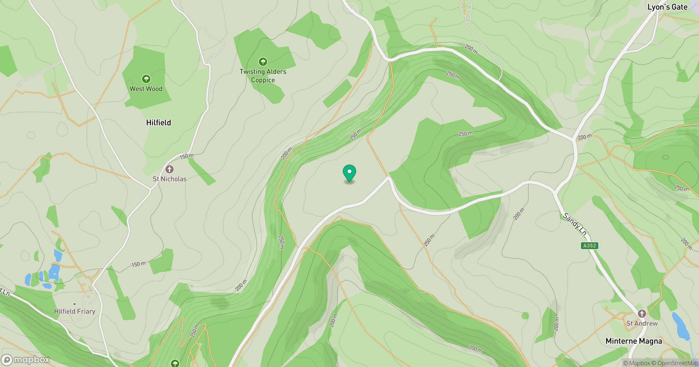
Grid reference: ST644050
View on OpenStreetMapOpens a map in a new tab, centred on the hill.
Hills within 30 km
Straight-line distance, not a walking route or confirmation of access.
No comments yet. Be the first.