
The Beacon
Good walks are even better shared.
Overview
The Beacon
The Beacon towers majestically in the Brecon Beacons National Park, standing proud with an elevation of just 1 metre above sea level (well, technically speaking!). This Marilyn is a popular spot for hikers, with trails that cater to all levels of experience. The geological wonders, comprised primarily of Old Red Sandstone, entice geologists and casual explorers alike.
Routes
The Beacon Walk from Crickhowell
This delightful walk begins in the charming town of Crickhowell and spans approximately 9 km. It is rated as moderate, making it perfect for families and those looking to stretch their legs without pushing too hard. The route meanders through lush greenery, offering glimpses of wildlife – so keep your eyes peeled!
The Beacon via Table Mountain
A more demanding route that will take you over Table Mountain. Covering around 12 km, this challenging hike rewards you with stunning panoramic views and a sense of accomplishment you’ll want to brag about at the next BBQ!
Summit Features
Upon reaching the summit, hikers are greeted by a trig point, ideal for an Insta-worthy photo, and a stone cairn to take your hat off to.
Views
The views from The Beacon are absolutely worth the ascent. You can see Llanthony Priory, a historical gem, and on clear days, the Severn Estuary is a sight for sore eyes.
Best Seasons
For optimal views, aim for spring or summer and consider an early morning jaunt to catch the mystical fog rolling through the valleys.
Access
Situated conveniently near Crickhowell, you’ll find a car park at the base, perfect for those driving. If public transport is your jam, bus services from nearby towns will get you close.
Facilities
Post-hike, refuel at one of the cafés in Crickhowell, where tactical refuelling (aka snacks) can make all the difference!
History
The beacon's name is steeped in history, harking back to a time when fires were lit for navigation. Its significance continues, now as a treasured landmark for adventurers.
Whether you’re there for the views, the exercise, or a little bit of both, The Beacon offers something for everyone.
Happy hiking! Stay safe and don’t forget to bring your camera along.
Last updated: 2023-10-01
Explore routes near The Beacon
Public walks starting within 80 km of this hill. Nearby does not mean a route reaches the summit; check its map and access before setting out.
Stourhead: Alfred's Tower, Park Hill Camp and Turner's Paddock
View route
Sturminster Newton, Cutt Mill and Stalbridge Lane
View route
Heal Somerset wetland ranger walk
View route
Mindful photowalk at Heal Somerset
View route
Route planning notes
These notes describe possible approaches, not verified navigable routes or permission to cross land. Check current paths, local access rules and conditions before setting out.
The Beacon Walk from Crickhowell
A picturesque route starting from Crickhowell, offering stunning views and lush landscapes along the way.
The Beacon via Table Mountain
A more challenging ascent that includes traversing Table Mountain for panoramic views.
Make a day of it, together
Find someone to share the walk with, or organise a day out along a route you like.
Hill facts and local notes
Classifications
Elevation
196m
643 ft
Prominence
110m
Coordinates
51.0089, -2.5247
ST632234
OS Map
183
Explorer: 129E
At the Summit
The summit is marked by a prominent trig point, which serves as a great spot for selfies. A small stone cairn can also be found, adding to the charm of this elevated viewing platform.
Terrain & Geology
The Beacon is composed primarily of Old Red Sandstone, which gives the summit its striking reddish hue. The geology also encompasses remnants of volcanic activity, leading to fascinating rock formations amidst the rolling hills.
Views & Scenery
From the summit, you can marvel at the mighty Llanthony Priory and the vast expanse of the Black Mountains to the east, with the rolling valleys creating a patchwork of green and gold. On clear days, the Severn Estuary can be glimpsed in the distance.
History & Heritage
Name Origin
The name 'Beacon' derives from the Old English term for a signal fire, indicating that this site may have been used for navigation or warning in ancient times.
Historical Significance
Historically, The Beacon served as a lookout point during various conflicts. Today, it stands proud as a favourite among hikers, bringing joy, exercise, and the occasional blister.
Getting There & Facilities
Check current local access restrictions, parking rules and transport timetables before travelling. These notes do not confirm public access to the summit.
Parking
A free car park is located at the base of the hill near Crickhowell, accommodating around 30 vehicles.
Public Transport
Buses run from Abergavenny and other nearby towns, with stops close to the start of popular routes.
Nearby Facilities
Crickhowell offers several cafés, pubs, and shops where you can stock up before your hike. Public toilets are also available in the town centre.
Safety Information
Known Hazards
- The weather can change abruptly in the mountains; always check forecasts and come prepared. Beware of slippery paths and potential for sudden fog banks.
General Safety Tips
- Check weather conditions before setting out
- Carry appropriate clothing and equipment
- Let someone know your planned route
- Take a map, compass, and GPS device
- Carry emergency supplies: food, water, first aid kit, torch
Hills
Some common questions about the hills answered
Are there group walks up The Beacon?
Many walkers use Walkmates to join or organise walks with others. You can check for group walks around The Beacon through the maps
Are there other walkers around The Beacon?
Activity varies by location and time, but Walkmates lets you see whether others have shared walks or shown interest in this area. Find other people through the walking friends search walking friends for The Beacon search or of course create your own walk for The Beacon
Can I organise a walk to The Beacon?
Yes. If there aren’t any walks listed already, you can create a walk and make it available for others to join.
If you're signed up to Walkmates, you can create a walk to The Beacon.
How do I find a walk up this hill?
There are often multiple ways to walk this hill, depending on experience and route preference. Walkmates helps you explore walks and routes that others have shared.
Can I suggest a new route up The Beacon?
Yes. You can suggest or create routes to share with others. Walkmates focuses on the social side of walking, so routes are used to help people organise walks and explore areas together, rather than as detailed navigation tools or route libraries.
Other uses really appreciate knowledgeable walkers sharing their routes. Share your favourite route to The Beacon here
The is an error or something incorrect about this hill. How do I let you know?
We always strive to keep the information on Walkmates as accurate as possible. If you find an error, please let us know through the contact form and we'll aim to correct it as quickly as possible
Community Discussion
Comments
Location
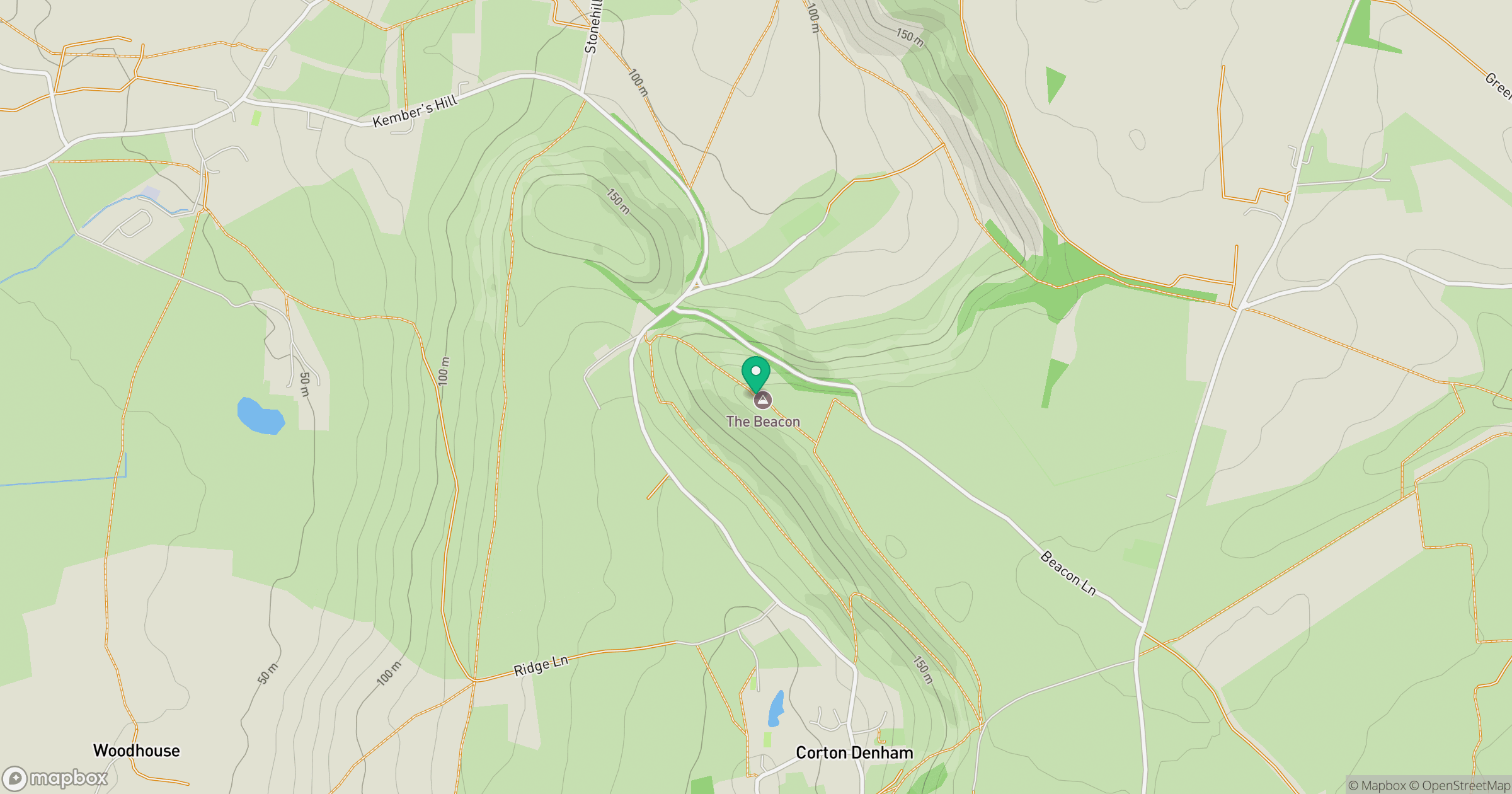
Grid reference: ST632234
View on OpenStreetMapOpens a map in a new tab, centred on the hill.
Hills within 30 km
Straight-line distance, not a walking route or confirmation of access.
No comments yet. Be the first.