

St Rayn Hill
Good walks are even better shared.
Overview
St Rayn Hill
St Rayn Hill, rising to a respectable 216 meters, may not be the tallest of hills, but what it lacks in elevation it makes up for in stunning views and charming countryside.
Geology
The hill is composed of sedimentary stones, a blend of sandstone and mudstone that lends itself beautifully to the rolling landscape of the Cotswolds. The gentle slopes have been sculpted by glacial activity, making it a perfect example of nature’s handiwork.
Routes
For a delightful adventure, consider the St Rayn Hill Circular Walk, a moderately challenging route of about 6.5 km that offers beautiful scenery and the chance to stretch your legs without getting exhausted. Starting from Tormarton, it meanders through meadows and woodlands, gradually leading you to the apex of the hill.
Summit Features
Upon reaching the summit, you’ll be greeted by a small stone cairn and a friendly wooden bench. It’s the ideal spot to take a breather, maybe share a snack or two (squirrels can be cheeky though!).
Terrain
The terrain is predominantly grassy, interlaced with rocky outcrops that add character to the landscape. Just watch your step, especially when navigating the summit area!
Views
The panoramic view from St Rayn Hill is nothing short of spectacular. To the north, the rolling hills of the Cotswolds beckon, while the Severn Estuary and, if you're lucky, the Brecon Beacons can be seen on clear days. Ideal times for viewing these vistas are during the bright days of spring and autumn, when nature is at her finest.
Hazards
As with any outdoor adventure, be mindful of the minor hazards present. The paths can be slippery after rainfall, and loose stones might make your trek a tad more adventurous than anticipated! Stay alert and keep your tummy hungrily cradled while hiking.
Nearby Summits
If you're feeling extra ambitious, other nearby summits like Cley Hill and Horsley Hill provide additional hiking opportunities. Just don’t forget to pack a snack!
Access
To reach the hill, park your car at the village hall in Tormarton, which offers a convenient starting point. Public transport options are available, but check the local bus times as they may differ. Bath, the nearest town, is a mere 16 km away and gifts you with plenty of opportunities for post-hike refreshment.
Facilities
For facilities, Tormarton has a quaint village shop for any necessities. For a proper meal, you might have to venture back to Bath, which has a plethora of eateries ready to serve up hearty meals and stiff drinks.
History
The name St Rayn Hill suggests a historical significance tied to its topography, deriving from the Old English word for a slope. It has stood as a natural lookout and part of ancient trade routes, drawing people since time immemorial.
In summary, St Rayn Hill is a delightful spot for both casual and seasoned hikers. With its gentle slopes, rich geology, inviting views, and a sprinkle of history, it certainly is a hidden gem in the South West. Just remember to keep your hat on, lest the Cotswolds breeze plays tricks on you!
Happy hiking!
Explore routes near St Rayn Hill
Public walks starting within 80 km of this hill. Nearby does not mean a route reaches the summit; check its map and access before setting out.
Langdon Hill Circular
View route
Maunsel Lock to Charlton Bridge: Durston and Cogload canal return
View route
Maunsel Lock to Fordgate: Somerset Space Walk Towpath Return
View route
Ham Wall: Avalon Hide and Walton Heath wetland circuit, Somerset
View route
Route planning notes
These notes describe possible approaches, not verified navigable routes or permission to cross land. Check current paths, local access rules and conditions before setting out.
St Rayn Hill Circular Walk
A scenic circular walk starting from the village of Tormarton, taking you through lush countryside and gently ascending to the summit.
Make a day of it, together
Find someone to share the walk with, or organise a day out along a route you like.
Photo Gallery
View all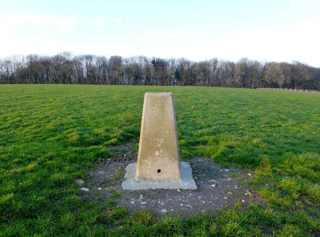 Photo could not load
ST3909 : St Rayn's Hill
Rude Health
Hill facts and local notes
Classifications
Elevation
238m
780 ft
Prominence
117m
Coordinates
50.8839, -2.8552
ST399097
OS Map
193
Explorer: 116
At the Summit
The summit features a small, weathered stone cairn and a wooden bench for weary hikers to rest and admire the surroundings.
Terrain & Geology
St Rayn Hill is primarily composed of sedimentary rocks, showcasing a mix of sandstone and mudstone which have been shaped by the glacial activities of the last Ice Age.
Views & Scenery
From the summit, you can enjoy expansive views of the Cotswolds, the Severn Estuary and on a clear day, the distant Brecon Beacons.
History & Heritage
Name Origin
The name 'Rayn' is believed to derive from the Old English word for 'slope' or 'rising ground'.
Historical Significance
Historically, St Rayn Hill has served as a vantage point for local inhabitants and was once part of ancient trade routes.
Getting There & Facilities
Check current local access restrictions, parking rules and transport timetables before travelling. These notes do not confirm public access to the summit.
Parking
Parking is available at Tormarton village hall. Remember to keep your car clear of the lanes!
Public Transport
Regular bus services operate from nearby towns to Tormarton, although schedules may vary.
Nearby Facilities
Tormarton has a small village shop for refreshments, but for a proper meal, you might want to head back to Bath.
Safety Information
Known Hazards
- Occasional loose stones on the path and wet, slippery sections after rain.
General Safety Tips
- Check weather conditions before setting out
- Carry appropriate clothing and equipment
- Let someone know your planned route
- Take a map, compass, and GPS device
- Carry emergency supplies: food, water, first aid kit, torch
Hills
Some common questions about the hills answered
Are there group walks up St Rayn Hill?
Many walkers use Walkmates to join or organise walks with others. You can check for group walks around St Rayn Hill through the maps
Are there other walkers around St Rayn Hill?
Activity varies by location and time, but Walkmates lets you see whether others have shared walks or shown interest in this area. Find other people through the walking friends search walking friends for St Rayn Hill search or of course create your own walk for St Rayn Hill
Can I organise a walk to St Rayn Hill?
Yes. If there aren’t any walks listed already, you can create a walk and make it available for others to join.
If you're signed up to Walkmates, you can create a walk to St Rayn Hill.
How do I find a walk up this hill?
There are often multiple ways to walk this hill, depending on experience and route preference. Walkmates helps you explore walks and routes that others have shared.
Can I suggest a new route up St Rayn Hill?
Yes. You can suggest or create routes to share with others. Walkmates focuses on the social side of walking, so routes are used to help people organise walks and explore areas together, rather than as detailed navigation tools or route libraries.
Other uses really appreciate knowledgeable walkers sharing their routes. Share your favourite route to St Rayn Hill here
The is an error or something incorrect about this hill. How do I let you know?
We always strive to keep the information on Walkmates as accurate as possible. If you find an error, please let us know through the contact form and we'll aim to correct it as quickly as possible
Community Discussion
Comments
Location
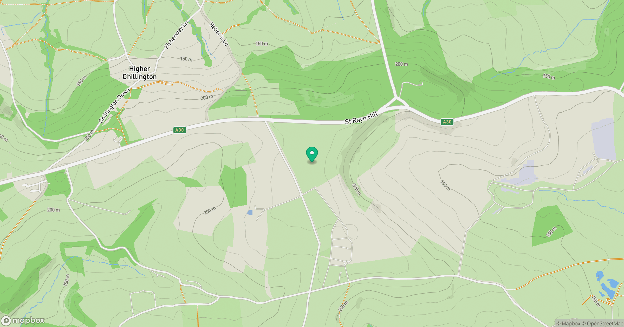
Grid reference: ST399097
View on OpenStreetMapOpens a map in a new tab, centred on the hill.
Hills within 30 km
Straight-line distance, not a walking route or confirmation of access.
No comments yet. Be the first.