

Sguman Coinntich
Good walks are even better shared.
NG9730 : West ridge of Sgùman Còinntich
John Allan Photo source
Overview
Sguman Coinntich: A Hidden Gem in the Highlands
Sguman Coinntich stands proudly at 721 meters, nestled within the scenic beauty of the Scottish Highlands. This mountainous beauty is classified as a Corbett, meaning it's tall enough to provide stunning vistas without the congestion often found on larger summits.
Geology
The mountain’s fascinating composition of schist and various metamorphic rocks provides a glimpse into the Earth's ancient past. These rocks are essentially old ocean floors that made a monumental ascent, carving out the terrain we tread upon today. A slow but sure reminder that nature has been at work for millions of years!
Routes
One of the most popular hiking routes starts at Kilchoan. This moderate 14-kilometre track takes around five hours to traverse. You'll be treated to views of lush valleys and rocky paths—perfect for skipping if you're in a jolly mood!
Summit Features
Perched atop Sguman Coinntich is a handsome stone cairn, beckoning hikers to stop for a moment to take in the glorious panoramas before them. Bring your camera—this is an Instagram-worthy spot!
Terrain Type
You'll encounter a delightful mix of rocky and grassy slopes, with a few boggy patches that tend to surprise unsuspecting hikers. If you’re not careful, you might find yourself having a chat with a particularly clingy patch of mud!
Views
The summit offers stunning vistas, showcasing the Ardnamurchan Peninsula's beauty and the sparkling coastline beyond. For the best views, aim to visit during spring or early summer when the heather paints the landscape in vibrant hues.
Hazards
While the picturesque trails are inviting, hikers should exercise caution, especially on rocky sections. The weather can change more quickly than you can say 'Scottish mist,' so always be prepared.
Nearby Summits
Nearby, Beinn na h-Uamha (637 meters) makes a great companion hike, adding another notch to your summiting belt.
Access
Parking is conveniently located at Kilchoan, with local shops and cafes to replenish your energy either before or after your ascent. Public transport options might be limited, but local services connect you well enough.
History
The name 'Sguman Coinntich' hints at its distinctive conical features, possibly stemming from ages of lore. Locals have long revered this mountain, and it plays a significant role in the area's cultural tapestry.
In conclusion, whether you're a seasoned hiker or just looking for a nice stroll with a view, Sguman Coinntich offers a pleasant day out in nature's embrace. So lace up your boots, grab your gear, and set out to discover this Highland gem!
Explore routes near Sguman Coinntich
Walks starting near this hill. Open a route to check its map, distance and full itinerary.
Beinn Eighe Lancaster Wreckage at Coire Mhic Fhearchair
View route
Glen Affric: Coire Loch Woodland Trail
View route
Fort Augustus to Kytra Lock: Caledonian Canal Towpath
View route
Fairy Lochs Liberator Wreckage Circuit
View route
Route planning notes
These notes describe possible approaches. Check a route's map and access information when planning your walk.
Kilchoan to Sguman Coinntich
An enticing route starting from Kilchoan, which offers a moderate climb through scenic valleys and rocky paths. Perfect for those who enjoy a bit of a workout without extreme challenges.
Make a day of it, together
Find someone to share the walk with, or organise a day out along a route you like.
Photo Gallery
View all Photo could not load
NG9730 : West ridge of Sgùman Còinntich
John Allan
 Photo could not load
NG9730 : Looking west from the summit of Sguman Coinntich
John Ferguson
 Photo could not load
NG9730 : Summit, Sgùman Còinntich
Richard Webb
 Photo could not load
NG9730 : Summit trig point, Sguman Coinntich
Jim Barton
 Photo could not load
NG9730 : Sgùman Còinntich Trigpoint
John Allan
Hill facts and local notes
Classifications
Elevation
879m
2,884 ft
Prominence
415m
Coordinates
57.3188, -5.3613
NG976303
OS Map
25
Explorer: 414N 429
At the Summit
The summit features a substantial stone cairn, providing a perfect resting spot and a backdrop for memorable summit photos. Be sure to check the view—it's worth its weight in gold.
Terrain & Geology
Sguman Coinntich is predominantly composed of schist and other metamorphic rocks, typical of the Highland region. The geological formations here tell tales of ancient ocean floors uplifted millions of years ago, forming the rugged terrains that hikers adore today.
Views & Scenery
From the summit, spectacular views of the surrounding mountains, including the impressive peaks of the Ardnamurchan Peninsula, as well as glimpses of the coastline and the neighbouring islands.
History & Heritage
Name Origin
The name 'Sguman Coinntich' translates roughly to 'the mound of the cones,' possibly a reference to the conical shape of the mountain itself.
Historical Significance
This mountain has long been a favourite amongst locals and hikers seeking the serenity of the Highlands, steeped in rich mythology and nature's grandeur.
Getting There & Facilities
Parking
Parking is available at Kilchoan, providing easy access to the trailhead. Be mindful of local regulations.
Public Transport
While the nearest bus routes are limited, there's access from the local village services, which typically connect via Fort William.
Nearby Facilities
Kilchoan has a small shop and a couple of cafes where you can grab a bite or drink before or after your hike. Toilets are available at the community hall.
Safety Information
Known Hazards
- Care should be taken with tricky rocky sections, especially in wet conditions. Additionally, be wary of rapidly changing weather, as the Scottish Highlands are notorious for their unpredictability.
General Safety Tips
- Check weather conditions before setting out
- Carry appropriate clothing and equipment
- Let someone know your planned route
- Take a map, compass, and GPS device
- Carry emergency supplies: food, water, first aid kit, torch
Hills
Some common questions about the hills answered
Are there group walks up Sguman Coinntich?
Many walkers use Walkmates to join or organise walks with others. You can check for group walks around Sguman Coinntich through the maps
Are there other walkers around Sguman Coinntich?
Activity varies by location and time, but Walkmates lets you see whether others have shared walks or shown interest in this area. Find other people through the walking friends search walking friends for Sguman Coinntich search or of course create your own walk for Sguman Coinntich
Can I organise a walk to Sguman Coinntich?
Yes. If there aren’t any walks listed already, you can create a walk and make it available for others to join.
If you're signed up to Walkmates, you can create a walk to Sguman Coinntich.
How do I find a walk up this hill?
There are often multiple ways to walk this hill, depending on experience and route preference. Walkmates helps you explore walks and routes that others have shared.
Can I suggest a new route up Sguman Coinntich?
Yes. You can suggest or create routes to share with others. Walkmates focuses on the social side of walking, so routes are used to help people organise walks and explore areas together, rather than as detailed navigation tools or route libraries.
Other uses really appreciate knowledgeable walkers sharing their routes. Share your favourite route to Sguman Coinntich here
The is an error or something incorrect about this hill. How do I let you know?
We always strive to keep the information on Walkmates as accurate as possible. If you find an error, please let us know through the contact form and we'll aim to correct it as quickly as possible
Community Discussion
Comments
Location
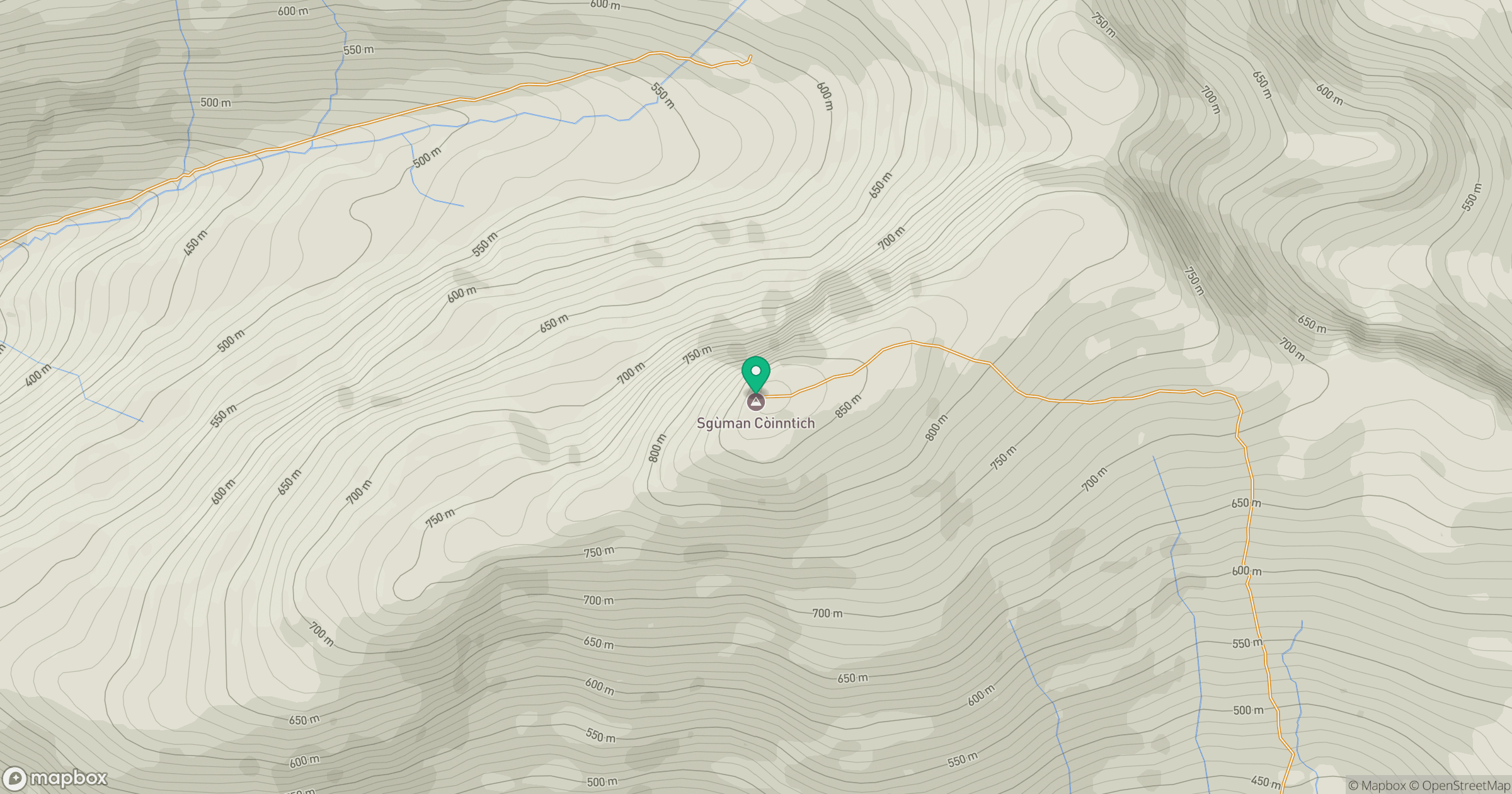
Grid reference: NG976303
View on OpenStreetMapOpens a map in a new tab, centred on the hill.
No comments yet. Be the first.