

Pen-y-crug
Good walks are even better shared.
SO0230 : sheep grazing near summit of Pen-y-crug
Trevor Littlewood Photo source
Overview
Pen-y-crug is a 331 m hill northwest of Brecon in Bannau Brycheiniog National Park. Its grassy summit is enclosed by an impressive Iron Age hillfort, with views over Brecon, the Usk Valley, the Central Beacons and the Black Mountains.
Pen-y-crug
Pen-y-crug is a 331 m hill just northwest of Brecon in Bannau Brycheiniog National Park. Grassy slopes rise to an impressive Iron Age hillfort, with wide views across the Usk Valley to the Central Beacons and Black Mountains. Its Welsh name means “top of the hillock”. The hill is classified as a Hump.
Walking routes
Maen-du Well out-and-back
The National Park's short route starts at Maen-du Well, beside Maes y Ffynnon on the edge of Brecon (SO039296). Follow the waymarked field paths and stiles onto the open hillside, then climb through the earthworks to the trig point. The natural summit is the ground 5 m north of the pillar. Return by the same path to the well.
Allow 1–2 hours for this 2.5 km return walk. The leaflet describes 140 m of climb and grades the route Moderate.
Brecon via Crug Villa
Walking Britain's 4.9 km circuit starts by Watergate Bridge/Kensington car park. Walk up to the Cathedral, follow Pendre and take the signed track past Crug Villa to the hillfort and summit. Descend towards Maen-du Well, then return through the residential paths and Peppercorn Lane to Pendre and the Cathedral. Retrace the town approach to Watergate. The publisher gives 167 m ascent and 2 hours.
Bus Interchange and River Usk
For a longer town-and-country walk, the National Park's Nature Walks Route 3 starts and finishes at Brecon Bus Interchange. It climbs via the Cathedral, Pendre and Crug Villa, visits the summit, then returns through Maen-du Well and the residential area to Cradoc Road, the Promenade and the River Usk. Town paths complete the circuit to the interchange. This published route is 7.2 km and Grade 4 in the booklet's accessibility scale, with rough and sometimes steep ground and high stiles.
Summit and landscape
A trig point stands within the hillfort, close to the natural high ground. The surrounding earthworks are archaeological remains: leave stones and banks undisturbed and use established paths through them. In clear weather the outlook includes Brecon, the Usk Valley, Pen y Fan and the Central Beacons, the Black Mountains and neighbouring hillforts.
The hill is formed from sandstone and mudstone of the St Maughan's Formation, part of the Devonian Old Red Sandstone. Its open slopes provide a viewpoint over old river courses around the hill.
History
The hillfort was a defended Iron Age settlement, enclosed by substantial banks and ditches. Its entrance lay on the southeast side. The surviving defences vary around the hill, making the site particularly rewarding to explore on the established paths. Quarrying and brick-and-tile production in the 18th and 19th centuries left later workings around the slopes.
Access and practicalities
The hilltop is common land owned and managed by the National Park. Approaches include public footpaths and a bridleway. Grassy paths can become muddy and slippery; several routes cross stiles and fields with livestock. Keep dogs on leads and take care around ground-nesting birds. The open summit is exposed to wind and rain. Town circuits include road crossings, and the longer river return has steps and a short section without pavement.
There is a small parking area off the minor Cradoc road at SO028309, north of the hill. For a Brecon start, the Cathedral has pay-and-display parking; Kensington and Promenade are other town options. Follow parking signs and keep gates and residential access clear. Brecon provides shops, cafés and toilets, including facilities at the Cathedral.
Brecon Bus Interchange is the start of the 7.2 km route. Check Traveline Cymru for your travel date and return journey. Before setting out, check the National Park's temporary path notices and follow signs on the ground.
Explore routes near Pen-y-crug
Walks starting near this hill. Open a route to check its map, distance and full itinerary.
Brecon Basin to Brynich Aqueduct: Canal Towpath Walk
View route
Pen y Fan via Corn Du from Storey Arms
View route
A Very Merry Winter Walk ending with Cake & a Hot Drink!
View route
Usk Reservoir: Glasfynydd Forest and Dam Circuit
View route
Route planning notes
These notes describe possible approaches. Check a route's map and access information when planning your walk.
Maen-du Well to Pen-y-crug and back
Start and finish at Maen-du Well, Maes y Ffynnon (SO039296). Follow the National Park waymarks across fields and stiles, then climb the open hillside through the hillfort to the trig point. The natural high ground is 5 m north of the pillar. Retrace the same path to the well. The National Park gives 2.5 km return, 1–2 hours and 140 m of climb. Grassy paths can be slippery and livestock may be present; keep dogs on leads.
Brecon via Crug Villa and Maen-du Well
Start and finish by Watergate Bridge/Kensington car park in Brecon (SO042286). Walk to the Cathedral and follow Pendre to the signed lane and track past Crug Villa. Climb through the hillfort to the trig and the high ground 5 m north. Descend on the field path to Maen-du Well, then follow residential paths via Bron-y-crug and Peppercorn Lane to Pendre and the Cathedral. Retrace the town approach to Watergate. Walking Britain gives 4.9 km, 167 m ascent and 2 hours for this circuit. It includes stiles, road crossings and grazing fields.
Brecon Bus Interchange and River Usk circuit
Start and finish at Brecon Bus Interchange. Follow the National Park Nature Walks Route 3 through town to the Cathedral and Pendre, then take the track past Crug Villa to the hillfort, trig and natural high ground just north. Descend via Maen-du Well, cross the housing estate to Cradoc Road and continue to the Promenade. Follow the River Usk and town paths back to the interchange. The published circuit is 7.2 km. Its Grade 4 rating reflects rough, sometimes steep ground and high stiles; the town return also has road crossings, a short section without pavement and riverside steps.
Make a day of it, together
Find someone to share the walk with, or organise a day out along a route you like.
Photo Gallery
View all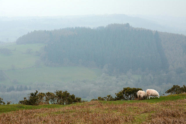 Photo could not load
SO0230 : sheep grazing near summit of Pen-y-crug
Trevor Littlewood
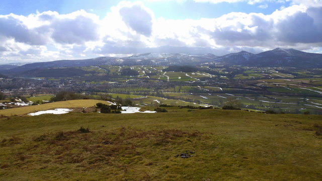 Photo could not load
SO0230 : View south from Pen-y-crug trig
Jonathan Billinger
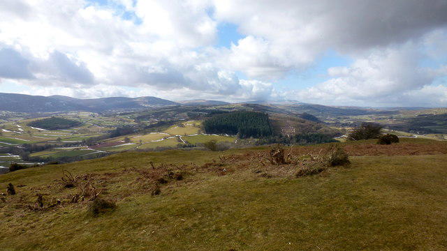 Photo could not load
SO0230 : View west from Pen-y-crug
Jonathan Billinger
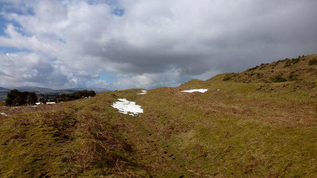 Photo could not load
SO0230 : Hillfort ramparts, Pen-y-crug
Jonathan Billinger
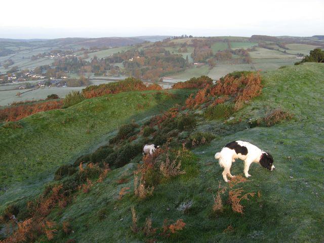 Photo could not load
SO0230 : Hill fort ramparts
Jonathan Wilkins
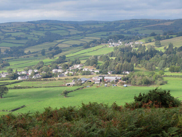 Photo could not load
SO0230 : View towards Pysgodlyn Farm from Pen-y-crug
Gareth James
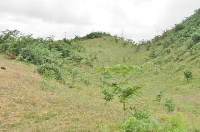 Photo could not load
SO0230 : Pen-y-Crug - Ditch and Ramparts
Colin Smith
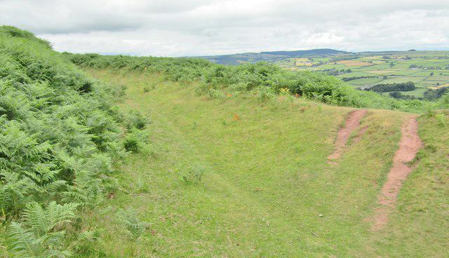 Photo could not load
SO0330 : Pen-y-Crug - Ditch and Ramparts
Colin Smith
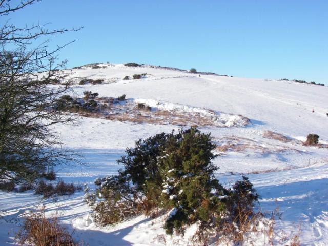 Photo could not load
SO0330 : Pen-y-crug under snow
Alan Bowring
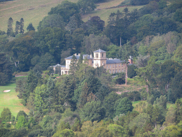
SO0230 : View towards Penoyre House from Pen-y-crug
Gareth James
Hill facts and local notes
Classifications
Elevation
331m
1,086 ft
Prominence
110m
Coordinates
51.9628, -3.4142
SO029303
OS Map
160
Explorer: OL12E
At the Summit
The grassy summit lies within an Iron Age hillfort. A trig point stands nearby; the natural high ground is 5 m north of the pillar. Leave the earthworks and stones undisturbed.
Terrain & Geology
The hill is formed from sandstone and mudstone of the St Maughan’s Formation, part of the Devonian Old Red Sandstone. The surrounding landscape includes old courses of the River Usk.
Views & Scenery
In clear weather there are wide views over Brecon and the Usk Valley, with Pen y Fan and the Central Beacons to the south and the Black Mountains to the east. Neighbouring hillforts are also visible.
History & Heritage
Name Origin
The Welsh name Pen-y-crug means “top of the hillock”.
Historical Significance
Pen-y-crug is an Iron Age hillfort with substantial defensive banks and ditches and an entrance on the southeast side. It enclosed a settlement where people lived and worked. Quarrying and brick-and-tile production in the 18th and 19th centuries left later industrial remains around the hill.
Getting There & Facilities
Parking
Fforest Fawr Geopark identifies a small parking area off the minor Cradoc road at SO028309, north of the hill. For walks from Brecon, the Cathedral has pay-and-display parking; Kensington and Promenade are other town options. Follow local signs and keep gates and residential access clear.
Public Transport
Brecon Bus Interchange is the start and finish of the National Park’s 7.2 km Pen y Crug circular walk. Check Traveline Cymru for buses on your travel date and the return journey: https://www.traveline.cymru/timetables/
Nearby Facilities
Brecon has shops, cafés and toilets. Brecon Cathedral provides toilets and a café beside its pay-and-display car park. Bring drinking water for the hill walk.
Safety Information
Known Hazards
- Grassy paths can be muddy and slippery, with uneven ground and several stiles on the field approaches.
- Livestock graze the fields and common. Keep dogs on leads around animals and ground-nesting birds.
- The open summit is exposed to wind and rain. Town circuits include road crossings; the longer river return has steps and a short section without pavement.
- Use established paths through the hillfort and leave its banks, ditches and stones undisturbed.
General Safety Tips
- Check weather conditions before setting out
- Carry appropriate clothing and equipment
- Let someone know your planned route
- Take a map, compass, and GPS device
- Carry emergency supplies: food, water, first aid kit, torch
Hills
Some common questions about the hills answered
Are there group walks up Pen-y-crug?
Many walkers use Walkmates to join or organise walks with others. You can check for group walks around Pen-y-crug through the maps
Are there other walkers around Pen-y-crug?
Activity varies by location and time, but Walkmates lets you see whether others have shared walks or shown interest in this area. Find other people through the walking friends search walking friends for Pen-y-crug search or of course create your own walk for Pen-y-crug
Can I organise a walk to Pen-y-crug?
Yes. If there aren’t any walks listed already, you can create a walk and make it available for others to join.
If you're signed up to Walkmates, you can create a walk to Pen-y-crug.
How do I find a walk up this hill?
There are often multiple ways to walk this hill, depending on experience and route preference. Walkmates helps you explore walks and routes that others have shared.
Can I suggest a new route up Pen-y-crug?
Yes. You can suggest or create routes to share with others. Walkmates focuses on the social side of walking, so routes are used to help people organise walks and explore areas together, rather than as detailed navigation tools or route libraries.
Other uses really appreciate knowledgeable walkers sharing their routes. Share your favourite route to Pen-y-crug here
The is an error or something incorrect about this hill. How do I let you know?
We always strive to keep the information on Walkmates as accurate as possible. If you find an error, please let us know through the contact form and we'll aim to correct it as quickly as possible
Community Discussion
Comments
Location
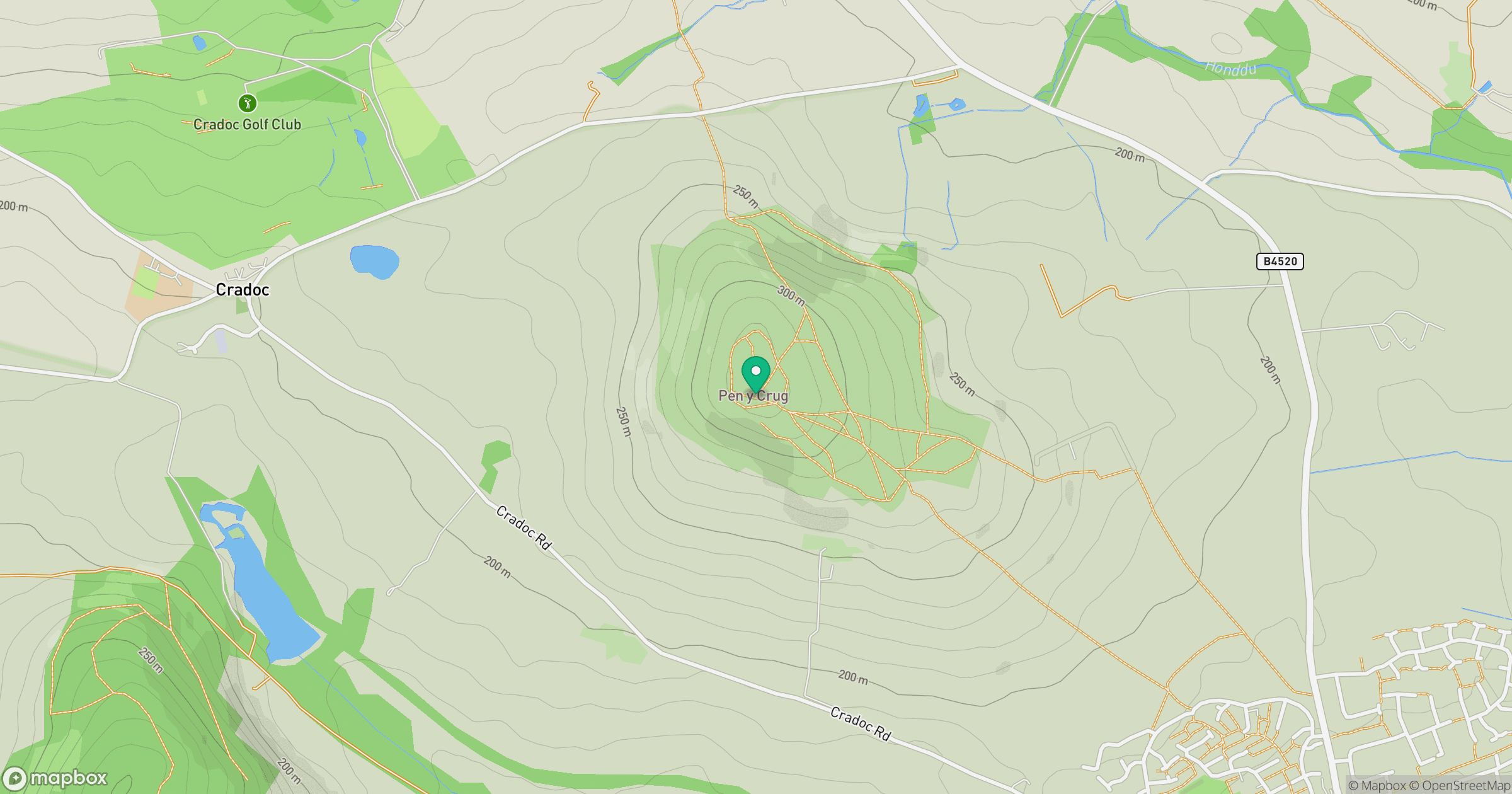
Grid reference: SO029303
View on OpenStreetMapOpens a map in a new tab, centred on the hill.


No comments yet. Be the first.