

Waun Rydd
Good walks are even better shared.
SO0620 : Waun Rydd
Rude Health Photo source
Overview
Waun Rydd
Nestled in the stunning Brecon Beacons National Park, Waun Rydd stands tall with an elevation of 754 meters. As a Marilyn, this peak offers not only fantastic views but also a sense of achievement for those who reach its summit.
Geology
Waun Rydd is a magnificent example of Old Red Sandstone, which gives the mountain its characteristic reddish tint. The rocky outcrops at the summit provide excellent photo opportunities and make the hike a bit more exciting; just don’t trip over while taking that perfect shot!
Access
Getting to Waun Rydd is a breeze, with plenty of options available for both drivers and public transport users. The nearest parking is at the Talybont Reservoir car park, which operates a small fee for the day. For those relying on public transport, Talybont-on-Usk is just a short bus ride away. Don’t forget the snacks; nothing’s better than a picnic on the summit!
Routes
There are several fantastic routes to tackle: the Talybont Reservoir Circuit is a 10.5 km moderate trek that takes about 3.5 hours. Alternatively, the Glyntawe route is a more straightforward 6 km walk perfect for families and takes about 2 hours.
Terrain
The terrain is rugged and occasionally boggy, with grassy slopes leading up to rockier sections near the top. Make sure to wear sturdy boots to keep your feet happy!
Views
The summit provides breathtaking views, especially of Pen y Fan and Talybont Reservoir. For the best visual feast, aim to hike during the spring or autumn. Early morning visits might reward you with magical mist swirling around the valleys - a sight you won’t forget and a perfect way to start your day!
Nearby Summits
Do keep an eye out for nearby peaks such as Pen y Fan and Corn Du, which offer additional hiking opportunities and breathtaking vistas to adjoin your adventure.
History
The name Waun Rydd translates to 'field of the wide moor', reflecting the expansive views from the summit. Historically, the area has been significant, with signs of ancient settlements, making this not only a walk in nature but also a journey through time.
Conclusion
Whether you're a seasoned hiker or just fancy a lovely stroll amidst some beautiful landscapes, Waun Rydd has something to offer every adventurer. Pack your bags, lace up your boots, and let the great outdoors surprise you!
Explore routes near Waun Rydd
Walks starting near this hill. Open a route to check its map, distance and full itinerary.
Brecon Basin to Brynich Aqueduct: Canal Towpath Walk
View route
Pen y Fan via Corn Du from Storey Arms
View route
A Very Merry Winter Walk ending with Cake & a Hot Drink!
View route
Aircraft Crash Site - Wellington Bomber and Vampire Jet (Black Mountain range)
View route
Route planning notes
These notes describe possible approaches. Check a route's map and access information when planning your walk.
Talybont Reservoir Circuit
A popular circular route starting from Talybont Reservoir, leading up to the summit and returning via scenic paths through the nature reserve.
Glyntawe to Waun Rydd
An excellent path from Glyntawe leading directly to the summit, offering stunning views over the surrounding valleys.
Make a day of it, together
Find someone to share the walk with, or organise a day out along a route you like.
Photo Gallery
View all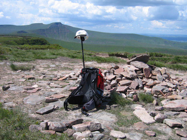 Photo could not load
SO0620 : Waun Rydd
Rude Health
Hill facts and local notes
Classifications
Elevation
769m
2,524 ft
Prominence
169m
Coordinates
51.8765, -3.3638
SO062206
OS Map
160
Explorer: OL12E
At the Summit
The summit of Waun Rydd features a prominent rocky outcrop and a small cairn, which makes for a perfect photo op. Just watch your step!
Terrain & Geology
Waun Rydd is primarily composed of Old Red Sandstone, which gives it a unique reddish hue. The summit area features exposed rock outcrops, and the surrounding hills are characterized by a mix of grassland and heather.
Views & Scenery
From the summit, hikers can see Pen y Fan, the highest peak in South Wales, and the beautiful Talybont Reservoir below.
History & Heritage
Name Origin
The name 'Waun Rydd' roughly translates from Welsh to 'field of the wide moor', reflecting the expansive grassy landscapes surrounding the mountain.
Historical Significance
This area has a rich cultural history, with evidence of ancient settlements nearby, and has long been a favourite among nature lovers and walkers.
Getting There & Facilities
Parking
There is parking available at the Talybont Reservoir car park, with a small charge for the day. Arrive early to beat the crowds!
Public Transport
The nearest bus stop is in Talybont-on-Usk, which is serviced by regular buses from nearby towns.
Nearby Facilities
Public toilets are available at the Talybont Reservoir car park. The nearest cafes can be found in Talybont-on-Usk.
Safety Information
Known Hazards
- Muddy sections can be present during wet weather, and some rocky areas may require careful navigation.
General Safety Tips
- Check weather conditions before setting out
- Carry appropriate clothing and equipment
- Let someone know your planned route
- Take a map, compass, and GPS device
- Carry emergency supplies: food, water, first aid kit, torch
Hills
Some common questions about the hills answered
Are there group walks up Waun Rydd?
Many walkers use Walkmates to join or organise walks with others. You can check for group walks around Waun Rydd through the maps
Are there other walkers around Waun Rydd?
Activity varies by location and time, but Walkmates lets you see whether others have shared walks or shown interest in this area. Find other people through the walking friends search walking friends for Waun Rydd search or of course create your own walk for Waun Rydd
Can I organise a walk to Waun Rydd?
Yes. If there aren’t any walks listed already, you can create a walk and make it available for others to join.
If you're signed up to Walkmates, you can create a walk to Waun Rydd.
How do I find a walk up this hill?
There are often multiple ways to walk this hill, depending on experience and route preference. Walkmates helps you explore walks and routes that others have shared.
Can I suggest a new route up Waun Rydd?
Yes. You can suggest or create routes to share with others. Walkmates focuses on the social side of walking, so routes are used to help people organise walks and explore areas together, rather than as detailed navigation tools or route libraries.
Other uses really appreciate knowledgeable walkers sharing their routes. Share your favourite route to Waun Rydd here
The is an error or something incorrect about this hill. How do I let you know?
We always strive to keep the information on Walkmates as accurate as possible. If you find an error, please let us know through the contact form and we'll aim to correct it as quickly as possible
Community Discussion
Comments
Location
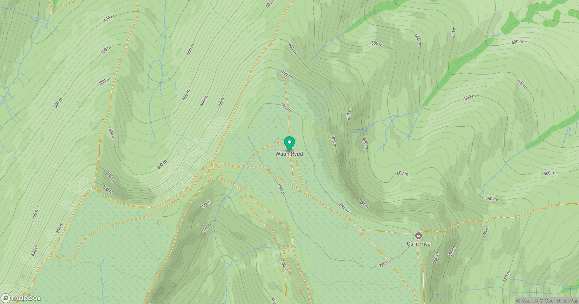
Grid reference: SO062206
View on OpenStreetMapOpens a map in a new tab, centred on the hill.


No comments yet. Be the first.