

Carneddau
Good walks are even better shared.
SO0755 : Above steep slopes on the Carneddau with view to Radnor Forest hills
Andrew Hill Photo source
Overview
Overview
The Carneddau mountain range is a majestic expanse nestled within the heart of Snowdonia National Park, standing tall with its highest peak, Carnedd Llewelyn, soaring to 1,064 meters.
Geology
Composed mainly of ancient Ordovician layers, the geology of the Carneddau features unique rock formations that provide insights into the Earth’s past. Visitors can expect rugged outcrops that tell tales of the ancient ocean that once covered this region.
Routes
Carnedd Llewelyn from the A5: A well-trodden path leading from the A5 road, this route is favoured for its accessibility and lovely views. Ideal for families looking to stretch their legs in nature's playground.
Via the North Ridge: For those who crave adventure, the North Ridge offers a gripping ascent that winds through rocky terrain. It’s often said that true adventure lies just beyond your comfort zone!
Summit Features
Expect to find a majestic cairn marking the summit, which is a favourite picnic spot for those who have made the climb. Don’t forget to sign the summit log and maybe leave a funny note.
Terrain Type
The terrain is a mix of grassy hills, rocky scrambles, and occasional bogs. A sturdy pair of hiking boots is recommended unless you fancy a new mud-themed fashion statement!
Views
Carneddau provides panoramic views of Snowdonia, where clear days allow for sights all the way to Anglesey. The post-summit sense of achievement is only matched by the jaw-dropping scenery.
Hazards
While the trails are popular, caution is advised. The weather can change in the blink of an eye—sunshine one minute, a cloud full of rain the next. Always carry a map and compass, and trust me, that fancy phone GPS won’t be of much help when the signal disappears.
Access
Finding your way to the Carneddau is straightforward. The nearest parking allows for easy access to several paths, making it a prime location for a day hike.
Facilities
Once you've conquered the peaks and returned victorious, Bethesda is the perfect spot to enjoy a refreshing drink and possibly a slice of cake to celebrate your triumph over the mountains.
Conclusion
In summary, the Carneddau range is a feast for the senses and the soul—perfect for leisurely walkers and seasoned hikers looking to lose themselves in the wild. Gear up, stay safe, and embrace the beauty that awaits!
Explore routes near Carneddau
Walks starting near this hill. Open a route to check its map, distance and full itinerary.
Elan Valley: Reservoir Trail to Pen y Garreg Dam
View route
Brecon Basin to Brynich Aqueduct: Canal Towpath Walk
View route
Pen y Fan via Corn Du from Storey Arms
View route
A Very Merry Winter Walk ending with Cake & a Hot Drink!
View route
Route planning notes
These notes describe possible approaches. Check a route's map and access information when planning your walk.
Carnedd Llewelyn via Pen yr Ole Wen
This classic route begins in the Ogwen Valley near Glan Dena and ascends Pen yr Ole Wen before continuing to Carnedd Dafydd and Carnedd Llewelyn. The route offers dramatic views over the surrounding valleys and lakes, with some steep sections that require good fitness and basic scrambling skills.
Carneddau Horseshoe
A well-known circular route that starts and ends at Llyn Ogwen. This loop takes in multiple peaks including Pen yr Ole Wen, Carnedd Dafydd, Carnedd Llewelyn, and Yr Elen. It is a challenging but rewarding full-day hike with spectacular views of Snowdonia.
Foel Grach and Carnedd Llewelyn from Cwm Eigiau
Starting near the Cwm Eigiau car park, this route ascends through the quiet and scenic valley, reaching Foel Grach before heading to the summit of Carnedd Llewelyn. A less-travelled approach that offers a sense of remoteness.
Carnedd Llewelyn and Yr Elen from Gerlan
A quieter route that begins in the village of Gerlan near Bethesda. The path climbs gradually through the valley before tackling the steep ascent to Carnedd Llewelyn. On the return, it takes in the ridge to Yr Elen, offering a beautiful perspective of the Carneddau range.
High Carneddau Traverse
This long ridge walk starts at Llyn Ogwen and traverses the main summits of the Carneddau range, including Pen yr Ole Wen, Carnedd Dafydd, Carnedd Llewelyn, and Foel-fras. It is an ambitious and strenuous route suited for experienced hillwalkers.
Make a day of it, together
Find someone to share the walk with, or organise a day out along a route you like.
Photo Gallery
View all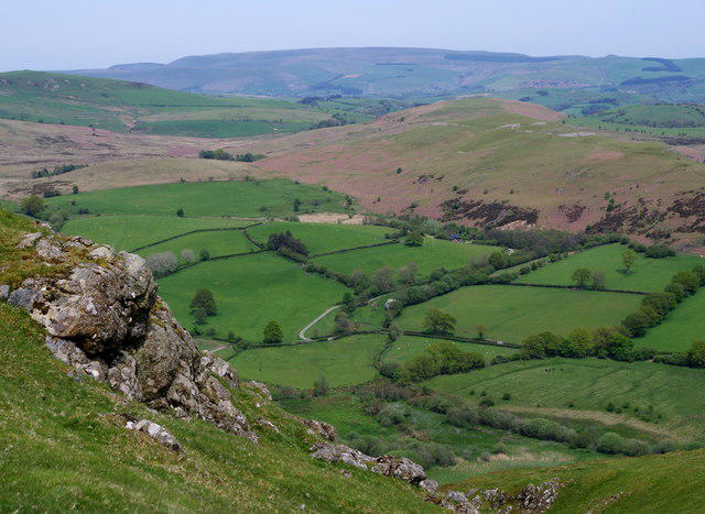 Photo could not load
SO0755 : Above steep slopes on the Carneddau with view to Radnor Forest hills
Andrew Hill
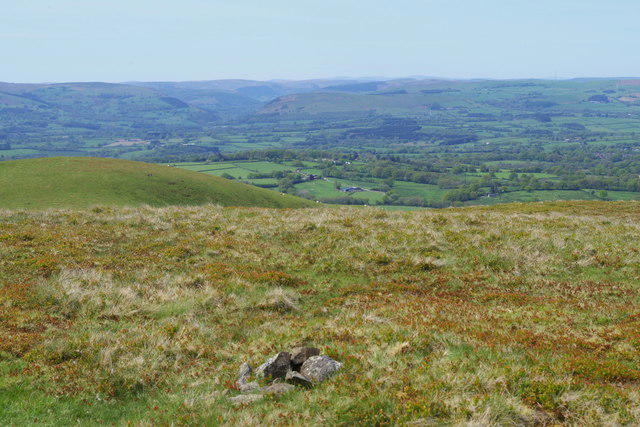 Photo could not load
SO0655 : On the highest summit of the Carneddau hills
Andrew Hill
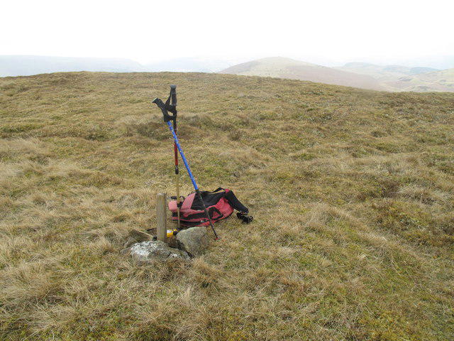 Photo could not load
SO0655 : Carneddau Summit
Rude Health
Hill facts and local notes
Classifications
Elevation
445m
1,460 ft
Prominence
206m
Coordinates
52.1872, -3.3619
SO069551
OS Map
147
Explorer: 200E
At the Summit
At the summit, you'll find a distinctive cairn adorned with a trig point, providing a perfect backdrop for those quintessential summit selfies.
Terrain & Geology
The Carneddau mountains are predominantly composed of grits and mudstones from the Ordovician period. These ancient rocks have weathered into a striking landscape, featuring craggy peaks and steep cliffs that are as dramatic as they are beautiful.
Views & Scenery
The view from the summit unveils breathtaking vistas of the Snowdon Range, as well as the expansive coast of Conwy in the distance. Don't forget to wave at the tourists on the shore—it's a long way down!
History & Heritage
Name Origin
The name 'Carneddau' comes from the Welsh word 'carnedd', meaning 'cairn' or 'stone heap', reflecting the numerous stone structures scattered across the mountains.
Historical Significance
The Carneddau have a rich cultural heritage, being a significant area for early Welsh clans and later becoming a haven for mountaineers and hikers seeking the wild beauty of Snowdonia.
Getting There & Facilities
Parking
The closest parking is at the layby near the A5 road, where you can find ample space for several vehicles. Be sure to arrive early on weekends as it can fill up fast!
Public Transport
Buses run from Bangor and other nearby towns to the A5. However, check local schedules as they may be limited, especially on weekends.
Nearby Facilities
In Bethesda, you’ll find several cafes and shops, including the popular Pizzeria which serves a mean coffee and the best carrot cake this side of the hills!
Safety Information
Known Hazards
- Rockfalls and unstable ground, particularly in wet weather. Navigation can be tricky in misty conditions, so good map skills are essential. Be wary of eroded paths which can lead to unexpected scrambles.
General Safety Tips
- Check weather conditions before setting out
- Carry appropriate clothing and equipment
- Let someone know your planned route
- Take a map, compass, and GPS device
- Carry emergency supplies: food, water, first aid kit, torch
Hills
Some common questions about the hills answered
Are there group walks up Carneddau?
Many walkers use Walkmates to join or organise walks with others. You can check for group walks around Carneddau through the maps
Are there other walkers around Carneddau?
Activity varies by location and time, but Walkmates lets you see whether others have shared walks or shown interest in this area. Find other people through the walking friends search walking friends for Carneddau search or of course create your own walk for Carneddau
Can I organise a walk to Carneddau?
Yes. If there aren’t any walks listed already, you can create a walk and make it available for others to join.
If you're signed up to Walkmates, you can create a walk to Carneddau.
How do I find a walk up this hill?
There are often multiple ways to walk this hill, depending on experience and route preference. Walkmates helps you explore walks and routes that others have shared.
Can I suggest a new route up Carneddau?
Yes. You can suggest or create routes to share with others. Walkmates focuses on the social side of walking, so routes are used to help people organise walks and explore areas together, rather than as detailed navigation tools or route libraries.
Other uses really appreciate knowledgeable walkers sharing their routes. Share your favourite route to Carneddau here
The is an error or something incorrect about this hill. How do I let you know?
We always strive to keep the information on Walkmates as accurate as possible. If you find an error, please let us know through the contact form and we'll aim to correct it as quickly as possible
Community Discussion
Comments
Location
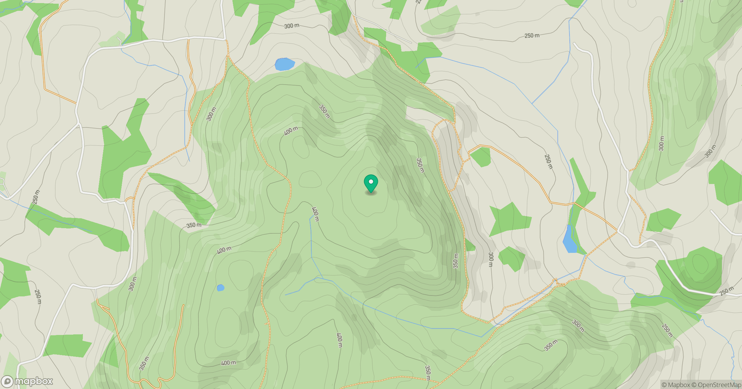
Grid reference: SO069551
View on OpenStreetMapOpens a map in a new tab, centred on the hill.


No comments yet. Be the first.