
Yr Allt
Good walks are even better shared.
Overview
Yr Allt: A Jewel in the Brecon Beacons
Yr Allt, perched at an elevation of 470 meters, offers a delightful experience for hikers seeking both tranquility and spectacular views. Nestled within the heart of Brecon Beacons National Park, it boasts a prominent prominence, making it a notable feature in the landscape.
Geology
The geological makeup of Yr Allt showcases a fascinating range of sedimentary rocks, predominantly sandstone and mudstone. These rocks have eroded over millennia, giving rise to its undulating hills and scenic cliffs. It’s a perfect spot for geology enthusiasts to examine the impacts of natural weathering.
Routes
One popular route is The Allt Circular, which begins in Cwmdu. This moderate trek spans approximately 8.5 km, winding through picturesque Welsh countryside and providing ample opportunities for photographs and perhaps the odd sheep selfie.
Summit Features
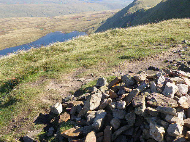
Upon reaching the summit, hikers are greeted with a modest stone cairn and a wooden post marking the top. It’s a great place to catch your breath and absorb the stunning landscapes around you.
Terrain
The terrain surrounding Yr Allt is primarily grassy, interspersed with rocky outcrops. While the grassy areas are a joy to stroll through, watch out for the occasional boggy patch that can surprise the unwary trekker!
Views
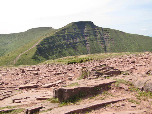
Hikers are rewarded with panoramic views that encompass the iconic peaks of Pen y Fan and Corn Du. The best times to experience these vistas are in spring and autumn when the air is crisp, and the scenery truly shines.
Hazards
Though the trails are generally well-marked, hikers should keep in mind that weather conditions can change quickly in the Brecon Beacons. Always check the forecast and dress accordingly to ensure a safe and enjoyable hike.
Access
Accessing Yr Allt is straightforward, with parking available in Cwmdu village. Buses from Abergavenny and Brecon make getting here a breeze if you prefer public transport.
Nearby Summits
If you're up for more adventure, nearby summits include the famous Pen y Fan and Corn Du, both offering their own unique views and trails.
Facilities
After your hike, why not pop over to Cwmdu for a snack or to Brecon for a more extensive selection of cafés and shops? It’s a great way to reward yourself after a day on the hills.
History
Yr Allt translates to 'The Slope' in Welsh, a name that encapsulates its gentle rise. Within the context of the Brecon Beacons, it holds cultural significance and serves as a cherished hike for both locals and visitors alike.
In conclusion, Yr Allt serves as a splendid day trip or half-day adventure, combining accessible trails, spectacular views, and a touch of Welsh charm. So pack your boots and set off to explore this delightful peak!
Explore routes near Yr Allt
Public walks starting within 80 km of this hill. Nearby does not mean a route reaches the summit; check its map and access before setting out.
Brecon Basin to Brynich Aqueduct: Canal Towpath Walk
View route
World Curlew Day Walk and Talk at Mynydd Illtud
View route
A Very Merry Winter Walk ending with Cake & a Hot Drink!
View route
Pen y Fan via Corn Du from Storey Arms
View route
Route planning notes
These notes describe possible approaches, not verified navigable routes or permission to cross land. Check current paths, local access rules and conditions before setting out.
The Allt Circular
This route starts from the nearby village of Cwmdu and provides a lovely circular walk which can be enjoyed by both seasoned hikers and families alike.
Make a day of it, together
Find someone to share the walk with, or organise a day out along a route you like.
Hill facts and local notes
Classifications
Elevation
333m
1,093 ft
Prominence
107m
Coordinates
51.9675, -3.3319
SO085307
OS Map
160
Explorer: OL12E
At the Summit
The summit features a small, well-built stone cairn that adds to the charm of the view, along with a wooden post marking the highest point.
Terrain & Geology
Yr Allt is primarily composed of sedimentary rock, including sandstone and mudstone, which have weathered over time, forming the gentle slopes and dramatic cliffs that characterise the area.
Views & Scenery
From the summit, hikers can enjoy sweeping views over the stunning Brecon Beacons, as well as glimpses of Pen y Fan and the central Beacons region.
History & Heritage
Name Origin
The name 'Yr Allt' translates from Welsh as 'The Slope' or 'The Hill', which is quite fitting for this gentle ascent.
Historical Significance
As part of the Brecon Beacons, Yr Allt holds significance in Welsh culture and history, being a beloved local hiking spot.
Getting There & Facilities
Check current local access restrictions, parking rules and transport timetables before travelling. These notes do not confirm public access to the summit.
Parking
There's parking available at the Cwmdu village car park, which offers easy access to the trails leading up to Yr Allt.
Public Transport
Buses from Abergavenny and Brecon run regularly, with the closest bus stop located in Cwmdu, just a short walk from the start of the trail.
Nearby Facilities
Facilities in the nearest village of Cwmdu include a small café, and additional amenities can be found in Brecon.
Safety Information
Known Hazards
- Weather conditions can change rapidly, so it’s advisable to check forecasts and be prepared for sudden changes.
General Safety Tips
- Check weather conditions before setting out
- Carry appropriate clothing and equipment
- Let someone know your planned route
- Take a map, compass, and GPS device
- Carry emergency supplies: food, water, first aid kit, torch
Hills
Some common questions about the hills answered
Are there group walks up Yr Allt?
Many walkers use Walkmates to join or organise walks with others. You can check for group walks around Yr Allt through the maps
Are there other walkers around Yr Allt?
Activity varies by location and time, but Walkmates lets you see whether others have shared walks or shown interest in this area. Find other people through the walking friends search walking friends for Yr Allt search or of course create your own walk for Yr Allt
Can I organise a walk to Yr Allt?
Yes. If there aren’t any walks listed already, you can create a walk and make it available for others to join.
If you're signed up to Walkmates, you can create a walk to Yr Allt.
How do I find a walk up this hill?
There are often multiple ways to walk this hill, depending on experience and route preference. Walkmates helps you explore walks and routes that others have shared.
Can I suggest a new route up Yr Allt?
Yes. You can suggest or create routes to share with others. Walkmates focuses on the social side of walking, so routes are used to help people organise walks and explore areas together, rather than as detailed navigation tools or route libraries.
Other uses really appreciate knowledgeable walkers sharing their routes. Share your favourite route to Yr Allt here
The is an error or something incorrect about this hill. How do I let you know?
We always strive to keep the information on Walkmates as accurate as possible. If you find an error, please let us know through the contact form and we'll aim to correct it as quickly as possible
Community Discussion
Comments
Location
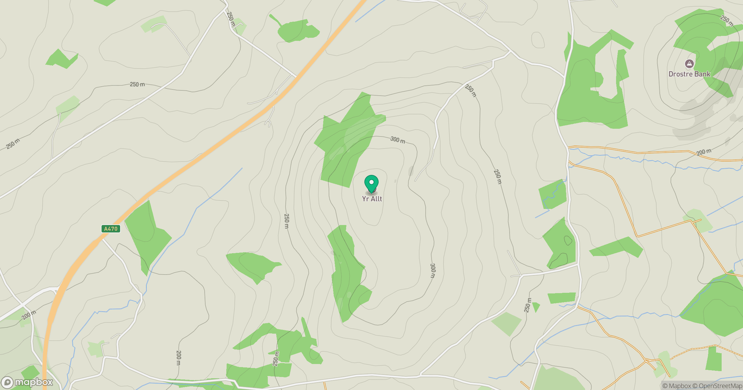
Grid reference: SO085307
View on OpenStreetMapOpens a map in a new tab, centred on the hill.
Hills within 30 km
Straight-line distance, not a walking route or confirmation of access.
No comments yet. Be the first.