

Fan Gyhirych
Good walks are even better shared.
SN8819 : View north from Fan Gyhirych
Gareth James Photo source
Overview
Exploring Fan Gyhirych
Fan Gyhirych, sitting proudly in the Brecon Beacons, is a Marilyn that offers not just a pleasant climb but a visual feast for nature enthusiasts. Whether you're a seasoned hiker or a casual stroller, the allure of its sweeping views and cheerful vibes make it a popular spot.
Geology
As you navigate this stunning landscape, the fascinating geology becomes apparent. The area is shaped from Old Red Sandstone, presenting a beautiful tapestry of worn rocks and verdant hills. Geology buffs will revel in the diverse rock formations, each telling a story of ancient landscapes.
Routes and Ascent
The most favoured route begins at Storey Arms, a handy starting point complete with parking and a café—ideal for those in need of a caffeine fix before tackling the ascent. The path leads you through breath-taking valleys, with the occasional rocky patch to scramble over. Ensure you pause to admire the beauty around you; after all, it's not a race!
Summit Features
Upon reaching the summit, you'll be greeted by the sturdy trig point—perfect for snapping a photo to make your friends jealous! The expansive views stretch across the hauntingly beautiful Welsh countryside, showcasing nature in all her glory.
Views
The vistas from Fan Gyhirych are simply out of this world. On a clear day, you could wave hello to the Black Mountains and take in the lush valleys below. The best time to visit? Either during the vibrant bloom of late spring or when the autumn leaves tickle the senses with their colours. What’s not to love?
Hazards
As with any mountain adventure, care must be taken. The weather can change faster than you can say 'brolly', and slippery rocks after rain can bring a few surprises. Always check the forecast and ensure you have appropriate gear.
Nearby Summits
You can easily extend your adventure to nearby Fan Fawr, which boasts an even higher elevation for those wanting to add another notch to their hiking belt.
Access & Facilities
Getting here is a cinch, with ample parking at Storey Arms, just waiting for your trusty steed (or car). Brecon is a stone's throw away and offers all the amenities you might need after a long day of exploration, including a hearty meal and a pint.
In conclusion, Fan Gyhirych is a delight for walkers of all types. Enjoy your expedition, respect the countryside, and don’t forget, there’s no such thing as bad weather, just inappropriate clothing! Happy hiking!
Explore routes near Fan Gyhirych
Walks starting near this hill. Open a route to check its map, distance and full itinerary.
Aircraft Crash Site - Wellington Bomber and Vampire Jet (Black Mountain range)
View route
Usk Reservoir: Glasfynydd Forest and Dam Circuit
View route
Pen y Fan via Corn Du from Storey Arms
View route
Brecon Basin to Brynich Aqueduct: Canal Towpath Walk
View route
Route planning notes
These notes describe possible approaches. Check a route's map and access information when planning your walk.
Fan Gyhirych via Maen Madoc and Ogof Ffynnon Ddu
This popular route starts at the car park near Maen Madoc, following the Beacons Way trail past the ancient standing stone. The route then ascends gradually toward Fan Gyhirych, offering stunning views of the Fforest Fawr Geopark. On the descent, walkers can explore the Ogof Ffynnon Ddu Nature Reserve, home to one of the largest cave systems in the UK.
Fan Gyhirych Circular via Sarn Helen Roman Road
This route begins at Craig-y-Nos Country Park and follows the historic Sarn Helen Roman road, offering a mix of ancient history and scenic beauty. The path climbs steadily to the summit of Fan Gyhirych before looping back through open moorland and quiet valleys.
Fan Gyhirych Direct Ascent from Blaen Llia
Starting from the Blaen Llia car park, this shorter but steeper route provides a more direct ascent to Fan Gyhirych. The path climbs through grassy slopes and rugged terrain, making it ideal for those looking for a more challenging but rewarding hike.
Fan Gyhirych and Fan Nedd Ridge Walk
A longer ridge walk that connects Fan Gyhirych with neighboring Fan Nedd. Starting at the lay-by near SN923164, this route follows a mix of grassy paths and open ridges, offering breathtaking panoramic views of the Brecon Beacons National Park.
Fan Gyhirych and Cribarth Exploration
This adventurous route begins at the Black Mountain Quarries and combines the ascent of Fan Gyhirych with a visit to the dramatic limestone crags of Cribarth. The varied terrain includes open moorlands, rocky outcrops, and historical quarry sites.
Make a day of it, together
Find someone to share the walk with, or organise a day out along a route you like.
Photo Gallery
View all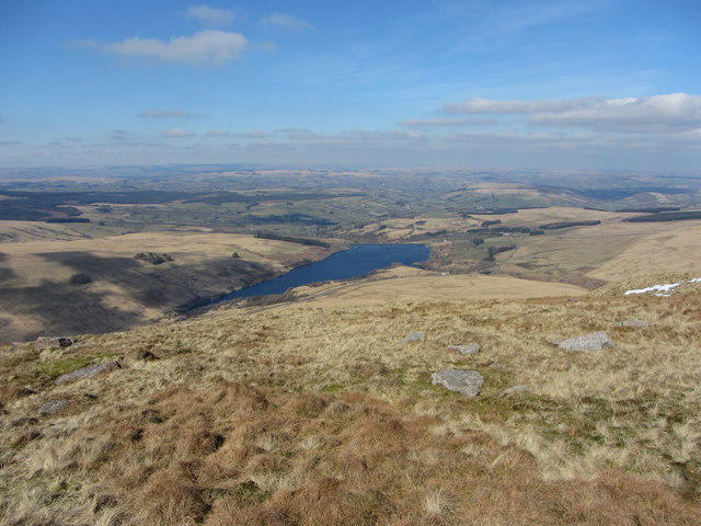 Photo could not load
SN8819 : View north from Fan Gyhirych
Gareth James
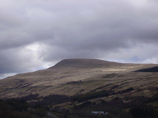 Photo could not load
SN8819 : Fan Gyhirych
Geraint Smith
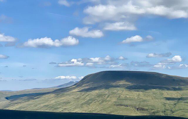 Photo could not load
SN8819 : Fan Gyhirych
Alan Hughes
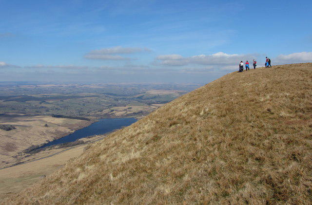 Photo could not load
SN8719 : Walkers on the edge of Fan Gyhirych
Gareth James
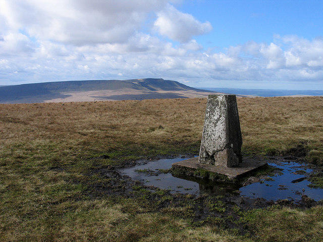 Photo could not load
SN8819 : Summit area of Fan Gyhirych
Trevor Littlewood
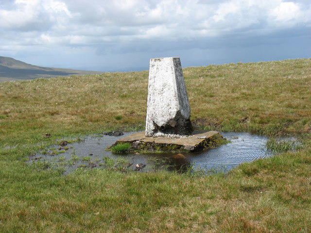 Photo could not load
SN8819 : Fan Gyhirych: the trig point in the moat
David Purchase
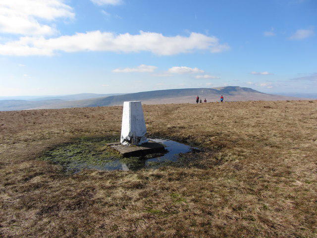 Photo could not load
SN8819 : Trig Point on Fan Gyhirych, looking west
Gareth James
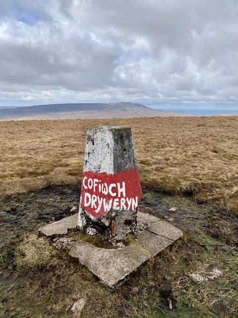 Photo could not load
SN8819 : Dilapidated trig point on Fan Gyhirych
Alan Hughes
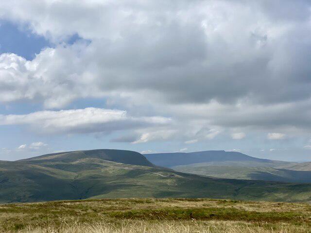 Photo could not load
SN8819 : Fan Gyhirych
Alan Hughes
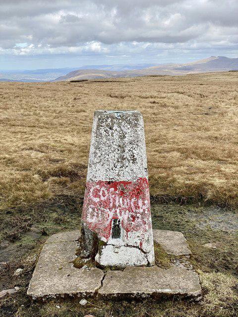
SN8819 : Trig point on Fan Gyhirych
Alan Hughes
Hill facts and local notes
Classifications
Elevation
726m
2,382 ft
Prominence
282m
Coordinates
51.8594, -3.6270
SN880191
OS Map
160
Explorer: OL12W
At the Summit
The summit features a prominent trig point, which offers a handy point of reference for those trying to avoid anyone asking for directions; it’s a bit of a local landmark!
Terrain & Geology
Fan Gyhirych is primarily composed of Old Red Sandstone, lending its rugged appearance and weathered crags. The geology presents a magnificent array of exposed rock formations, making it a haven for amateur geologists.
Views & Scenery
From the summit, behold views over the expansive Brecon Beacons and the distant Welsh valleys, including Monmouthshire and the Black Mountains.
History & Heritage
Name Origin
The name 'Fan Gyhirych' is derived from Welsh, meaning 'Peak of the Socks', thought to refer to the mist or low clouds that often 'sock' in the mountain.
Historical Significance
Historically, the area has been a meeting ground for various cultures, including ancient grazing rights for local sheep farmers.
Getting There & Facilities
Parking
The Storey Arms car park (SN 980 191) offers ample parking, with facilities near by and a friendly café for a pre-walk brew.
Public Transport
Regular bus services from Cardiff and nearby towns to Brecon, followed by a taxi or a brisk walk to the car park.
Nearby Facilities
The Storey Arms Café offers toilets, and you can grab a snack or a warm drink before or after your hike.
Safety Information
Known Hazards
- Be mindful of changing weather conditions, and the rocky terrain can be slippery when wet.
General Safety Tips
- Check weather conditions before setting out
- Carry appropriate clothing and equipment
- Let someone know your planned route
- Take a map, compass, and GPS device
- Carry emergency supplies: food, water, first aid kit, torch
Hills
Some common questions about the hills answered
Are there group walks up Fan Gyhirych?
Many walkers use Walkmates to join or organise walks with others. You can check for group walks around Fan Gyhirych through the maps
Are there other walkers around Fan Gyhirych?
Activity varies by location and time, but Walkmates lets you see whether others have shared walks or shown interest in this area. Find other people through the walking friends search walking friends for Fan Gyhirych search or of course create your own walk for Fan Gyhirych
Can I organise a walk to Fan Gyhirych?
Yes. If there aren’t any walks listed already, you can create a walk and make it available for others to join.
If you're signed up to Walkmates, you can create a walk to Fan Gyhirych.
How do I find a walk up this hill?
There are often multiple ways to walk this hill, depending on experience and route preference. Walkmates helps you explore walks and routes that others have shared.
Can I suggest a new route up Fan Gyhirych?
Yes. You can suggest or create routes to share with others. Walkmates focuses on the social side of walking, so routes are used to help people organise walks and explore areas together, rather than as detailed navigation tools or route libraries.
Other uses really appreciate knowledgeable walkers sharing their routes. Share your favourite route to Fan Gyhirych here
The is an error or something incorrect about this hill. How do I let you know?
We always strive to keep the information on Walkmates as accurate as possible. If you find an error, please let us know through the contact form and we'll aim to correct it as quickly as possible
Community Discussion
Comments
Location
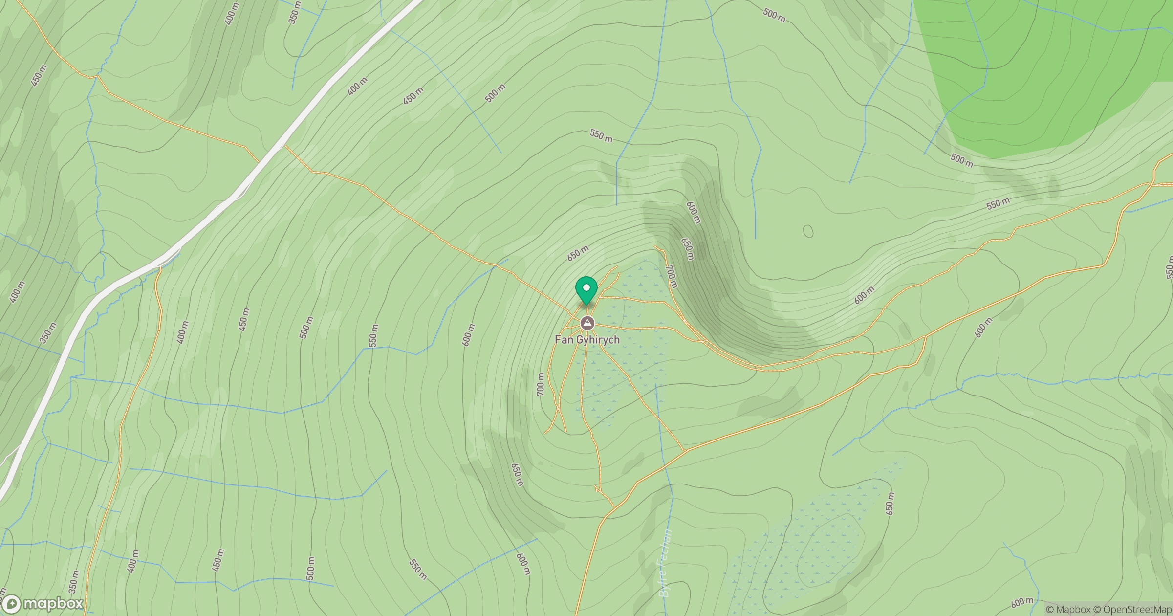
Grid reference: SN880191
View on OpenStreetMapOpens a map in a new tab, centred on the hill.


No comments yet. Be the first.