

Pen y Fan
Good walks are even better shared.
SO0121 : On the summit plateau of Pen y Fan in the Brecon Beacons
Jeremy Bolwell Photo source
Overview
Pen y Fan is an 886-metre mountain in Powys and the highest point in South Wales. Routes range from the popular Pont ar Daf approach to longer northern and Neuadd circuits, all requiring preparation for exposed mountain conditions.
Pen y Fan
Pen y Fan rises to 886 metres in Powys, in the central Bannau Brycheiniog (Brecon Beacons). It is the highest mountain in South Wales. DoBIH records 672 metres of prominence and identifies a large cairn as the summit feature. Its classifications include Marilyn, Simm, Hewitt and Nuttall, as well as county-top categories. The broad summit has Bronze Age burial-cairn remains and a National Trust marker. DoBIH · British Geological Survey · National Park archaeology
Choosing a route
These are route summaries, not turn-by-turn navigation. Choose a complete itinerary and carry suitable mapping.
- Pont ar Daf and Storey Arms circuit: the National Trust publishes 6.4 km and 3½ hours. From Pont ar Daf, SN988199, climb to Bwlch Duwynt and continue below Corn Du to Pen y Fan. Return over Corn Du and via the Tommy Jones memorial area, Blaen Taf Fawr and Y Gyrn to Storey Arms, then follow the connecting path back. This is a mountain walk with steep sections. National Trust route
- Horseshoe Ridge from Taf Fechan/Neuadd: the National Trust’s itinerary starts at SO038169, passes Lower Neuadd and climbs Graig Fan Ddu before crossing Corn Du, Pen y Fan and Cribyn. It returns south on Gap Road and is published as 16 km and 5–6 hours. The described route does not climb Fan y Big; extensions and different forest starts need their own totals. National Trust horseshoe
- Cwm Gwdi and Cefn Cwm Llwch: the northern ridge gives a steep out-and-back, published at about 7.5–8 km. It does not pass Llyn Cwm Llwch. A circuit over Corn Du and down past the lake is a different, longer walk. Wild Trails Wales · Ramblers routes
- Eastern Neuadd approach: a published out-and-back follows Gap Road to Bwlch ar y Fan, bypasses Cribyn on its southern side, and climbs Craig Cwm Sere to Pen y Fan. Wild Trails Wales estimates 12 km; the final climb is steep, with a brief hands-on rocky section. Route guide
The general Neuadd and Taf Fechan labels cover overlapping approaches. They should not be treated as additional fixed-length circuits without an exact start, summit sequence and return.
Rock, landscape and views
The mountain’s Devonian rocks belong to the Old Red Sandstone grouping. Sandstone and siltstone of the Brownstones Formation lie below the more resistant Pen y Fan Formation, which helps form the flat summit profile. Glaciers later reshaped the valleys and steep northern faces. Llyn Cwm Llwch lies in a glacial hollow below the peaks. British Geological Survey · BGS rock-unit definition
On a clear day the panorama includes the Black Mountains, other mountains of mid and south Wales, the Severn Estuary and parts of south-west England. Visibility depends on the day’s weather; no season guarantees the best view. Nearby summit heights in current DoBIH are Corn Du 871.5 m, Cribyn 793.8 m and Fan Frynych 628.3 m. Older visitor guides often use different rounded or superseded figures. National Trust landscape guide · DoBIH
Getting there
Pont ar Daf on the A470 is the main western trailhead; Cwm Gwdi serves the northern ridge. Both National Trust car parks charge non-members. Use designated spaces and check current arrangements. Public toilets are at Pont ar Daf, with no facilities at the summit. Bring food and water; the Trust advises that there is no water-bottle refill point at Pont ar Daf. Current visitor information · National Trust planning advice
The T4 links Merthyr Tydfil, Brecon and Newtown, with a stop at Storey Arms. Check the operator’s current timetable, service notices and return journey before travelling. T4 service · Visit Wales access guide
Safety and conservation
Steep edges, loose or wet footing, strong winds and low cloud can make even the popular paths serious. Know how to navigate and select the correct descent. Carry waterproofs, warm layers, food, water and a torch, and leave your route and return plan with someone. Keep dogs on short leads around livestock and ground-nesting birds, stay on established paths and take litter home. Mountain safety advice
Snow and ice require suitable winter skills and equipment, potentially including an ice axe and compatible crampons. Assess the forecast and ground conditions, allow for short daylight and turn back if the route exceeds your skills or equipment. BMC winter advice · Winter preparation
Name and history
English interpretations of the Welsh name vary, including the mountain’s peak and the beacon’s summit. The summit cairn is part of the area’s Bronze Age funerary landscape. Cwm Gwdi was a Victorian military training area and passed into National Trust care in 1996. UKHillwalking on the name · National Park archaeology · National Trust history
Explore routes near Pen y Fan
Walks starting near this hill. Open a route to check its map, distance and full itinerary.
Pen y Fan via Corn Du from Storey Arms
View route
Brecon Basin to Brynich Aqueduct: Canal Towpath Walk
View route
A Very Merry Winter Walk ending with Cake & a Hot Drink!
View route
Merthyr Tydfil with Men Walking & Talking
View route
Route planning notes
These notes describe possible approaches. Check a route's map and access information when planning your walk.
Pont ar Daf and Storey Arms circuit via Pen y Fan and Corn Du
Start at Pont ar Daf car park, SN988199. Climb to Bwlch Duwynt and traverse below Corn Du to Pen y Fan. Return over Corn Du, descend towards the Tommy Jones memorial, then cross Blaen Taf Fawr and Y Gyrn to Storey Arms; use the connecting path back to Pont ar Daf. The National Trust publishes 6.4 km and 3.5 hours for this circuit. Steep steps, exposed edges and poor visibility require care.
Horseshoe Ridge from Taf Fechan: Corn Du, Pen y Fan and Cribyn
The National Trust circuit starts at Taf Fechan/Neuadd car park, SO038169. Pass Lower Neuadd, climb Graig Fan Ddu and follow the ridge over Corn Du and Pen y Fan. Descend Craig Cwm Sere, climb Cribyn, then descend to Gap Road and follow it south to the start. NT estimates 16 km and 5–6 hours. Its described route does not climb Fan y Big. Steep climbs, rocky descents and boggy ground make this a demanding day.
Cwm Gwdi via Cefn Cwm Llwch (out and back)
From Cwm Gwdi car park, SO024248, climb onto Cefn Cwm Llwch and follow the northern ridge to Pen y Fan; return the same way. The upper section is steep, with rocky steps that may need hands. Wild Trails Wales estimates 7.5 km; Ramblers rounds this out-and-back to about 8 km. This ridge route does not pass Llyn Cwm Llwch. Adding Corn Du and a descent past the lake creates a longer circuit that needs its own mapped return.
Neuadd valley circuits (variant planning note)
The original Neuadd entry overlaps the Horseshoe Ridge circuit: Graig Fan Ddu, Corn Du, Pen y Fan, Cribyn and Gap Road. Other versions add Fan y Big or start at different forest car parks. This note does not define a second measured circuit. Choose the exact trailhead, summit list and return on a map; published variants are not interchangeable.
Neuadd via Gap Road and Craig Cwm Sere (out and back)
From Neuadd car park follow Gap Road along the eastern side of the valley to Bwlch ar y Fan. Use the path below Cribyn’s southern flank, then climb Craig Cwm Sere to Pen y Fan. Return the same way. Wild Trails Wales publishes about 12 km for this out-and-back. The final ascent is steep, with a brief hands-on rocky section; this is a mountain route, not a gentle forest walk.
Make a day of it, together
Find someone to share the walk with, or organise a day out along a route you like.
Photo Gallery
View all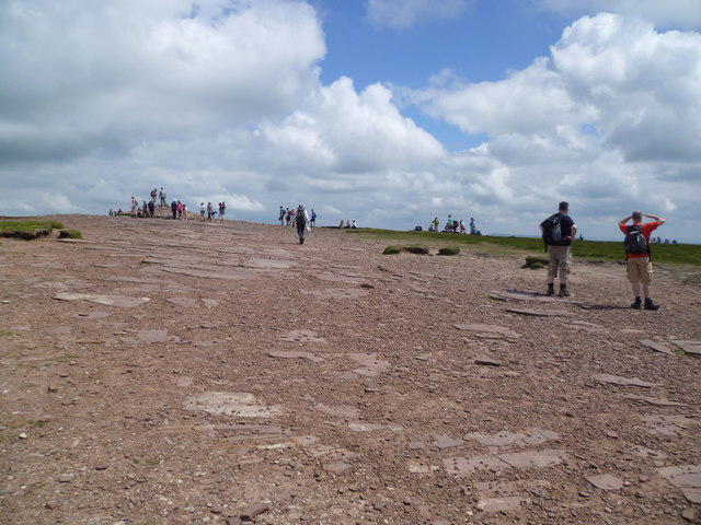 Photo could not load
SO0121 : On the summit plateau of Pen y Fan in the Brecon Beacons
Jeremy Bolwell
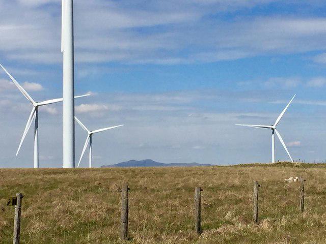 Photo could not load
SO0121 : Pen y Fan
Alan Hughes
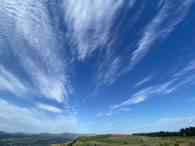 Photo could not load
SO0121 : Big sky above the Brecon Beacons
Alan Hughes
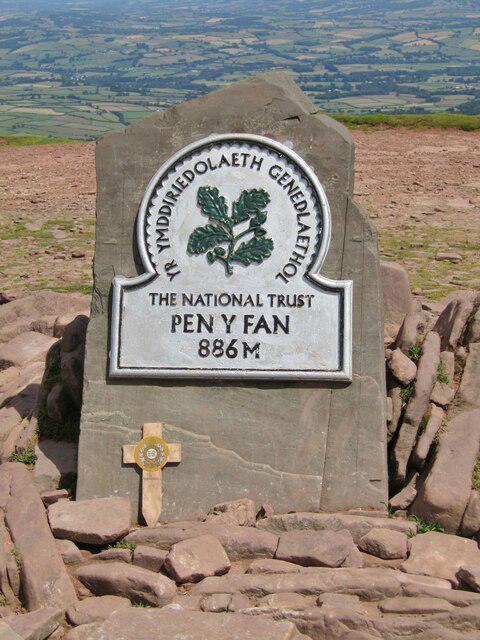 Photo could not load
SO0121 : Pen y Fan - 886m amsl
Colin Smith
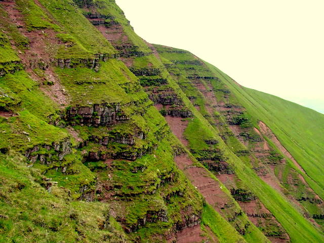 Photo could not load
SO0121 : Western Slopes of Pen y Fan
George Tod
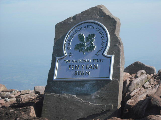 Photo could not load
SO0121 : New National Trust summit marker
Paul Warren
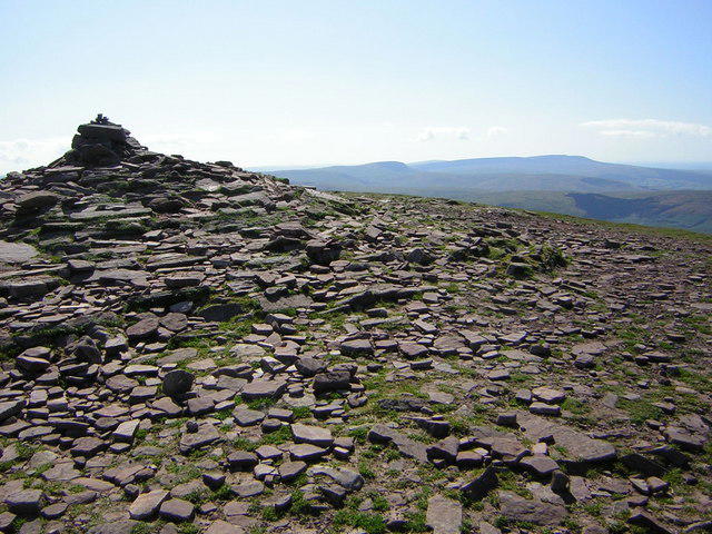 Photo could not load
SO0121 : The summit of Pen y Fan
Kenneth Yarham
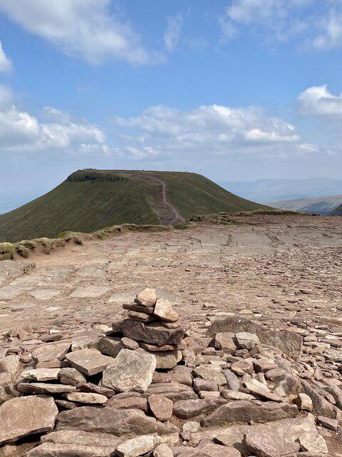 Photo could not load
SO0121 : Pen y Fan from Corn Du
Alan Hughes
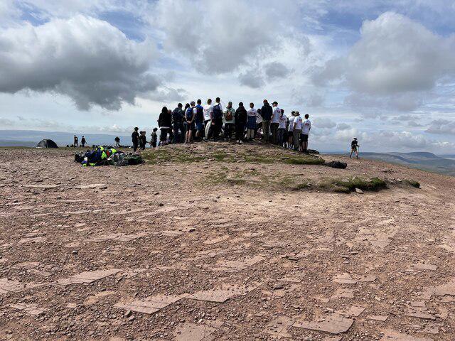 Photo could not load
SO0121 : Charity walkers on the summit of Pen-y-Fan 2907' / 886m
John H Darch
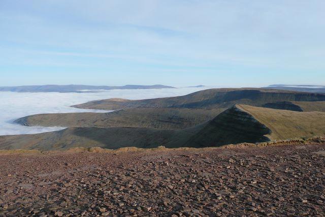
SO0121 : Top of Southern Britain on New Year's Eve - east-north-east
Graham Horn
Hill facts and local notes
Classifications
Elevation
886m
2,907 ft
Prominence
672m
Coordinates
51.8840, -3.4368
SO012215
OS Map
160
Explorer: OL12E
At the Summit
A large cairn marks the broad summit, with Bronze Age burial-cairn remains and a National Trust summit plaque. DoBIH records the summit feature as a large cairn.
Terrain & Geology
Pen y Fan is underlain by Devonian rocks within the Old Red Sandstone grouping. Sandstone and siltstone of the Brownstones Formation are overlain by the more resistant Pen y Fan Formation, helping create the flat summit profile. Later glaciation reshaped the valleys and steep northern faces; Old Red Sandstone is a rock grouping, not a geological period.
Views & Scenery
From the summit, you can see the Black Mountains to the east and the vast landscape of South Wales, including the Severn Estuary on a clear day.
History & Heritage
Name Origin
English interpretations of the Welsh name vary, including “the mountain’s peak” and “the beacon’s summit”. A single literal translation is not universally agreed.
Historical Significance
The summit preserves a Bronze Age burial cairn, part of a wider prehistoric funerary landscape on the high ridges. Cwm Gwdi below the mountain was a Victorian military training area; the National Trust took it into its care in 1996.
Getting There & Facilities
Parking
Pont ar Daf National Trust car park on the A470, SN988199, is the main western trailhead. Cwm Gwdi, SO024248, serves the northern approach; Taf Fechan/Neuadd, SO038169, is the National Trust horseshoe start. Pont ar Daf and Cwm Gwdi charge non-members. Use designated spaces and check current charges and access before travel.
Public Transport
The T4 between Merthyr Tydfil, Brecon and Newtown stops at Storey Arms, beside the western walking approaches. Check TrawsCymru for current timetables, service notices and the last return bus. Northern and Neuadd starts need separate transport planning.
Nearby Facilities
Public toilets are at Pont ar Daf car park. There are no facilities at the summit. Bring food and water: the National Trust advises that Pont ar Daf has no water-bottle refill point. Do not rely on access to the Storey Arms education centre’s facilities.
Safety Information
Known Hazards
- Steep escarpment drops and rocky steps require care, especially in strong winds or poor visibility.
- Low cloud can obscure junctions and descent routes; carry a map and compass and know how to use them.
- Wet rock, mud and boggy sections can be slippery; extended ridge circuits add substantial ascent and descent.
- The popular western paths are still mountain routes. Choose a walk suited to the group and conditions, and be ready to turn back.
Seasonal Hazards
Snow and ice can make the steep paths and escarpments hazardous. Winter conditions require appropriate skills and equipment, including competent ice-axe and crampon use when needed. Check a mountain forecast and ground conditions, allow for short daylight and do not rely on summer timings.
General Safety Tips
- Check weather conditions before setting out
- Carry appropriate clothing and equipment
- Let someone know your planned route
- Take a map, compass, and GPS device
- Carry emergency supplies: food, water, first aid kit, torch
Hills
Some common questions about the hills answered
Are there group walks up Pen y Fan?
Many walkers use Walkmates to join or organise walks with others. You can check for group walks around Pen y Fan through the maps
Are there other walkers around Pen y Fan?
Activity varies by location and time, but Walkmates lets you see whether others have shared walks or shown interest in this area. Find other people through the walking friends search walking friends for Pen y Fan search or of course create your own walk for Pen y Fan
Can I organise a walk to Pen y Fan?
Yes. If there aren’t any walks listed already, you can create a walk and make it available for others to join.
If you're signed up to Walkmates, you can create a walk to Pen y Fan.
How do I find a walk up this hill?
There are often multiple ways to walk this hill, depending on experience and route preference. Walkmates helps you explore walks and routes that others have shared.
Can I suggest a new route up Pen y Fan?
Yes. You can suggest or create routes to share with others. Walkmates focuses on the social side of walking, so routes are used to help people organise walks and explore areas together, rather than as detailed navigation tools or route libraries.
Other uses really appreciate knowledgeable walkers sharing their routes. Share your favourite route to Pen y Fan here
The is an error or something incorrect about this hill. How do I let you know?
We always strive to keep the information on Walkmates as accurate as possible. If you find an error, please let us know through the contact form and we'll aim to correct it as quickly as possible
Community Discussion
Comments
Location
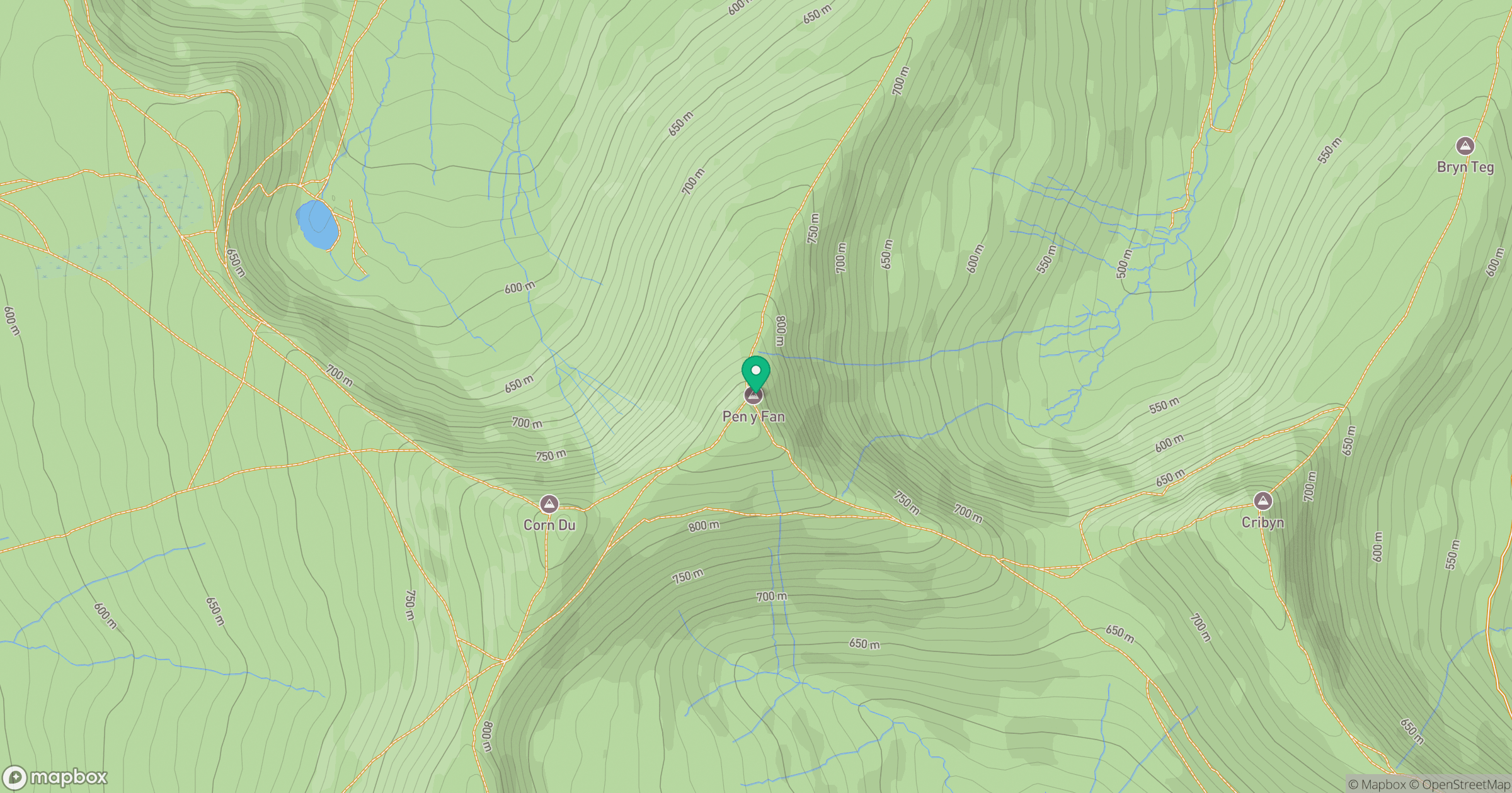
Grid reference: SO012215
View on OpenStreetMapOpens a map in a new tab, centred on the hill.


No comments yet. Be the first.