
Moel Fenni Fach
Good walks are even better shared.
Overview
Moel Fenni Fach: The Little Mountain with a Big Heart
Nestled in the idyllic Brecon Beacons National Park, Moel Fenni Fach stands its ground at 469 meters above sea level. This quaint hill is a popular haunt for hikers seeking stunning views without the exhaustive challenges found on nearby giants.
Geology
Made predominantly of Old Red Sandstone, Moel Fenni Fach is a geologist's delight. Formed in the Devonian period, these sandy sediments have weathered beautifully over time, creating a splendid tapestry of rolling hills that captivate both the eye and the camera.
Routes
Garn Trefin Trail
One of the most favoured routes begins at Taff's Well, an easy and agreeable path that bursts with greenery. Prepare for a 5.4 km round trip that will take about 2.5 hours—perfect for those who fancy a mix of nature and a little cardio workout.
Summit Features
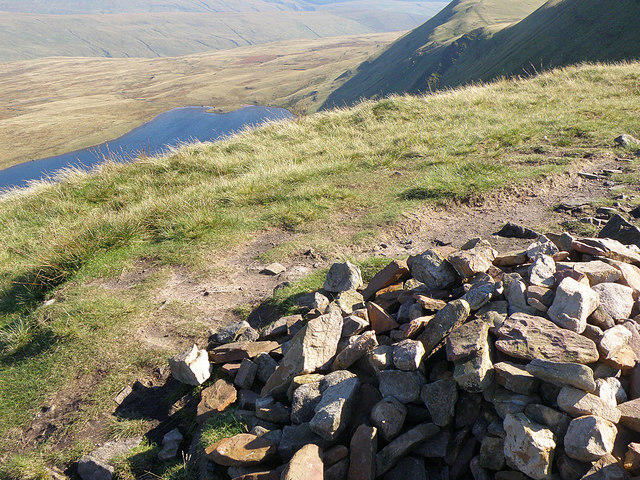
When you finally reach the gentle summit, be greeted by a humble cairn—a pile of stones that whispers tales of those who've come before. Don’t forget to snap that classic summit photo to show off your triumph!
Terrain
The terrain is predominantly grassy, making your ascent feel more like a stroll in a garden than a mountain climb. But watch your step as there are pockets of rocky outcrops ready to catch you unawares.
Views
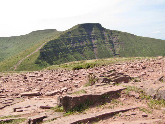
The summit rewards you with breathtaking views of the Brecon Beacons, notably Pen y Fan, appearing majestic in the distance. Ideally, plan your hike during spring or early autumn, when the scenery is dressed in vibrant hues and the air is clear.
Hazards
As delightful as the hike is, watch for patches of mud along the trail, especially after a rain shower. A slip here and there is part of the adventure—just make sure your sense of balance is sharper than your camera’s focus!
Nearby Summits
Take a moment to glance over at Moel Fenni, its slightly taller sibling at 508 meters. Who knows, you might just feel inspired for another round!
Access
Parking can be a tad limited, with the nearest lay-by located along the A4059 road. If public transport is more your style, head to Taff's Well for a bus that gets you close to the trailhead.
Facilities
Post-hike, indulge at a quaint café in Taff's Well—treat yourself to coffee and cake; you’ve earned it! Restrooms are also conveniently located nearby.
History
The mountain's name drips with rich heritage. 'Moel' simply means 'hill' in Welsh, while 'Fenni' references the river that meanders through the region. The hills have long been a part of local lore, adding depth to your adventure.
Conclusion
Moel Fenni Fach may be small, but it offers a hefty dose of charm, view, and a sense of accomplishment. So lace up those hiking boots, grab a friend, and get ready to explore this delightful hill!
Explore routes near Moel Fenni Fach
Public walks starting within 80 km of this hill. Nearby does not mean a route reaches the summit; check its map and access before setting out.
Brecon Basin to Brynich Aqueduct: Canal Towpath Walk
View route
World Curlew Day Walk and Talk at Mynydd Illtud
View route
Pen y Fan via Corn Du from Storey Arms
View route
A Very Merry Winter Walk ending with Cake & a Hot Drink!
View route
Route planning notes
These notes describe possible approaches, not verified navigable routes or permission to cross land. Check current paths, local access rules and conditions before setting out.
Garn Trefin Trail
A lovely route starting from the village of Taff's Well, leading you through lush greenery before tackling the gentle ascent to Moel Fenni Fach.
Make a day of it, together
Find someone to share the walk with, or organise a day out along a route you like.
Hill facts and local notes
Classifications
Elevation
290m
951 ft
Prominence
110m
Coordinates
51.9549, -3.4355
SO014294
OS Map
160
Explorer: OL12E
At the Summit
The summit is marked by a modest cairn and offers a panoramic view, perfect for a victory pose or a candid ‘I’m on top of the world’ photo!
Terrain & Geology
Moel Fenni Fach is primarily composed of Old Red Sandstone, formed during the Devonian period. This sedimentary rock gives rise to the area's distinct rolling hills and vibrant colouration.
Views & Scenery
From the summit, one can see the stunning vistas of the Brecon Beacons, including Pen y Fan and the sprawling valleys below.
History & Heritage
Name Origin
The name 'Moel' is derived from the Welsh word for 'hill', while 'Fenni' refers to the river Fenni, reflecting the landscape's geography.
Historical Significance
The area has rich historical ties, with evidence of ancient settlements and significant cultural folklore surrounding the Brecon Beacons.
Getting There & Facilities
Check current local access restrictions, parking rules and transport timetables before travelling. These notes do not confirm public access to the summit.
Parking
There is a lay-by along the A4059 road, approximately 1 km from the starting point. Limited parking available.
Public Transport
The nearest bus stop is in Taff's Well, with regular services connecting to larger towns.
Nearby Facilities
There's a lovely café in Taff's Well where you can refuel post-hike, plus public toilets available nearby.
Safety Information
Known Hazards
- Watch out for mud and wet areas, especially after rain. Slippery trails can test your balance skills.
General Safety Tips
- Check weather conditions before setting out
- Carry appropriate clothing and equipment
- Let someone know your planned route
- Take a map, compass, and GPS device
- Carry emergency supplies: food, water, first aid kit, torch
Hills
Some common questions about the hills answered
Are there group walks up Moel Fenni Fach?
Many walkers use Walkmates to join or organise walks with others. You can check for group walks around Moel Fenni Fach through the maps
Are there other walkers around Moel Fenni Fach?
Activity varies by location and time, but Walkmates lets you see whether others have shared walks or shown interest in this area. Find other people through the walking friends search walking friends for Moel Fenni Fach search or of course create your own walk for Moel Fenni Fach
Can I organise a walk to Moel Fenni Fach?
Yes. If there aren’t any walks listed already, you can create a walk and make it available for others to join.
If you're signed up to Walkmates, you can create a walk to Moel Fenni Fach.
How do I find a walk up this hill?
There are often multiple ways to walk this hill, depending on experience and route preference. Walkmates helps you explore walks and routes that others have shared.
Can I suggest a new route up Moel Fenni Fach?
Yes. You can suggest or create routes to share with others. Walkmates focuses on the social side of walking, so routes are used to help people organise walks and explore areas together, rather than as detailed navigation tools or route libraries.
Other uses really appreciate knowledgeable walkers sharing their routes. Share your favourite route to Moel Fenni Fach here
The is an error or something incorrect about this hill. How do I let you know?
We always strive to keep the information on Walkmates as accurate as possible. If you find an error, please let us know through the contact form and we'll aim to correct it as quickly as possible
Community Discussion
Comments
Location
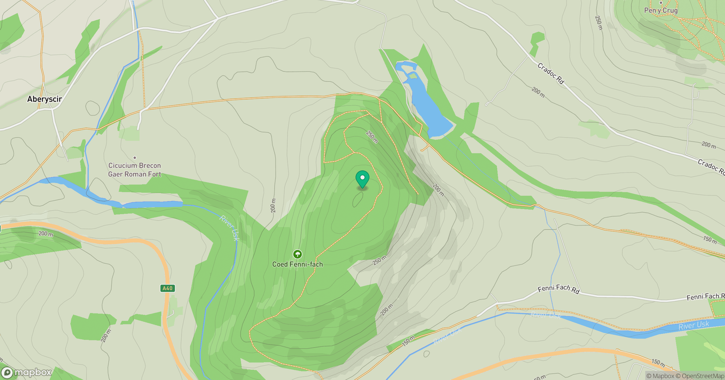
Grid reference: SO014294
View on OpenStreetMapOpens a map in a new tab, centred on the hill.
Hills within 30 km
Straight-line distance, not a walking route or confirmation of access.
No comments yet. Be the first.