

Mynydd Sylen
Good walks are even better shared.
Overview
Mynydd Sylen: An Explorer's Delight
Mynydd Sylen, standing proudly at 314 meters, is a quaint yet compelling hill located in the stunning Brecon Beacons National Park.
Geology
Mynydd Sylen's character is sculpted by its sandstone and mudstone, remnants of the Mesozoic era’s titanic geological shifts. This creates not only an interesting terrain for hiking but also serves as a natural history lesson for the geology buffs amongst us.
Routes
The Mynydd Sylen Circular is the recommended route, stretching about 8.5 km. This moderately challenging hike not only takes you up to the summit but also showcases scenic panoramic views. Expect to spend around 3.5 hours wandering through nature’s artwork. You might even spot a sheep or two considering they are the honorary guides of the Welsh valleys!
Summit Features
Reaching the summit, you'll find a modest cairn and a trig point - the perfect spots for a triumphant selfie! Just remember, no summits were conquered without some effort.
Terrain
The terrain is predominantly grassy with some rocky sections. While not overly technical, it does demand a bit of attention, especially if you want to maintain your dignity and not end up resembling a sheep tumbling down a hill!
Views
As you traverse the hills, prepare for jaw-dropping views. On clear days, the vistas stretch across the Brecon Beacons and reveal glimpses of the magnificent Black Mountains. Plan your hike for spring or autumn for maximum visual splendour.
Hazards
While the paths are generally accessible, caution is advised after rainfall as they can become quite slippery. Keep an eye out for wandering livestock that may decide to share your trail!
Access
Accessing Mynydd Sylen is straightforward. There's a small parking space in Clydach at SN503110, and regular bus services from Swansea make it an easy trip if you prefer public transport.
Facilities
Once you’ve completed your hike, you can find various cafes and local facilities in the village of Clydach, ensuring you can refresh yourself after that well-deserved adventure.
History
The name Mynydd Sylen translates as 'Sullen Mountain'. This name may reflect the often unpredictable nature of Welsh weather, which can dramatically change in an instant, much like our moods during a rainy day! This mountain has been a part of Welsh folklore and history, contributing to the rich tapestry of culture.
In conclusion, Mynydd Sylen is both an accessible choice for those new to hiking and a delightful exploration for seasoned walkers looking to enjoy the beauty of the Brecon Beacons. So lace up those boots and set forth on a little piece of Welsh magic!
Explore routes near Mynydd Sylen
Public walks starting within 80 km of this hill. Nearby does not mean a route reaches the summit; check its map and access before setting out.
Llanelli North Dock to Burry Port Harbour Coastal Walk
View route
Llanelli North Dock to Machynys Point and Wetland Centre
View route
Llanelli warden-led wildlife walk
View route
Llanelli warden-led wildlife walk
View route
Route planning notes
These notes describe possible approaches, not verified navigable routes or permission to cross land. Check current paths, local access rules and conditions before setting out.
Mynydd Sylen Circular
A scenic circular route starting from the village of Clydach, offering panoramic views as you ascend.
Make a day of it, together
Find someone to share the walk with, or organise a day out along a route you like.
Photo Gallery
View all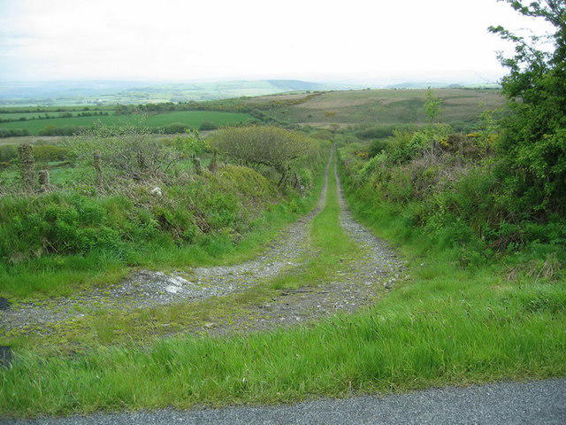 Photo could not load
SN5107 : Heol Cwm Twcwr Access Road
Alan Richards
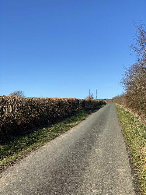 Photo could not load
SN5107 : Mynydd Sylen
Alan Hughes
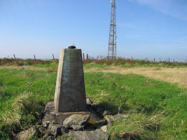 Photo could not load
SN5108 : Mynydd Sylen
Rude Health
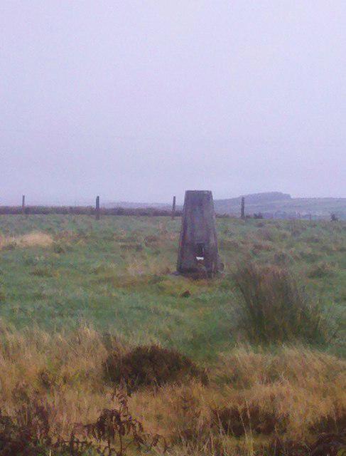 Photo could not load
SN5108 : Mynydd Sylen trig point
Mama Herb
Hill facts and local notes
Classifications
Elevation
284m
932 ft
Prominence
215m
Coordinates
51.7511, -4.1522
SN515080
OS Map
159
Explorer: 178
At the Summit
The summit features a modest cairn and a small trig point, both excellent for a photo op or simply to claim your conquest of this pleasing hill.
Terrain & Geology
Mynydd Sylen consists mainly of sandstone and mudstone, reflecting the rich geological processes that shaped the South Wales region. These rocks date back to the Mesozoic era, making them fascinating for geological exploration and study.
Views & Scenery
On a clear day, you can observe the rolling hills of the Brecon Beacons and as far as the Black Mountains to the north.
History & Heritage
Name Origin
The name 'Mynydd Sylen' translates to 'Sullen Mountain' in English, possibly reflecting the often moody Welsh weather.
Historical Significance
This area is steeped in local folklore, and its position in the Brecon Beacons has played a role in the culture and economy of the region.
Getting There & Facilities
Check current local access restrictions, parking rules and transport timetables before travelling. These notes do not confirm public access to the summit.
Parking
There is a small parking area in Clydach at SN503110, suitable for around 5-6 cars.
Public Transport
Regular bus services operate to Clydach from nearby towns like Swansea and Merthyr Tydfil.
Nearby Facilities
The nearest facilities such as cafes and toilets can be found in the village of Clydach, approximately 2 km from the parking area.
Safety Information
Known Hazards
- Be cautious of slippery paths, especially after rain, and keep an eye out for livestock in the fields.
General Safety Tips
- Check weather conditions before setting out
- Carry appropriate clothing and equipment
- Let someone know your planned route
- Take a map, compass, and GPS device
- Carry emergency supplies: food, water, first aid kit, torch
Hills
Some common questions about the hills answered
Are there group walks up Mynydd Sylen?
Many walkers use Walkmates to join or organise walks with others. You can check for group walks around Mynydd Sylen through the maps
Are there other walkers around Mynydd Sylen?
Activity varies by location and time, but Walkmates lets you see whether others have shared walks or shown interest in this area. Find other people through the walking friends search walking friends for Mynydd Sylen search or of course create your own walk for Mynydd Sylen
Can I organise a walk to Mynydd Sylen?
Yes. If there aren’t any walks listed already, you can create a walk and make it available for others to join.
If you're signed up to Walkmates, you can create a walk to Mynydd Sylen.
How do I find a walk up this hill?
There are often multiple ways to walk this hill, depending on experience and route preference. Walkmates helps you explore walks and routes that others have shared.
Can I suggest a new route up Mynydd Sylen?
Yes. You can suggest or create routes to share with others. Walkmates focuses on the social side of walking, so routes are used to help people organise walks and explore areas together, rather than as detailed navigation tools or route libraries.
Other uses really appreciate knowledgeable walkers sharing their routes. Share your favourite route to Mynydd Sylen here
The is an error or something incorrect about this hill. How do I let you know?
We always strive to keep the information on Walkmates as accurate as possible. If you find an error, please let us know through the contact form and we'll aim to correct it as quickly as possible
Community Discussion
Comments
Location
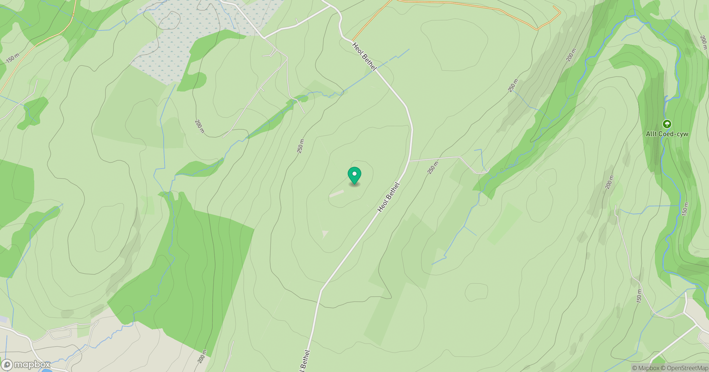
Grid reference: SN515080
View on OpenStreetMapOpens a map in a new tab, centred on the hill.
Hills within 30 km
Straight-line distance, not a walking route or confirmation of access.
Rhossili Down - The Beacon
193m
Mynydd Llangyndeyrn
263m
Banc y Llyn
280m
Cefn Bryn
187m
Llanmadoc Hill
186m
No comments yet. Be the first.