
Pen y Moelfre
Good walks are even better shared.
Overview
Pen y Moelfre: An Outdoor Gem
Nestled in the stunning Snowdonia National Park, Pen y Moelfre offers a delightful hiking experience for adventurers of all levels. Standing at 542 meters, this Marilyn is not the tallest, but it certainly provides a feast for the eyes!
Geology
The mountain is primarily formed from sedimentary rocks that tell the story of ancient shallow seas. This rich geological history adds to the allure of the hike; there’s always something fascinating to observe, whether it be the varied terrain or the unique rock formations that come into view.
Routes
There are a couple of routes to consider:
- Trawsfynydd Route: A gentle ascent starting from Trawsfynydd village, making it perfect for families and those looking for a leisurely stroll.
- Cwm Pen y Moelfre Path: A more demanding trek that rewards you with stunning views and a solid workout. Prepare to huff and puff – but the reward is well worth it!
Summit Features
At the top, you’ll be greeted by a sturdy stone cairn overlooking the scenic views – ideal for that obligatory photo or a well-earned snack.
Terrain Type
The terrain varies from grassy slopes ideal for a gentle stroll, to rocky outcrops that will challenge your footing at times. Sturdy boots are highly recommended!
Views
On clear days, the vistas are splendid, offering sights of Cadair Idris and lush valleys stretching for miles. For the best views, try to time your hike during spring or autumn; the colours are simply magnificent.
Hazards
Weather in this region can be notoriously fickle, so it’s essential to come prepared. Ensure you have waterproof gear and keep an eye on the conditions because what starts as a sunny day can quickly turn into a misty affair.
Access
Getting here is convenient, with parking available at the village of Trawsfynydd. For those utilizing public transport, local buses run from nearby towns such as Bala. Once you arrive and are set to embark, you'll find the local community to be quite welcoming!
Facilities
While you're here, take advantage of the local cafes for a warm cuppa and perhaps even a slice of cake – hiking burns calories, right? Public toilets are also available, keeping your comfort in mind.
History
Pen y Moelfre not only presents a physical challenge but is steeped in local folklore and traditions, making it a fascinating destination for those interested in the culture of the region. The name itself means 'the mountain peak of Moelfre', indicating its significance as a local landmark.
In conclusion, Pen y Moelfre is a delightful destination for hikers looking to immerse themselves in the natural beauty of Snowdonia. Whether you’re a seasoned hiker or just out for a casual walk, this mountain has something for everyone. Happy hiking!
Explore routes near Pen y Moelfre
Public walks starting within 80 km of this hill. Nearby does not mean a route reaches the summit; check its map and access before setting out.
Abergwili to Nantgaredig: Tywi Valley Path out and back
View route
Llanelli North Dock to Machynys Point and Wetland Centre
View route
Llanelli North Dock to Burry Port Harbour Coastal Walk
View route
Gower winter wildlife and birdwatching walk
View route
Route planning notes
These notes describe possible approaches, not verified navigable routes or permission to cross land. Check current paths, local access rules and conditions before setting out.
Trawsfynydd Route
A pleasant walk starting from Trawsfynydd village, winding through lush farmland and affording great views as you ascend.
Cwm Pen y Moelfre Path
A more challenging route through a scenic cwm, providing stunning views across the landscape; not for the faint-hearted!
Make a day of it, together
Find someone to share the walk with, or organise a day out along a route you like.
Hill facts and local notes
Classifications
Elevation
166m
545 ft
Prominence
138m
Coordinates
51.8177, -4.4073
SN341159
OS Map
159
Explorer: 177
At the Summit
The summit is marked by a distinctive stone cairn and a fantastic panoramic view, perfect for that Instagram shot (or just to impress your mates!).
Terrain & Geology
Predominantly composed of sedimentary rocks, visible layers reveal the mountain's geological past, which showcases the quality of the ancient rocks formed in shallow seas.
Views & Scenery
On a clear day, enjoy breathtaking views of nearby peaks including Cadair Idris and the sweeping valleys of Snowdonia.
History & Heritage
Name Origin
The name 'Pen y Moelfre' translates to 'the mountain peak of Moelfre', reflecting its prominence in the region.
Historical Significance
This mountain has been a point of interest for local folklore and ascension traditions over the centuries, as well as a testing ground for hiking enthusiasts.
Getting There & Facilities
Check current local access restrictions, parking rules and transport timetables before travelling. These notes do not confirm public access to the summit.
Parking
Parking is available at Trawsfynydd village's public car park, with spaces typically available year-round.
Public Transport
Buses from Bala and Porthmadog connect to Trawsfynydd; check local schedules for availability.
Nearby Facilities
In Trawsfynydd, you'll find a couple of local cafes for a warming brew and some friendly locals; public toilets are also available.
Safety Information
Known Hazards
- Beware of sudden weather changes; visibility can drop quickly. Slippery rocks and uneven terrain can be encountered, especially after rainfall.
General Safety Tips
- Check weather conditions before setting out
- Carry appropriate clothing and equipment
- Let someone know your planned route
- Take a map, compass, and GPS device
- Carry emergency supplies: food, water, first aid kit, torch
Hills
Some common questions about the hills answered
Are there group walks up Pen y Moelfre?
Many walkers use Walkmates to join or organise walks with others. You can check for group walks around Pen y Moelfre through the maps
Are there other walkers around Pen y Moelfre?
Activity varies by location and time, but Walkmates lets you see whether others have shared walks or shown interest in this area. Find other people through the walking friends search walking friends for Pen y Moelfre search or of course create your own walk for Pen y Moelfre
Can I organise a walk to Pen y Moelfre?
Yes. If there aren’t any walks listed already, you can create a walk and make it available for others to join.
If you're signed up to Walkmates, you can create a walk to Pen y Moelfre.
How do I find a walk up this hill?
There are often multiple ways to walk this hill, depending on experience and route preference. Walkmates helps you explore walks and routes that others have shared.
Can I suggest a new route up Pen y Moelfre?
Yes. You can suggest or create routes to share with others. Walkmates focuses on the social side of walking, so routes are used to help people organise walks and explore areas together, rather than as detailed navigation tools or route libraries.
Other uses really appreciate knowledgeable walkers sharing their routes. Share your favourite route to Pen y Moelfre here
The is an error or something incorrect about this hill. How do I let you know?
We always strive to keep the information on Walkmates as accurate as possible. If you find an error, please let us know through the contact form and we'll aim to correct it as quickly as possible
Community Discussion
Comments
Location
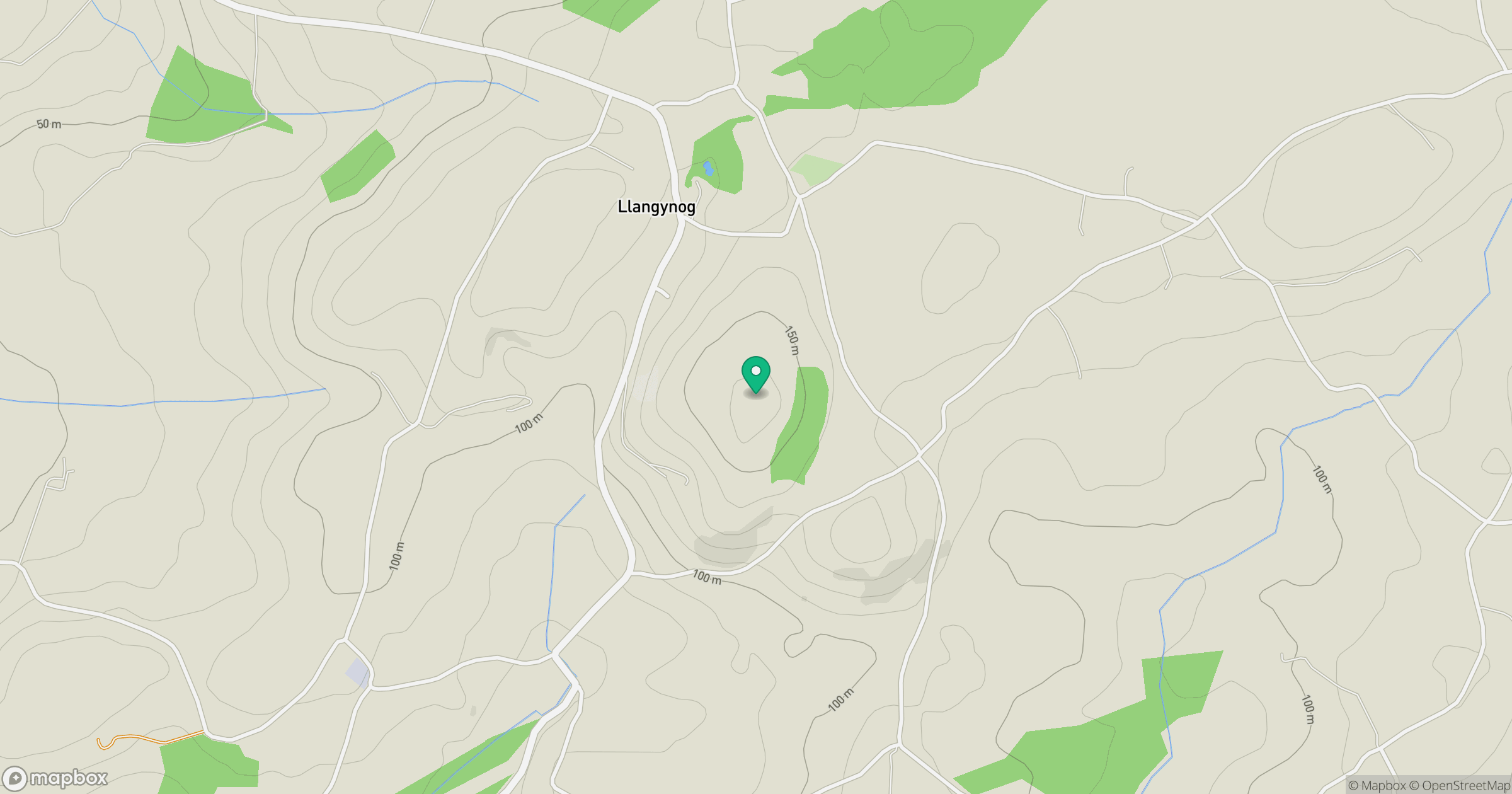
Grid reference: SN341159
View on OpenStreetMapOpens a map in a new tab, centred on the hill.
Hills within 30 km
Straight-line distance, not a walking route or confirmation of access.
Rhossili Down - The Beacon
193m
Moelfre
335m
Brandy Hill
206m
Mynydd Llangyndeyrn
263m
Llanmadoc Hill
186m
No comments yet. Be the first.