

Cefn Bryn
Good walks are even better shared.
SS5188 : Ponies at a Puddle
Des Blenkinsopp Photo source
Overview
Cefn Bryn
Cefn Bryn is the prominent common-land ridge across central Gower, in Swansea. Current DoBIH records give 186.6 m, with 132.5 m prominence, making it a Hump and Tump. These current figures supersede the older 188 m listing and the unsupported 196 m narrative. Primary hill record
Summit uncertainty
The listed point is ground about 4 m southeast of the trig pillar, beside the compound perimeter fence, at SS5180988967. DoBIH explicitly warns that there may be higher natural ground inside the compound. Stay outside the fence: this page does not establish access to the compound or certainty about the absolute natural highpoint. The trig is a useful landmark, not proof that its base is the highest ground.
Landscape and history
The ridge exposes Devonian Old Red Sandstone, including Brownstones and pebbly conglomerate, folded into an anticline and affected by a thrust. It gives wide views over Gower towards its southern bays and the Bristol Channel. Geological Society field guide
Farther west, Maen Ceti or Arthur’s Stone is a Neolithic chambered tomb. Bronze Age cairns form part of the wider historic common-land landscape. These monuments are separate from the listed summit point. Heneb landscape record
A complete return walk
The Cefn Bryn and Three Cliffs Bay circular from Penmaen follows Walking Britain’s 14.6 km itinerary: the ridge and Arthur’s Stone, Reynoldston, Mill Wood, the public path through Penrice Castle Park, Nicholaston Woods and the coastal path back through the burrows to Penmaen. Use the linked directions and map for each junction. Optional viewpoints, archaeological detours and any tide-related alternative are not given the same total. No scalar walking time is asserted. Full route
This is a substantial mixed-terrain circuit with stiles, mud and exposed sections. It crosses the A4118 and includes a roadside stretch. Check tides and conditions for the coastal return; never wade a channel or follow an unsafe beach shortcut. If the route cannot be followed safely, turn back or use a confirmed safe alternative and allow for the changed distance. Wales Coast Path tide advice, current diversion information
Travel and facilities
The route starts and ends at the small Penmaen car park near the church, SS531888. Although the route publisher calls it an NT car park, National Trust’s current page identifies Penmaen parking as non-NT and lists no toilets. Check signs and carry provisions. National Trust visitor information
Service 118 is listed via Penmaen church; check the date-specific timetable and last return. Any connection from the stop to the car park is extra to the published walk. Traveline Cymru
Sources checked on 18 October 2026. The route is undated. Consult the current Wales Coast Path diversion information before walking; the guide and this source check do not guarantee current safe passage. The private summit compound and Parc-Le-Breos hotel grounds are not part of the public itinerary.
Explore routes near Cefn Bryn
Walks starting near this hill. Open a route to check its map, distance and full itinerary.
Gower winter wildlife and birdwatching walk
View route
Llanelli warden-led wildlife walk
View route
Llanelli warden-led wildlife walk
View route
Swansea Clyne Valley Railway Walk: Blackpill to Dunvant
View route
Route planning notes
These notes describe possible approaches. Check a route's map and access information when planning your walk.
Cefn Bryn and Three Cliffs Bay circular from Penmaen
Start and finish at the small Penmaen car park (SS531888) off the A4118 near the church. Follow the Gower Way onto Cefn Bryn past the trig and remain outside the compound. Continue west along the ridge, cross the road and visit Arthur’s Stone, then return to the road and descend south to Reynoldston. Cross the A4118 to Mill Wood, turn left by the pool and use the yellow-waymarked public path through Penrice Castle Park. Follow the published A4118 roadside section with care, then the lane and track through Nicholaston Woods to the Wales Coast Path. Turn left along the main path through Nicholaston and Penmaen Burrows. At Three Cliffs Bay turn left towards Notthill, then follow the track junctions back to the A4118 and starting car park. Walking Britain gives 14.6 km for this complete circuit. Use its map/directions; optional topograph or archaeology detours, tide diversions and different starts change the total. Do not enter the compound, private buildings or Parc-Le-Breos hotel grounds. Source: https://www.walkingbritain.co.uk/walk-3761-description
Make a day of it, together
Find someone to share the walk with, or organise a day out along a route you like.
Photo Gallery
View all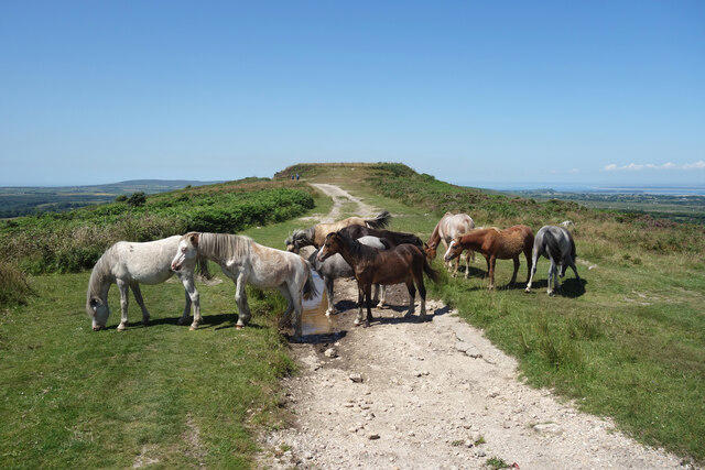 Photo could not load
SS5188 : Ponies at a Puddle
Des Blenkinsopp
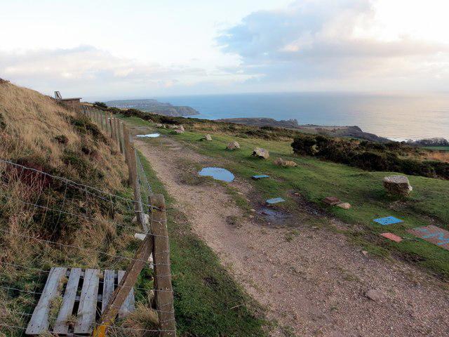 Photo could not load
SS5188 : Cefn Bryn
Alan Richards
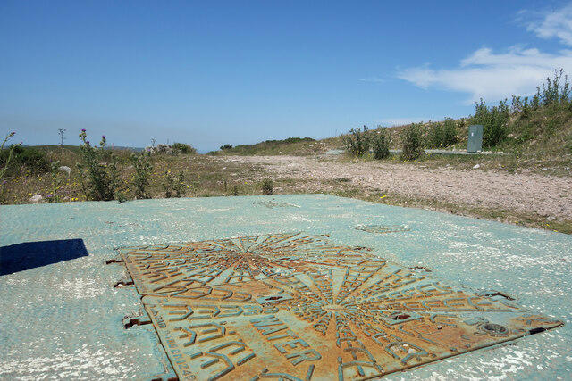 Photo could not load
SS5188 : Manhole Covers by the Reservoir
Des Blenkinsopp
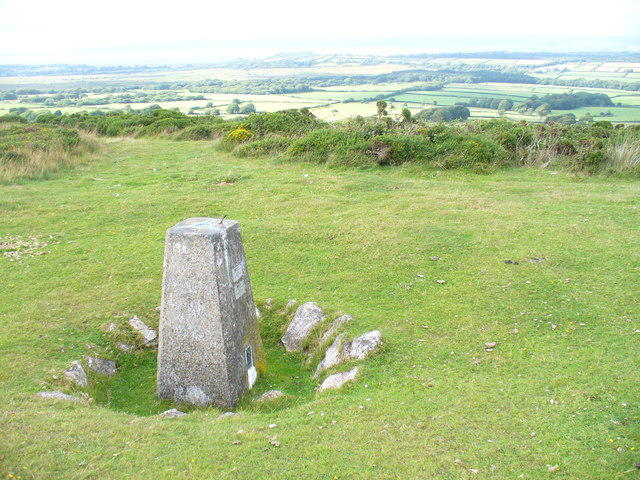 Photo could not load
SS5188 : Trig Point on Cefn Bryn
Colin Smith
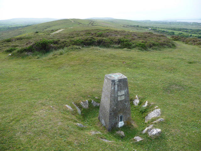 Photo could not load
SS5188 : Trig point on Cefn Bryn, Gower
Jeremy Bolwell
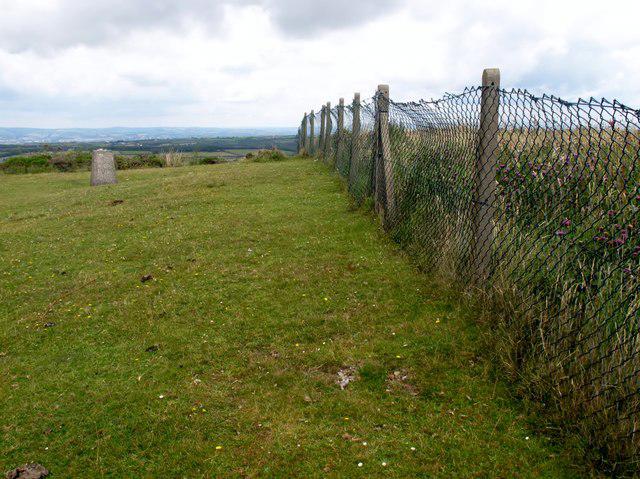 Photo could not load
SS5188 : Cefn Bryn
Rude Health
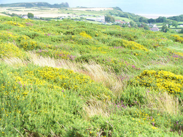 Photo could not load
SS5188 : On Cefn Bryn Ridge
Colin Smith
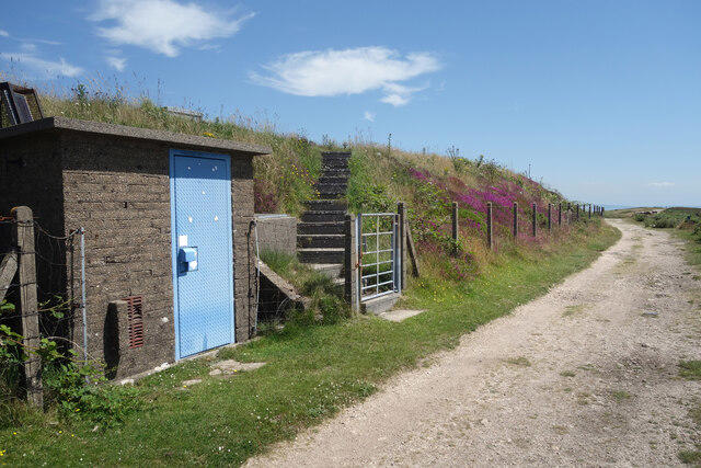 Photo could not load
SS5188 : Flowers on the Reservoir
Des Blenkinsopp
Hill facts and local notes
Classifications
Elevation
187m
612 ft
Prominence
132m
Coordinates
51.5800, -4.1402
SS518889
OS Map
159
Explorer: 164
At the Summit
Current DoBIH lists 186.6 m at ground about 4 m southeast of the trig pillar beside the compound perimeter fence, at SS5180988967. It explicitly notes that higher natural ground may exist inside the compound. Stay outside the fence; the trig and nearby artificial structures do not settle that uncertainty. Arthur’s Stone is a separate monument farther west along the ridge.
Terrain & Geology
Cefn Bryn is an Old Red Sandstone ridge. The Geological Society describes Devonian Brownstones and pebbly conglomerate folded into the Cefn Bryn anticline, with a thrust affecting the ridge. This is a more specific account than a blanket Silurian-and-sandstone description.
Views & Scenery
Wide views across the Gower peninsula and its southern bays, with the Bristol Channel beyond in clear conditions.
History & Heritage
Name Origin
Welsh cefn means 'ridge' and bryn means 'hill', according to Ordnance Survey's place-name glossary.
Historical Significance
Cefn Bryn Common contains important prehistoric remains. Heneb records the Neolithic chambered tomb Maen Ceti, also called Arthur’s Stone, and numerous Bronze Age cairns along the ridge. Their archaeological importance is distinct from the modern summit measurement.
Getting There & Facilities
Parking
The described complete route starts at the small Penmaen car park at SS531888, reached from the lane by the church off the A4118. National Trust’s current visitor information identifies Penmaen parking as non-NT and says there is no National Trust car park here. Check signs, availability and any charges; do not block lanes or gates.
Public Transport
Adventure Travel service 118 between Swansea and Rhossili is listed via Penmaen church by Traveline Cymru. Check the timetable for your date and direction, including the last return. The stop is near the A4118 approach to the route start; any walk between the stop and car park is additional to the published circuit.
Nearby Facilities
National Trust lists no toilets at Penmaen and Nicholaston Burrows. Carry water and food for the full circuit; do not rely on refreshments or private facilities along the route being open.
Safety Information
Known Hazards
- Do not enter or climb into the fenced summit compound. DoBIH notes possible higher natural ground inside; access and the absolute highpoint remain uncertain.
- The ridge is exposed to wind and poor visibility. Paths, woodland and wetland sections may be muddy or slippery.
- The full route crosses the A4118 and includes about 250 m along it; take particular care with traffic.
- Check tides, weather and Wales Coast Path diversions before the coastal return. Do not wade channels or use beach shortcuts when unsafe; turn back or use a confirmed safe alternative, which changes route totals.
- Keep dogs on a lead around grazing animals and follow current site notices.
General Safety Tips
- Check weather conditions before setting out
- Carry appropriate clothing and equipment
- Let someone know your planned route
- Take a map, compass, and GPS device
- Carry emergency supplies: food, water, first aid kit, torch
Hills
Some common questions about the hills answered
Are there group walks up Cefn Bryn?
Many walkers use Walkmates to join or organise walks with others. You can check for group walks around Cefn Bryn through the maps
Are there other walkers around Cefn Bryn?
Activity varies by location and time, but Walkmates lets you see whether others have shared walks or shown interest in this area. Find other people through the walking friends search walking friends for Cefn Bryn search or of course create your own walk for Cefn Bryn
Can I organise a walk to Cefn Bryn?
Yes. If there aren’t any walks listed already, you can create a walk and make it available for others to join.
If you're signed up to Walkmates, you can create a walk to Cefn Bryn.
How do I find a walk up this hill?
There are often multiple ways to walk this hill, depending on experience and route preference. Walkmates helps you explore walks and routes that others have shared.
Can I suggest a new route up Cefn Bryn?
Yes. You can suggest or create routes to share with others. Walkmates focuses on the social side of walking, so routes are used to help people organise walks and explore areas together, rather than as detailed navigation tools or route libraries.
Other uses really appreciate knowledgeable walkers sharing their routes. Share your favourite route to Cefn Bryn here
The is an error or something incorrect about this hill. How do I let you know?
We always strive to keep the information on Walkmates as accurate as possible. If you find an error, please let us know through the contact form and we'll aim to correct it as quickly as possible
Community Discussion
Comments
Location
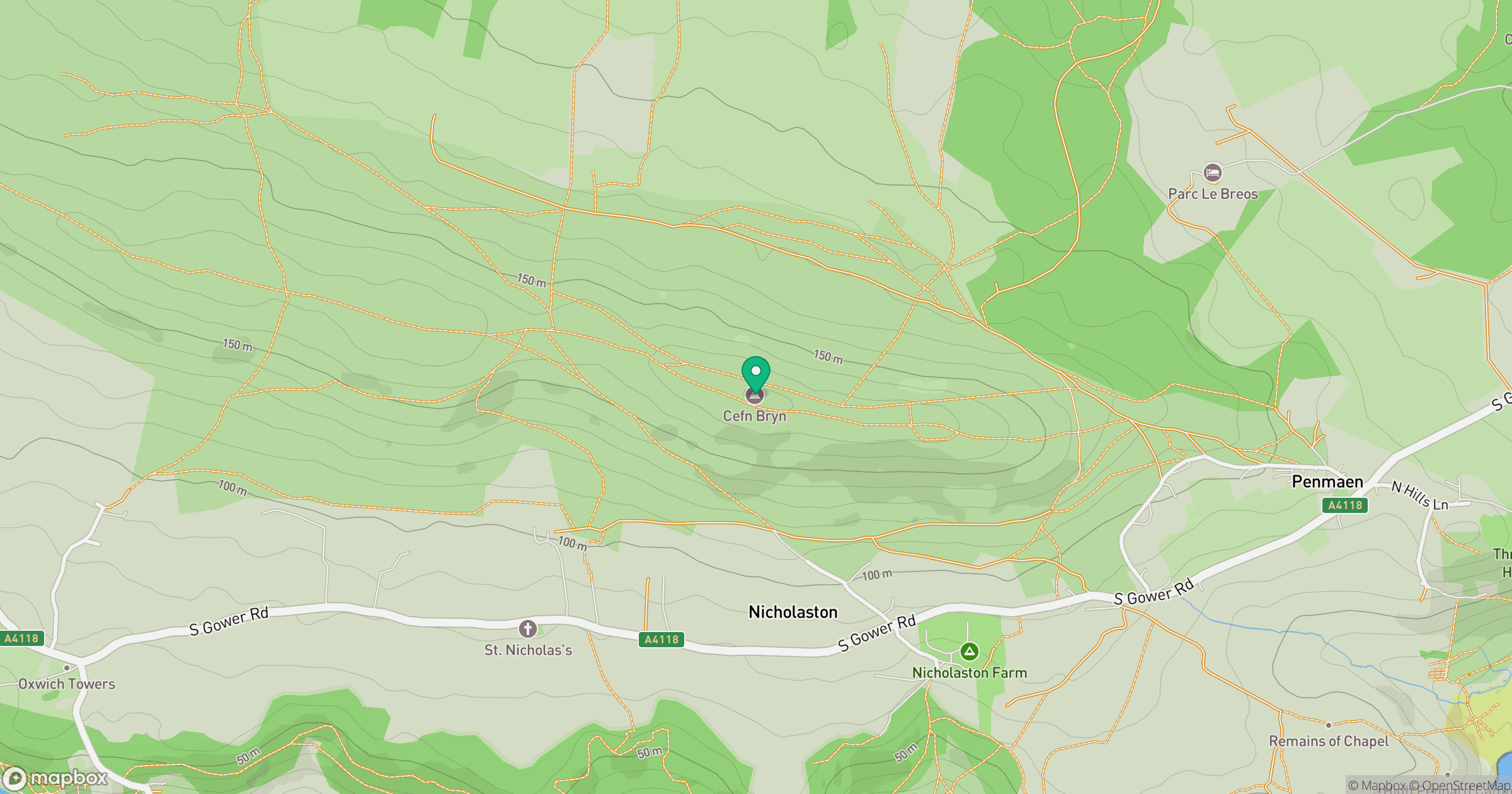
Grid reference: SS518889
View on OpenStreetMapOpens a map in a new tab, centred on the hill.
Nearby Hills
Rhossili Down - The Beacon
193m

Fan Brycheiniog - Twr y Fan Foel
802m
Fan Gyhirych
726m

Dunkery Beacon
520m
Pen y Fan
886m
No comments yet. Be the first.