
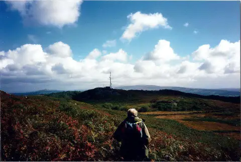
Banc y Llyn
Good walks are even better shared.
Overview
Banc y Llyn
Nestled in the heart of Snowdonia National Park, Banc y Llyn stands at a respectable 674 meters, making it a popular spot for hikers looking to explore the stunning Welsh landscape without tackling the highest peaks.
Geology
Banc y Llyn is primarily composed of Ordovician slate, a testament to the region's ancient geological history. The rocky outcrops found here are fascinating and are often used to teach geology due to their glacial features, such as the pronounced striations that tell the story of the last Ice Age.
Access and Parking
Getting to Banc y Llyn is a breeze. The nearest parking can be found in the quaint village of Bryn Glo, where you might even snag a quick chat with the locals. Be warned, spaces can be limited, especially on sunny weekends when every David and his dog seem to head for the hills!
Public transport options are available, with buses from Bala getting you reasonably close. Just keep an eye on the schedule, as you don’t want to be left high and dry like a solo sock in the laundry.
Routes
There are several routes to take. For a relaxed stroll, the Bryn Glo route offers a 5.5 km path that’s perfect for those who like to keep things easy but want to enjoy the views. For those feeling a bit frisky, the Cadair Idris loop provides a challenge of 12 km, allowing you to take in stunning vistas from multiple points – just don't forget to pack some snacks!
Summit Features
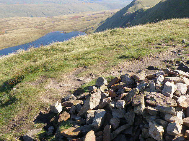
Upon reaching the summit, hikers are greeted by a trig point that stands proud against the sky and a quaint stone wind shelter for those who might need to escape a cheeky gust. The views from the top are quite literally breathtaking – just don’t try to hold your breath to preserve the view for longer!
Terrain and Hazards
Expect a mix of grassy meadows, rocky outcrops, and the occasional boggy bits that could play tricks on your boots. Be prepared for potential quick weather changes – a clear sky can swiftly turn into an unfriendly cloud cover, so pack accordingly.
Nearby Attractions
The nearby peaks, including Cadair Idris and Mynydd Mawr, offer additional hiking opportunities for the adventurous climber. Just remember, each peak has its quirks, so do your homework!
Facilities
Once you've conquered Banc y Llyn, head down to Bala to enjoy a well-earned cuppa or a bite to eat. The town has a range of facilities, including cafes and toilets, perfect for replenishing energy after your trek.
Conclusion
Whether you're a seasoned explorer or just looking to stretch your legs, Banc y Llyn provides a fantastic day out among the lush landscapes and storied history of Wales. Just remember to take your rubbish home with you; Mother Nature doesn’t need any extra nonsense!
And there you have it! Happy hiking, and may your boots stay dry and your energy levels high!
Explore routes near Banc y Llyn
Public walks starting within 80 km of this hill. Nearby does not mean a route reaches the summit; check its map and access before setting out.
Abergwili to Nantgaredig: Tywi Valley Path out and back
View route
Llanelli warden-led wildlife walk
View route
Llanelli warden-led wildlife walk
View route
Llanelli North Dock to Burry Port Harbour Coastal Walk
View route
Route planning notes
These notes describe possible approaches, not verified navigable routes or permission to cross land. Check current paths, local access rules and conditions before setting out.
Bryn Glo route
A popular hike starting from the small village of Bryn Glo, providing a well-defined, easy-to-follow path with stunning views.
Cadair Idris loop
This scenic loop connects Banc y Llyn with nearby peaks, offering a more challenging terrain for the avid hiker.
Make a day of it, together
Find someone to share the walk with, or organise a day out along a route you like.
Photo Gallery
View all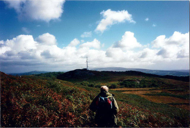 Photo could not load
SN5715 : Carmel
Alan Richards
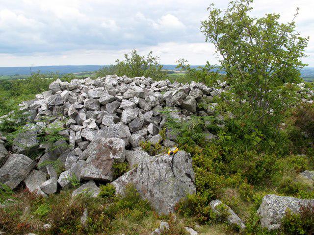 Photo could not load
SN5715 : Banc y Llyn
Rude Health
Hill facts and local notes
Classifications
Elevation
280m
919 ft
Prominence
129m
Coordinates
51.8226, -4.0623
SN579157
OS Map
159
Explorer: 178
At the Summit
The summit features a prominent trig point, a stone wind shelter, and impressive panoramic views that stretch across the surrounding valleys.
Terrain & Geology
Banc y Llyn is primarily composed of Ordovician slate, featuring characteristic rocky outcrops. The surrounding area showcases interesting glacial features, including striations on the rock faces.
Views & Scenery
From the summit, one can see the majestic Cadair Idris to the south, the rugged hills of the Rhinogs to the west, and the scenic Llyn Tegid (Bala Lake) in the north.
History & Heritage
Name Origin
The name ‘Banc y Llyn’ translates to ‘The Bank of the Lake’, evocative of its location near Llyn Tegid.
Historical Significance
Historically, the area was used for sheep grazing and has links to local folklore, including tales of mythical creatures said to inhabit the nearby waters.
Getting There & Facilities
Check current local access restrictions, parking rules and transport timetables before travelling. These notes do not confirm public access to the summit.
Parking
The nearest parking area can be found in the village of Bryn Glo, offering limited spaces and is only a short walk from the trailhead.
Public Transport
Buses from Bala can take hikers close to the starting point, though service may be infrequent, so check the schedule.
Nearby Facilities
Nearby Bala offers a range of cafes, shops, and toilets for those looking to refuel or refresh after their hike.
Safety Information
Known Hazards
- Variable weather conditions can lead to quickly changing situations. The terrain can be slippery when wet, and some areas are prone to low visibility.
General Safety Tips
- Check weather conditions before setting out
- Carry appropriate clothing and equipment
- Let someone know your planned route
- Take a map, compass, and GPS device
- Carry emergency supplies: food, water, first aid kit, torch
Hills
Some common questions about the hills answered
Are there group walks up Banc y Llyn?
Many walkers use Walkmates to join or organise walks with others. You can check for group walks around Banc y Llyn through the maps
Are there other walkers around Banc y Llyn?
Activity varies by location and time, but Walkmates lets you see whether others have shared walks or shown interest in this area. Find other people through the walking friends search walking friends for Banc y Llyn search or of course create your own walk for Banc y Llyn
Can I organise a walk to Banc y Llyn?
Yes. If there aren’t any walks listed already, you can create a walk and make it available for others to join.
If you're signed up to Walkmates, you can create a walk to Banc y Llyn.
How do I find a walk up this hill?
There are often multiple ways to walk this hill, depending on experience and route preference. Walkmates helps you explore walks and routes that others have shared.
Can I suggest a new route up Banc y Llyn?
Yes. You can suggest or create routes to share with others. Walkmates focuses on the social side of walking, so routes are used to help people organise walks and explore areas together, rather than as detailed navigation tools or route libraries.
Other uses really appreciate knowledgeable walkers sharing their routes. Share your favourite route to Banc y Llyn here
The is an error or something incorrect about this hill. How do I let you know?
We always strive to keep the information on Walkmates as accurate as possible. If you find an error, please let us know through the contact form and we'll aim to correct it as quickly as possible
Community Discussion
Comments
Location
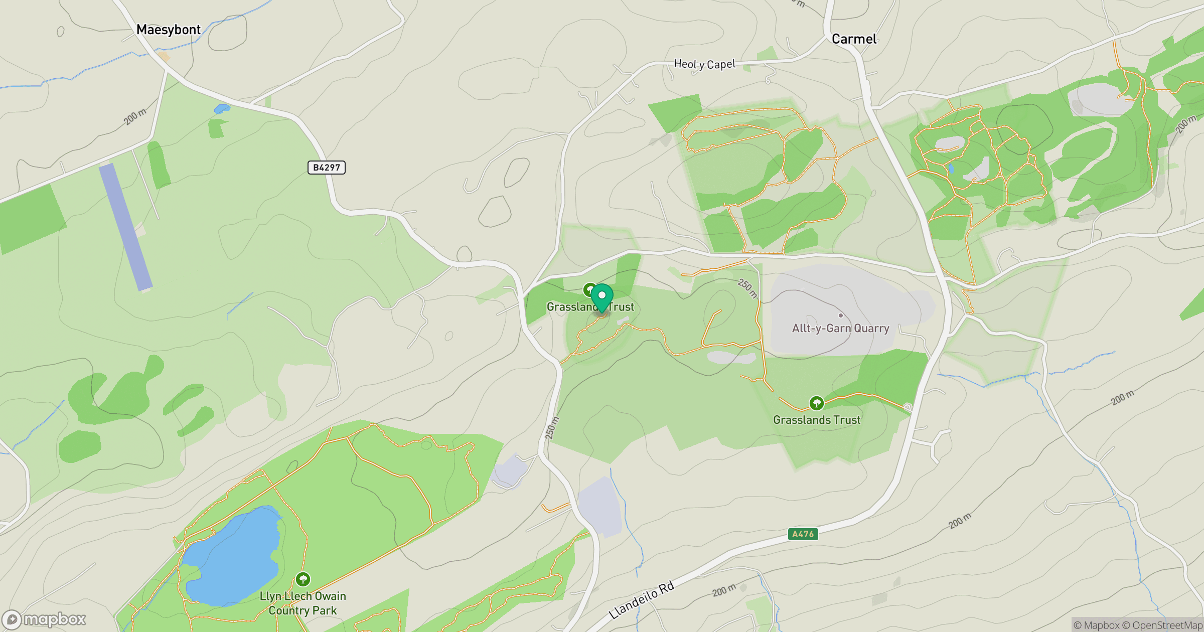
Grid reference: SN579157
View on OpenStreetMapOpens a map in a new tab, centred on the hill.
Hills within 30 km
Straight-line distance, not a walking route or confirmation of access.
Fan Brycheiniog - Twr y Fan Foel
802m
Mynydd Sylen
284m
Mynydd Figyn
328m
Mynydd y Betws
373m
Mynydd Llangyndeyrn
263m
No comments yet. Be the first.