
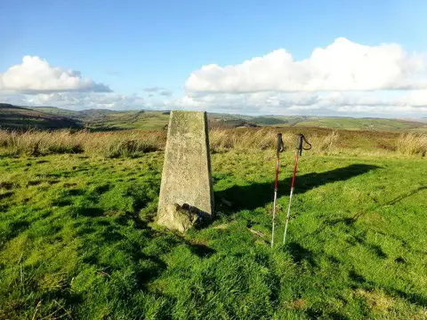
Banc Beili-Tew
Good walks are even better shared.
Overview
Banc Beili-Tew
Introduction
Banc Beili-Tew, standing at an admirable 600 meters, is a lovely Marilyn in the heart of Snowdonia National Park. With its diverse geological features and panoramic views, this mountain attracts hikers looking for both solitude and beauty.
Geology
The geology here is centered on ancient volcanic processes, so you'll find interesting rock formations. Keep your eyes peeled for remnants of lava flows, they make for a thrilling geological journey!
Access and Parking
Access to this mountain is relatively straightforward. The nearest parking is a small layby outside Llanymawddwy. Please avoid parking in front of homes to keep the locals happy!
Routes
The most popular route is the Banc Beili-Tew Circular Route, totaling about 8 kilometers. This moderate trek takes approximately 3.5 hours and offers an opportunity to spot some local wildlife along the way.
Summit Features
Upon reaching the summit, you will find a rocky outcrop crowned with a humble cairn. It’s the perfect place to catch your breath and take some breathtaking photographs.
Views
The views from the top are nothing short of spectacular. Hikers can admire the towering peaks of Cadair Idris and, if the weather is on your side, catch a glimpse of Snowdon in the distance. Spring and early autumn are the best seasons to appreciate the views in all their glory.
Hazards
Always keep an eye on the weather. It can change quicker than you can say 'Banc Beili-Tew'. Also, watch for sheep who believe the trails belong to them.
Facilities
After your adventure, reward yourself with a well-deserved meal at the local pub in Llanymawddwy. It's small but cozy, and the food is just what you need.
Conclusion
Banc Beili-Tew is a gem of a mountain, perfect for hikers of all abilities. Ready your boots and take on the challenge, and you won't be disappointed!
Happy hiking!
Explore routes near Banc Beili-Tew
Public walks starting within 80 km of this hill. Nearby does not mean a route reaches the summit; check its map and access before setting out.
Dolaucothi Estate: Cothi Valley and Red Waymarked Circuit
View route
Usk Reservoir: Glasfynydd Forest and Dam Circuit
View route
Abergwili to Nantgaredig: Tywi Valley Path out and back
View route
Llanerchaeron: Lanlas, Aberaeron and Aeron Valley circular
View route
Route planning notes
These notes describe possible approaches, not verified navigable routes or permission to cross land. Check current paths, local access rules and conditions before setting out.
Banc Beili-Tew Circular Route
A scenic circular route starting from the small village of Llanymawddwy, offering breathtaking views and a chance to experience the local wildlife.
Make a day of it, together
Find someone to share the walk with, or organise a day out along a route you like.
Photo Gallery
View all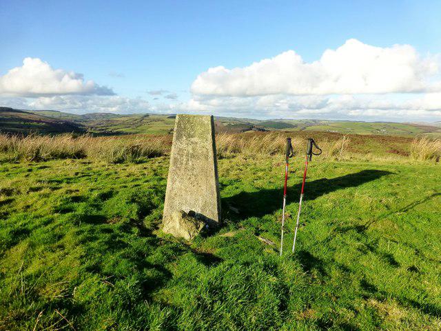 Photo could not load
SN6134 : Banc Beili-Tew
Rude Health
Hill facts and local notes
Classifications
Elevation
278m
912 ft
Prominence
120m
Coordinates
51.9928, -4.0171
SN616346
OS Map
146
Explorer: 186
At the Summit
The summit features a rugged rocky outcrop with a small cairn marking the highest point, providing a great spot to rest and take in the views.
Terrain & Geology
The mountain is primarily composed of volcanic rock, providing striking geological features and a diverse habitat. The remnants of ancient lava flows can be observed in various outcrops, contributing to the area's unique ecology.
Views & Scenery
From the summit, hikers can enjoy stunning views of the surrounding peaks including Cadair Idris and the sprawling valleys of mid-Wales. On a clear day, Snowdon can also be spied in the distance.
History & Heritage
Name Origin
The name 'Banc Beili-Tew' translates to 'the bank of the great beetle', a somewhat curious name that speaks to the area’s folklore.
Historical Significance
The mountain is part of the rich cultural tapestry of Snowdonia, providing habitat to various wildlife and being a traditional spot for local gatherings.
Getting There & Facilities
Check current local access restrictions, parking rules and transport timetables before travelling. These notes do not confirm public access to the summit.
Parking
There is a small layby for parking just outside the village of Llanymawddwy. Please be considerate and do not obstruct local residences.
Public Transport
The nearest train station is in Machynlleth. From there, local buses run towards the nearby villages, though check schedules as they change frequently.
Nearby Facilities
The tiny village of Llanymawddwy has a few local amenities, including a village shop and a pub that offers a hearty meal after a long hike—just don’t expect a five-star restaurant!
Safety Information
Known Hazards
- Be mindful of sudden weather changes; the weather can turn on a sixpence in these parts. Watch for the occasional sheep, as they may have dibs on the best spots!
General Safety Tips
- Check weather conditions before setting out
- Carry appropriate clothing and equipment
- Let someone know your planned route
- Take a map, compass, and GPS device
- Carry emergency supplies: food, water, first aid kit, torch
Hills
Some common questions about the hills answered
Are there group walks up Banc Beili-Tew?
Many walkers use Walkmates to join or organise walks with others. You can check for group walks around Banc Beili-Tew through the maps
Are there other walkers around Banc Beili-Tew?
Activity varies by location and time, but Walkmates lets you see whether others have shared walks or shown interest in this area. Find other people through the walking friends search walking friends for Banc Beili-Tew search or of course create your own walk for Banc Beili-Tew
Can I organise a walk to Banc Beili-Tew?
Yes. If there aren’t any walks listed already, you can create a walk and make it available for others to join.
If you're signed up to Walkmates, you can create a walk to Banc Beili-Tew.
How do I find a walk up this hill?
There are often multiple ways to walk this hill, depending on experience and route preference. Walkmates helps you explore walks and routes that others have shared.
Can I suggest a new route up Banc Beili-Tew?
Yes. You can suggest or create routes to share with others. Walkmates focuses on the social side of walking, so routes are used to help people organise walks and explore areas together, rather than as detailed navigation tools or route libraries.
Other uses really appreciate knowledgeable walkers sharing their routes. Share your favourite route to Banc Beili-Tew here
The is an error or something incorrect about this hill. How do I let you know?
We always strive to keep the information on Walkmates as accurate as possible. If you find an error, please let us know through the contact form and we'll aim to correct it as quickly as possible
Community Discussion
Comments
Location
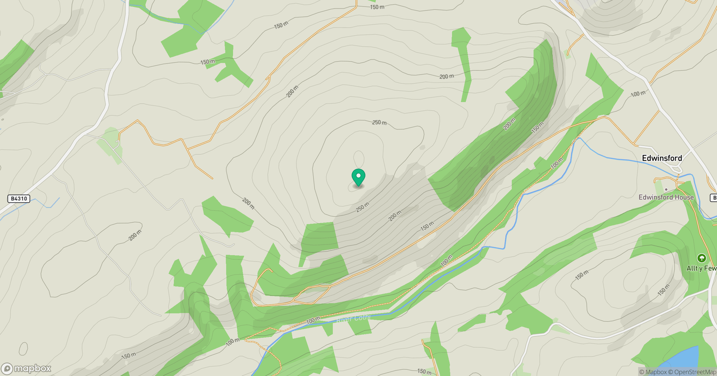
Grid reference: SN616346
View on OpenStreetMapOpens a map in a new tab, centred on the hill.
Hills within 30 km
Straight-line distance, not a walking route or confirmation of access.
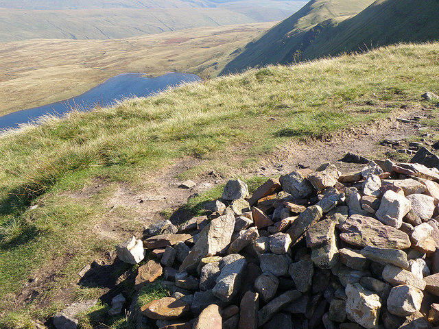
Fan Brycheiniog - Twr y Fan Foel
802m
Mynydd Figyn
328m
Banc Cwm-coed-ifor
308m
Mynydd Pencarreg
415m
Mynydd Llansadwrn
345m
No comments yet. Be the first.