
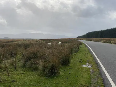
Mynydd Bwlch-y-Groes
Good walks are even better shared.
Overview
Mynydd Bwlch-y-Groes
Mynydd Bwlch-y-Groes is a hidden gem nestled in the rugged landscapes of Snowdonia National Park, known for its stunning views and vibrant flora. Rising to an elevation of 647 meters, it might not be the highest peak around, but it certainly packs a punch when it comes to charm and adventure.
Geology
The mountain's geology is characterised by a blend of volcanic and sedimentary rocks, remnants of ancient geological processes. Glacial activity carved the rugged terrain, leaving behind a landscape dotted with rocky outcrops and sheltered valleys. It's a perfect place for geology enthusiasts to appreciate the earth's history!
Routes
There are a couple of enjoyable routes to reach the summit:
- Bwlch-y-Groes Pass Route: This is the most common route, taking you directly from the Bwlch-y-Groes Pass. The ascent is quite manageable, and you'll be rewarded with you guessed it - magnificent views!
- Rhos-y-Gwaliau Route: Starting a bit further afield from Rhos-y-Gwaliau, this trail winds through beautiful heather and offers a more peaceful experience, away from the crowds.
Summit Features
At the summit, you'll find a cairn and a stone wind shelter. It’s the ideal spot to take a breather, have a snack, and enjoy the panoramic views of the surrounding peaks and valleys. Don’t forget to take a summit selfie!
Terrain Type
The terrain here is a delightful mix of rocky outcrops and lush grassy slopes. Be prepared for a few boggy sections near the base which can be a bit slippery, so good footwear is a must!
Views
The views from Mynydd Bwlch-y-Groes are nothing short of spectacular. You can see Cader Idris and even the remote hills lining the horizon. Spring and Autumn are the best seasons for clear views and vibrant scenery, so plan your hike accordingly!
Hazards
While the views are breathtaking, do keep in mind that the weather can turn on a dime. It’s always wise to check forecasts before heading out. Slippery rocks can be a bit treacherous, especially coming down, so take your time and watch your step!
Access
Getting to the mountain is simple. The nearest parking is located at Bwlch-y-Groes Pass, which can fill up quickly during busy periods. If you're relying on public transport, services from Dolgellau to Bala can get you nearby, though the schedule may require some planning.
Facilities
Facilities are limited on the mountain itself, but Dolgellau is the nearest town offering various cafes and public toilets—perfect for a post-hike cuppa!
History
The name Mynydd Bwlch-y-Groes translates to 'Mountain of the Pass of the Cross.' This area has historical significance as an important crossing point, linking communities for centuries. Local legends about ancient trails abound, adding a touch of intrigue to your hike.
So whether you're a seasoned hiker or a casual walker looking for a bit of adventure, Mynydd Bwlch-y-Groes is ready to welcome you with open arms (and stunning views). Grab your gear, lace up those boots, and hit the trail! Enjoy the great outdoors responsibly!
Explore routes near Mynydd Bwlch-y-Groes
Public walks starting within 80 km of this hill. Nearby does not mean a route reaches the summit; check its map and access before setting out.
Usk Reservoir: Glasfynydd Forest and Dam Circuit
View route
World Curlew Day Walk and Talk at Mynydd Illtud
View route
Aircraft Crash Site - Wellington Bomber and Vampire Jet (Black Mountain range)
View route
Pen y Fan via Corn Du from Storey Arms
View route
Route planning notes
These notes describe possible approaches, not verified navigable routes or permission to cross land. Check current paths, local access rules and conditions before setting out.
Bwlch-y-Groes Pass Route
An enjoyable ascent from the Bwlch-y-Groes Pass, offering splendid views and a straightforward approach.
Rhos-y-Gwaliau Route
Starting from the nearby hamlet of Rhos-y-Gwaliau, this route offers a more tranquil experience, winding through heather-covered slopes.
Make a day of it, together
Find someone to share the walk with, or organise a day out along a route you like.
Photo Gallery
View all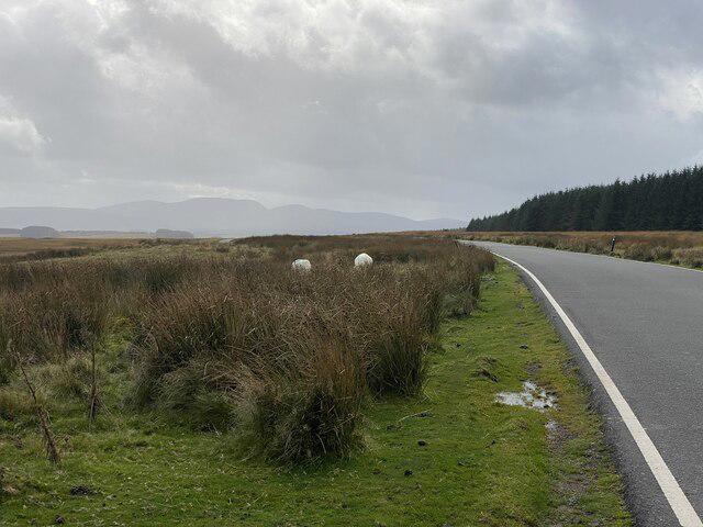 Photo could not load
SN8635 : View across Mynydd Bwlch-y-Groes
Alan Hughes
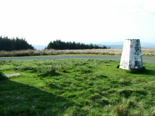 Photo could not load
SN8635 : Blaen Y Glyn trig point
Aaron Jones
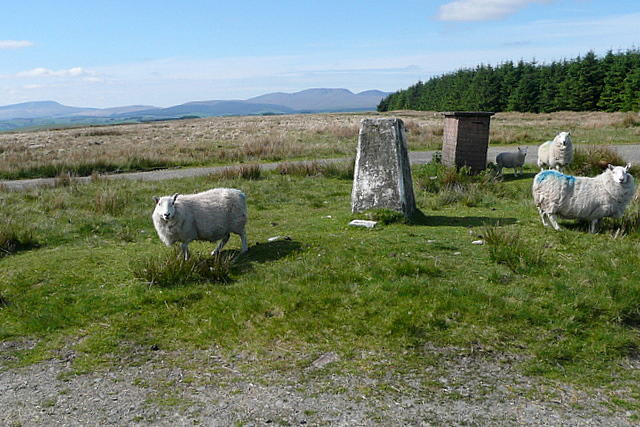 Photo could not load
SN8635 : On Mynydd Bwlch-y-groes
Graham Horn
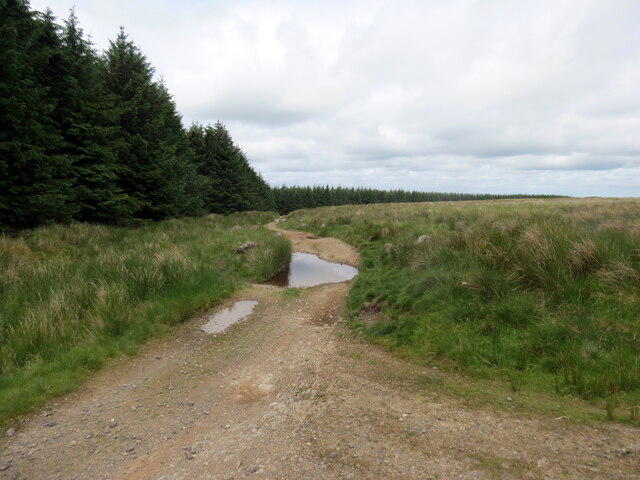 Photo could not load
SN8635 : Mynydd Bwlch-y-Groes
Alan Richards
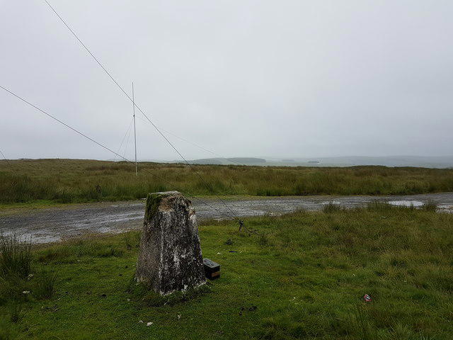 Photo could not load
SN8635 : Trigpoint
Brian Deegan
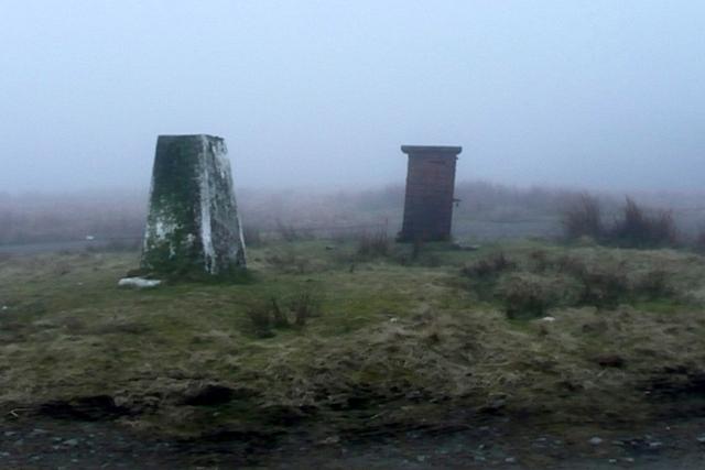 Photo could not load
SN8635 : Trig point on Mynydd Bwlch-y-groes
Graham Horn
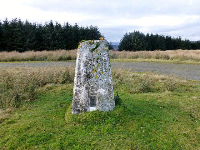 Photo could not load
SN8635 : Mynydd Bwlch-y-Groes
Rude Health
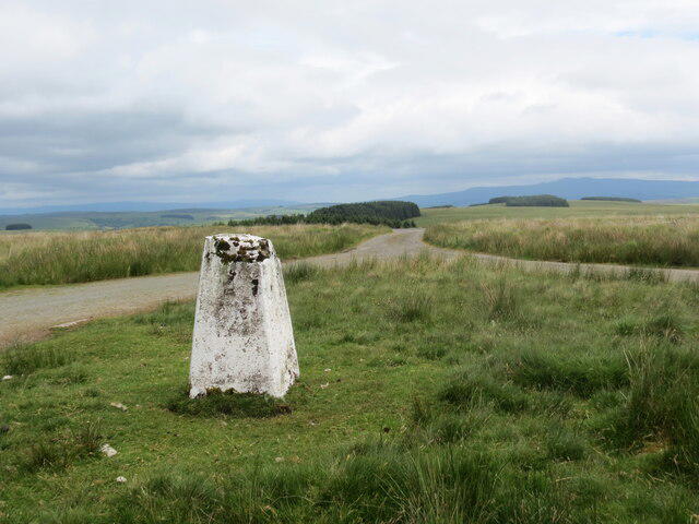 Photo could not load
SN8635 : Mynydd Bwlch-y-Groes
Alan Richards
Hill facts and local notes
Classifications
Elevation
442m
1,450 ft
Prominence
137m
Coordinates
52.0075, -3.6498
SN868356
OS Map
160
Explorer: OL12W 187S
At the Summit
The summit features a cairn and a stone wind shelter, perfect for a quick snack while taking in the views.
Terrain & Geology
The mountain is primarily composed of a mix of volcanic and sedimentary rocks, giving it a rugged terrain shaped by glacial activity during the last Ice Age.
Views & Scenery
From the summit, you can see the stunning landscapes of Snowdonia, including views of Cader Idris and the remote hills beyond.
History & Heritage
Name Origin
The name Mynydd Bwlch-y-Groes translates to 'Mountain of the Pass of the Cross', reflecting its historical significance as a crossing point.
Historical Significance
This area has been a vital passageway for centuries, with local legends linked to ancient trails and trade routes.
Getting There & Facilities
Check current local access restrictions, parking rules and transport timetables before travelling. These notes do not confirm public access to the summit.
Parking
There is a small car park at Bwlch-y-Groes Pass (SN868367), where you can safely leave your vehicle, but it can get busy during peak times.
Public Transport
The nearest bus service is from Dolgellau to Bala, but check local schedules as services can be limited.
Nearby Facilities
There are no facilities on the mountain itself, but Dolgellau has several cafes and public toilets.
Safety Information
Known Hazards
- Be aware of the potential for poor weather, which can change rapidly in this region. Keep an eye out for slippery rocks, especially when descending.
General Safety Tips
- Check weather conditions before setting out
- Carry appropriate clothing and equipment
- Let someone know your planned route
- Take a map, compass, and GPS device
- Carry emergency supplies: food, water, first aid kit, torch
Hills
Some common questions about the hills answered
Are there group walks up Mynydd Bwlch-y-Groes?
Many walkers use Walkmates to join or organise walks with others. You can check for group walks around Mynydd Bwlch-y-Groes through the maps
Are there other walkers around Mynydd Bwlch-y-Groes?
Activity varies by location and time, but Walkmates lets you see whether others have shared walks or shown interest in this area. Find other people through the walking friends search walking friends for Mynydd Bwlch-y-Groes search or of course create your own walk for Mynydd Bwlch-y-Groes
Can I organise a walk to Mynydd Bwlch-y-Groes?
Yes. If there aren’t any walks listed already, you can create a walk and make it available for others to join.
If you're signed up to Walkmates, you can create a walk to Mynydd Bwlch-y-Groes.
How do I find a walk up this hill?
There are often multiple ways to walk this hill, depending on experience and route preference. Walkmates helps you explore walks and routes that others have shared.
Can I suggest a new route up Mynydd Bwlch-y-Groes?
Yes. You can suggest or create routes to share with others. Walkmates focuses on the social side of walking, so routes are used to help people organise walks and explore areas together, rather than as detailed navigation tools or route libraries.
Other uses really appreciate knowledgeable walkers sharing their routes. Share your favourite route to Mynydd Bwlch-y-Groes here
The is an error or something incorrect about this hill. How do I let you know?
We always strive to keep the information on Walkmates as accurate as possible. If you find an error, please let us know through the contact form and we'll aim to correct it as quickly as possible
Community Discussion
Comments
Location
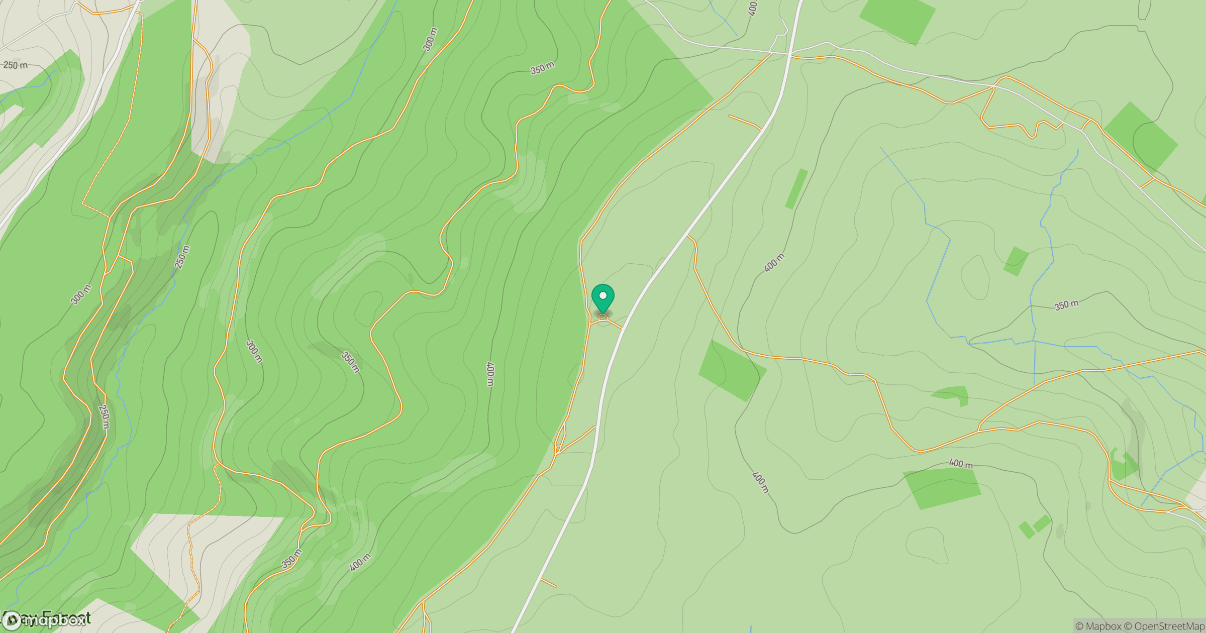
Grid reference: SN868356
View on OpenStreetMapOpens a map in a new tab, centred on the hill.
Hills within 30 km
Straight-line distance, not a walking route or confirmation of access.
No comments yet. Be the first.