
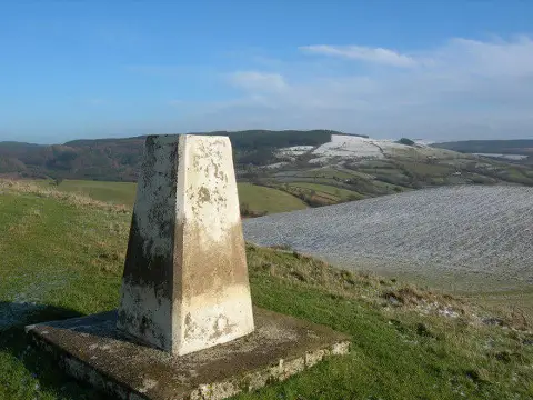
Mwmffri
Good walks are even better shared.
Overview
Mwmffri: The Hidden Gem of Snowdonia
Mwmffri, standing proudly at 609 meters (1998 feet), is a Marilyn nestled in the heart of Snowdonia. Despite its relatively modest height, it offers hikers a splendid journey with breathtaking views and a sense of solitude that only a quiet mountain can provide.
Geology
The mountain is composed primarily of ancient slate rock, formed during the Ordovician period. This geological treasure makes Mwmffri a striking sight, particularly as the slate catches the sunlight during your ascent.
Routes
Mwmffri Circular Walk
This moderate route starts and ends at the charming village of Cwmystwyth, covering about 9.5 km and taking approximately 3.5 hours. The steady incline rewards you with stunning views of the surrounding countryside.
Direct Ascent from Tal-y-bont
If you fancy a challenge, the direct ascent from Tal-y-bont is for you. Expect a steeper climb covering 5.0 km in about 2 hours. This route is favoured by the more adventurous spirits who can't resist the allure of a quick hike to the summit.
Summit Features
At the summit, you'll be greeted by a stone cairn and a well-worn trig point, perfect for showcasing your achievement to friends (and making them a bit envious).
Terrain Type
Get ready for an exciting mix of rocky paths and grassy knolls, but do watch out for the occasional boggy patch. Waterproof boots are always a wise investment in these parts!
Views
From the top, Mwmffri offers views that will knock your socks off! You can see the expansive valleys of Snowdonia and the colossal peaks of Cadair Idris and Penygadair. The best times to witness this beauty are during spring and autumn, when visibility is at its peak.
Hazards
While hiking this mountain, be mindful of steep, rocky paths, which can be slippery when wet. Always keep an eye on your footing to avoid any unexpected tumbles.
Nearby Summits
Consider extending your adventure by exploring nearby summits like Cadair Idris (893 meters) and Penygadair (811 meters).
Access
Nearest Parking
Look for a small layby on the B4574 road, about a mile from Cwmystwyth for parking.
Public Transport
Buses to Cwmystwyth from Aberystwyth are few and far between, so plan ahead to avoid any transportation hiccups.
Nearest Town
The lively town of Aberystwyth is your best bet for supplies or a hearty meal post-hike.
Facilities
Cwmystwyth has a lovely little pub nearby, while Aberystwyth boasts a selection of cafes and toilets to refresh you after your adventure.
History
The name Mwmffri possibly hails from the Welsh term for 'a place of snow', which fits its wintery look. Rich in history, this area was once known for its slate quarrying, providing essential livelihoods to its inhabitants.
Now that you're well-acquainted with Mwmffri, what are you waiting for? Grab your hiking boots and experience this marvellous mountain for yourself!
Explore routes near Mwmffri
Public walks starting within 80 km of this hill. Nearby does not mean a route reaches the summit; check its map and access before setting out.
Usk Reservoir: Glasfynydd Forest and Dam Circuit
View route
Dolaucothi Estate: Cothi Valley and Red Waymarked Circuit
View route
Aircraft Crash Site - Wellington Bomber and Vampire Jet (Black Mountain range)
View route
World Curlew Day Walk and Talk at Mynydd Illtud
View route
Route planning notes
These notes describe possible approaches, not verified navigable routes or permission to cross land. Check current paths, local access rules and conditions before setting out.
Mwmffri Circular Walk
A scenic loop starting and ending at the village of Cwmystwyth, taking you to the summit with a steady incline and breathtaking views.
Direct Ascent from Tal-y-bont
A direct but steep ascent from Tal-y-bont; a quicker way to reach the summit for the more adventurous.
Make a day of it, together
Find someone to share the walk with, or organise a day out along a route you like.
Photo Gallery
View all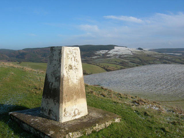 Photo could not load
SN8036 : Triangulation Pillar (S6299)
Adrian Dust
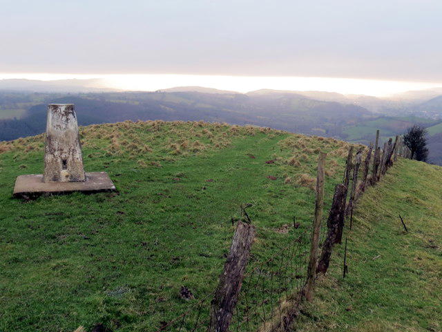 Photo could not load
SN8036 : Mwmffri
Alan Richards
Hill facts and local notes
Classifications
Elevation
302m
990 ft
Prominence
101m
Coordinates
52.0105, -3.7434
SN804361
OS Map
160
Explorer: 187S
At the Summit
The summit boasts an impressive stone cairn and a weathered trig point, ideal for a photo op to show your mates you made it!
Terrain & Geology
The mountain is primarily composed of ancient slate rock, formed in the Ordovician period, giving it a rugged yet stunningly beautiful appearance.
Views & Scenery
From the summit, one can see the expansive valleys of Snowdonia, as well as prominent peaks like Cadair Idris and Penygadair.
History & Heritage
Name Origin
Mwmffri is thought to derive from the Welsh for 'a place of snow', reflecting its winter landscape.
Historical Significance
Traditionally, this area was important for quarrying slate, fueling local industry and providing livelihoods.
Getting There & Facilities
Check current local access restrictions, parking rules and transport timetables before travelling. These notes do not confirm public access to the summit.
Parking
There is a small layby along the B4574 road, approximately 1 mile from the village of Cwmystwyth, which offers parking space for a few cars.
Public Transport
Buses run irregularly to Cwmystwyth from Aberystwyth, so checking schedules in advance is essential.
Nearby Facilities
Cwmystwyth has a quaint little pub nearby, and Aberystwyth offers cafes and toilets, perfect for pre- or post-hike refreshments.
Safety Information
Known Hazards
- Steep, rocky paths can be treacherous, especially in wet conditions; always watch your footing.
General Safety Tips
- Check weather conditions before setting out
- Carry appropriate clothing and equipment
- Let someone know your planned route
- Take a map, compass, and GPS device
- Carry emergency supplies: food, water, first aid kit, torch
Hills
Some common questions about the hills answered
Are there group walks up Mwmffri?
Many walkers use Walkmates to join or organise walks with others. You can check for group walks around Mwmffri through the maps
Are there other walkers around Mwmffri?
Activity varies by location and time, but Walkmates lets you see whether others have shared walks or shown interest in this area. Find other people through the walking friends search walking friends for Mwmffri search or of course create your own walk for Mwmffri
Can I organise a walk to Mwmffri?
Yes. If there aren’t any walks listed already, you can create a walk and make it available for others to join.
If you're signed up to Walkmates, you can create a walk to Mwmffri.
How do I find a walk up this hill?
There are often multiple ways to walk this hill, depending on experience and route preference. Walkmates helps you explore walks and routes that others have shared.
Can I suggest a new route up Mwmffri?
Yes. You can suggest or create routes to share with others. Walkmates focuses on the social side of walking, so routes are used to help people organise walks and explore areas together, rather than as detailed navigation tools or route libraries.
Other uses really appreciate knowledgeable walkers sharing their routes. Share your favourite route to Mwmffri here
The is an error or something incorrect about this hill. How do I let you know?
We always strive to keep the information on Walkmates as accurate as possible. If you find an error, please let us know through the contact form and we'll aim to correct it as quickly as possible
Community Discussion
Comments
Location
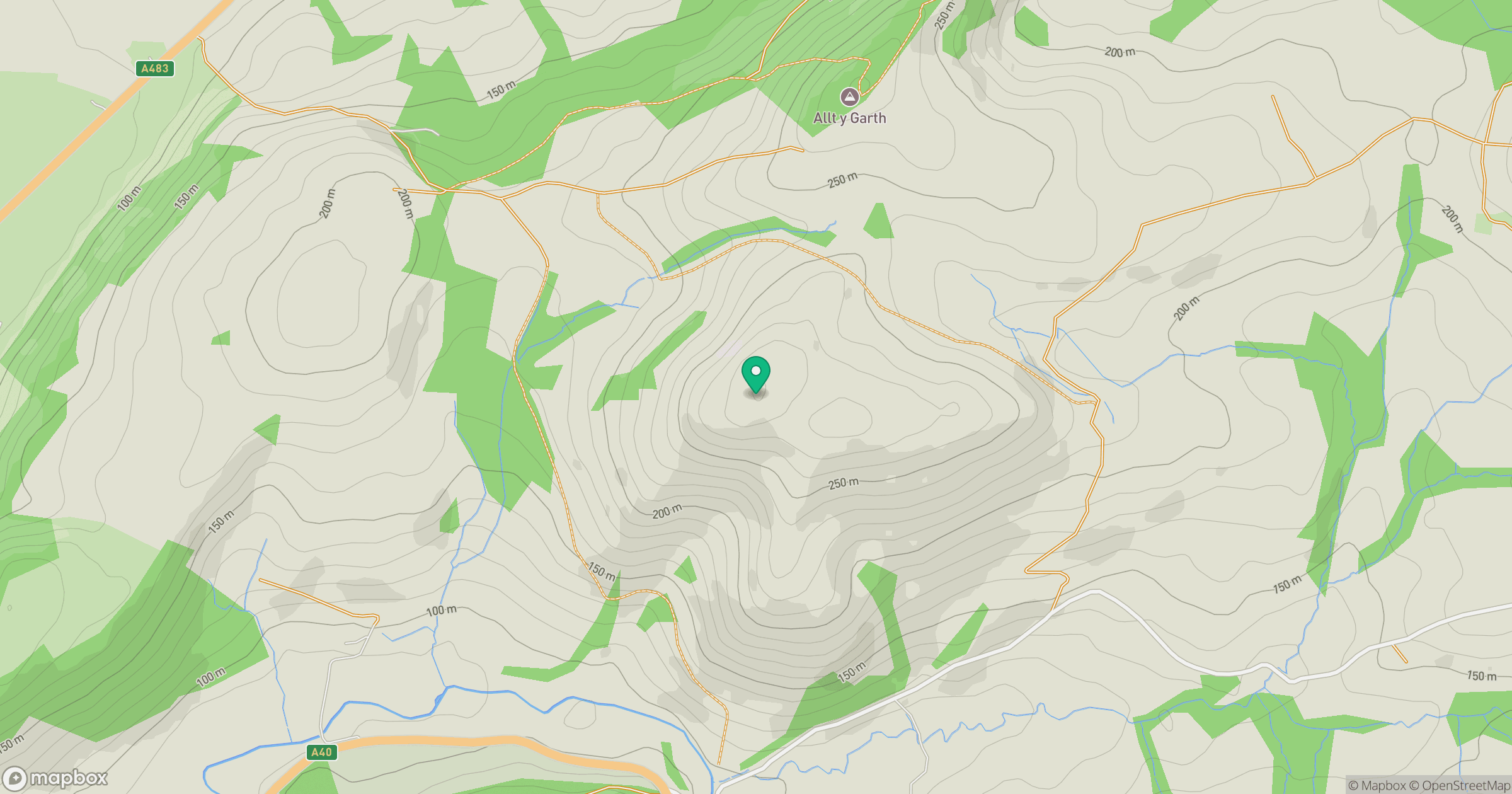
Grid reference: SN804361
View on OpenStreetMapOpens a map in a new tab, centred on the hill.
Hills within 30 km
Straight-line distance, not a walking route or confirmation of access.
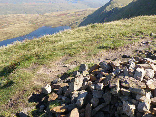
Fan Brycheiniog - Twr y Fan Foel
802m
Fan Gyhirych
726m
Pen y Fan
886m
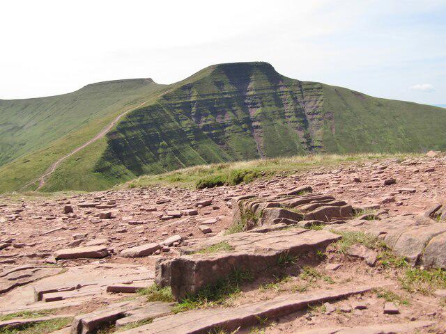
Cribyn
794m
Mynydd Myddfai
440m
No comments yet. Be the first.