
Yr Allt
Good walks are even better shared.
Overview
Yr Allt: An Engaging Expedition
Overview
Yr Allt, rising to a modest height of 383 meters, might not be the tallest in the Welsh Marches, but it beckons hikers with its breathtaking views and approachable terrain. Whether you're looking for a light jaunt or an opportunity to stretch your legs, this Marilyn is a delightful destination.
Geology
Like a good wine, Yr Allt gets its character from its Old Red Sandstone origins. The volcanic rock layers tell a story of ancient geological processes that have shaped this landscape over millions of years. You'll find that the rugged nature adds a touch of drama to your hike without requiring a cape!
Routes
The most common route starts at Bwlch Rhiw Coch, a well-trodden path that takes you through lush greenery and alleviates the worries of city life. The trail is around 4.5 km one way and takes about 2 hours, making it perfect for a morning or afternoon hike.
Summit Features
When you reach the top, head straight for the sizeable cairn — not just a collection of stones, but a legitimate landmark that begs for a selfie! It’s a perfect rest stop for taking in the surrounding landscapes and pondering life's greatest mysteries, like why some socks always disappear in the wash.
Terrain Type
Expect a mix of grassy slopes interspersed with rocky outcrops. Be cautious of waterlogged areas, particularly after rain; it can end up feeling like you’re walking through a marshland instead of a mountain trail!
Views
The views from Yr Allt are nothing short of spectacular. On a clear day, you can spot the impressive peaks of the Brecon Beacons, the Black Mountains, and shimmering sights of the Wye Valley. The best time for these views? Spring and autumn, where vibrant colours enrich the landscape like artists with a palette.
Hazards
The biggest hazard is the terrain; uneven paths can make your trek a little less than smooth. A good pair of waterproof boots and an extra sandwich can ensure you’re well prepared.
Nearby Summits
After conquering Yr Allt, why not challenge yourself with some nearby hills? Cilfaesty Hill (387 meters) and Pen y Fan (886 meters) loom nearby, offering more opportunities for adventure!
Access
Access is straightforward, with parking available at Bwlch Rhiw Coch for early risers. If public transport is your thing, buses from Knighton bring you close enough to walk the remaining distance. Knighton itself offers cafes and shops, so you can refuel post-hike!
Facilities
While amenities aren’t on the summit, a quick trip to Knighton will sort out your cravings. Load up on caffeine or grab a bite before you hit the trails.
History
The translation of Yr Allt, 'The Hill', doesn’t have the fanciest etymology, but it serves to remind us that sometimes simplicity is extraordinary. The region’s prehistoric significance is palpable, with historical sites adding depth to the visit.
With all these offerings, Yr Allt stands ready to welcome hikers of all kinds with open arms (metaphorically speaking). Pack your bags, lace up those boots, and set out on your adventure today!
Explore routes near Yr Allt
Walks starting near this hill. Open a route to check its map, distance and full itinerary.
Usk Reservoir: Glasfynydd Forest and Dam Circuit
View route
Pen y Fan via Corn Du from Storey Arms
View route
Brecon Basin to Brynich Aqueduct: Canal Towpath Walk
View route
Aircraft Crash Site - Wellington Bomber and Vampire Jet (Black Mountain range)
View route
Route planning notes
These notes describe possible approaches. Check a route's map and access information when planning your walk.
From Bwlch Rhiw Coch
A moderate climb offering a scenic route through lush greenery and rewarding views.
Make a day of it, together
Find someone to share the walk with, or organise a day out along a route you like.
Hill facts and local notes
Classifications
Elevation
353m
1,157 ft
Prominence
100m
Coordinates
51.9533, -3.5809
SN914294
OS Map
160
Explorer: OL12E
At the Summit
A prominent cairn marks the summit, providing a perfect spot for a photo and a well-deserved snack break.
Terrain & Geology
The mountain is primarily composed of volcanic rock from the Old Red Sandstone period, which contributes to its rugged terrain.
Views & Scenery
Panoramic views of the Brecon Beacons and the Black Mountains, as well as glimpses of the Wye Valley.
History & Heritage
Name Origin
Yr Allt translates to 'The Hill', which is as straightforward as it gets — no obscure history there!
Historical Significance
The area has been inhabited since prehistoric times, showcasing ancient burial mounds nearby.
Getting There & Facilities
Parking
There is a small car park at Bwlch Rhiw Coch, which accommodates about 10 cars. Arrive early to secure a spot!
Public Transport
The nearest bus stop is in the village of Llangunllo, from where it’s a 2-mile walk to the trailhead.
Nearby Facilities
While there are no facilities directly on the mountain, Knighton hosts cafes, public toilets, and small shops.
Safety Information
Known Hazards
- The terrain can be uneven and slippery, especially after rain; take care to wear appropriate footwear.
General Safety Tips
- Check weather conditions before setting out
- Carry appropriate clothing and equipment
- Let someone know your planned route
- Take a map, compass, and GPS device
- Carry emergency supplies: food, water, first aid kit, torch
Hills
Some common questions about the hills answered
Are there group walks up Yr Allt?
Many walkers use Walkmates to join or organise walks with others. You can check for group walks around Yr Allt through the maps
Are there other walkers around Yr Allt?
Activity varies by location and time, but Walkmates lets you see whether others have shared walks or shown interest in this area. Find other people through the walking friends search walking friends for Yr Allt search or of course create your own walk for Yr Allt
Can I organise a walk to Yr Allt?
Yes. If there aren’t any walks listed already, you can create a walk and make it available for others to join.
If you're signed up to Walkmates, you can create a walk to Yr Allt.
How do I find a walk up this hill?
There are often multiple ways to walk this hill, depending on experience and route preference. Walkmates helps you explore walks and routes that others have shared.
Can I suggest a new route up Yr Allt?
Yes. You can suggest or create routes to share with others. Walkmates focuses on the social side of walking, so routes are used to help people organise walks and explore areas together, rather than as detailed navigation tools or route libraries.
Other uses really appreciate knowledgeable walkers sharing their routes. Share your favourite route to Yr Allt here
The is an error or something incorrect about this hill. How do I let you know?
We always strive to keep the information on Walkmates as accurate as possible. If you find an error, please let us know through the contact form and we'll aim to correct it as quickly as possible
Community Discussion
Comments
Location
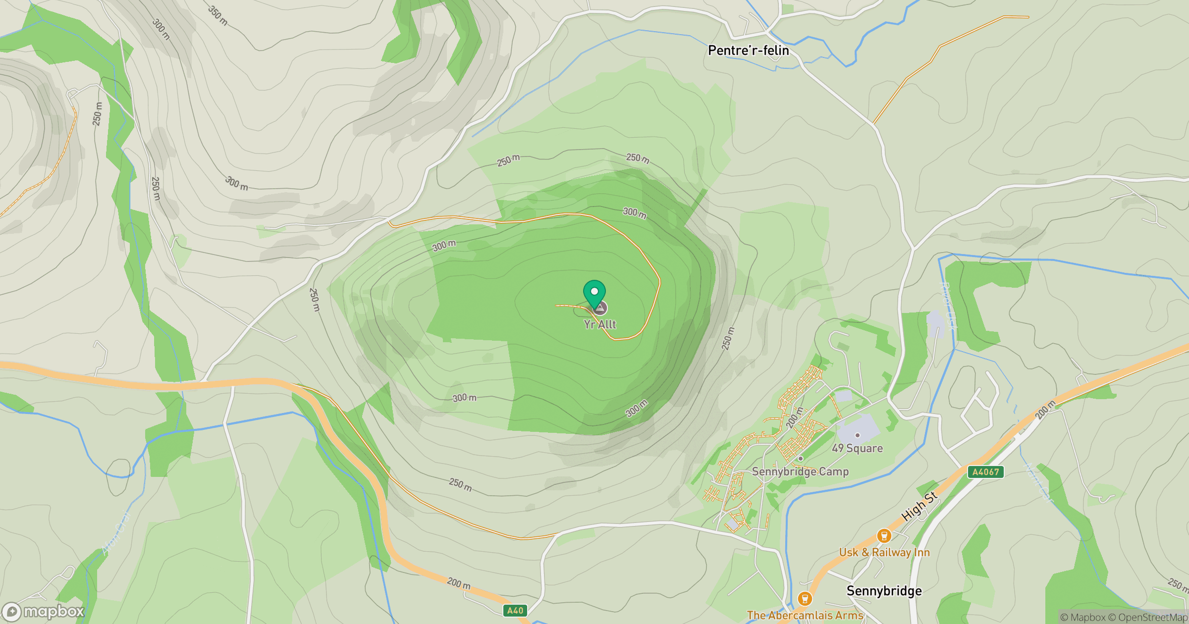
Grid reference: SN914294
View on OpenStreetMapOpens a map in a new tab, centred on the hill.


No comments yet. Be the first.