
Mynydd Myddfai
Good walks are even better shared.
Overview
Mynydd Myddfai: A Hiker's Delight
Nestled in the picturesque Brecon Beacons National Park, Mynydd Myddfai stands tall at 510 metres, offering hikers a treasure trove of stunning vistas and a bit of Welsh folklore.
Geology
Mynydd Myddfai is primarily composed of Old Red Sandstone, a rock formation that provides ample opportunity for geology buffs to appreciate the rich geological history of the region. Its sedimentary layers tell tales of ancient landscapes and environments, providing a fun excuse to bring a geology book along for inspiration!
Routes
The most popular route is the Myddfai to Mynydd Myddfai Loop, which takes approximately 2.5 hours to cover 5 kilometers. It offers a mix of forest paths and lovely open moorland, perfect for those eager to stretch their legs.
For the more adventurous, the Lakeside Trail from Llyn y Fan Fach is a challenging 7.5-kilometer hike, best saved for those feeling sprightly—a great way to enjoy the magnificent lake views before heading to the summit!
Summit Features
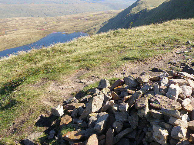
Upon reaching the summit, hikers will find a modest cairn marking the peak, as well as a breathtaking panorama of the surrounding hills and valleys. You may even find a few sheep gazing out at the scenery—they have great taste in views!
Terrain
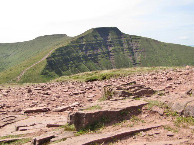
The terrain is a delightful mix of grassy slopes with occasional rocky outcrops, providing a gentle but steady ascent that keeps you engaged without turning your calves into jelly.
Views
On a crisp clear day, the views from Mynydd Myddfai are simply jaw-dropping, with the Black Mountain range and the lush Towy Valley stretching out below. The best times for these breathtaking vistas are during spring and early autumn when the landscape is painted in vibrant colours.
Hazards
While Mynydd Myddfai is generally a safe hike, do keep an eye on the weather. It has a tendency to change quicker than a toddler's mood. Sudden mist can roll in, so ensuring you have a map (or a good sense of direction) is crucial!
Nearby Summits
If you're feeling ambitious, consider including nearby peaks like Mynydd Du (759 metres) or Fan Brycheiniog (802 metres) in your adventure. These mountains are worthy companions, each offering their own unique charm and challenges.
Access
Starting your journey from the quaint village of Myddfai is seamless as there’s a small car park available. Just remember to come early, as spots tend to fill up quicker than you can say 'Bwlch.' For those relying on public transport, regular bus services from Llandovery make accessing Myddfai a breeze.
Facilities
Don’t forget to refuel! Myddfai has a delightful café and public toilets, so you can both grab a hot drink and take care of business before your hike.
History
The name 'Myddfai' evokes a sense of adventure and history, meaning 'wild' and referencing the ancient settlement. Additionally, it's steeped in rich folklore about the Physicians of Myddfai, historical figures who were said to be skilled healers during the Middle Ages. Time for their next convention?
In conclusion, Mynydd Myddfai is a hidden gem within the Brecon Beacons awaiting your footsteps. Whether you're hoping to snap a picture or simply breathe in that wonderfully fresh mountain air, it promises memories to last a lifetime.
Happy hiking!
Explore routes near Mynydd Myddfai
Public walks starting within 80 km of this hill. Nearby does not mean a route reaches the summit; check its map and access before setting out.
Usk Reservoir: Glasfynydd Forest and Dam Circuit
View route
Aircraft Crash Site - Wellington Bomber and Vampire Jet (Black Mountain range)
View route
World Curlew Day Walk and Talk at Mynydd Illtud
View route
Dolaucothi Estate: Cothi Valley and Red Waymarked Circuit
View route
Route planning notes
These notes describe possible approaches, not verified navigable routes or permission to cross land. Check current paths, local access rules and conditions before setting out.
Myddfai to Mynydd Myddfai Loop
A beautiful circular route starting from the village of Myddfai, offering a mix of forest paths and open moorland.
Lakeside Trail from Llyn y Fan Fach
An alternative approach that combines stunning views of Llyn y Fan Fach and a steady ascent towards the summit.
Make a day of it, together
Find someone to share the walk with, or organise a day out along a route you like.
Photo Gallery
View all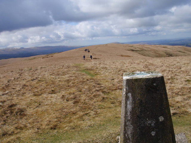 Photo could not load
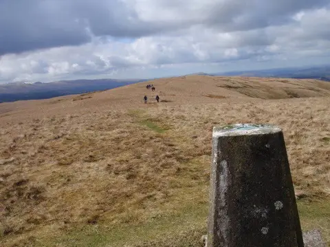
SN8029 : Mynydd Myddfai
Alan Richards
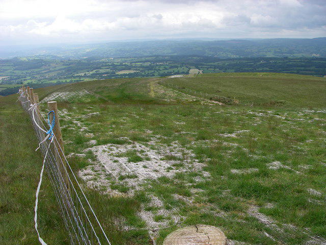 Photo could not load
SN8029 : Pipeline across the mountain
Alan Bowring
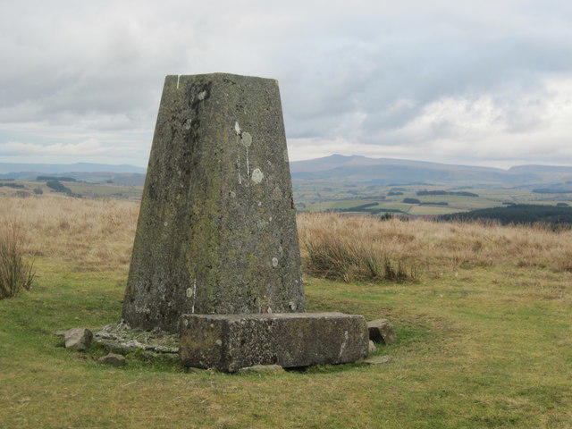 Photo could not load
SN8029 : Mynydd Myddfai trig point
John Light
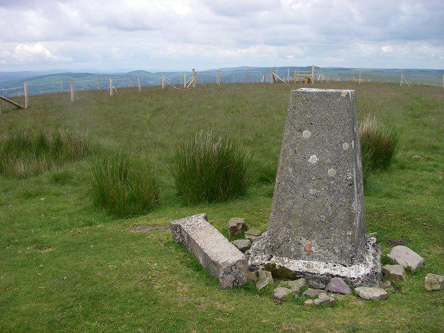 Photo could not load
SN8029 : Summit of Mynydd Myddfai
Alan Bowring
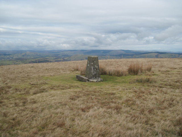 Photo could not load
SN8029 : Mynydd Myddfai trig point looking north
John Light
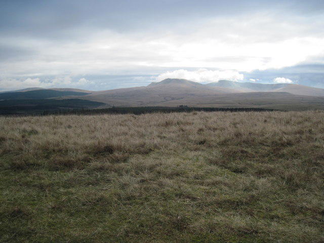 Photo could not load
SN8029 : View south from Mynydd Myddfai
John Light
Hill facts and local notes
Classifications
Elevation
440m
1,444 ft
Prominence
130m
Coordinates
51.9531, -3.7376
SN806297
OS Map
160
Explorer: OL12W
At the Summit
The summit is marked by a modest cairn and offers panoramic views of the surrounding hills and valleys.
Terrain & Geology
Primarily composed of Old Red Sandstone, Mynydd Myddfai features striking sedimentary formations that provide insight into the region's geological history.
Views & Scenery
Spectacular views of the Black Mountain range and the Towy Valley can be seen from the summit on a clear day.
History & Heritage
Name Origin
Myddfai is derived from the Welsh words 'Mydd' meaning 'wild' and 'fai' which references the ancient settlement.
Historical Significance
The area around Myddfai is steeped in folklore, particularly the legends of the Physicians of Myddfai, who were said to be skilled healers in the Middle Ages.
Getting There & Facilities
Check current local access restrictions, parking rules and transport timetables before travelling. These notes do not confirm public access to the summit.
Parking
There is a small car park in Myddfai village, which serves as a perfect base for the hike. Spaces are limited, so arrive early.
Public Transport
Regular bus services run to Myddfai from Llandovery. Check local timetables for the most up-to-date information.
Nearby Facilities
Myddfai has a charming café where you can fuel up before your hike, and public toilets are also available nearby.
Safety Information
Known Hazards
- Be cautious of sudden changes in weather. The area can become misty quickly, impacting visibility.
General Safety Tips
- Check weather conditions before setting out
- Carry appropriate clothing and equipment
- Let someone know your planned route
- Take a map, compass, and GPS device
- Carry emergency supplies: food, water, first aid kit, torch
Hills
Some common questions about the hills answered
Are there group walks up Mynydd Myddfai?
Many walkers use Walkmates to join or organise walks with others. You can check for group walks around Mynydd Myddfai through the maps
Are there other walkers around Mynydd Myddfai?
Activity varies by location and time, but Walkmates lets you see whether others have shared walks or shown interest in this area. Find other people through the walking friends search walking friends for Mynydd Myddfai search or of course create your own walk for Mynydd Myddfai
Can I organise a walk to Mynydd Myddfai?
Yes. If there aren’t any walks listed already, you can create a walk and make it available for others to join.
If you're signed up to Walkmates, you can create a walk to Mynydd Myddfai.
How do I find a walk up this hill?
There are often multiple ways to walk this hill, depending on experience and route preference. Walkmates helps you explore walks and routes that others have shared.
Can I suggest a new route up Mynydd Myddfai?
Yes. You can suggest or create routes to share with others. Walkmates focuses on the social side of walking, so routes are used to help people organise walks and explore areas together, rather than as detailed navigation tools or route libraries.
Other uses really appreciate knowledgeable walkers sharing their routes. Share your favourite route to Mynydd Myddfai here
The is an error or something incorrect about this hill. How do I let you know?
We always strive to keep the information on Walkmates as accurate as possible. If you find an error, please let us know through the contact form and we'll aim to correct it as quickly as possible
Community Discussion
Comments
Location
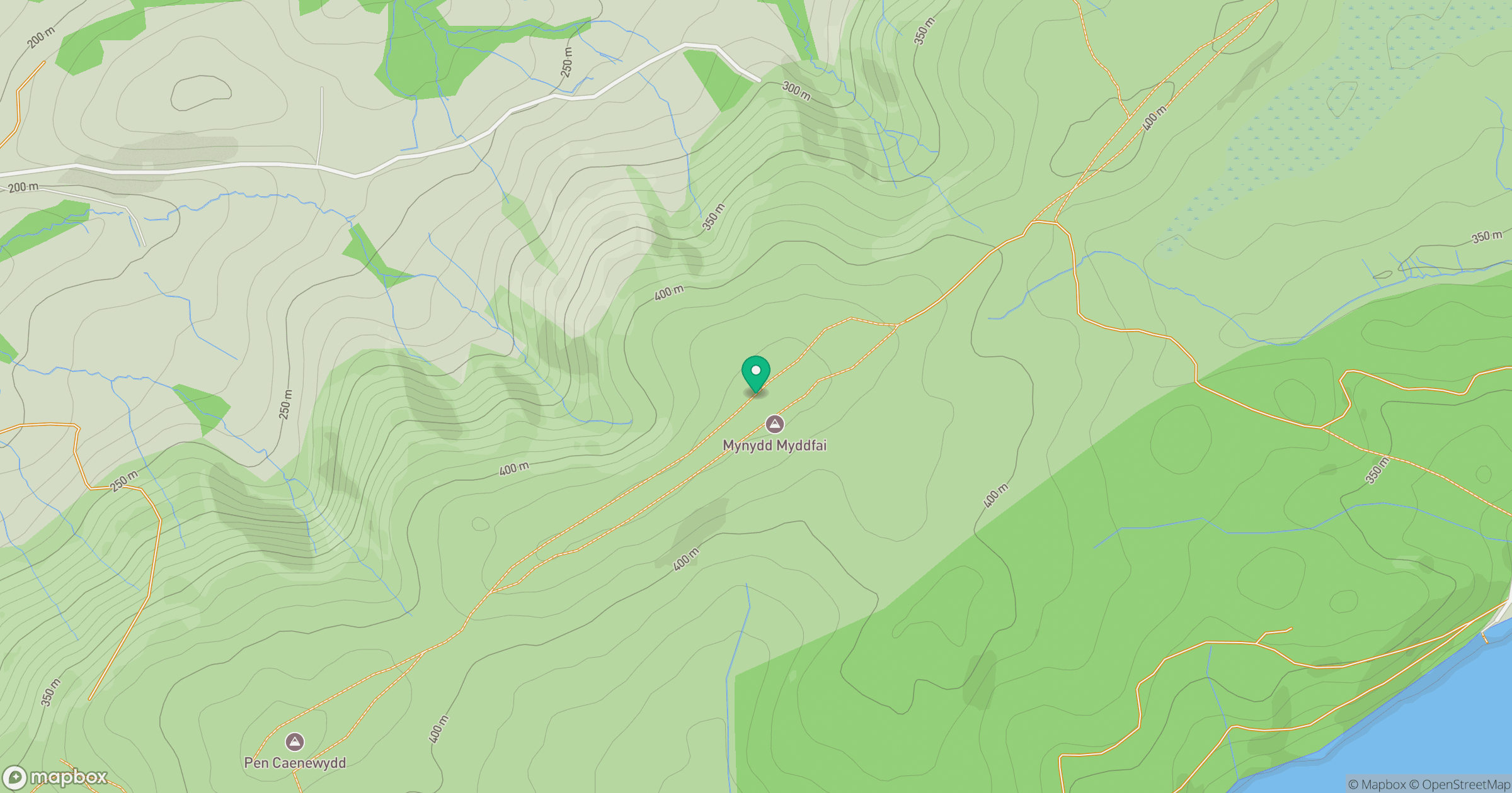
Grid reference: SN806297
View on OpenStreetMapOpens a map in a new tab, centred on the hill.
Hills within 30 km
Straight-line distance, not a walking route or confirmation of access.
No comments yet. Be the first.