

Meall nan Tarmachan NE Top
Good walks are even better shared.
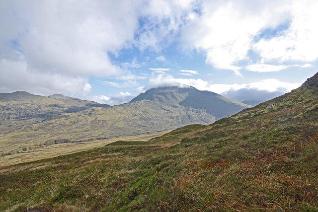
NN5939 : Meall nan Tarmachan from Beinn Ghlas
Peter S Photo source
Overview
Meall nan Tarmachan NE Top
A hidden gem in the heart of the Scottish Highlands, Meall nan Tarmachan NE Top provides both a challenge and a reward for adventurers and nature lovers. With an elevation of 946 meters, this peak might not be the tallest, but it holds its own with breathtaking views and a charming summit experience.
Geology
The underlying geology of Meall nan Tarmachan NE Top is composed mainly of Old Red Sandstone, which has given rise to unique rock formations. For those fascinated by geology, the erosion patterns and rock types provide a glimpse into the turbulent history of the area.
Routes
The most popular approach is the Meall nan Tarmachan Circuit, a loop that takes you over the main peak before continuing to the NE Top. This moderate hike usually takes around 4.5 hours and covers approximately 10.5 km, so pack a picnic, breathable layers, and your sense of adventure.
Summit Features
Upon reaching the summit, you'll be greeted by a modest cairn, encouraging hikers to rest and take in the stunning panoramas. It’s an ideal spot for a quick snack - perhaps not a full three-course meal, but we won’t judge!
Terrain Type
The terrain varies from rocky paths to grassy slopes, with some boggy patches along the way. Just a gentle reminder: leave the flip-flops at home and choose sturdy footwear instead.
Views
Once atop, the views are simply magnificent. You will see Loch Tay sparkling below and the majestic peaks of Ben Lawers looming beyond. The scenery is a photographer’s delight, particularly during late spring or early autumn when the colours are at their most vibrant.
Hazards
While the trails are generally well-trodden, be mindful of steep drops near the summit. Also, the weather can change on a dime in the Highlands, so ensure you’re suited with layers and snacks (though not your emergency chocolate bars - those are sacred).
Access
To find your way to Meall nan Tarmachan NE Top, venture to the car park at NN586366, near the Ben Lawers Visitor Centre. Buses to Killin are available, but getting to the car park may require a taxi.
Facilities
Before or after your hike, the Ben Lawers Visitor Centre is a fantastic stop with a café providing the quintessential Scottish fuel – coffee and cakes! It also has toilets, so don’t drink too much coffee before you embark on your adventure.
History
The name 'Meall nan Tarmachan' translates to 'hill of the ptarmigan', a testament to the wildlife that thrives in this area. With ancient paths leading to and from this peak, it serves as a reminder of the long-standing relationship between the local community and their environment.
So, whether you're a seasoned hillwalker or just looking to enjoy a day amid Scotland's glorious nature, Meall nan Tarmachan NE Top awaits with open arms and enchanting vistas!
Conclusion
In essence, visiting Meall nan Tarmachan NE Top can be a delightful jaunt for anyone seeking a taste of the Scottish Highlands above the ordinary. Just remember your essentials and enjoy the hike!
Explore routes near Meall nan Tarmachan NE Top
Walks starting near this hill. Open a route to check its map, distance and full itinerary.
Killin: Falls of Dochart, Finlarig and Moirlanich Longhouse
View route
Kenmore: Drummond Hill Black Rock Trail above Loch Tay
View route
Aberfeldy: Glassie Woodland and River Tay Circular
View route
Loch Lubnaig: West Shore Railway Path from Ben Ledi Car Park
View route
Route planning notes
These notes describe possible approaches. Check a route's map and access information when planning your walk.
Meall nan Tarmachan Circuit
A popular loop that allows hikers to summit both Meall nan Tarmachan and its NE Top, offering stunning views and diverse terrain.
Make a day of it, together
Find someone to share the walk with, or organise a day out along a route you like.
Photo Gallery
View all Photo could not load
NN5939 : Meall nan Tarmachan from Beinn Ghlas
Peter S
 Photo could not load
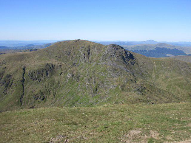
NN5939 : Lochan an Tairbh Uisge
Alastair Seagroatt
Hill facts and local notes
Classifications
Elevation
808m
2,650 ft
Prominence
23m
Coordinates
56.5275, -4.2913
NN591396
OS Map
51
Explorer: OL48E 378E
At the Summit
The NE Top features a small cairn marking the high point, providing a perfect spot for a well-deserved rest and snack. Just don't forget to take a selfie to prove you made it!
Terrain & Geology
The mountain is primarily composed of Old Red Sandstone, which has weathered into interesting rock formations and provides a variety of colourful strata, alongside some basalt intrusions. This rocky foundation gives a clue as to the dynamic geological processes that shaped this stunning landscape.
Views & Scenery
From the summit, you can observe Loch Tay, the rugged peaks of Ben Lawers, and the rolling hills of the Trossachs. On a clear day, you might even catch a glimpse of distant peaks in the Southern Highlands.
History & Heritage
Name Origin
The name 'Meall nan Tarmachan' is derived from Gaelic, meaning 'hill of the ptarmigan', reflecting the wildlife endemic to the area.
Historical Significance
This area is rich in history, with ancient paths often used by shepherds and the local community, alongside significant archaeological sites nearby.
Getting There & Facilities
Parking
There is a car park at NN586366, close to the Ben Lawers Visitor Centre, which serves as an excellent starting point for your hike.
Public Transport
Buses to Killin run regularly from larger towns such as Aberfeldy. Subsequent travel to the car park may require a taxi or a good walk.
Nearby Facilities
The Ben Lawers Visitor Centre offers facilities including a café and toilets, perfect for a post-hike treat or a pre-hike caffeine boost.
Safety Information
Known Hazards
- Be cautious of steep drops around the summit. Weather can change rapidly, so make sure to check conditions before setting out.
General Safety Tips
- Check weather conditions before setting out
- Carry appropriate clothing and equipment
- Let someone know your planned route
- Take a map, compass, and GPS device
- Carry emergency supplies: food, water, first aid kit, torch
Hills
Some common questions about the hills answered
Are there group walks up Meall nan Tarmachan NE Top?
Many walkers use Walkmates to join or organise walks with others. You can check for group walks around Meall nan Tarmachan NE Top through the maps
Are there other walkers around Meall nan Tarmachan NE Top?
Activity varies by location and time, but Walkmates lets you see whether others have shared walks or shown interest in this area. Find other people through the walking friends search walking friends for Meall nan Tarmachan NE Top search or of course create your own walk for Meall nan Tarmachan NE Top
Can I organise a walk to Meall nan Tarmachan NE Top?
Yes. If there aren’t any walks listed already, you can create a walk and make it available for others to join.
If you're signed up to Walkmates, you can create a walk to Meall nan Tarmachan NE Top.
How do I find a walk up this hill?
There are often multiple ways to walk this hill, depending on experience and route preference. Walkmates helps you explore walks and routes that others have shared.
Can I suggest a new route up Meall nan Tarmachan NE Top?
Yes. You can suggest or create routes to share with others. Walkmates focuses on the social side of walking, so routes are used to help people organise walks and explore areas together, rather than as detailed navigation tools or route libraries.
Other uses really appreciate knowledgeable walkers sharing their routes. Share your favourite route to Meall nan Tarmachan NE Top here
The is an error or something incorrect about this hill. How do I let you know?
We always strive to keep the information on Walkmates as accurate as possible. If you find an error, please let us know through the contact form and we'll aim to correct it as quickly as possible
Community Discussion
Comments
Location
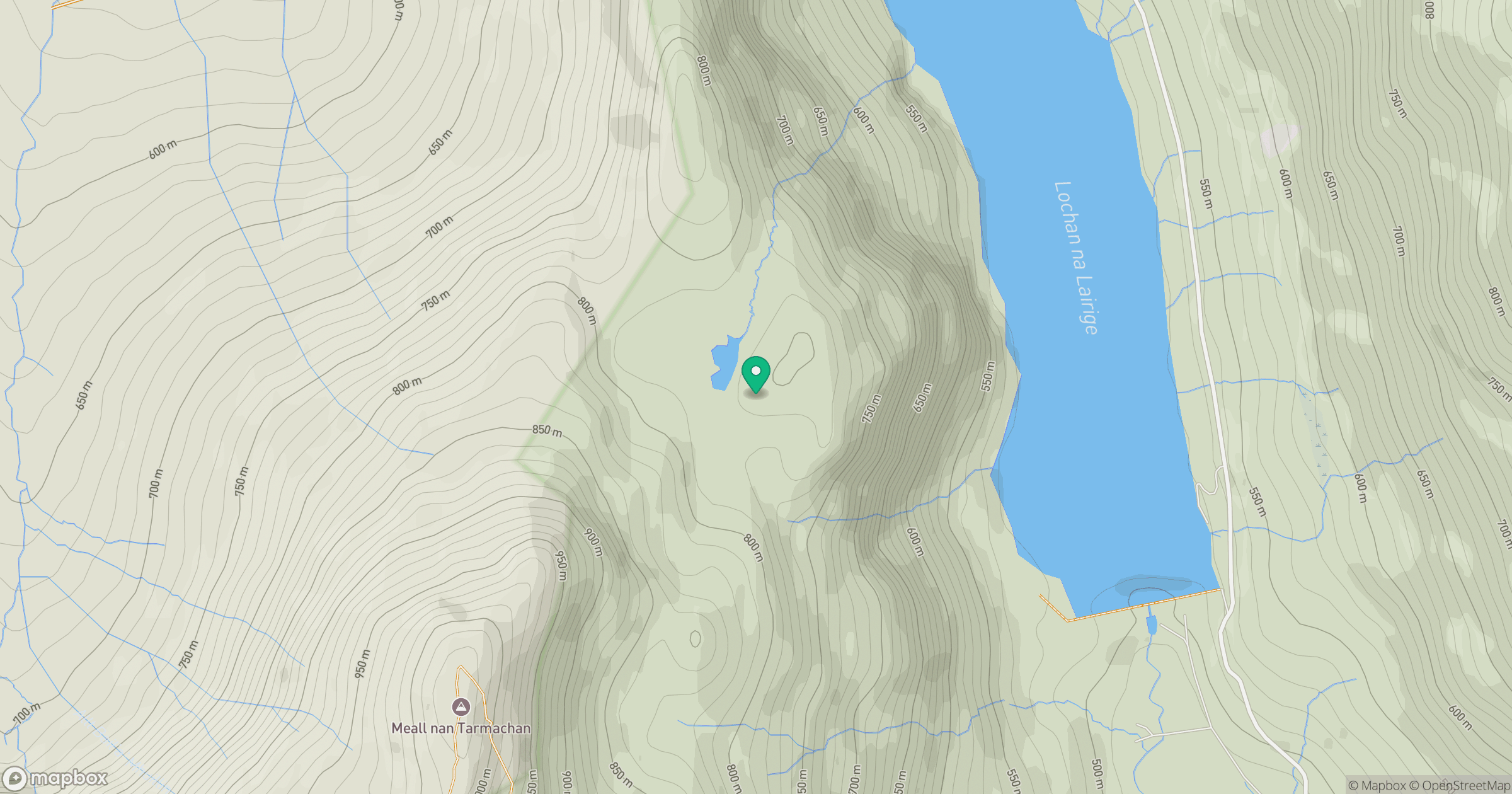
Grid reference: NN591396
View on OpenStreetMapOpens a map in a new tab, centred on the hill.
No comments yet. Be the first.