
Ben More
Good walks are even better shared.
Overview
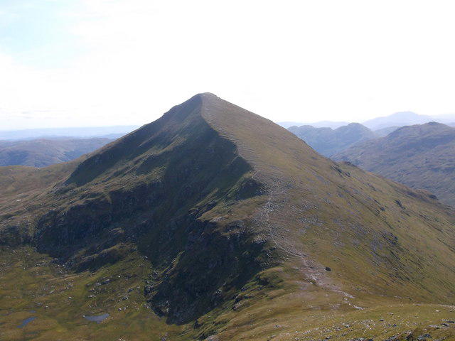
Ben More is the 1173.9 m Munro above Crianlarich, the highest mountain in Loch Lomond & The Trossachs National Park. Its steep north-west shoulder rises from Benmore Farm beside the A85. It can be climbed alone or combined with Stob Binnein across Bealach Eadar da-Bheinn; the southern approach from Inverlochlarig is a separate, longer outing.
Ben More (Crianlarich)
Overview
Ben More is the 1173.9 m Munro above Crianlarich, the highest mountain in Loch Lomond & The Trossachs National Park. Its steep north-west shoulder rises from Benmore Farm beside the A85. It can be climbed alone or combined with Stob Binnein across Bealach Eadar da-Bheinn; the southern approach from Inverlochlarig is a separate, longer outing.
Summit
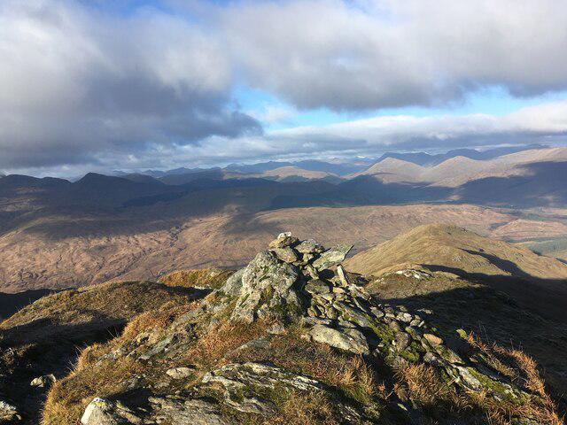
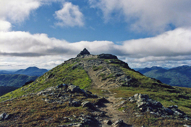
The surveyed summit feature is the trig point at 1173.9 m. A large cairn stands nearby. The summit grid reference NN432244 identifies the top, not the Benmore Farm start.
Routes and complete returns
Ben More via Benmore Farm and back
Start at the signed Ben More approach beside the A85 near Benmore Farm, NN420263. Follow the zigzag farm track to the gate, then climb the steep north-west shoulder path to Ben More’s summit trig point and nearby large cairn. Return by the same shoulder path and farm track to the A85 start. This route climbs Ben More only. Keep clear of Sloc Curraidh and its steep headwall; descending into the corrie is not a shortcut. The sustained descent, route finding and any snow or ice require care. Check current estate notices and park without obstructing the road or farm access.
Ben More and Stob Binnein from Benmore Farm
Start by Benmore Farm on the A85, at the signed approach near NN420263. Follow the farm track, then climb Ben More’s steep north-west shoulder, keeping out of Sloc Curraidh. From the summit descend south to Bealach Eadar da-Bheinn; the short rocky step has an eastern bypass. Climb Stob Binnein by its north ridge, then return north to the same bealach. Descend west into Benmore Glen and follow the track north to the A85 start. This complete two-Munro circuit has 1335 m of ascent; Walkhighlands gives 6–8 hours. Check current stalking notices and take care beside the A85. The full circuit is 12 km.
Stob Binnein and Ben More from Inverlochlarig
Start and finish at Inverlochlarig car park, NN445185, west of Balquhidder. Follow current signed hill access near the car park, then climb the Stob Invercarnaig shoulder and southern ridge over Stob Coire an Lochain to Stob Binnein. Continue north through the bealach to Ben More. Return to the bealach, descend west, then make the rough, pathless traverse towards the pass at the head of Benmore Glen. Descend south through Inverlochlarig Glen and join the track and signed return to the car park. This two-Munro circuit has 1357 m of ascent; UKHillwalking gives 6–7 hours. The glen return is boggy, crosses burns and needs careful navigation. Check estate guidance; winter cornices affect the high southern ridge. The full circuit is 14.8 km.
Terrain and geology
Farm track, a very steep north-west shoulder path, rocky summit ground and steep grassy ridges. The paired northern circuit returns through wet and sometimes boggy Benmore Glen. The separate southern circuit includes a rough, partly pathless traverse and glen return.
The massif is formed from metamorphic Dalradian schists. NatureScot records mainly nutrient-poor rocks and soils, with local nutrient-rich mica-schist outcrops that support distinctive mountain plants. These are not the basalt lavas of the unrelated Ben More on Mull.
Safety and seasons
Steep, sustained ascents and descents make both the single-summit and paired routes demanding. Wet grass, rock and eroded ground can be slippery.
On Ben More, keep out of Sloc Curraidh and its steep headwall. Poor visibility can lead walkers into dangerous ground; the corrie is also an avalanche hazard in snow.
Ben More’s south descent includes a short rock step with an eastern bypass. The southern Inverlochlarig circuit has a rough, boggy, partly pathless return and burn crossings.
Low cloud and strong wind increase route-finding and exposure problems. Carry a map, compass, waterproofs, warm clothing, food, water, torch and emergency equipment; know when to turn back.
Snow and ice can make the steep summit slopes and descents serious winter mountaineering terrain. Sloc Curraidh on Ben More is prone to avalanches, and Stob Binnein’s southern ridge can develop cornices. Check mountain weather and current snow conditions, allow enough daylight for the full return, and carry the equipment and skills appropriate to the conditions.
Access and parking
For the northern approach, use only suitable roadside space near Benmore Farm on the A85, keeping the carriageway, gateways and farm access clear. A larger layby farther east near the west end of Loch Iubhair adds road walking; take care around fast traffic. For the southern approach, use Inverlochlarig car park, NN445185, at the public-road end west of Balquhidder. Follow the current signed hill entrance nearby. A July 2026 walk report describes changed lower access, so older stile directions may be out of date. Check current deer-management notices before setting out. NatureScot’s Southern Highlands table, updated 23 September 2026, lists Suie Estate east of the ridge: stalking from early September to 20 October and 30 October to 15 February, with no stalking on Sundays. It says the normal Benmore Farm route, returning the same way, is acceptable. Check other approaches with the estate rather than extending that advice to eastern or southern variants; the listed contact is 01567 820354. Follow reasonable local signs and keep dogs under close control.
Transport and facilities
Crianlarich has rail and coach links. The northern Benmore Farm start is about 2 miles east along the A85; this extra approach is outside the hill-route totals and involves road traffic. Inverlochlarig is a separate southern start reached via Balquhidder. Check current services and arrange onward transport for the chosen start.
Public toilets are listed in Crianlarich and at its railway station; check current availability before relying on them. Carry food, water and equipment for the full mountain return.
Views
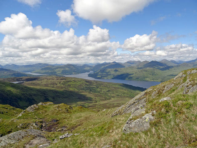
In clear weather the summit looks across the southern Highlands, with Ben Lui to the west, Ben Lawers above Loch Tay, and Stob Binnein immediately to the south.
Name and conservation history
The name 'Ben More' translates to 'Big Mountain' in Gaelic, fitting given its imposing stature in the landscape.
The Ben More–Stob Binnein massif was first notified as a Site of Special Scientific Interest in 1972. Its protected features include alpine heath, alpine moss heath, tall-herb ledges and important plant and lichen assemblages.
Nearby landscape
Benmore Glen lies west of the ridge linking the two Munros. Loch Dochart and Loch Iubhair lie to the north; the southern approach starts at Inverlochlarig beyond Loch Voil and Loch Doine. These northern and southern trailheads are far apart by road.
Explore routes near Ben More
Walks starting near this hill. Open a route to check its map, distance and full itinerary.
West Highland Way: Tyndrum to Bridge of Orchy
View route
Killin: Falls of Dochart, Finlarig and Moirlanich Longhouse
View route
Loch Katrine: Trossachs Pier to Stronachlachar
View route
Loch Katrine: Brenachoile Point Shore Walk from Trossachs Pier
View route
Route planning notes
These notes describe possible approaches. Check a route's map and access information when planning your walk.
Ben More via Benmore Farm and back
Start at the signed Ben More approach beside the A85 near Benmore Farm, NN420263. Follow the zigzag farm track to the gate, then climb the steep north-west shoulder path to Ben More’s summit trig point and nearby large cairn. Return by the same shoulder path and farm track to the A85 start. This route climbs Ben More only. Keep clear of Sloc Curraidh and its steep headwall; descending into the corrie is not a shortcut. The sustained descent, route finding and any snow or ice require care. Check current estate notices and park without obstructing the road or farm access.
Ben More and Stob Binnein from Benmore Farm
Start by Benmore Farm on the A85, at the signed approach near NN420263. Follow the farm track, then climb Ben More’s steep north-west shoulder, keeping out of Sloc Curraidh. From the summit descend south to Bealach Eadar da-Bheinn; the short rocky step has an eastern bypass. Climb Stob Binnein by its north ridge, then return north to the same bealach. Descend west into Benmore Glen and follow the track north to the A85 start. This complete two-Munro circuit has 1335 m of ascent; Walkhighlands gives 6–8 hours. Check current stalking notices and take care beside the A85.
Stob Binnein and Ben More from Inverlochlarig
Start and finish at Inverlochlarig car park, NN445185, west of Balquhidder. Follow current signed hill access near the car park, then climb the Stob Invercarnaig shoulder and southern ridge over Stob Coire an Lochain to Stob Binnein. Continue north through the bealach to Ben More. Return to the bealach, descend west, then make the rough, pathless traverse towards the pass at the head of Benmore Glen. Descend south through Inverlochlarig Glen and join the track and signed return to the car park. This two-Munro circuit has 1357 m of ascent; UKHillwalking gives 6–7 hours. The glen return is boggy, crosses burns and needs careful navigation. Check estate guidance; winter cornices affect the high southern ridge.
Make a day of it, together
Find someone to share the walk with, or organise a day out along a route you like.
Hill facts and local notes
Classifications
Elevation
1,174m
3,851 ft
Prominence
986m
Coordinates
56.3860, -4.5401
NN432244
OS Map
51
Explorer: 046N 365N
At the Summit
The surveyed summit feature is the trig point at 1173.9 m. A large cairn stands nearby. The summit grid reference NN432244 identifies the top, not the Benmore Farm start.
Terrain & Geology
The massif is formed from metamorphic Dalradian schists. NatureScot records mainly nutrient-poor rocks and soils, with local nutrient-rich mica-schist outcrops that support distinctive mountain plants. These are not the basalt lavas of the unrelated Ben More on Mull.
Views & Scenery
In clear weather the summit looks across the southern Highlands, with Ben Lui to the west, Ben Lawers above Loch Tay, and Stob Binnein immediately to the south.
History & Heritage
Name Origin
The name 'Ben More' translates to 'Big Mountain' in Gaelic, fitting given its imposing stature in the landscape.
Historical Significance
The Ben More–Stob Binnein massif was first notified as a Site of Special Scientific Interest in 1972. Its protected features include alpine heath, alpine moss heath, tall-herb ledges and important plant and lichen assemblages.
Getting There & Facilities
Parking
For the northern approach, use only suitable roadside space near Benmore Farm on the A85, keeping the carriageway, gateways and farm access clear. A larger layby farther east near the west end of Loch Iubhair adds road walking; take care around fast traffic. For the southern approach, use Inverlochlarig car park, NN445185, at the public-road end west of Balquhidder. Follow the current signed hill entrance nearby. A July 2026 walk report describes changed lower access, so older stile directions may be out of date. Check current deer-management notices before setting out. NatureScot’s Southern Highlands table, updated 23 September 2026, lists Suie Estate east of the ridge: stalking from early September to 20 October and 30 October to 15 February, with no stalking on Sundays. It says the normal Benmore Farm route, returning the same way, is acceptable. Check other approaches with the estate rather than extending that advice to eastern or southern variants; the listed contact is 01567 820354. Follow reasonable local signs and keep dogs under close control.
Public Transport
Crianlarich has rail and coach links. The northern Benmore Farm start is about 2 miles east along the A85; this extra approach is outside the hill-route totals and involves road traffic. Inverlochlarig is a separate southern start reached via Balquhidder. Check current services and arrange onward transport for the chosen start.
Nearby Facilities
Public toilets are listed in Crianlarich and at its railway station; check current availability before relying on them. Carry food, water and equipment for the full mountain return.
Safety Information
Known Hazards
- Steep, sustained ascents and descents make both the single-summit and paired routes demanding. Wet grass, rock and eroded ground can be slippery.
- On Ben More, keep out of Sloc Curraidh and its steep headwall. Poor visibility can lead walkers into dangerous ground; the corrie is also an avalanche hazard in snow.
- Ben More’s south descent includes a short rock step with an eastern bypass. The southern Inverlochlarig circuit has a rough, boggy, partly pathless return and burn crossings.
- Low cloud and strong wind increase route-finding and exposure problems. Carry a map, compass, waterproofs, warm clothing, food, water, torch and emergency equipment; know when to turn back.
Seasonal Hazards
Snow and ice can make the steep summit slopes and descents serious winter mountaineering terrain. Sloc Curraidh on Ben More is prone to avalanches, and Stob Binnein’s southern ridge can develop cornices. Check mountain weather and current snow conditions, allow enough daylight for the full return, and carry the equipment and skills appropriate to the conditions.
General Safety Tips
- Check weather conditions before setting out
- Carry appropriate clothing and equipment
- Let someone know your planned route
- Take a map, compass, and GPS device
- Carry emergency supplies: food, water, first aid kit, torch
Hills
Some common questions about the hills answered
Are there group walks up Ben More?
Many walkers use Walkmates to join or organise walks with others. You can check for group walks around Ben More through the maps
Are there other walkers around Ben More?
Activity varies by location and time, but Walkmates lets you see whether others have shared walks or shown interest in this area. Find other people through the walking friends search walking friends for Ben More search or of course create your own walk for Ben More
Can I organise a walk to Ben More?
Yes. If there aren’t any walks listed already, you can create a walk and make it available for others to join.
If you're signed up to Walkmates, you can create a walk to Ben More.
How do I find a walk up this hill?
There are often multiple ways to walk this hill, depending on experience and route preference. Walkmates helps you explore walks and routes that others have shared.
Can I suggest a new route up Ben More?
Yes. You can suggest or create routes to share with others. Walkmates focuses on the social side of walking, so routes are used to help people organise walks and explore areas together, rather than as detailed navigation tools or route libraries.
Other uses really appreciate knowledgeable walkers sharing their routes. Share your favourite route to Ben More here
The is an error or something incorrect about this hill. How do I let you know?
We always strive to keep the information on Walkmates as accurate as possible. If you find an error, please let us know through the contact form and we'll aim to correct it as quickly as possible
Community Discussion
Comments
Location
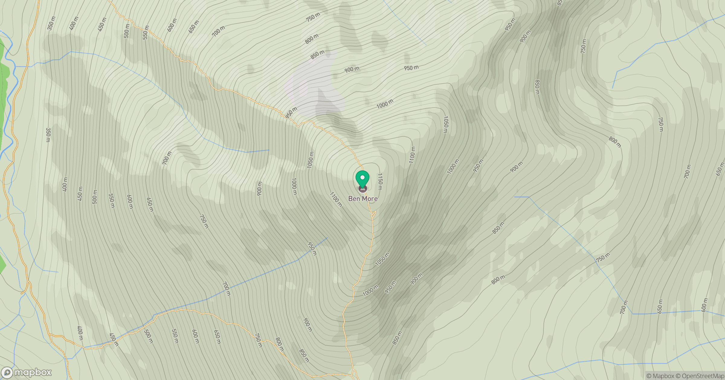
Grid reference: NN432244
View on OpenStreetMapOpens a map in a new tab, centred on the hill.
No comments yet. Be the first.