

Meall nan Tarmachan
Good walks are even better shared.
NN5838 : The Path on the last climb to the Summit
Iain Lees Photo source
Overview
Meall nan Tarmachan is a 1043.6 m Munro in Perthshire, west of Ben Lawers and above Loch Tay. The summit can be reached from Ben Lawers NNR car park and descended by the same path. Continuing over Meall Garbh and the Tarmachan Ridge adds narrow exposed ground, a rocky descent and more demanding navigation.
Meall nan Tarmachan
Meall nan Tarmachan is a 1043.6 m Munro in Perthshire. Its summit is marked by a cairn. The ridge looks over Loch Tay and towards the Ben Lawers and Glen Lyon hills.
Summit return or ridge circuit
The summit-only outing starts at Ben Lawers NNR car park (NN608377), climbs the south-east approach and returns the same way. It avoids the Meall Garbh continuation, but includes a steep rocky upper path.
The Walkhighlands ridge circuit continues over Meall Garbh and Beinn nan Eachan, then descends from the bealach before Creag na Caillich towards the quarry track and returns to the car park. The guide publishes 13 km and 5–7 hours and describes Creag na Caillich as an optional out-and-back from the descent bealach.
Meall Garbh's narrow crest is exposed. A short Grade 1 rocky descent follows it; the summer bypass branches right above the step. Wet or icy conditions increase the difficulty. Mist complicates navigation across the ridge and the rough, boggy descent.
Access and facilities
Use the Ben Lawers NNR car park off the A827. No public transport reaches this route start. There are no toilets on site; NTS directs visitors to Killin or Kenmore. Only the reserve's self-guided trails are waymarked. NTS asks walkers to use paths to protect fragile vegetation and keep dogs under close control around livestock. Its hill ground has no deer-stalking access restrictions; this does not describe every neighbouring estate.
Snow can obstruct the access road and obscure the steep summit approach. Ice on the Meall Garbh descent calls for particular care.
Geology, name and history
The ridge's Dalradian calcareous mica schists are metamorphosed sedimentary rocks. The name refers to ptarmigan. A public appeal enabled NTS to acquire Tarmachan land in 1996.
Explore routes near Meall nan Tarmachan
Walks starting near this hill. Open a route to check its map, distance and full itinerary.
Killin: Falls of Dochart, Finlarig and Moirlanich Longhouse
View route
Kenmore: Drummond Hill Black Rock Trail above Loch Tay
View route
Aberfeldy: Glassie Woodland and River Tay Circular
View route
Loch Lubnaig: West Shore Railway Path from Ben Ledi Car Park
View route
Route planning notes
These notes describe possible approaches. Check a route's map and access information when planning your walk.
Meall nan Tarmachan summit and return
Start at Ben Lawers NNR car park (NN608377), climb the south-east approach to the summit cairn, then retrace the ascent to the same car park. This omits Meall Garbh and the exposed ridge continuation; the upper path is still steep and rocky.
Tarmachan Ridge circuit (Walkhighlands)
From Ben Lawers car park (NN608377), climb Meall nan Tarmachan, then cross Meall Garbh and Beinn nan Eachan. Return from the bealach before Creag na Caillich over boggy ground to the quarry track and back to the car park. Meall Garbh has a narrow crest and a Grade 1 descent with a summer bypass on the right above it. Walkhighlands gives 13 km and 5–7 hours; its guide also describes an optional out-and-back to Creag na Caillich.
Make a day of it, together
Find someone to share the walk with, or organise a day out along a route you like.
Photo Gallery
View all Photo could not load
NN5838 : The Path on the last climb to the Summit
Iain Lees
 Photo could not load
NN5838 : Loch Tay from Meall nan Tarmachan
Nigel Brown
 Photo could not load
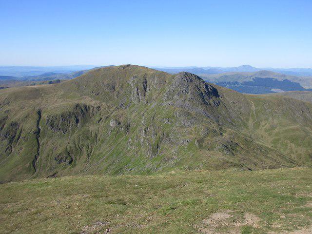
NN5838 : Tarmachan Ridge (Loch Tay)
Anthony O'Neil
 Photo could not load
NN5838 : Footsteps in the snow
Doug Lee
 Photo could not load
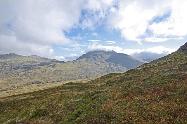
NN5838 : Meall nan Tarmachan
Robert Struthers
 Photo could not load
NN5838 : Cairn on the summit of Meall nan Tarmachan
G Laird
 Photo could not load
NN5838 : The Path Passes Underneath the Summit of Meall nan Tarmachan
Iain Lees
 Photo could not load
NN5838 : Summit of Meall nan Tarmachan
Iain Russell
 Photo could not load
NN5838 : Perfect Conditions on the summit area of Meall nan Tarmachan
Iain Lees

NN5839 : Meall nan Tarmachan
David Brown
Hill facts and local notes
Classifications
Elevation
1,044m
3,424 ft
Prominence
494m
Coordinates
56.5217, -4.3013
NN585390
OS Map
51
Explorer: OL48E 378E
At the Summit
A cairn marks the summit.
Terrain & Geology
The Tarmachan ridge lies within the Ben Lawers SSSI, whose bedrock is chiefly Dalradian calcareous mica schist. These metamorphic rocks began as sediments and were altered and folded during mountain building.
Views & Scenery
Loch Tay to the south, the Ben Lawers range to the east and the Glen Lyon hills to the north, when visibility allows.
History & Heritage
Name Origin
The name refers to ptarmigan; tarmachan is the Gaelic name for the bird.
Historical Significance
The National Trust for Scotland acquired land on the Tarmachan ridge in 1996 following a public appeal, extending its conservation work at Ben Lawers.
Getting There & Facilities
Parking
Ben Lawers NNR car park, NN608377, reached by the hill road off the A827 north of Loch Tay. NTS lists a £4 parking charge, free for members, checked 16 October 2026. It is unsuitable for coaches or large motorhomes.
Public Transport
Walkhighlands lists no public transport to the Ben Lawers car park start. An onward journey is needed from settlements served by public transport; do not assume a summer bus reaches the trailhead.
Nearby Facilities
There are no toilets at Ben Lawers NNR car park. NTS directs visitors to public toilets in Killin or Kenmore; both villages have places to eat. Information is provided beside the car park.
Safety Information
Known Hazards
- Meall Garbh has a narrow exposed crest and a short rocky descent. The summer bypass leaves on the right above the bad step; it does not bypass the preceding narrow crest.
- Wet or icy rock makes the descent from Meall Garbh more awkward.
- Complex ridge terrain is difficult to navigate in mist; the return towards the quarry track is rough and boggy, with only faint paths.
Seasonal Hazards
Snow can block the Ben Lawers access road. Deep snow complicates the steep summit approach; ice makes the rocky descent from Meall Garbh more serious.
General Safety Tips
- Check weather conditions before setting out
- Carry appropriate clothing and equipment
- Let someone know your planned route
- Take a map, compass, and GPS device
- Carry emergency supplies: food, water, first aid kit, torch
Hills
Some common questions about the hills answered
Are there group walks up Meall nan Tarmachan?
Many walkers use Walkmates to join or organise walks with others. You can check for group walks around Meall nan Tarmachan through the maps
Are there other walkers around Meall nan Tarmachan?
Activity varies by location and time, but Walkmates lets you see whether others have shared walks or shown interest in this area. Find other people through the walking friends search walking friends for Meall nan Tarmachan search or of course create your own walk for Meall nan Tarmachan
Can I organise a walk to Meall nan Tarmachan?
Yes. If there aren’t any walks listed already, you can create a walk and make it available for others to join.
If you're signed up to Walkmates, you can create a walk to Meall nan Tarmachan.
How do I find a walk up this hill?
There are often multiple ways to walk this hill, depending on experience and route preference. Walkmates helps you explore walks and routes that others have shared.
Can I suggest a new route up Meall nan Tarmachan?
Yes. You can suggest or create routes to share with others. Walkmates focuses on the social side of walking, so routes are used to help people organise walks and explore areas together, rather than as detailed navigation tools or route libraries.
Other uses really appreciate knowledgeable walkers sharing their routes. Share your favourite route to Meall nan Tarmachan here
The is an error or something incorrect about this hill. How do I let you know?
We always strive to keep the information on Walkmates as accurate as possible. If you find an error, please let us know through the contact form and we'll aim to correct it as quickly as possible
Community Discussion
Comments
Location
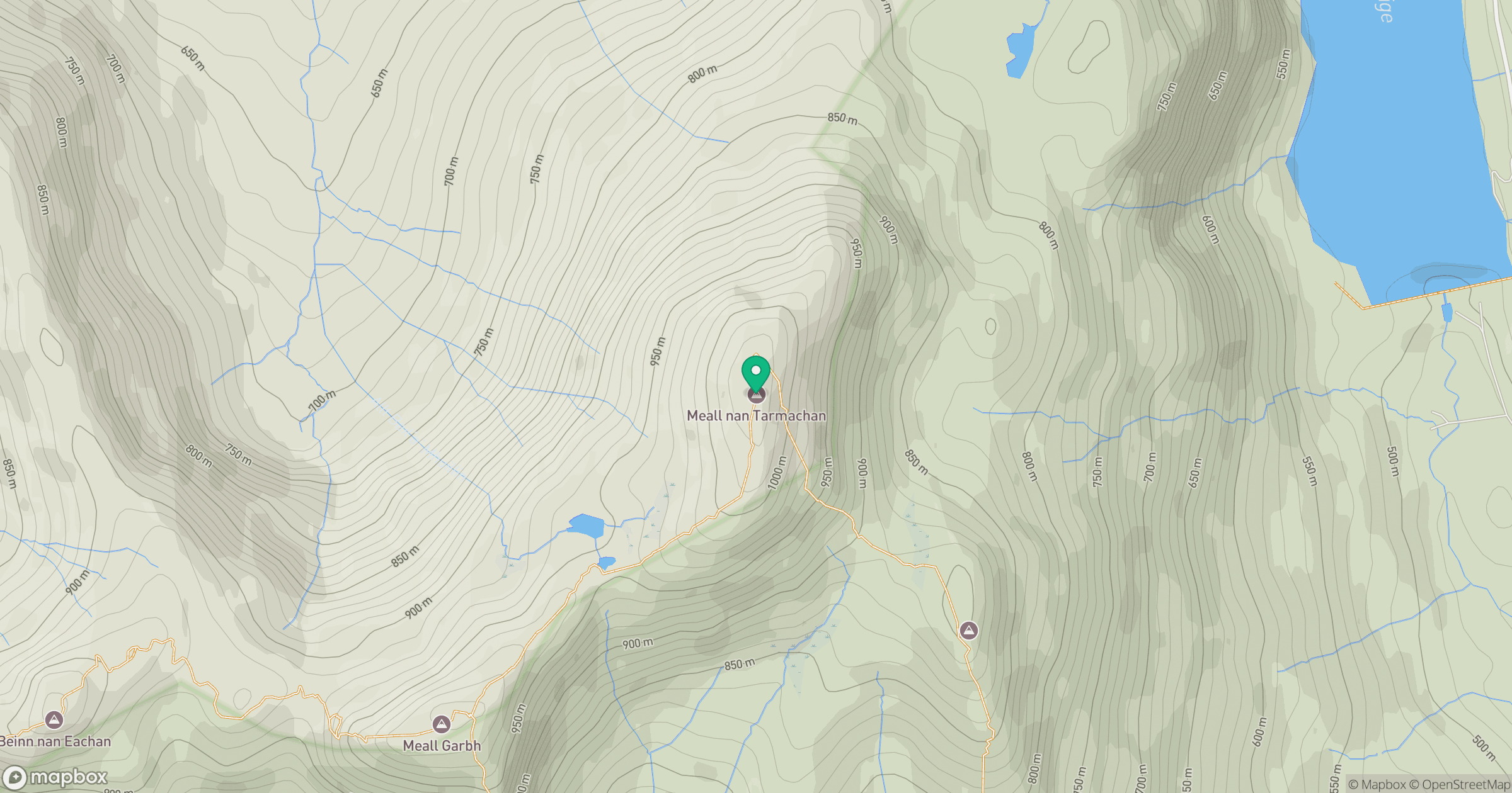
Grid reference: NN585390
View on OpenStreetMapOpens a map in a new tab, centred on the hill.
No comments yet. Be the first.