

Ben Vorlich
Good walks are even better shared.
Overview
Ben Vorlich rises to 985.3 m above the south shore of Loch Earn in the Southern Highlands. The usual ascent starts at Ardvorlich and climbs the north ridge to the summit trig point, with broad views across Loch Earn, the Highlands and central Scotland. Returning the same way gives a substantial hillwalk; continuing to Stuc a' Chroin adds steep rocky ground, scrambling and a rougher return.
Ben Vorlich (Loch Earn)
Overview
Ben Vorlich is a 985.3 m Munro above the south shore of Loch Earn, on the southern edge of the Highlands. Its familiar outline and wide views make it a rewarding hillwalk from Ardvorlich.
The Ardvorlich ascent
The usual route follows an estate track into Glen Vorlich, crosses the Coire Buidhe burn and climbs the north ridge. The upper path is steep and rocky. The summit is at the trig point; the separate cairn 125 m east-south-east is lower.
For an out-and-back walk, descend by the same route. Walking Britain describes a 9.8 km itinerary, including the eastern cairn, with an estimated time of 5 hours 40 minutes.
Continuing to Stuc a' Chroin
The two-Munro circuit descends west and south-west from Ben Vorlich to the intervening bealach. Stuc a' Chroin presents a much rougher ascent, including boulders and scrambling beside its steep buttress. The alternative western line is still steep. The return bypasses the buttress and contours across wet, eroded ground around Ben Vorlich to rejoin the Ardvorlich path.
Walkhighlands gives 14.5 km and 6–7 hours for its circuit. This is a more demanding outing than Ben Vorlich alone. Stuc a' Chroin is 973 m in the current DoBIH survey record.
Landscape and geology
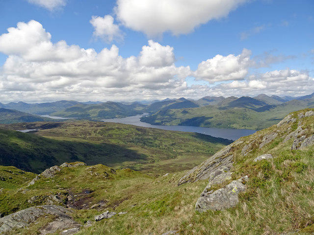
Views take in Loch Earn, Ben Lawers to the north and Ben More to the west. Clear conditions reveal the contrast between the Highlands and the lower country towards Stirling and the Forth.
The mountain's metamorphosed sedimentary bedrock belongs to the Ben Ledi Grit Formation of the Dalradian Southern Highland Group, folded within the Tay Nappe.
Access and facilities
The start is at Ardvorlich on the south shore of Loch Earn, with informal roadside parking near the burn bridge. Leave entrances and passing places clear. Lochearnhead has places to stay, eat and drink. Buses serve Lochearnhead and St Fillans, but onward travel to the Ardvorlich start needs planning.
Conditions and safety
Allow for steep ground, loose stones, wind and poor visibility. The circuit's traversing paths can be boggy and indistinct. Snow and ice can hide the upper path and require winter skills and equipment; the Stuc a' Chroin buttress becomes expert winter mountaineering terrain.
Name and history
Ben Vorlich is commonly translated as 'hill of the bay'. The Cairngorm Club Journal documented an ascent from Ardvorlich in 1896, showing the long-established appeal of this Loch Earn mountain.
Explore routes near Ben Vorlich
Walks starting near this hill. Open a route to check its map, distance and full itinerary.
Loch Lubnaig: West Shore Railway Path from Ben Ledi Car Park
View route
Killin: Falls of Dochart, Finlarig and Moirlanich Longhouse
View route
Loch Katrine: Trossachs Pier to Stronachlachar
View route
Loch Katrine: Brenachoile Point Shore Walk from Trossachs Pier
View route
Route planning notes
These notes describe possible approaches. Check a route's map and access information when planning your walk.
Ben Vorlich from Ardvorlich (north ridge)
From Ardvorlich on Loch Earn's south shore, follow the estate track past the house, cross the Coire Buidhe burn and climb the north ridge to the trig point. Visit the lower eastern cairn, then retrace the outward route. Walking Britain gives 9.8 km and 5 hours 40 minutes for this steep hillwalk.
Ben Vorlich and Stuc a' Chroin from Ardvorlich
Climb Ben Vorlich by its north ridge, then descend west and south-west to the bealach. Continue over boulders and steep scrambling ground beside Stuc a' Chroin's buttress, then south to its summit. Return via the steep western bypass and the boggy traverse around Ben Vorlich to the Ardvorlich path. Walkhighlands gives 14.5 km and 6–7 hours. For experienced hillwalkers; much more serious in winter.
Make a day of it, together
Find someone to share the walk with, or organise a day out along a route you like.
Photo Gallery
View all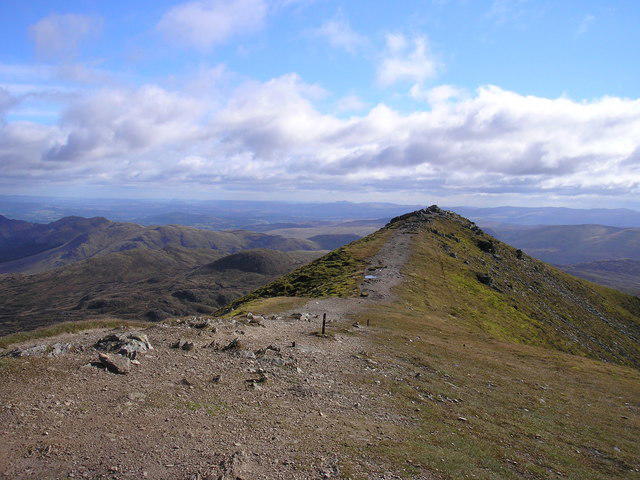 Photo could not load
NN6218 : Ben Vorlich
Iain Lees
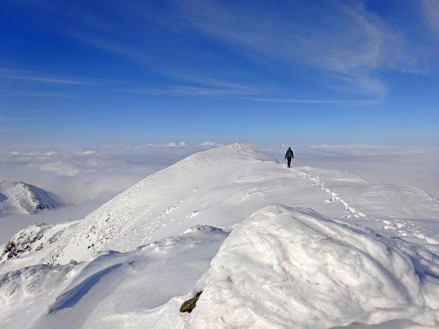 Photo could not load
NN6318 : Ben Vorlich Summit, Winter
Adam Ward
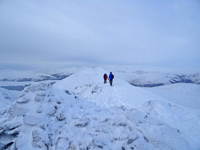 Photo could not load
NN6318 : Ben Vorlich Summit Ridge
Adam Ward
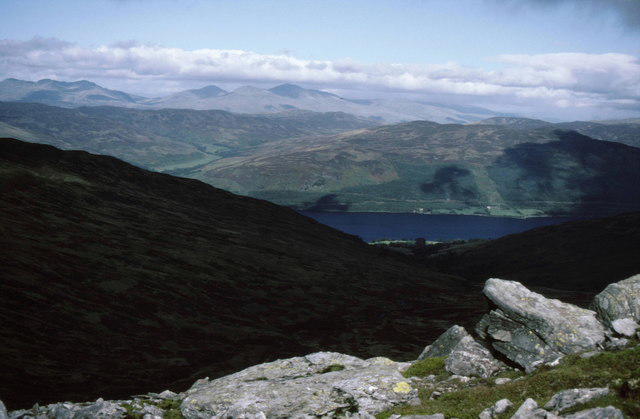 Photo could not load
NN6218 : View north from summit of Ben Vorlich
Russel Wills
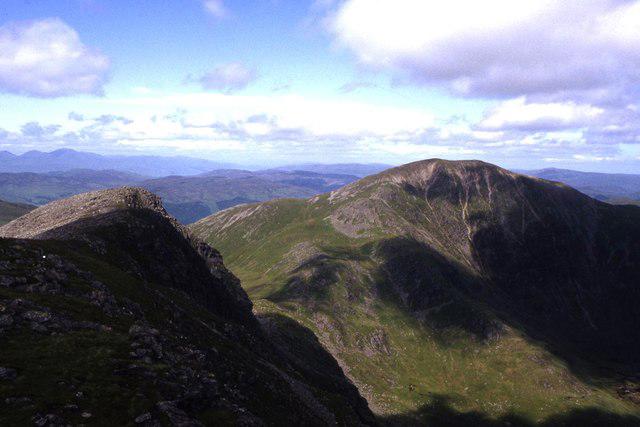 Photo could not load
NN6218 : Ben Vorlich from Stuc a Chroin
Colin Park
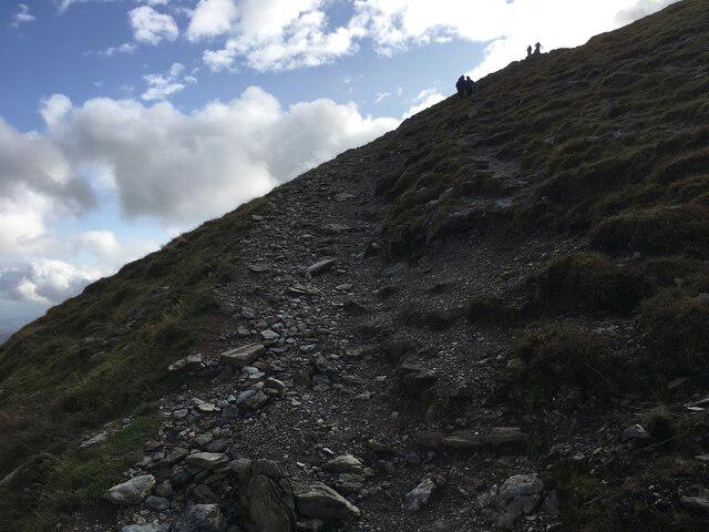 Photo could not load
NN6218 : Path towards the summit of Ben Vorlich
Steven Brown
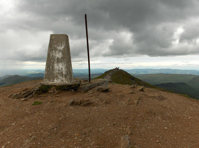 Photo could not load
NN6218 : Ben Vorlich
Andrew Smith
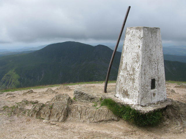 Photo could not load
NN6218 : Ben Vorlich Trig Point
G Laird
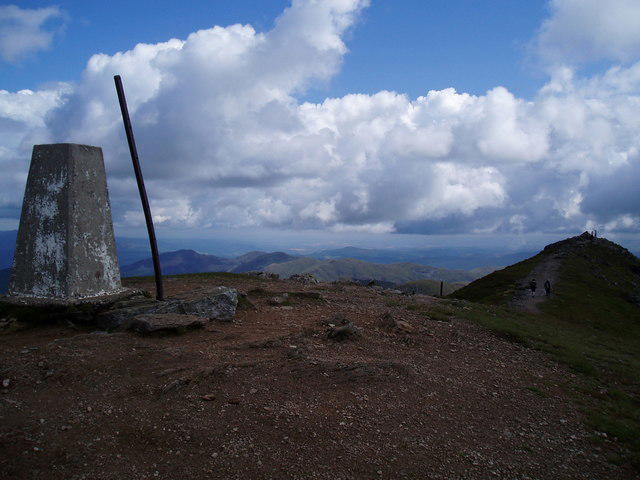 Photo could not load
NN6218 : Almost twin tops of Ben Vorlich
Douglas Nelson
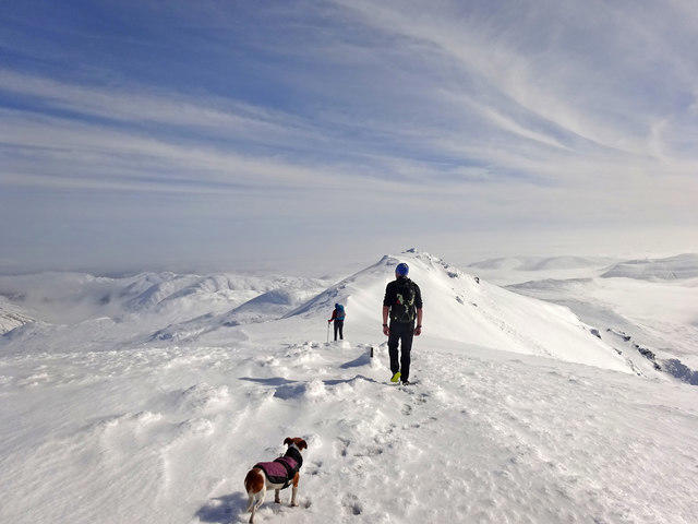
NN6218 : Winter Summit Stroll
Adam Ward
Hill facts and local notes
Classifications
Elevation
985m
3,233 ft
Prominence
834m
Coordinates
56.3427, -4.2195
NN629189
OS Map
57
Explorer: OL46N OL47W 365N 368W
At the Summit
The summit is marked by a trig point. A separate cairn 125 m east-south-east, at NN 63033 18865, is lower.
Terrain & Geology
Ben Vorlich is formed from metamorphosed sedimentary rocks of the Ben Ledi Grit Formation, part of the Dalradian Southern Highland Group. These include sandstone-derived rocks and finer-grained layers. The mountain lies within the down-turned hinge zone of the Tay Nappe.
Views & Scenery
Loch Earn below, Ben Lawers to the north, Ben More to the west and the contrast between the Highlands and central Scotland. In clear weather the outlook extends towards Stirling, the Forth estuary and the Pentland Hills.
History & Heritage
Name Origin
The name is commonly translated as 'hill of the bay'.
Historical Significance
An ascent from Ardvorlich is described in the Cairngorm Club Journal of 1896, recording walkers approaching from Lochearnhead and climbing via Glen Vorlich.
Getting There & Facilities
Parking
Informal roadside parking by the Ardvorlich Burn bridge on the south shore of Loch Earn, near NN633232. Spaces are limited; keep estate entrances, the road and passing places clear.
Public Transport
Buses serve Lochearnhead and St Fillans, but there is no regular bus to the Ardvorlich route start on the south shore. Plan the onward journey and check current timetables before travelling.
Nearby Facilities
Lochearnhead has accommodation and places to eat and drink. Carry what you need for the mountain; no staffed facilities are described on the ascent.
Safety Information
Known Hazards
- Steep upper slopes and loose or eroded sections of path can be slippery when wet.
- The Stuc a' Chroin continuation involves steep rocky ground and scrambling; its bypass and descent are also steep.
- The circuit return traverses wet, boggy ground where the path can be faint.
- Strong wind, low cloud and cold can make exposed upper slopes harder to navigate.
Seasonal Hazards
Snow and ice can cover the upper path and make the steep slopes serious winter terrain. Winter equipment and the skills to use it are needed when conditions demand; the Stuc a' Chroin buttress is an expert winter mountaineering undertaking.
General Safety Tips
- Check weather conditions before setting out
- Carry appropriate clothing and equipment
- Let someone know your planned route
- Take a map, compass, and GPS device
- Carry emergency supplies: food, water, first aid kit, torch
Hills
Some common questions about the hills answered
Are there group walks up Ben Vorlich?
Many walkers use Walkmates to join or organise walks with others. You can check for group walks around Ben Vorlich through the maps
Are there other walkers around Ben Vorlich?
Activity varies by location and time, but Walkmates lets you see whether others have shared walks or shown interest in this area. Find other people through the walking friends search walking friends for Ben Vorlich search or of course create your own walk for Ben Vorlich
Can I organise a walk to Ben Vorlich?
Yes. If there aren’t any walks listed already, you can create a walk and make it available for others to join.
If you're signed up to Walkmates, you can create a walk to Ben Vorlich.
How do I find a walk up this hill?
There are often multiple ways to walk this hill, depending on experience and route preference. Walkmates helps you explore walks and routes that others have shared.
Can I suggest a new route up Ben Vorlich?
Yes. You can suggest or create routes to share with others. Walkmates focuses on the social side of walking, so routes are used to help people organise walks and explore areas together, rather than as detailed navigation tools or route libraries.
Other uses really appreciate knowledgeable walkers sharing their routes. Share your favourite route to Ben Vorlich here
The is an error or something incorrect about this hill. How do I let you know?
We always strive to keep the information on Walkmates as accurate as possible. If you find an error, please let us know through the contact form and we'll aim to correct it as quickly as possible
Community Discussion
Comments
Location
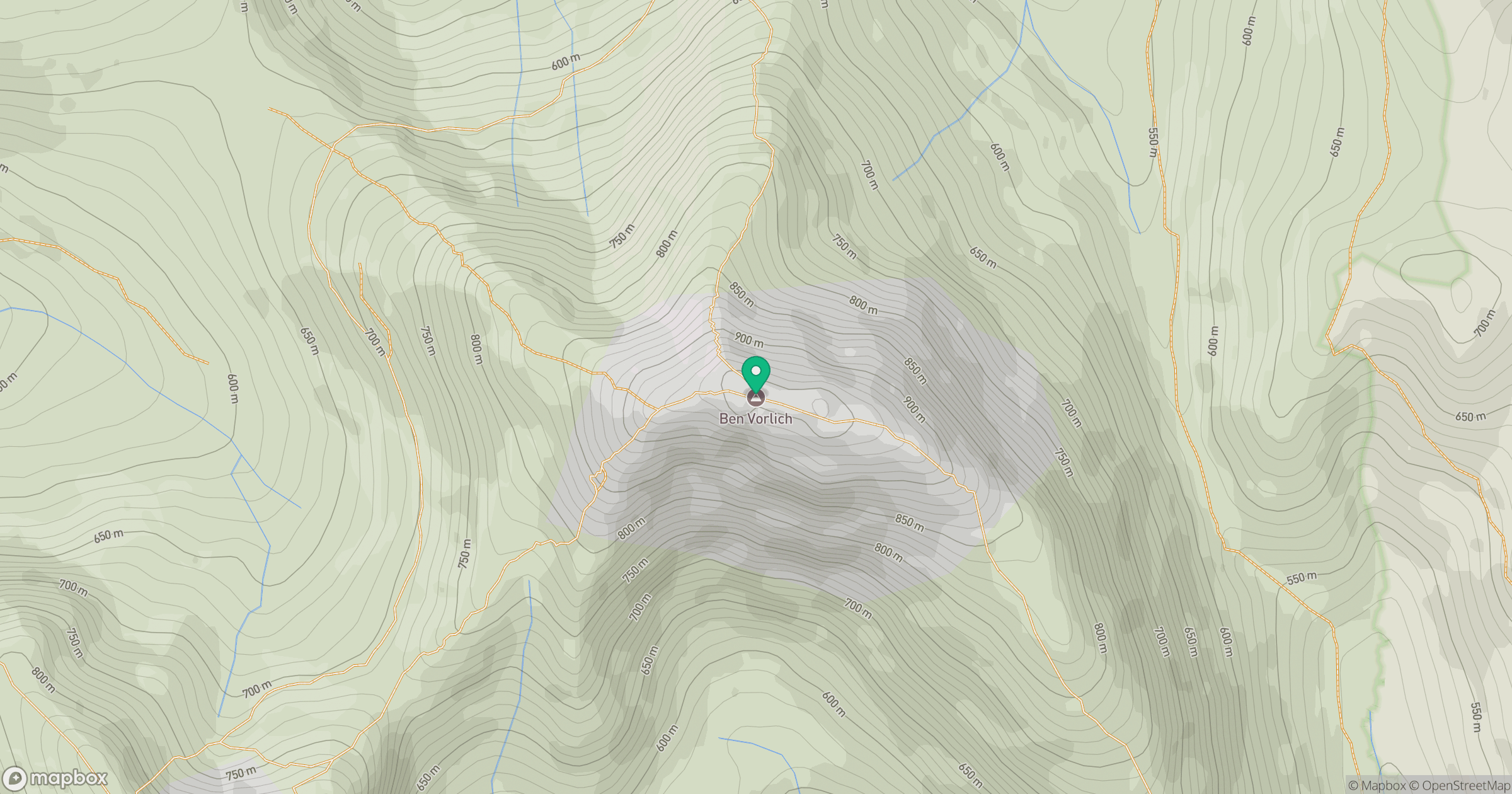
Grid reference: NN629189
View on OpenStreetMapOpens a map in a new tab, centred on the hill.

No comments yet. Be the first.