

Ben Lawers
Good walks are even better shared.
NN6341 : Snow patches on Ben Lawers
Alan O'Dowd Photo source
Overview
Ben Lawers is a 1,214.3-metre Munro above Loch Tay in Perth and Kinross. The usual approach crosses Beinn Ghlas from the National Nature Reserve car park. The area is renowned for arctic-alpine plants, but its high mountain routes require fitness, navigation and suitable equipment.
Ben Lawers
Ben Lawers rises north of Loch Tay in Perth and Kinross. It is Scotland's tenth-highest Munro and the highest mountain in the Southern Highlands. DoBIH records 1,214.3 metres, commonly rounded to 1,214 metres, and 914 metres of prominence. The summit has a trig point and view indicator; the enormous nineteenth-century cairn built to increase its height has disappeared. DoBIH · National Trust for Scotland · Walkhighlands hill guide
Walking routes
The usual start is the National Nature Reserve car park, NN608377. The established two-Munro circuit crosses Beinn Ghlas, continues to Ben Lawers, then returns to the intervening col and bypasses Beinn Ghlas on its northern side. Walkhighlands estimates 11 km, 942 metres of ascent and 4–6 hours for this particular itinerary. The bypass is not a descent north from Ben Lawers itself. Returning over Beinn Ghlas instead changes the itinerary. Two-Munro circuit
Experienced walkers can extend over An Stùc, Meall Garbh and Meall Greigh, finishing at Lawers. This five-Munro traverse requires a planned return journey. An Stùc introduces steep, loose scrambling, especially serious when wet or icy. The separate eastern circuit from Lawers is a different itinerary; its published figures must not be reused for this traverse. Traverse options · Eastern-range terrain
The proposed Lochan na Lairige shortcut and unnamed Tarmachan-viewpoint extension have not been verified as complete routes. Their cards should not be used for navigation. The Tarmachan Ridge is a separate mountain walk. Tarmachan route
Access and facilities
The NNR car park is reached by the hill road off the A827. Parking is charged for non-members; check current arrangements before travel. There is no bus to the trailhead. Information is provided beside the parking area, but there are no toilets on site: use facilities in Killin or Kenmore before arrival. The former visitor centre was removed in 2010. Bring food, water and mountain equipment. Current NTS visitor information · Visitor-centre history
Landscape, plants and history
The area's rocks include lime-rich Dalradian mica schist, formed from older sediments altered by heat, pressure and folding. This geology helps sustain the mountain's renowned arctic-alpine vegetation. Do not leave paths to seek out rare plants. British Geological Survey · NatureScot SSSI citation
In clear weather there are extensive views over Loch Tay and the surrounding mountains. Nearby peaks include Beinn Ghlas and the eastern Lawers Munros. Meall Greigh's measured height is 1,000.7 metres, commonly rounded to 1,001 metres; Meall Garbh in the Lawers range is 1,123.1 metres. NTS summit views · DoBIH
NTS traces the mountain's name to the Lawers Burn, Uisge Labhar, interpreted as 'speaking burn'. The name is associated with flowing water. The Trust acquired Ben Lawers in 1950 for its botanical importance, and conservation work continues today. Shielings and other remains also record the area's older farming history. NTS Gaelic trail guide · NTS history
Safety and responsible access
This is a strenuous mountain outing with steep, rocky ground. A high starting point does not remove the risks of cold, wind or poor visibility. The summit paths are not waymarked throughout. Carry a map and compass and know how to use them; check the mountain forecast and allow enough daylight. NTS mountain advice
Snow and ice require suitable winter equipment and skills, including competent ice-axe and crampon use when conditions demand them. Plan around the terrain and weather rather than relying on a summer time estimate. Mountaineering Scotland winter skills
Stay on paths to protect fragile vegetation, take litter home and keep dogs under close control around livestock and wildlife. Lower-level alternatives include the Edramucky and Morenish Woodland trails. NTS access guidance · Lower-level walks
Explore routes near Ben Lawers
Walks starting near this hill. Open a route to check its map, distance and full itinerary.
Killin: Falls of Dochart, Finlarig and Moirlanich Longhouse
View route
Kenmore: Drummond Hill Black Rock Trail above Loch Tay
View route
Aberfeldy: Glassie Woodland and River Tay Circular
View route
Crieff: Lady Mary's Walk and the River Earn
View route
Route planning notes
These notes describe possible approaches. Check a route's map and access information when planning your walk.
Ben Lawers via Nature Reserve Car Park
From the NNR car park at NN608377, climb Beinn Ghlas and continue along the ridge to Ben Lawers, returning over the same two summits. This out-and-back differs from the published circuit that bypasses Beinn Ghlas on descent. Expect steep, rocky sections and exposed high-level walking; carry navigation and suitable mountain equipment.
Ben Lawers and Beinn Ghlas Circuit
Start at the NNR car park, NN608377, and cross Beinn Ghlas to Ben Lawers. Return to the col between the peaks, then take the bypass around the north side of Beinn Ghlas to rejoin the outward path. Do not descend north from Ben Lawers itself. Walkhighlands gives 11 km, 942 m ascent and 4–6 hours for this itinerary; 6 hours is the upper published estimate. It remains a high, weather-exposed mountain walk.
Ben Lawers Ridge Walk (five-Munro traverse)
From the NNR car park, cross Beinn Ghlas and Ben Lawers, then continue over An Stùc, Meall Garbh and Meall Greigh to finish at Lawers. Arrange return transport beforehand. The descent of An Stùc towards Meall Garbh is a steep, loose scramble, especially serious when wet or icy. This is not a verified circular route from the hotel. Plan the full itinerary with a detailed map.
Ben Lawers from Lochan na Lairige (unverified variant)
The proposed high-level car park at NN608390 and direct shortcut over Beinn Ghlas have not been verified. Do not rely on this entry for parking, navigation or a quicker ascent. Use the established NNR car park at NN608377 and a published route, or verify a complete alternative start, line and return independently before setting out.
Ben Lawers and Tarmachan Viewpoint (unverified extension)
The proposed detour has no identified viewpoint, grid reference or verified connecting path. It should not be used as a navigational route. Follow the established Ben Lawers/Beinn Ghlas itinerary unless you have independently mapped the extension. The Tarmachan Ridge is a separate mountain walk and should not be assumed to be a short diversion.
Make a day of it, together
Find someone to share the walk with, or organise a day out along a route you like.
Photo Gallery
View all Photo could not load
NN6341 : Snow patches on Ben Lawers
Alan O'Dowd
 Photo could not load
NN6341 : Trig pillar, Ben Lawers
David Brown
 Photo could not load
NN6341 : Toposcope on Ben Lawers
Steven Brown
 Photo could not load
NN6341 : Mountain runners approaching the summit of Ben Lawers
James T M Towill
 Photo could not load
NN6341 : Benchmark on Ben Lawer's Trig Point
Ross Mathieson
 Photo could not load
NN6341 : Approach to the Top of Ben Lawers
Sarah Charlesworth
 Photo could not load
NN6341 : Trig Point on Ben Lawers
G Laird
 Photo could not load
NN6341 : Summit trig on Ben Lawers
Richard Law
 Photo could not load
NN6341 : Ben Lawers trig point, 1976
Jim Barton

NN6341 : Summit of Ben Lawers
Iain Russell
Hill facts and local notes
Classifications
Elevation
1,214m
3,984 ft
Prominence
914m
Coordinates
56.5449, -4.2209
NN635414
OS Map
51
Explorer: OL48E 378E
At the Summit
A trig point and view indicator mark the summit area. DoBIH records the trig point as the summit feature and notes a rock about 5 metres north at a very similar height. The enormous nineteenth-century cairn is no longer present.
Terrain & Geology
The area is chiefly underlain by Dalradian calcareous mica schist. Ancient marine sediments were altered by heat, pressure and folding during mountain building. The Ben Lawers Schist Formation includes other metamorphosed sedimentary layers; lime-rich rocks and glacial deposits support the exceptionally rich mountain flora.
Views & Scenery
In clear weather, views extend over Loch Tay and the surrounding Lawers range, with a broad panorama of Highland mountains. Low cloud can obscure the outlook.
History & Heritage
Name Origin
NTS traces Ben Lawers to the Lawers Burn, Uisge Labhar, interpreted as 'speaking burn'. The name is associated with the sound of flowing water.
Historical Significance
The National Trust for Scotland acquired Ben Lawers in 1950 for its botanical importance. Shielings and other remains record older farming and grazing. A nineteenth-century summit cairn attempted to lift the mountain above 4,000 feet, but has disappeared. The visitor centre opened in 1972 and was removed in 2010; conservation and outdoor interpretation continue.
Getting There & Facilities
Parking
Ben Lawers National Nature Reserve car park, NN608377, on the hill road off the A827 north of Loch Tay. Parking is charged for non-members. Check NTS for current arrangements; the car park is not suitable for coaches or large campervans/motorhomes.
Public Transport
No bus serves the NNR car park. Plan an onward journey from local bus or rail services and check current timetables before travel; do not assume a taxi or return connection will be available without arranging it.
Nearby Facilities
Information is provided beside the NNR car park. There are no toilets on site; NTS directs visitors to public toilets in Killin or Kenmore. The former visitor centre was removed in 2010. Bring food and water rather than expecting a visitor-centre café.
Safety Information
Known Hazards
- Steep and rocky upper paths; wind, cold and poor visibility can make navigation and balance difficult.
- The return bypass passes north of Beinn Ghlas, reached by retracing from Ben Lawers to the intervening col.
- The extended eastern ridge crosses An Stùc, where steep, loose scrambling is much more serious than the usual two-Munro route.
- The five-Munro traverse finishes at Lawers; arrange a return journey rather than assuming a short circuit.
Seasonal Hazards
Snow and ice can turn the walk into winter mountaineering. Appropriate skills and equipment, including competent ice-axe and crampon use when conditions demand them, are essential. Check mountain weather, ground conditions and available daylight; summer route times are not winter guarantees.
General Safety Tips
- Check weather conditions before setting out
- Carry appropriate clothing and equipment
- Let someone know your planned route
- Take a map, compass, and GPS device
- Carry emergency supplies: food, water, first aid kit, torch
Hills
Some common questions about the hills answered
Are there group walks up Ben Lawers?
Many walkers use Walkmates to join or organise walks with others. You can check for group walks around Ben Lawers through the maps
Are there other walkers around Ben Lawers?
Activity varies by location and time, but Walkmates lets you see whether others have shared walks or shown interest in this area. Find other people through the walking friends search walking friends for Ben Lawers search or of course create your own walk for Ben Lawers
Can I organise a walk to Ben Lawers?
Yes. If there aren’t any walks listed already, you can create a walk and make it available for others to join.
If you're signed up to Walkmates, you can create a walk to Ben Lawers.
How do I find a walk up this hill?
There are often multiple ways to walk this hill, depending on experience and route preference. Walkmates helps you explore walks and routes that others have shared.
Can I suggest a new route up Ben Lawers?
Yes. You can suggest or create routes to share with others. Walkmates focuses on the social side of walking, so routes are used to help people organise walks and explore areas together, rather than as detailed navigation tools or route libraries.
Other uses really appreciate knowledgeable walkers sharing their routes. Share your favourite route to Ben Lawers here
The is an error or something incorrect about this hill. How do I let you know?
We always strive to keep the information on Walkmates as accurate as possible. If you find an error, please let us know through the contact form and we'll aim to correct it as quickly as possible
Community Discussion
Comments
Location
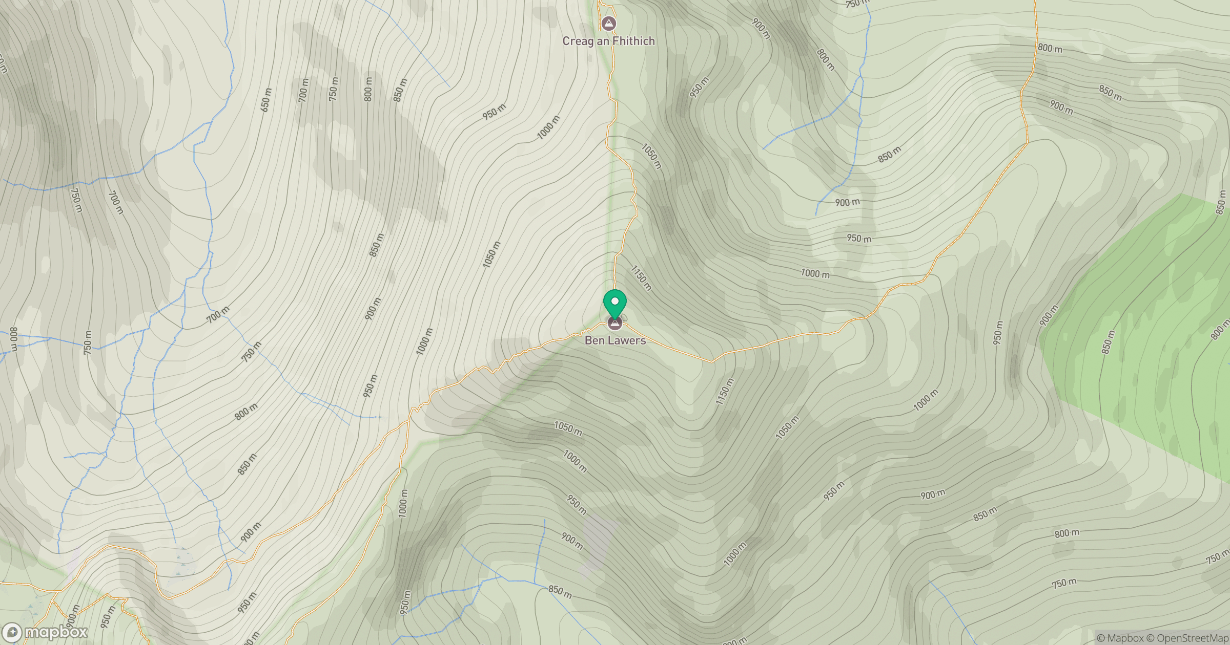
Grid reference: NN635414
View on OpenStreetMapOpens a map in a new tab, centred on the hill.
No comments yet. Be the first.